I also started out in a better mind to my visiting Indianapolis -- unlike the last trip. As I was leaving Indy that last late afternoon, passing the state's government complex of buildings and the Central Canal area, I thought I might just like to have a better look-see. So on a sunny morning I ran out the Interstate and made my way to the streets abounding the Capitol. A turn brought me on to Ohio Street where I discovered that there was an open parking spot at the curb where I was within a block of the Indiana History Center and the Canal. I thought that was a good start -- finding curbside parking right where you want to be? Ha! Get the camera!
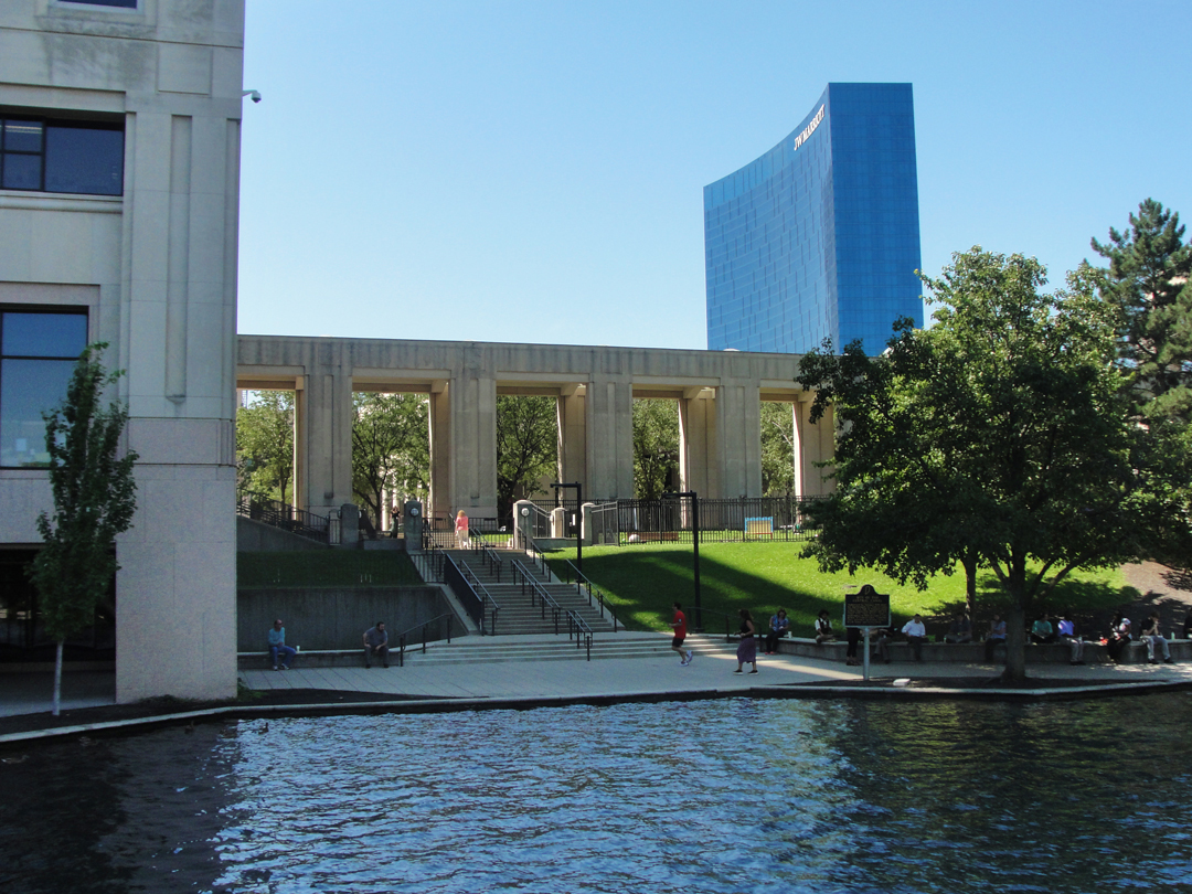
The Central Canal at the Indiana Government complex. Coming up the sidewalk to see this view, I stopped and said to myself "It looks like Caprica City!" Both the re-invented Battlestar Galactica and its spin-off Caprica used settings like this -- with a little CGI, of course -- to represent the height of human civilization out in the far flung reaches of space.
Don't be surprised if this part of Indy winds up in some of my own work; it's just too good a location to pass up.
I was pleasantly surprised to see quite a number of government employees (I'm supposing) taking some outside lunch time along the walkways. It was a good day for it.
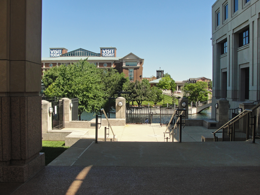
Here a look back across the canal to the History Center, which I would visit a short time later.
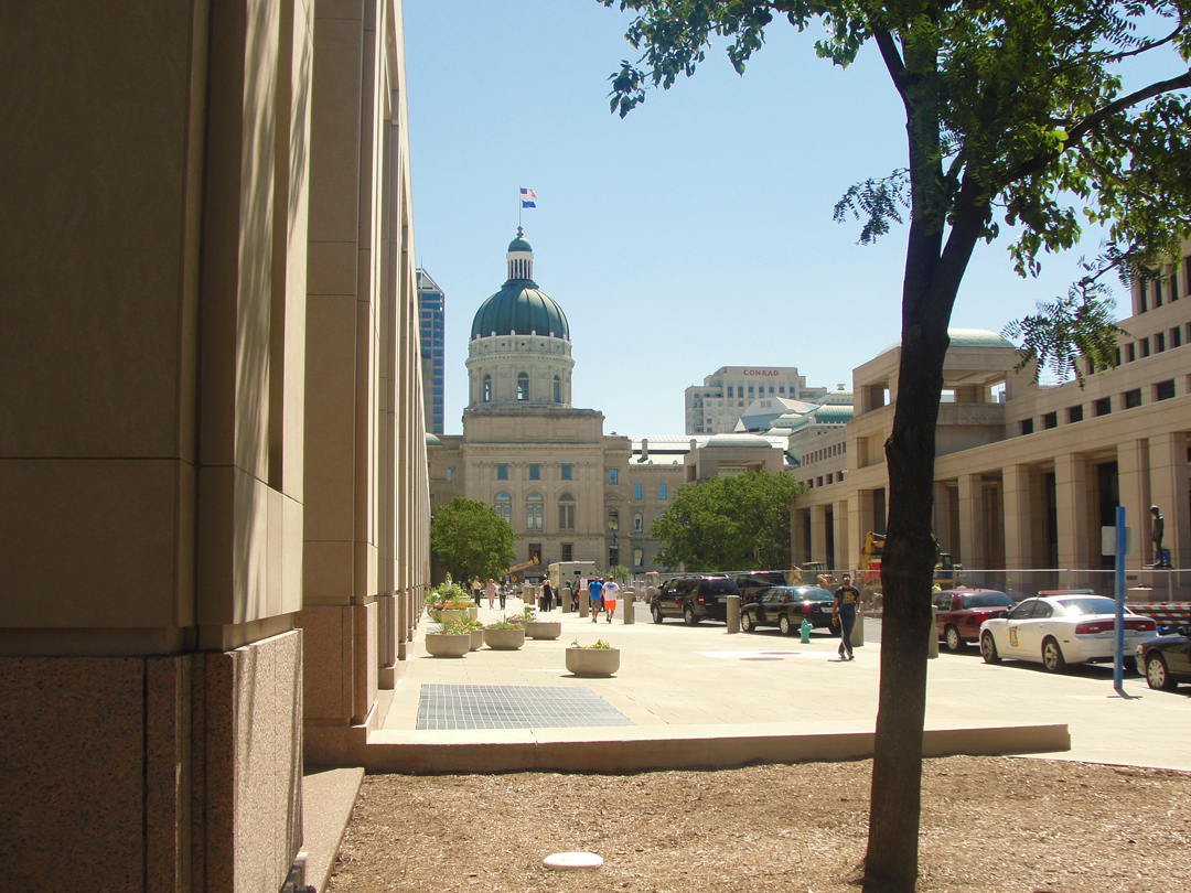
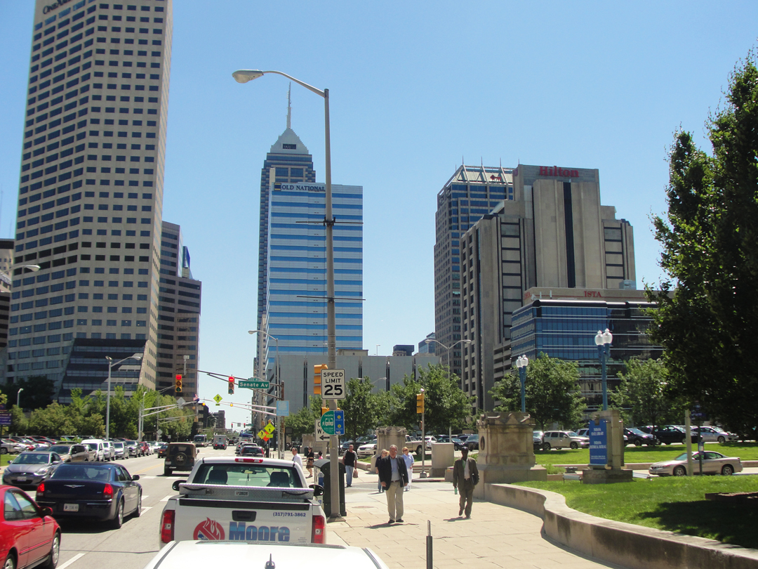
Below, views of the Capitol and downtown Indy.
My plan was to head to Terre Haute on US 40. There was little concerning the drive in Dreiser's recounting, other than a few passing words: "The run to Terre Haute was more or less uninteresting, a flat and lifeless country." Wow. Elsewhere he mentions Brazil, and Booth sketched a bridge in Reelsville, both of which are along a line traversed by US 40, and having perused my map for possibilities, 40 looked like the only real choice. I also knew that it was likely that here, as in other locales, the US Highway system-number would have been laid on an already existing road. Of course here, as in other locales, the highway as it is now has been improved.
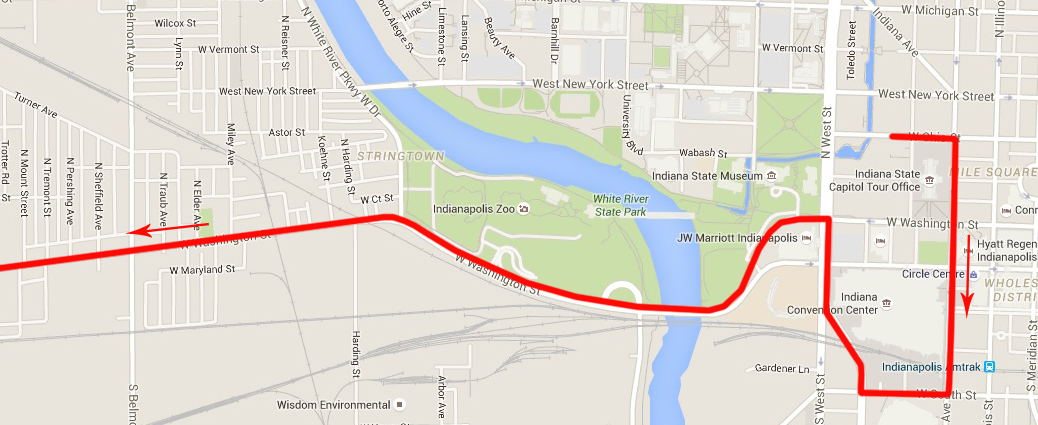
At any rate, from my curbside spot, I had to get to 40, via Washington Street, which would eventually run on to the same pavement. Naturally I missed my best turning because I was goggling about, at scenes like these:
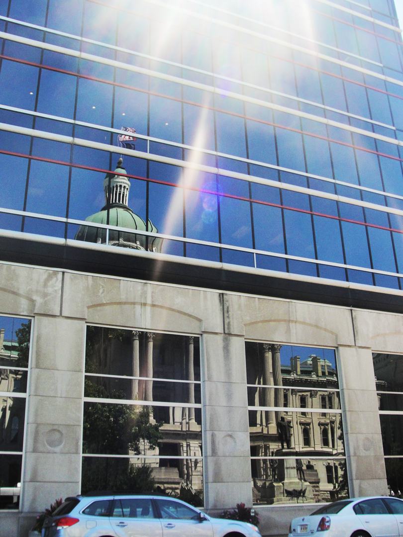
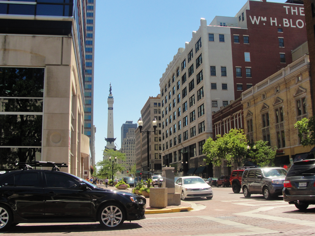
At left, the Indiana Capitol, reflected, and at right, a view of the Soldiers and Sailors Memorial down Market Street.
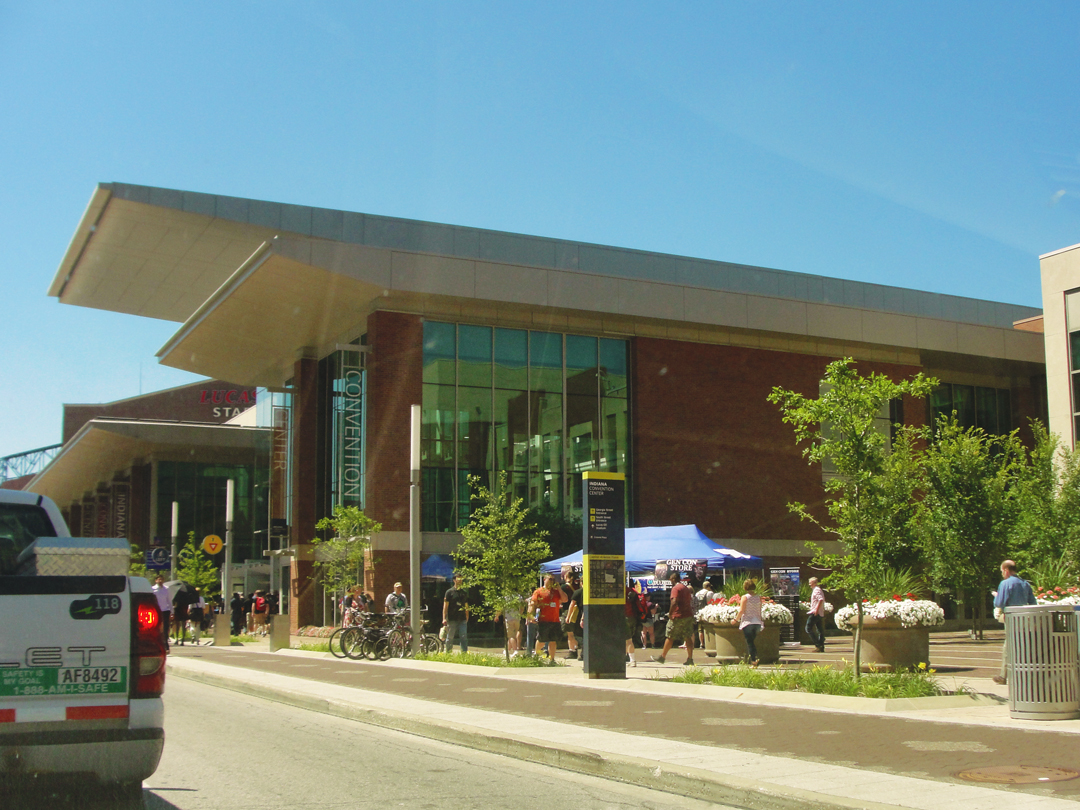
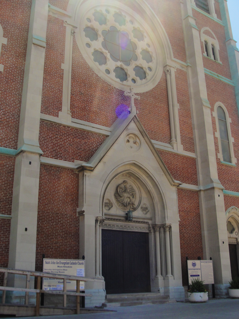
Above left, the Indianapolis Convention Center, hosting the GenCon, an annual gamers' weekend, which was just across the street from the old church, at right. Having had a moment of "Oh! I could have turned there," I passed the convention center and made a large U-turn to come back to Washington St and make a left.
I think I might just go back to Indy one of these days (put it on the list!) to amble about some more.
While at the History Center, I purchased a book of photographs shot by the W.H. Bass Photo Company, an Indianapolis business for over 100 years. In addition to their main focus of producing images for catalogs, their photographers also did street scenes of Indy for several decades in the 20th Century, the archive of which has been given over to the Center for preservation. It would be just the thing for me to take photos of those scenes now, for some "then" and "now" pictures. Yeah, someone's probably done it, might even be a book, but it sounds like a nice way to spend a day.
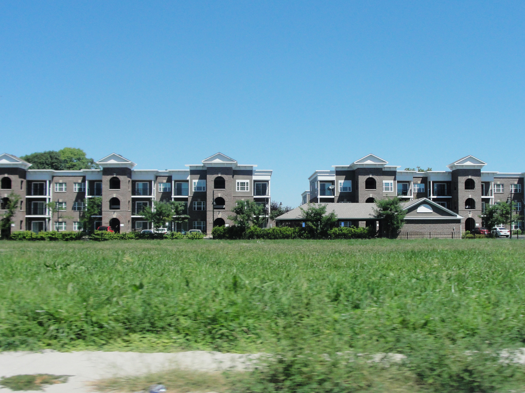
Heading SouthWest: this cluster of apartments or condominiums took my attention for a moment. They looked out of place, interlopers on the landscape compared to their surroundings. Probably some developer got the land "for a song," and advertised these as a way to "improve" the area.
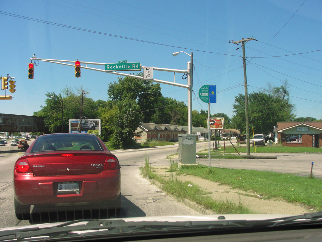
Less than a mile away were these boarded-up left-overs, looking like a motor lodge bypassed and gone to seed, now left for the next developer to evince some interest.
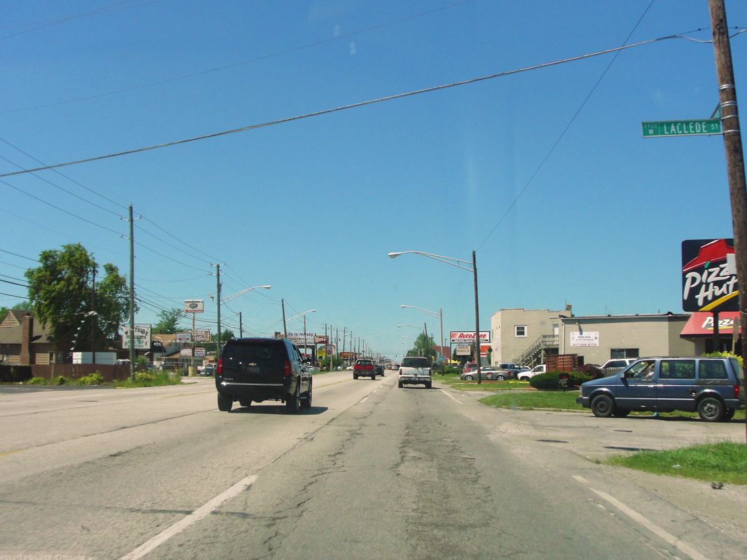
And of course the long, long drive through the Zoned Commercial that splays along so many 4 lane streets:
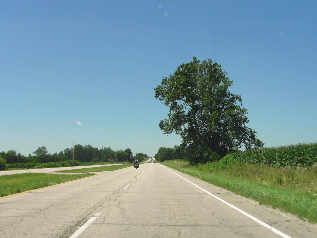
After a time, the Commercial area played out, the suburbs faded away, and it was with some relief actually, that I gained the fields outside the municipal precincts.
There would be roadside businesses, and little 'burgs, but for a good deal of this way it was corn and other plantings.
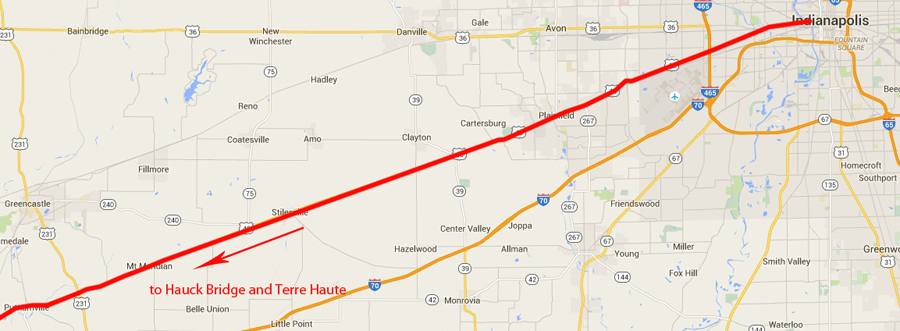
Below: along US 40, from Indianapolis to US 231
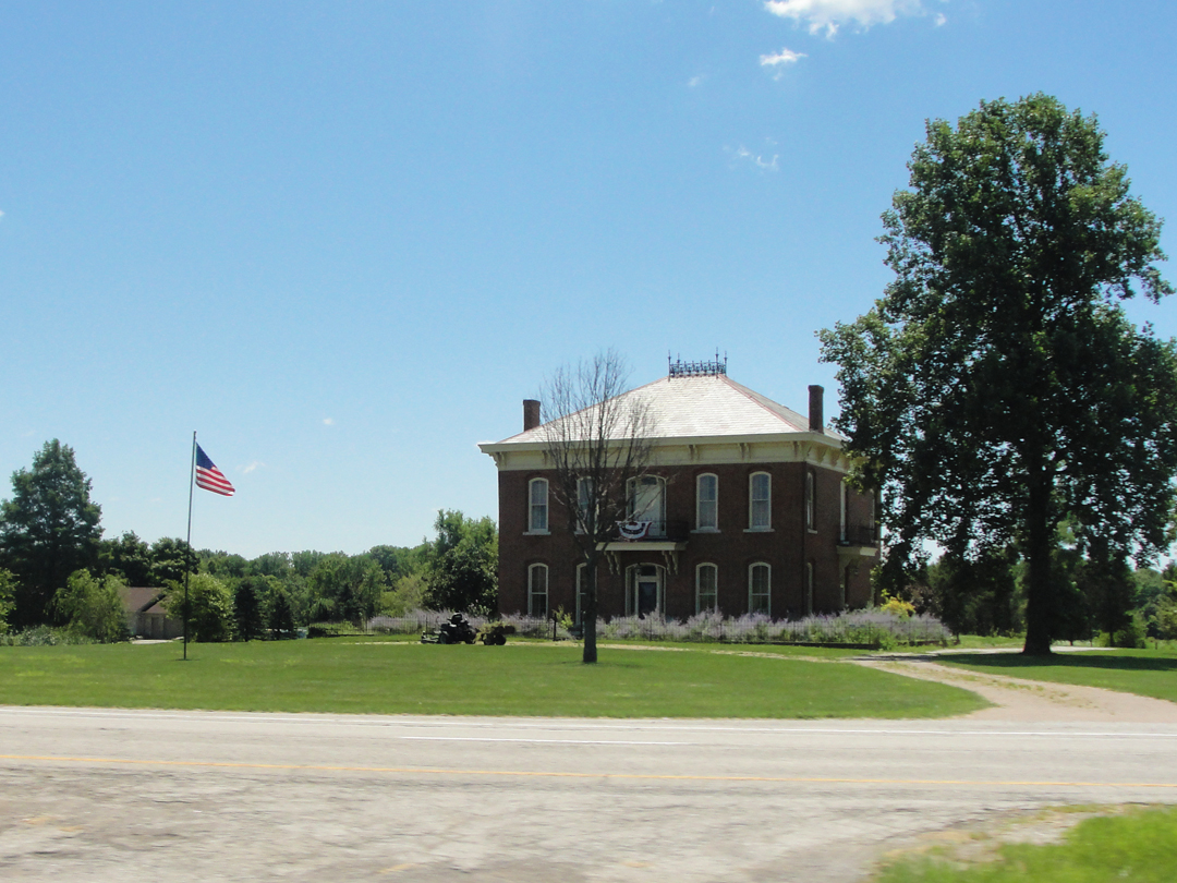
"That looks old enough!" I said and swiveled the camera around to shoot this. I was surprised that it came out this well.
I have often wondered, looking at old houses perched so close to the highway, what the owners have thought through the advancing decades. What did the original owner think when he or she stood on their stoop looking across the nearby fields? Was it a feeling of accomplishment for doing what they'd done and having a house like this? For putting how-ever many acres under cultivation? Was the road regarded at all? What of the latter owners? Did they look out on the increasing number of autos with fervor or disdain?
Then would have come the numbering system, an increase in traffic, the IMPROVEMENTS that would have winnowed away the yard. What did those owners think of all that? Now US 40 is just a given, and I wonder if any thought is given over to the traffic at all. Once there would have been engine noise, and now it's tire whine, but either are just a fact of life. I don't know where that all comes from, it's just "one of those things" I do, trying to put myself "in the shoes" of someone an hundred years ago, or more, maybe less; trying to imagine what standing on that stoop would have felt like.
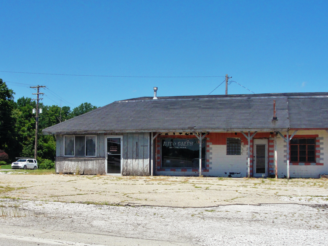
There was a stoplight at the intersection with US 231, and I took the moment to snap this photo of yet another building that had been home to something automotive, once upon a time.
As with the failed gas stations, I was shaking my head in wonder (I was wonder-filled on this trip, wasn't I?) at my age and the age in which I live that car-centric businesses have come and gone and come and gone, and their leavings litter my landscape.
At a guess, this was built in the 1980s, and held a few corner-store businesses, finally ending by saying "goodbye" to car salesmen as their venture went up. But such is our marketplace. Likely this poor building, never anything all that great to begin with, is destined to be razed as someone comes along with yet another "improvement" scheme.
A mile or so shy of Putnamville, I saw a sign advertising Old US 40, so I made a turn-about and went back to trace that laneway. Suddenly I was driving amongst trees, many of which closed over the old, pitted concrete road.

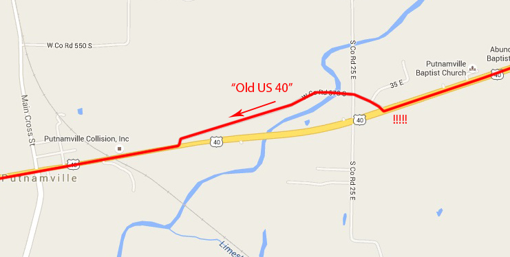
There were only a few houses visible through the screen of foliage, and an air of perhaps benign neglect. The only people who drive along this now are the residents, I'm sure, and a few people like me who are looking for anything with "old" in the name.
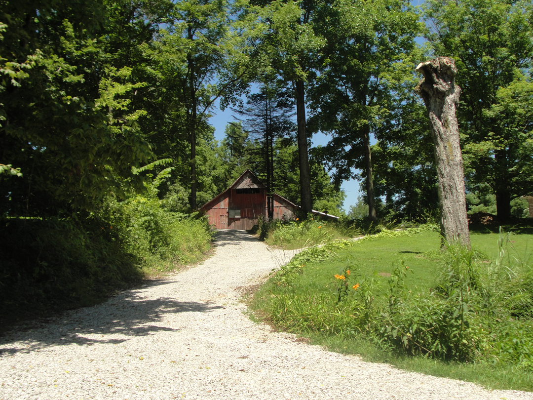
"Old enough?" Maybe. Old enough to warrant a photograph, anyway.
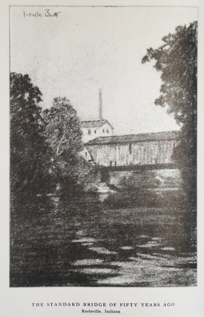
On their way, Dreiser & Co stopped in a little town named Reelsville, probably so Bert could procure gas and oil. The stop afforded Booth a vantage of a covered bridge, and the inclusion of that sketch in the book was the only indication of the pause in the journey.
My Indiana map has covered bridges noted, and Reelsville does not have one. A couple of miles to the North and East, however, was indicated the Hauck Bridge. Finding it would necessitate a detour, but I thought to have a look at it to see if it would be a suitable "stand in" for the missing Reelsville crossing. It did make for a good "photo op."
When I went through Reelsville, I think I crossed one of the subsequent bridges at this location, a standard slab-sided concrete thing, like every other concrete road bridge. It was not until I'd gone past it I thought "Hmm, I wonder if that's where the sketch was made?"
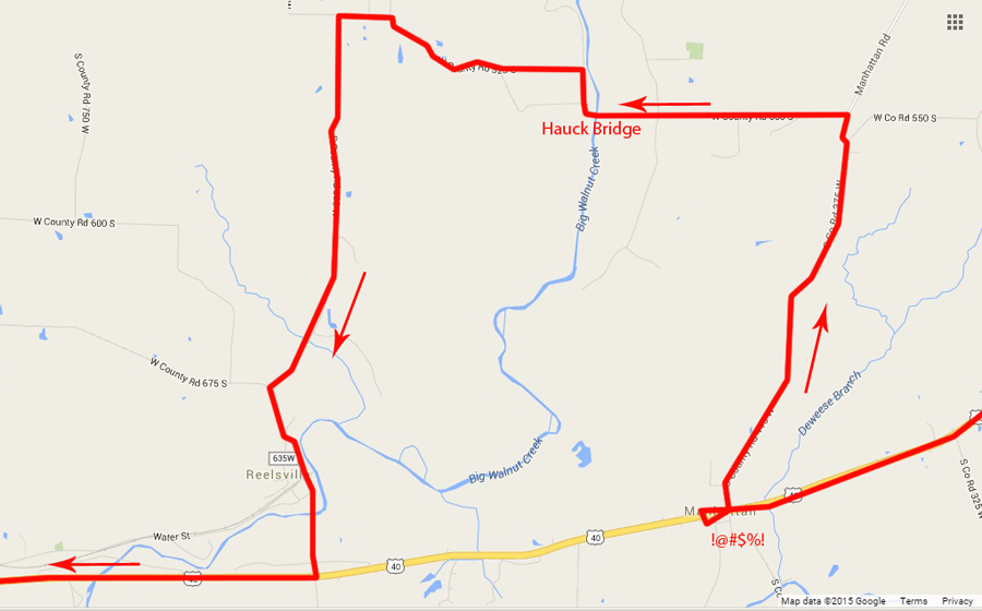
It took me a couple of tries before I found a road that would take me to the bridge -- not that the roads were absent, of course, but as in Pennsylvania seeing those damnably small road signs was problematic -- but after turning around and about I got the right road. Well, I got a road; not the one I had looked for, but one that would do it.
As I approached the Hauck, I was happily surprised to see that the bridge had not only been preserved, but an improved pavement bent away from the old roadway leaving the old road as a parking area.
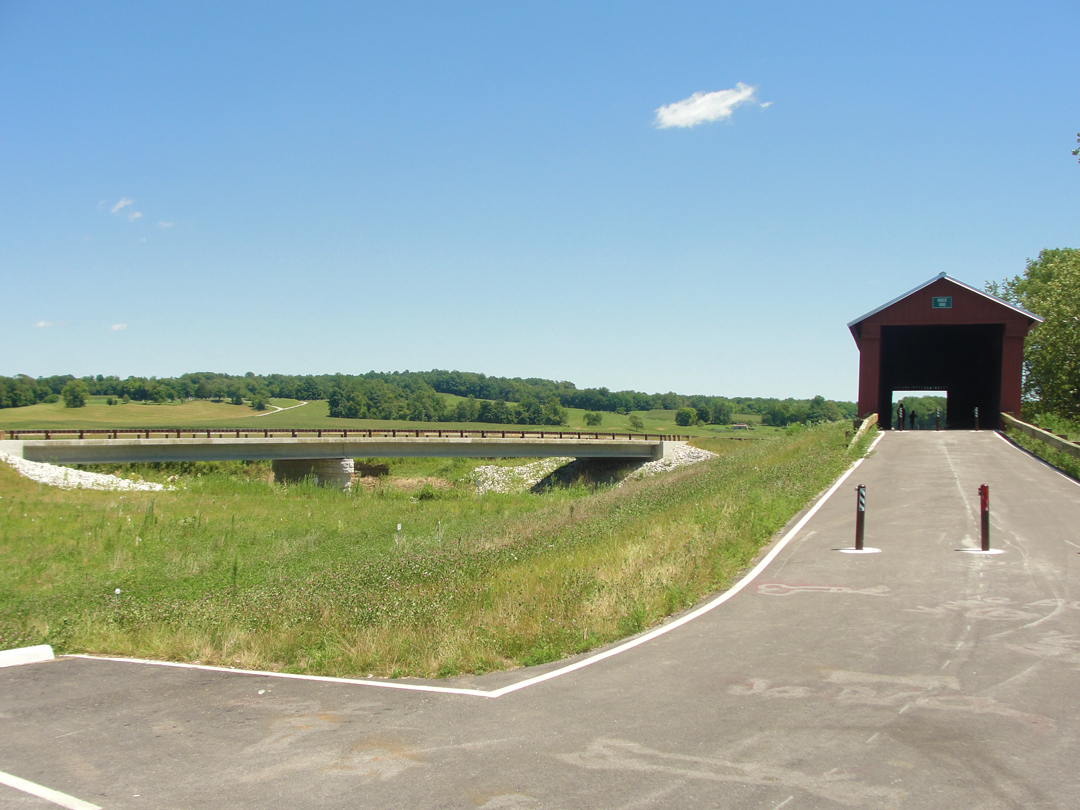
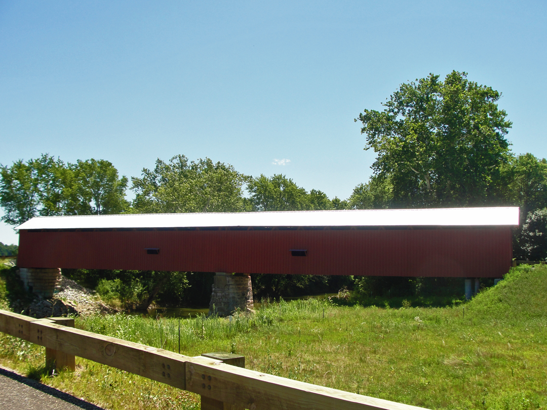
While I couldn't quite recreate Booth's vantage on the Reelsville, I rather like this view of the Hauck Bridge:
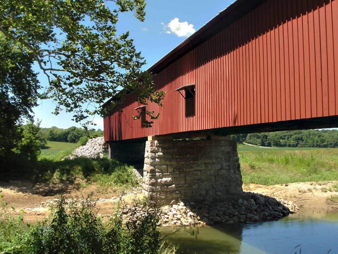
I also indulged my want for taking the "Indiana Pastoral" photograph:
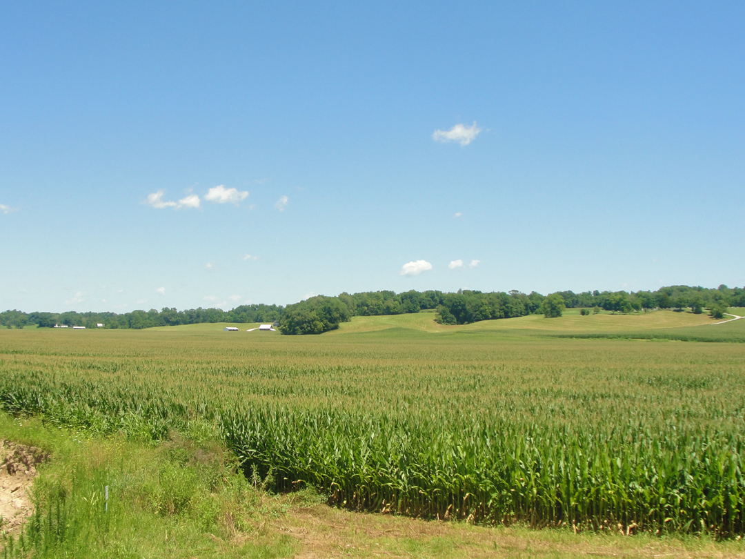
Somewhere on "the web" I came across a panel that read "If you want to know what someone fears losing, look at what they photograph" -- or words to that effect (I've tried to "re-find" it, but I haven't yet). There may be some truth to that statement. It may be that I fear losing the Pastoral, though to what I know not. Withering blight? Global warming? Do I fear losing blue and be-clouded skies, brilliant sunsets? Maybe. I don't take many photographs of people, though -- hmm.
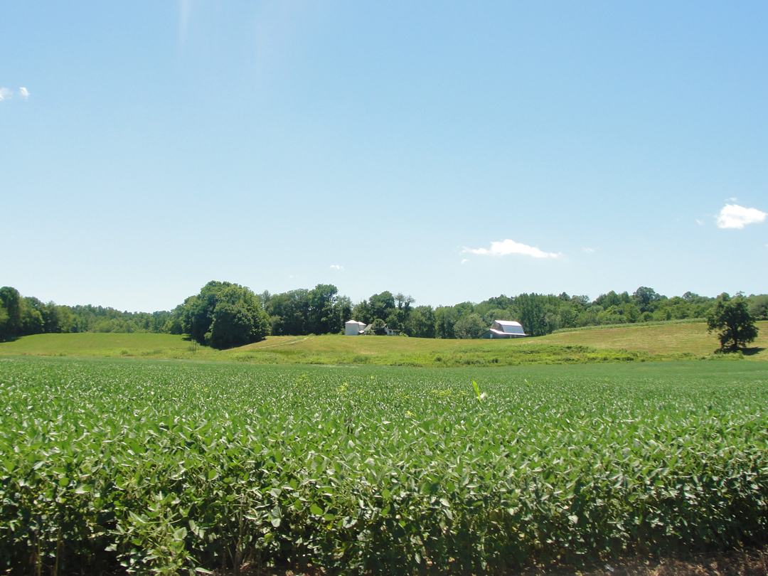
Be that as it may, I do like to pause and snap shots like these (there are many!), though I prefer to reside in a more urban environment. Still, an old farmhouse for a part-time residence would be O.K., I think, especially if it were a half-mile from the nearest neighbor.
What I'm not sure of is how the Pathfinder came to be in Reelsville, along what road? The stretches of Old 40 along here, I think, are actually more like "the middling" 40, earlier improvements that bypassed yet older roads, the roads that Dreiser & Co would have traveled over.

Having been around and through, now, and looking back at the maps, I'm thinking that Water Street would have been their exit from Reelsville in 1915, as it could easily been put in the system as part of 40 when the engineers were first designating, then left behind as the highways got their up-grades. But as had happened back in Pennsylvania and Ohio whilst looking for the Lake Roads, I am of the mind that after all some piece of macadam has been completely undone, and done over. Water Street to the West, but from the East? Traces only or nothing at all. Granted that this satellite view is only "so good;" maybe if I had a military grade surveillance image --
Almost as soon as I had turned onto the highway, there was another sign announcing Old US 40, and I pulled a quick right to drive it. As with the prior track, this one had also been mostly ignored and the foliage grown over it. Here though, were but three residences that I could note, and so little traffic that it was little better than a driveway. Near the Western end of this, a deadfall had been across half the old pavement for so long that it was collapsing of its own weight; no one had bothered to remove it, or even drive over it.
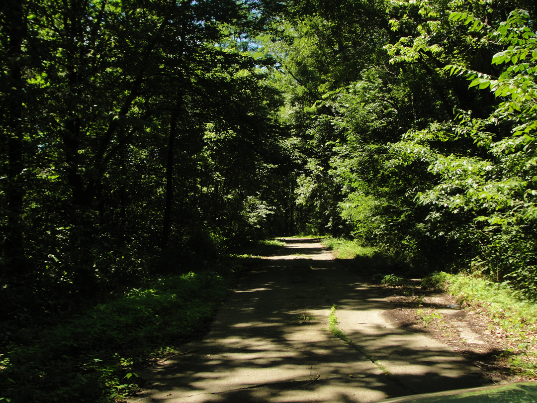
So ignored, in fact, that this piece of old road could be "in a Stephen King movie!" That's how overshadowed, dark, deep and lonely it looked.
Which reminds me of a story of his that I particularly enjoyed some years ago: "Mrs. Todd's Shortcut." Related by an old caretaker in Maine, the eponymous 'phelia Todd was always looking for shortening her drive times through the wilds; what she found not only made for some impossibly short drives, but also seemed to stop her aging, and might have reversed it.
The time that the caretaker went for a drive with Mrs. Todd, though, he saw things that he thought shouldn't exist. Along this old bit of Hwy 40 it would be easy to imagine things alongside the decrepit paving -- alongside or overhead!
Could be fun to drive this strip at night! Road trip anyone?
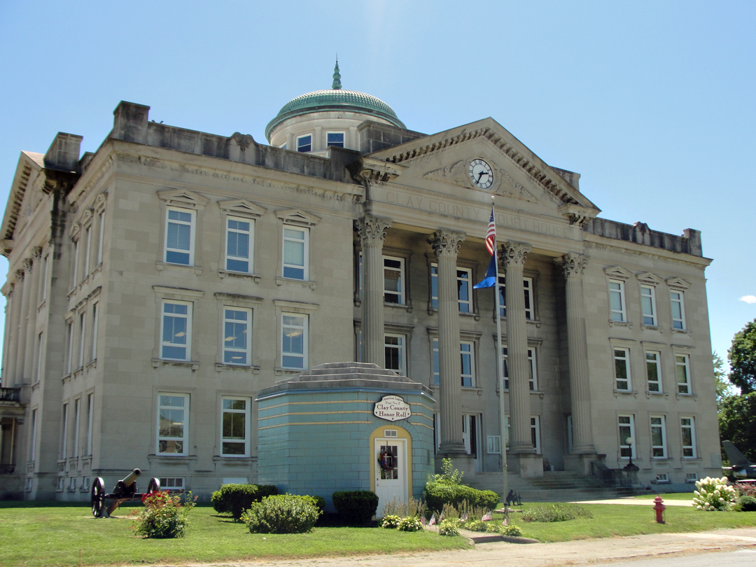
The Knox County Court House in Brazil, IN.
The orange cones were back as I came to Brazil. US 40 and the main street through here coincided, and the whole thing was getting reconstructed. I was shaking my head as I looked for a turn so that I could stop in at a corner antique store, and shook my head more as I tried to get back on 40. Once back Westbound, though it was easy going.
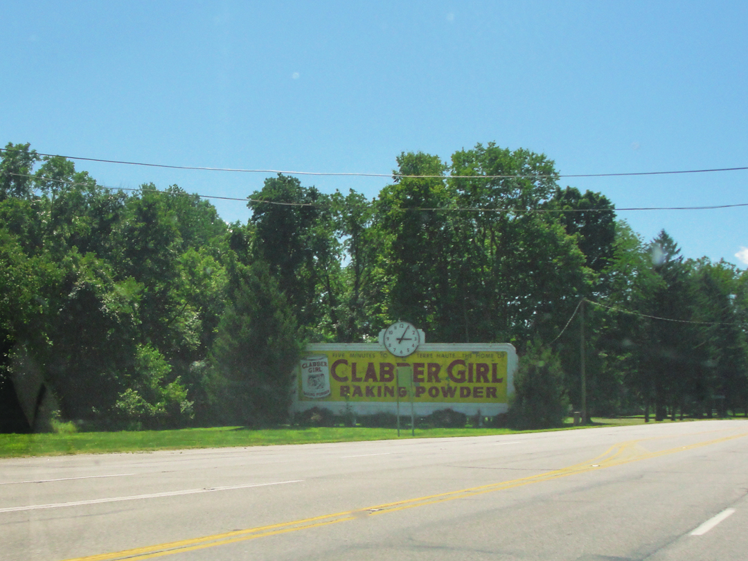
Having found, in 2014, that Terre Haute was home to the Clabber Girl company, I was not surprised to see this sign as I closed on the city.
(Update 2018: Indiana Landmarks has noted recently that this billboard is going to be restored, with replacement parts as needed to the rear framing, and a fresh coat on paint on the face, so that this historical piece can look like new for the 21st Century.)
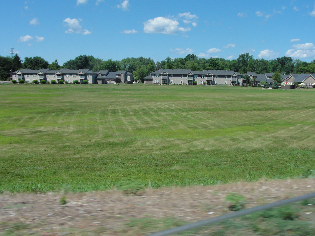
I was not surprised, certainly not by this point in time, to see this apartment complex. More like I was resigned to seeing it out on the edge of town.
US 40 turned off just before the road entered Terre Haute proper, going about on a bypass, but I elected to stay on the street which, as I soon found, was Wabash Avenue. I knew from last year that Wabash would take me right into the center of the city.
"Suppose, once upon a time in a very strange wonderland, so wonderful that no mere earthborn mortal could tell anything about it or make you feel how wonderful it was, you had been a very little boy who had gotten in there somehow (how, he could not tell) and after a very few years had been taken out again, and never after that saw it any more. And that during that time many strange and curious things happened -- things so strange and curious that, though you lived many years afterward and wandered here and there and to and fro upon the earth, still the things that happened in that wonderland, the colors of it and the sounds and the voices and the trees, were ever present, like a distant mirage or a background of very far off hills, but still present."
Not unlike Dreiser's thoughts on Warsaw, so his remembrance of Terre Haute, and indeed the towns to be visited down to Evansville. His first few years of life were lived in this SouthWest region of Indiana, and he put a great store on his boyhood memories. It is here, in his recounting, that he writes of the effects of his father's fortunes -- or lack there-of -- on his father's life and that of the man's family, Theo among them.
"We arrived [in Terre Haute] at nearly dusk, entering along a street whose name was change to Wabash shortly after my brother's song became so popular. Among the first things I saw were the buildings and grounds of the Rose Polytechnic Institute...only of interest to me because the man who founded it, Chauncey Rose, was once a friend and admirer of my father's. At the time my father's mill burned in Sullivan and he was made penniless, it was this man who came forward and urged him to begin anew, offering to advance him the money. But my father was too much of a religious and financial and moral coward to risk it. He was doubtful of success -- his nerve had been broken -- and he feared he might not be able to repay Mr. Rose and so, in event of his dying, his soul would be in danger of purgatory. Of such is the religious mind."
So Dreiser considers of his father. As he aged, Dreiser became more amenable to his father and that his father at least had convictions, but of things religious he remained at best skeptical, and mostly dubious. Much of his early life was colored by the tension between his father's strict Catholicism, and his mother's search for contentment.
Below: "Looking West from 9th & Main St" circa 1913 (LOC). Main was the street previously noted as having its name changed to Wabash, for the song.

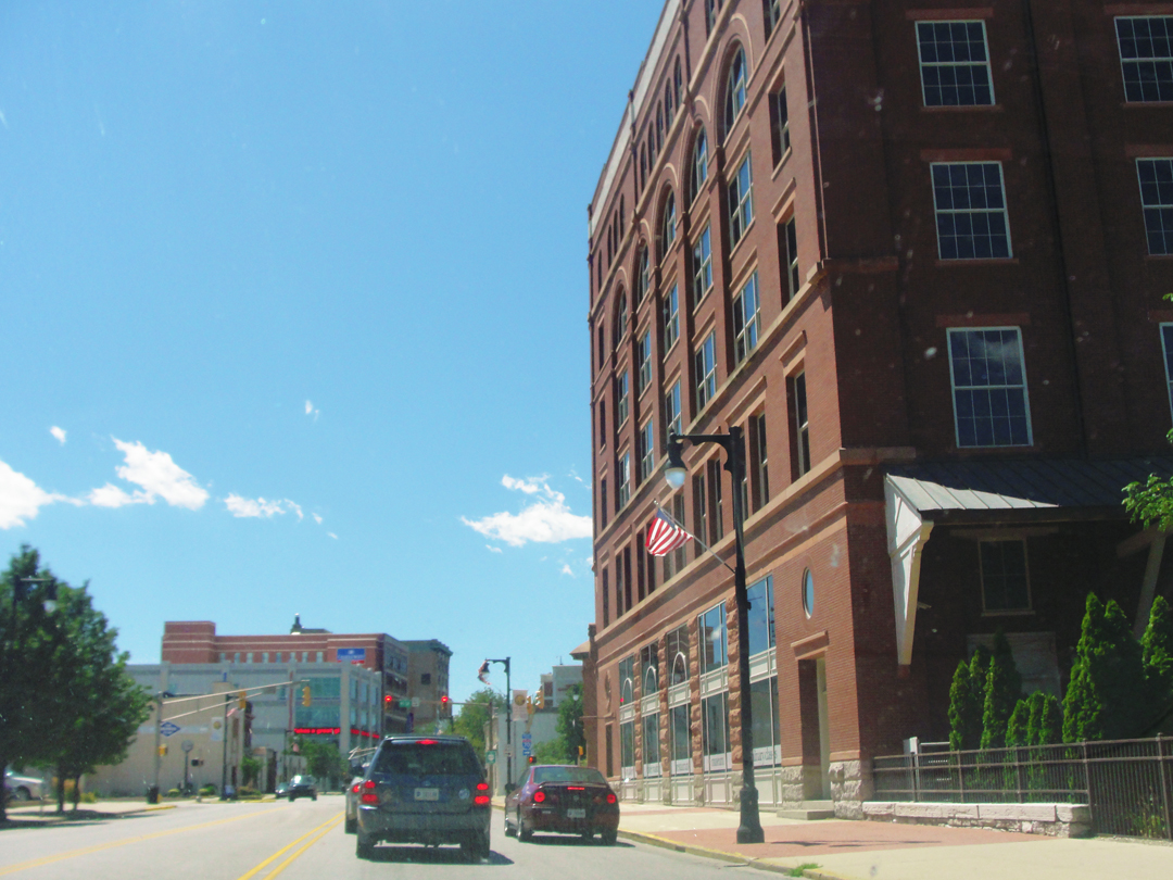
At right: Wabash Ave at the Clabber Girl building complex, looking West. The stoplight is at the intersection with 9th Street. In the distance of both photographs can be seen the same mid-rise commercial buildings.
Theo's brother, Paul Dresser, after floundering about with theatrical troupes for some years, wrote some songs in the late 1800s, which put him in the public eye. "Along the Banks of the Wabash Far Away" was a "monster hit" in 1897; sales of the sheet music netted Paul thousands of dollars; and it became the Indiana State Song in 1913. Paul was Johann Paul Dreiser, Junior, but anglicized his name to John Paul Dresser while out on the dramatic circuit.
As I had in Warsaw, I did the "address chase of 2014" when I visited Terre Haute last year, so I was not going to recreate my recreation of the Pathfinder's criss-crossing of the city streets, looking for Dreiser residences in this year of 2015. But, as I've fumbled along with my desultory researches, I came across some images that had me going back to the books anyway.
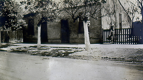
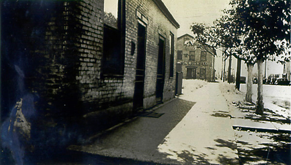
I came across a few photographs of this house (DWS). They are variously dated as "Summer 1936" or not at all; identified as "The Dreiser Home," or as "TD's birth place" or as "Paul Dreiser's birthplace;" and given the addresses of "115 Poplar Street," or "Walnut Street between 1st and 2nd." Oh! the discrepancies! After re-reading passages in both Holiday and Lingeman's biography, I think I've sorted this. I think --
Firstest, I'm pretty sure the woman in the photo above left is Helen Richardson, with whom Dreiser had a very long, and rocky, relationship. While this image's quality doesn't allow close scrutiny, the simplest of features here look as if they would match other photos of Richardson. By the '30s, Dreiser was taking photos himself, and so Theo not appearing with these houses makes me think he was behind the lens.
O.K. -- Lingeman notes that Dreiser returned to the Warsaw area in 1919, and visited with, among others, his 7th grade teacher May Calvert Baker (who encouraged his use of the library and helped expand his literary thinking). There is no reference to another visit to Terre Haute; however, there was another automobile trip that holds at least that possibility: in May of 1936, Richardson and Dreiser did make a drive through Indiana (Dreiser was not adept at driving, and Richardson was frequently behind the wheel on their journeys across the country); Dreiser was on his way to a speaking engagement at Purdue University (of all places!), while Richardson was going to Portland, Oregon, to visit her mother. I can easily imagine that Dreiser would suggest their taking some route that would allow them to pass through Terre Haute and make a swing by some old home places.
With that in mind, then: in Holiday Dreiser relates his asking after the location of his father's mill, and also for the first house his father had lived in, in Terre Haute. He was told that that house was on Poplar at 2nd, and that it was built of brick. He was also told, or at least wrote that he was told, that the house had been given a second story. Hmm? Well, I'm inclined to believe that this was the first house Paul Senior resided in. It couldn't have been his birth place, as he was born in Germany.
As for Paul Junior's birth place, that has been preserved. After all, he wrote sentimental songs that captured the imagination of the public, not "controversial" novels that were threatened with censorship by the Comstocks. So:
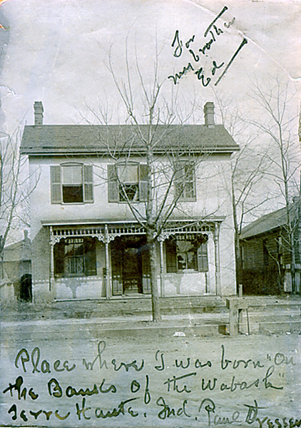

At left is a photo inscribed by Paul, Jr., to his youngest brother Ed (DWS); at right, that house today at the entrance to Fairbanks Park. It has been placed on Dresser Drive, just off of 1st St., and the park is literally on the banks of the Wabash.
And then I realized that the following house was was, if not the "spittin' image" of a Booth drawing, really close; maybe close enough -- after all, dormers can be added, but chimneys don't move much, if ever.

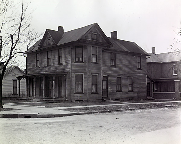
Noted as "Ed Dreiser birth place" (above left - DWS), this photo fits the bill described by Dreiser and Lingeman of the house at 12th and Walnut as being "large." So for now I'm going to accept this place as the house where Theo was born. as depicted in the Booth drawing (above right).
Well, enough of that.
"Terre Haute was not so different from Fort Wayne, or even Sandusky, minus the lake. It had the usual main street...lighted with many lamps, the city hall, postoffice [sic] principal hotel...I will say this for it, it seemed more vital than most of these other places...I asked Franklin about this, and he said that he felt it had exceptional vitality..."

Having done, as noted, the "address chase" already, I stopped for some coffee (what else? of course I did) at a shop I had visited in '14 -- The Corner Grind -- where I discovered a particular collectible:
What I don't know is: does one drink the collectible Coke? Or leave it and the caps intact for posterity? By the 200th anniversary, I can't imagine that the liquid will have aged well, but then, I won't be around to care.
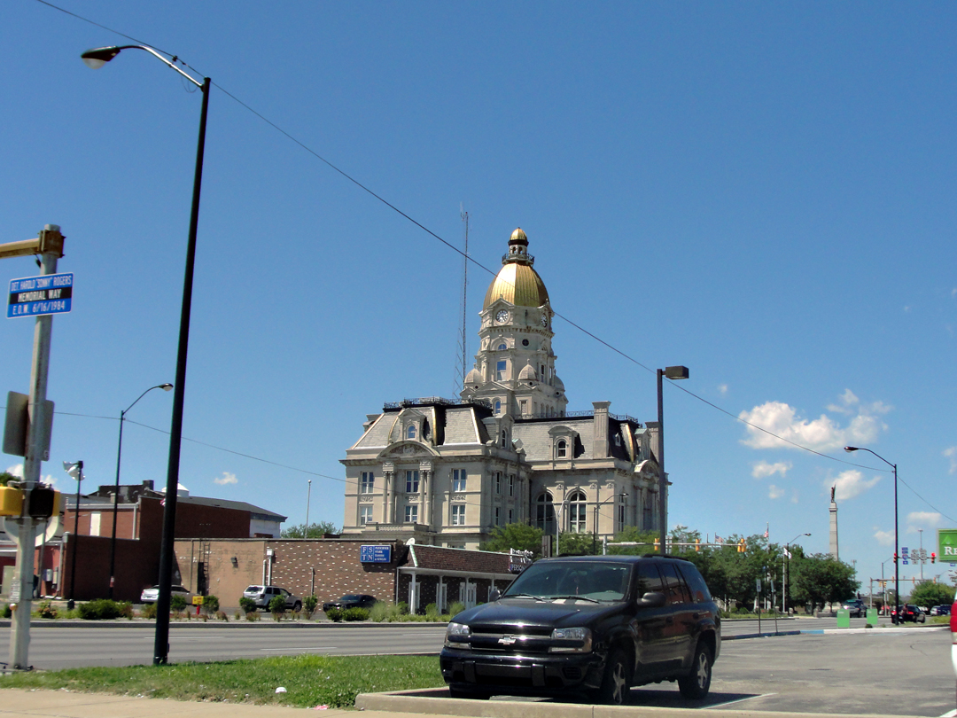
Having got my "joe," I was heading back to Fairbanks Park when I shot this view of the Vigo County Superior Court House. It is quite the piece of architecture. It also served as a point of vantage for the following panoramic of Terre Haute, in 1913 --
"Looking East from the Roof of the Court House."


I drove down that street that passes the court house in 2014, and as can be seen in my photo of said court house, and as seen at right, Terre Haute really doesn't look like that any longer.
"...something which I have always noticed about American cities and missed abroad, more or less...was here, -- a crude, sweet illusion about the importance of all things material. What lesser god, under the high arch of life itself, weaves this spell? What is it man is seeking, that he is so hungry, so lustful? These little girls and boys, these half-developed men and women with their white faces and their seeking hands -- oh, the pathos of it all!"
I think maybe that's the same today, only with shorter buildings.
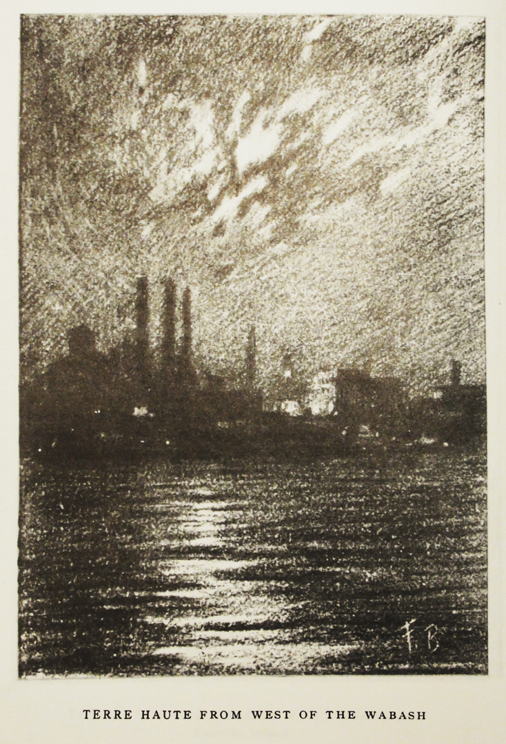
Fairbanks Park, with its Dresser Drive, is apparently a brownfield reclamation. In 1915, when Dreiser inquired after his father's mill, he was told it was at the foot of the street, which I believe to be Poplar St where it lands near the banks of the Wabash. That also would have put it just a short walk from the house at Poplar and 2nd, which makes sense. Paul Sr.'s woolen mill would have been one structure among many.
The river front was where industry was sited, with warehouses and wholesalers a street or two inland, as can be seen in the photo taken from the court house roof. Lingeman describes Terre Haute's industry, and Booth's sketched the place with tall smokestacks (left). Today, it is grass and trees. Either the city or the county overturned generations of commercial footprint, and gave the residents a place to loll by the river, and come for festivals and concerts.
Below, looking South, or down river -- Fairbanks Park and the Wabash River:
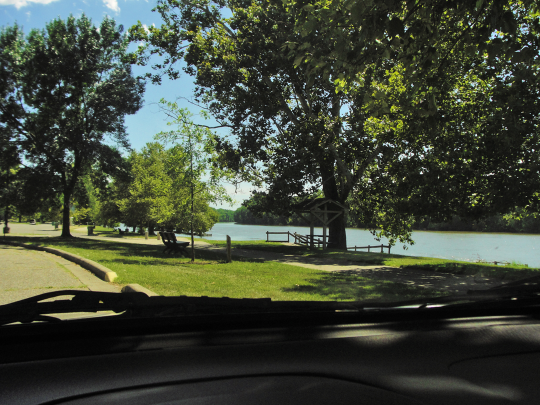
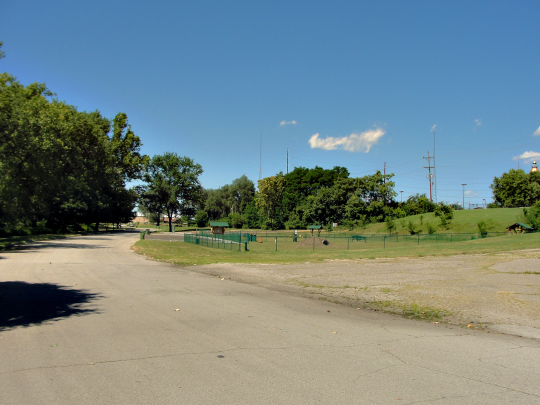
I really did want there to be something to see down there, though in hindsight it should have been obvious in 2014 that there was nought left of that industrial past.
In the photo at left is where I said "Somewhere along here?" I think this is the general area where the mill would have been. Yeah, pretty big for a general area -- I know, I know -- but Poplar St quits in a car park at the top of the rise, just to the right of the tree line in the middle right of the photo. So just beyond the playground?
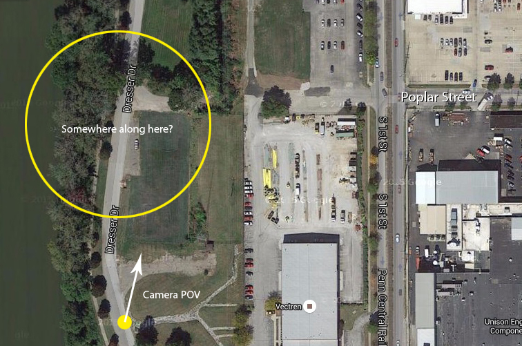
Satellite view showing Fairbanks Park, and where Poplar Street quits at the car park. With nothing else left for reference, at least that I've found yet, this is as close as I'm getting.
"Somewhere along here."
While in most places the roads haven't changed much, and so many towns and little hamlets still exist for no more reason than they're there, what can happen on top of the land amazes me. That so many generations of structures have already come and gone, even in my lifetime -- it's as amazing that some old places and buildings are still recognizable after 100 years or more.
But I had seen what I wanted of Terre Haute for this trip, and turned the saloon Southward again, looking for what Dreiser called "A Lush Egyptian Land." Not sure why he favored "Egyptian" as a description.
"The territory into which we were now passing was that...[which] of all places that I ever lived in my youth the most pleasing to me and full of the most colorful and poetic of memories. Infancy and its complete non-understanding had just gone...adolescence -- had not yet arrived. This was the region of the wonder period of youth, when trees, clouds, the sky...all filled me with delight...
Sullivan, as we found on consulting our map, lay only twentyfive [sic] miles south, or thereabouts."
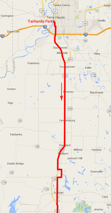
US 41 led away from Terre Haute, approximating the route of the Pathfinder. Heading for Sullivan, I made most of this leg on the improved highway, letting my mind wander just a bit. While I was not in that "just gotta' drive" frame of mind that I found myself in on other days, it was still nice to simply "go." There were soon to be routes off of the new road, and I was looking forward to driving them.
As I neared the town, I found myself playing "musical lane change" with some of the other vehicles on the road -- a situation I find particularly annoying when I'm not sure where I'm going to turn -- and so I took advantage of a break in opposing traffic to whip a turn to the left and get out in the county roads. I jogged around to come back to Section Street, which led from one end of the town to the other.
I'll be honest: I did not linger in Sullivan. Dreiser's luck at finding anything left from his childhood was limited, and disappointing. Say I was judging a book by its cover, but I saw little in Sullivan to make me want to pause longer than a red light took to cycle before I was back on the highway.
"Our road lay through a perfectly flat region, so flat and featureless that it should have been uninteresting and yet it was not...This section in which I had been partially reared had charm...The houses were all small and simple...but very good and new and seemingly comfortable, sheltering no doubt the sons and daughters of people who had been here when I was...The cattle in the fields looked healthy, fat. Timothy and corn were standing waist high. It was hot, as it should be in a fat riverland like this."
On the way, the company could see coal breakers near the "soft" coal mines of the region, and paused to marvel at the working of a mechanical hay press with a gasoline motor. Entering in to Sullivan, Dreiser writes "Once here I could not see it as it really was at the moment, nor can I now write of it intelligently or dispassionately." The fact of the place soon came clear, as much of what he remembered was gone. Houses he was familiar with were gone, fields and trees that had been childhood play places were over-grown, and of course the people he had known of were missing. The house he had lived in, however, was still there, though its condition reduced.
.jpg?1541209841093)
The house in Sullivan, in 1915 (DWS). Dreiser asked after, and was granted admittance to look about the house his mother had once kept neat. To his dismay he found "It was a litter." Speaking to the place under his mother's care, he wrote: "...there is an art in spareness and bareness and cleanliness... What we had, thanks to her, was clean and neat, with flowers..."
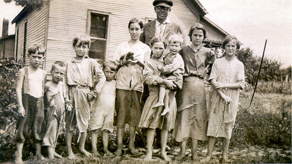
Dreiser with a group of "chattering children," (DWS) residents of the neighborhood, to which even in 1915 Dreiser remarked as being "poor white trash."
"...children with bare legs, bare arms, in most cases half bare bodies, and so dirty!"
" 'My brother's got tabuckalosis [sic] of the bones,' one little girl said to me, nodding at a skimpy, distrait looking youth who stood to one side, rather pleased than not that his ailment should attract so much attention

At left: Sullivan to Busseron.
Dreiser writes here many of his memories of his young boyhood, but the world he recalled had passed -- the world had moved on, and so then did the company. "Life moves so insensibly out from under you." They went to look after his father's woolen mill -- it was still there, at least -- and a few other things, but they did not linger. Soon, the Pathfinder was headed on South.
After exiting Sullivan, and back on US 41, I was looking forward to a goodly stretch of Old US 41, a better approximation of, or perhaps even the roadway followed in 1915. A couple of miles after the town quit, the Old road was a turn to the left, near Paxton.
"At Paxton and at Carlisle again we came upon coal mines...Miners in droves were to be seen walking along the roads as at Wilkes-Barre, their faces smudgy, their little lamps standing up from their caps..."
Old 41 traversed thus, and was little traveled, being, in many places, in close proximity to the improved highway. Not that I minded having little or no traffic around me.
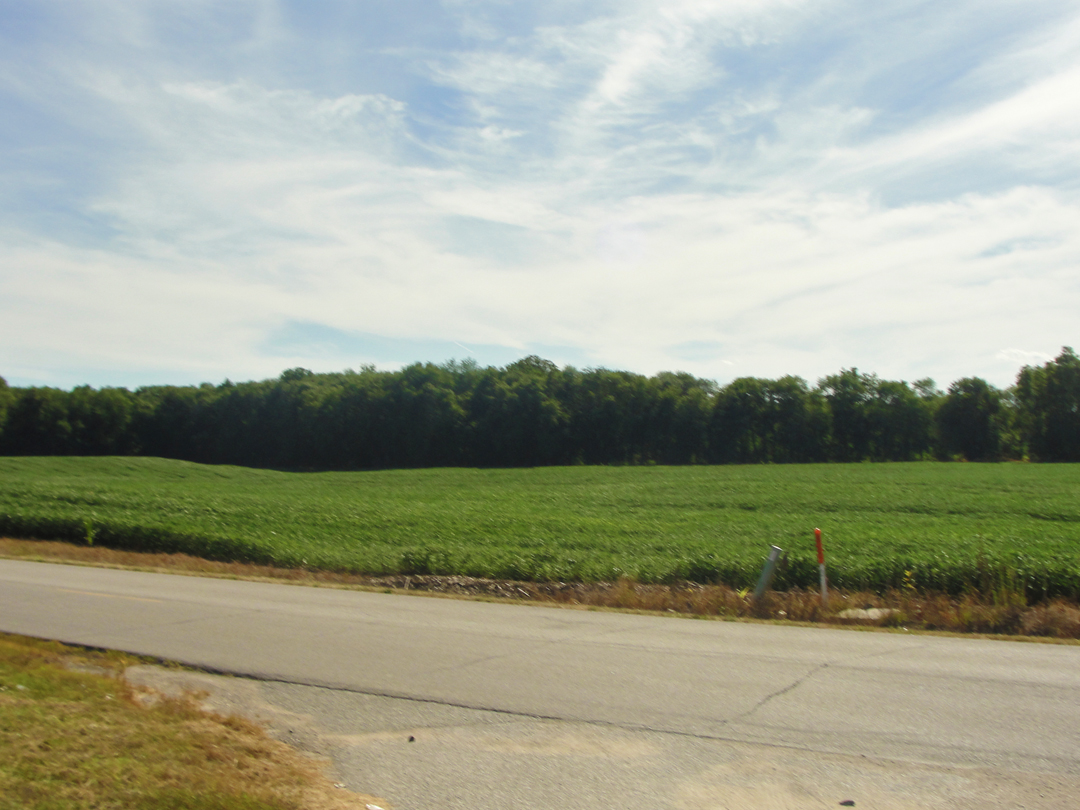
Above, right, and below: Old US 41 between Paxton and Carlisle. Here I said "O.K., now we're getting the 'lush Egyptian' landscape that Dreiser was after."
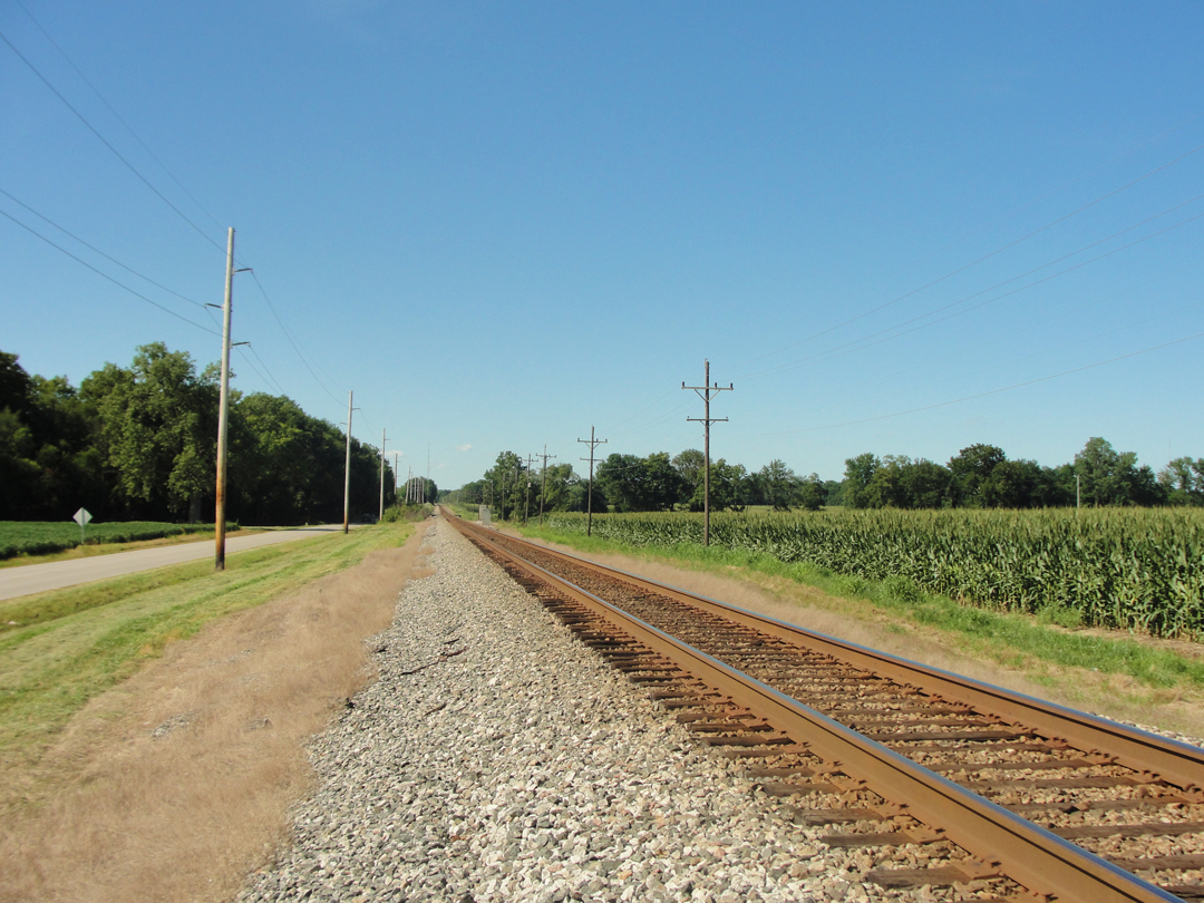
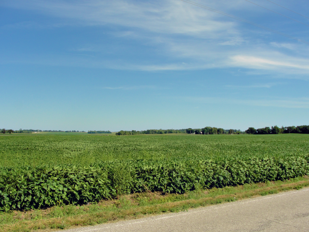
Below, left: the Old and the New -- very close! -- a little North of Carlisle. Just past Carlisle, the Old route crosses the new highway, and continues on the West side, as seen below right.
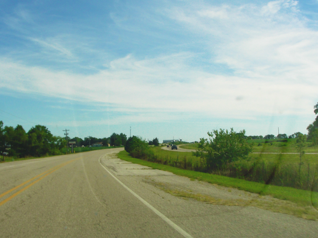
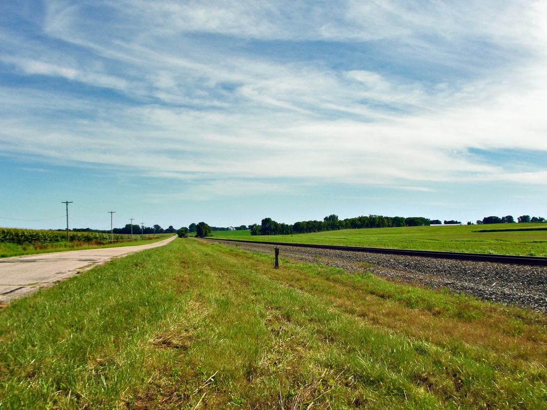
South of Carlisle: an unlooked for panoramic. I did not shoot the constituent images with this composite in mind, I just got lucky! For once. There are time when I do make the attempt, and it doesn't work as well.

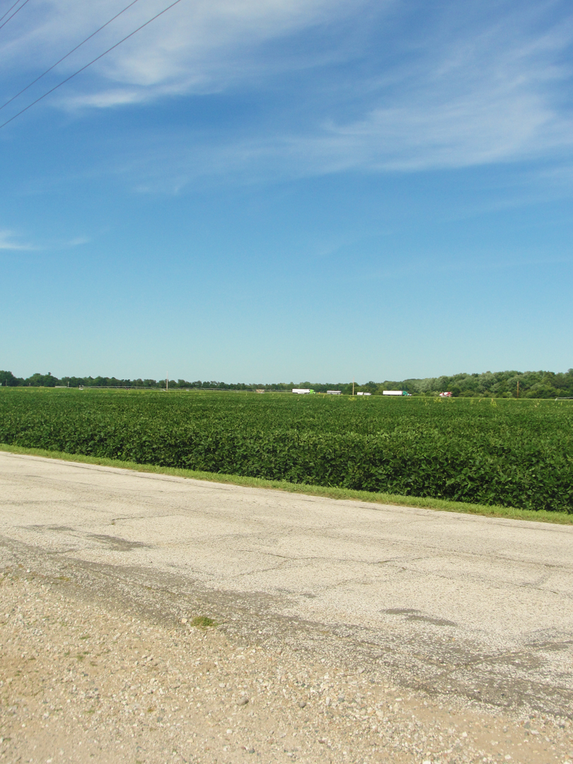
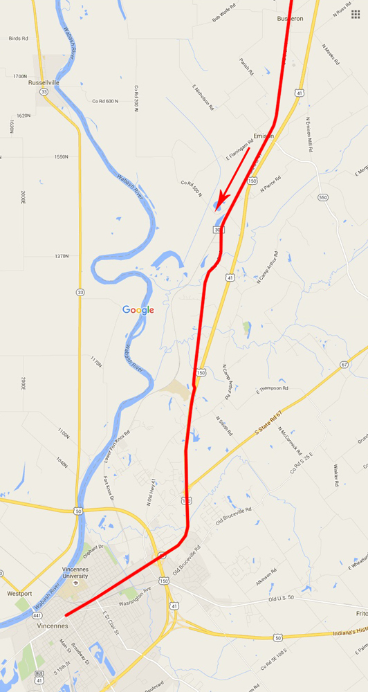
Above: a few miles North of Vincennes; at right, from Busseron to Vincennes. The photo was taken near where the arrow sits on the map, where the the Old and New come so close again.
Old 41 finally came back to the new road, and I finished my drive to Vincennes on that way, gaining the town proper on the Business Route along 6th Street. As I drove in, I saw what I guessed to be either a post office, or a court house, in what looked like that hybrid of Classical & Moderne architectural styles that immediately brings to my mind "PWA building!" So I turned to make my way 'round the block to find a better view.
Dreiser wrote "My youthful impressions of Vincennes, sharp as they may have been at the time, had by now become very vague." He recollected spending six weeks living in an apartment with the fire captain of Vincennes -- the man's wife was known by Theo's mother -- after leaving Terre Haute, and prior to moving to Sullivan. The firehouse the company found, and then got their usual gas and oil before heading on.
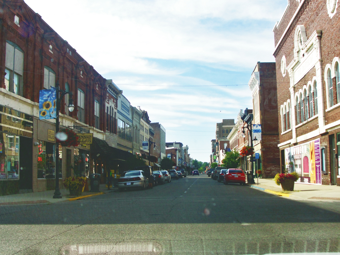
Instead of finding the "PWA building," I found myself on some principal street heading through the old business section. Well, I thought, this looks pretty O.K. Not unlike my impression of Bowling Green, way back in Ohio. A university here, too, probably helps that. Students do add something to the local to the commerce.
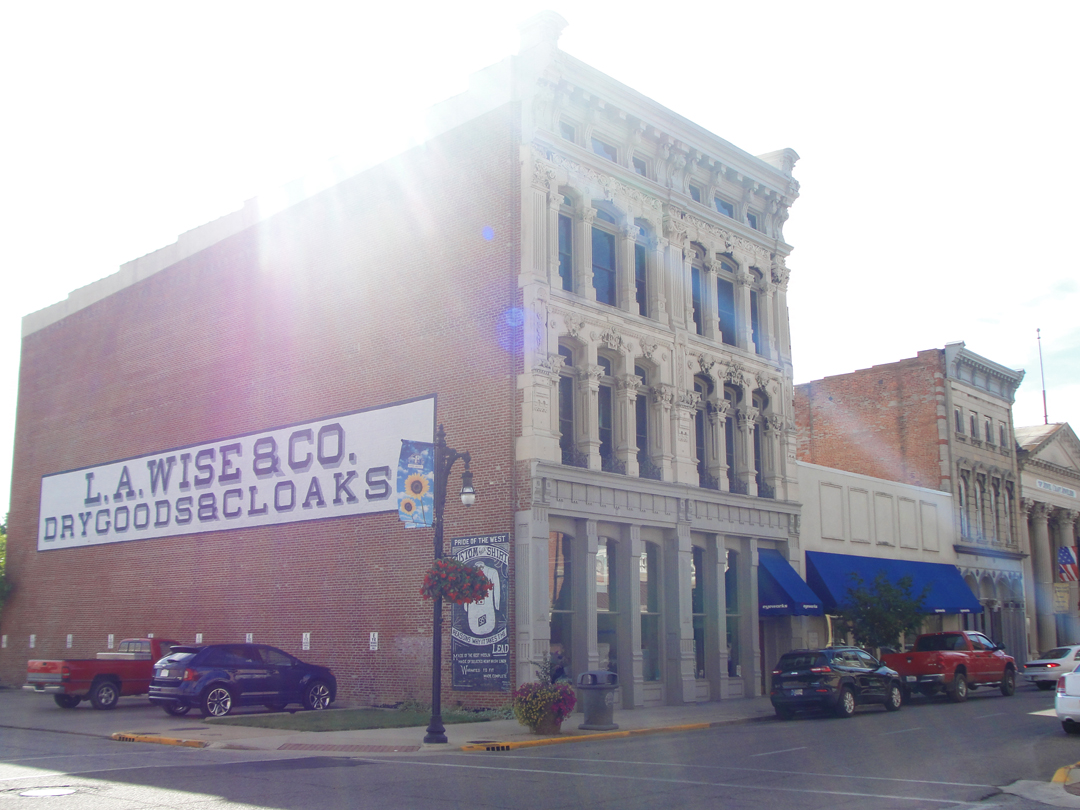
I rather liked that someone had bothered to restore this old sign, and at least the facade of this building was in good condition.
After this, I was back on the Business Route, which conveniently led toward my next favored way: South Decker Road. I saw the "PWA" building, but was already for heading out of town, and did not turn back.
"Uncertain is the outcome of all automobilists' plans forever and ever, as with all other plans. Although we had inquired and inquired, getting the exact way...we were soon safely on the wrong road. We had been told to make for a place called Decker, via a town called Purcell, but soon in the shades of a fast falling night we were scuttling up a cowpath, under dark and ghostly trees."
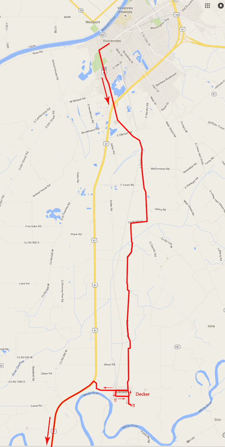
Decker was not only on my map, but it looked like the best ways to arrive there would be down the aptly named South Decker Road, and Old Decker Road. Having re-read of the meanderings of the Pathfinder and its passengers, I think these were the roads they were directed to, though how they got anywhere else is unknown, and I was happy to discover that gaining my desired way was surprisingly more easily done than had been the case in the past. Maybe because I had a map, or maybe because the sun was still lighting my day, I drove to Decker with no turns-about and only one detour, though that was brief and intentional.

At right, the subject of my detour. About half-way between Vincennes and Purcell I saw this warehouse or light factory off to my right. I turned that-a-way to have a closer look, and took this photo.
It was another moment for me to shake my head, because the place looked abandoned. Warehouses and "commerce parks" are still being erected in many places across the country, while previous constructions like this are left behind. I am frequently impressed by the sheer number of buildings that have been put up by one developer or another that may have been sold as good investments or good business or good something-or-other, only to have those superseded within a couple of years by yet another development, and just down the road.
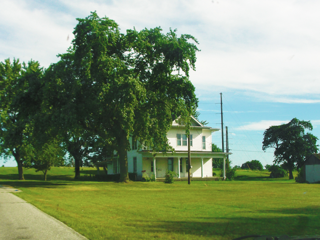
Just around the corner and down the road a bit from the abandoned warehouse was this farmhouse. Actually, standing on the porch here, you would easily see the warehouse, or what-ever it was, hulking over the corn field, maybe a quarter of a mile away to your left.
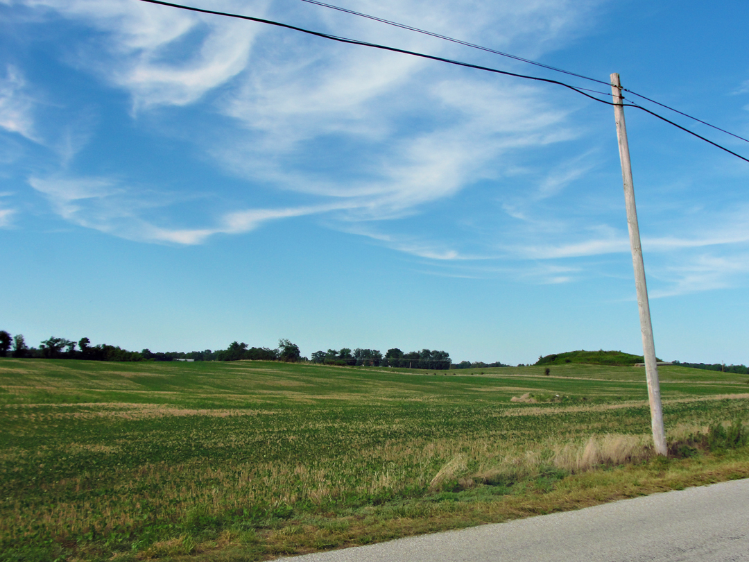
Looking back toward South Decker Road, on the way to Old Decker: another view of the "Egyptian" land. O.K., yes, I like taking photographs like this.
Somewhere, somehow, as the world drifted to twilight, the Pathfinder was turned around, and Dreiser & Co asked for directions -- again -- this time of a "charming milk maid" who explained how to get to Decker but told them "But it would be better if you went back." Not that they did.
They wound up asking for directions a few times.
"Riding is delightful in such a country. In lovely cottages as we tore past I heard mellifluous voices singing in some archaic way. You could see lighted lamps on the family tables, -- a man or woman or both sitting by reading. On doorsteps, in dooryards, now and then were loungers, possibly indifferent to the mosquitoes...then [went] by a wrong road away from Decker, but we found it finally."
At right: Vincennes to Decker
As the saloon rolled along, I noticed that I was in a particular agricultural region: the fields were ripe with watermelon. Well, actually what I was seeing was the school buses that had been re-purposed to haul the watermelon.
This was new to me. I realized too late that I had passed a couple of opportunities to stop and record an image of these ex-school buses, but I did not, for what-ever reason. By the road or in farm yards, the buses had been relieved of their windows, and large sections of the sides and roofs removed to allow the produce to be placed inside.
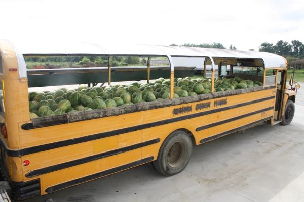
Like this. Coming around one curve, nearing Decker, I passed a work crew that looked to be ending its day in the field. I'll say that I was somewhat taken aback -- "You're kidding me, right?" I asked no one. Yep, the crew was Black. Brief thoughts of the age-old bigotry ran through my mind as I slowed to pass them, sitting or standing on or alongside the harvest of watermelon that they had loaded on the bus. What a world!
Shortly after, I gained Decker. "It was a railroad town." When Dreiser & Co arrived, he noted a large crowd at the store, apparently waiting for the next train to come in. While there, they asked after directions to Evansville, and were told of the ferry over the White River, and that it might not be running as the river was " 'runnin' purty high.' "
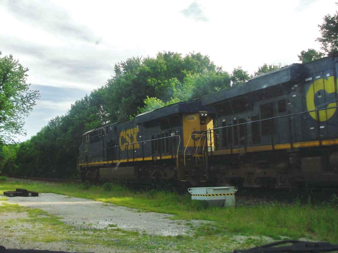
There are still trains that run by Decker, but I doubt they stop any longer. On the map, there was a road that looked like it might take me to the river, or maybe near it, running South from one corner of the town. As I approached 1st Street and the rail road track, the signal began to clang its alarm of an approaching train. I turned left on 1st as the freight pounded by.
I drove slowly down 1st, looking for the road, and found that it had been gated, with a PRIVATE sign attached. "Well, hell," I mumbled, and decided to try the next road that ran South, over on the opposite side of town, off of 5th Street.
It, too, ended -- as a farm driveway. I turned around and went back up 5th thinking I would regain the county road. I did, and I saw that Decker was almost entirely contained within four streets.
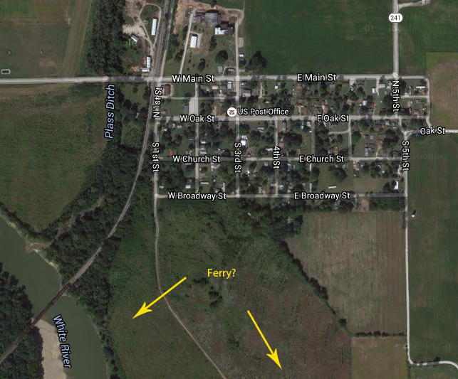
I do find it amusing that someone bothered to subdivide the streets' designations into West and East, or North and South. Decker seemed to me like another of the small 'burgs that exist simply for their existence, though I suppose that some of its residents may work on the neighboring fields as hands or foremen, but not owners. But, I could be wrong on that score.
Despite the warning that the ferry might have stopped for high water, the Pathfinder went on down the indicated road. That road, though, was "...perfectly horrible...great mucky ruts that almost stalled the car..." The road led them by an oil works -- derrick, workshops and oil men at their tasks -- which caught their interest: "It was so attractive that, although up to this moment we had been worrying about the car, we got out and...sat about here for half an hour basking in the eerie effect of the torches in the moonlight...It was fascinating."
The road did, after all, take them to a ferry landing. It took a few attempts with a signal bell, but they gained the ferryman's attention, and got conveyance to the South bank. The water, Dreiser observed, was indeed running high.
" 'Hook 'er up tight,' [the ferryman] called to his assistant. 'She might slip out yet.'
'But up at Decker,' I [said] mischievously, 'they said you ran all night.'
'They said! They said! Whadda they know about this here ferry I'm runnin' this, I guess.'...
We paid the bill...Then we bustled up and through an interesting, cleanly looking place called Hazleton...and so on toward Evansville, which we hoped surely to reach by midnight."
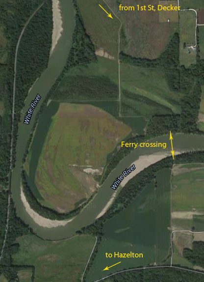
It was this reference to Hazelton which finally caught my attention, having re-read of the ferry crossing. At the time I was rambling around Decker (which only took a few minutes!) I was unsure where the ferry might have crossed. Which road? And to what bend in the river would it have gone? Looking over the text and this satellite image of the area has given me at least this proposal: the gated road at the foot of 1st Street was the road to the river, and may still be; across the White is another road that allows for access to Giro Road, by which one could drive to Hazelton.
Or not. I'd have to bump down that old road to see, I think -- in a 4X4! -- and as I've found, sometimes the old roads do disappear into the fields. But "somewhere around here" the Pathfinder was taken across.
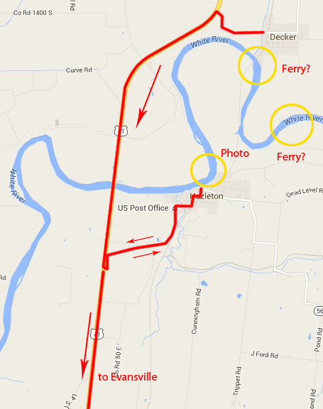
Hazelton got my attention because it happens to have been my next stop after Decker, though I hadn't planned it that way.
While I was in Decker, I was starting to think that maybe getting to Evansville would have to wait. The sun was getting low, and, remembering my floundering in the dark around Phillipsburg trying to find lodging, I was thinking that stopping before nightfall might be prudent. County route 241 took me back to US 41 again -- the improved version -- where I turned South.
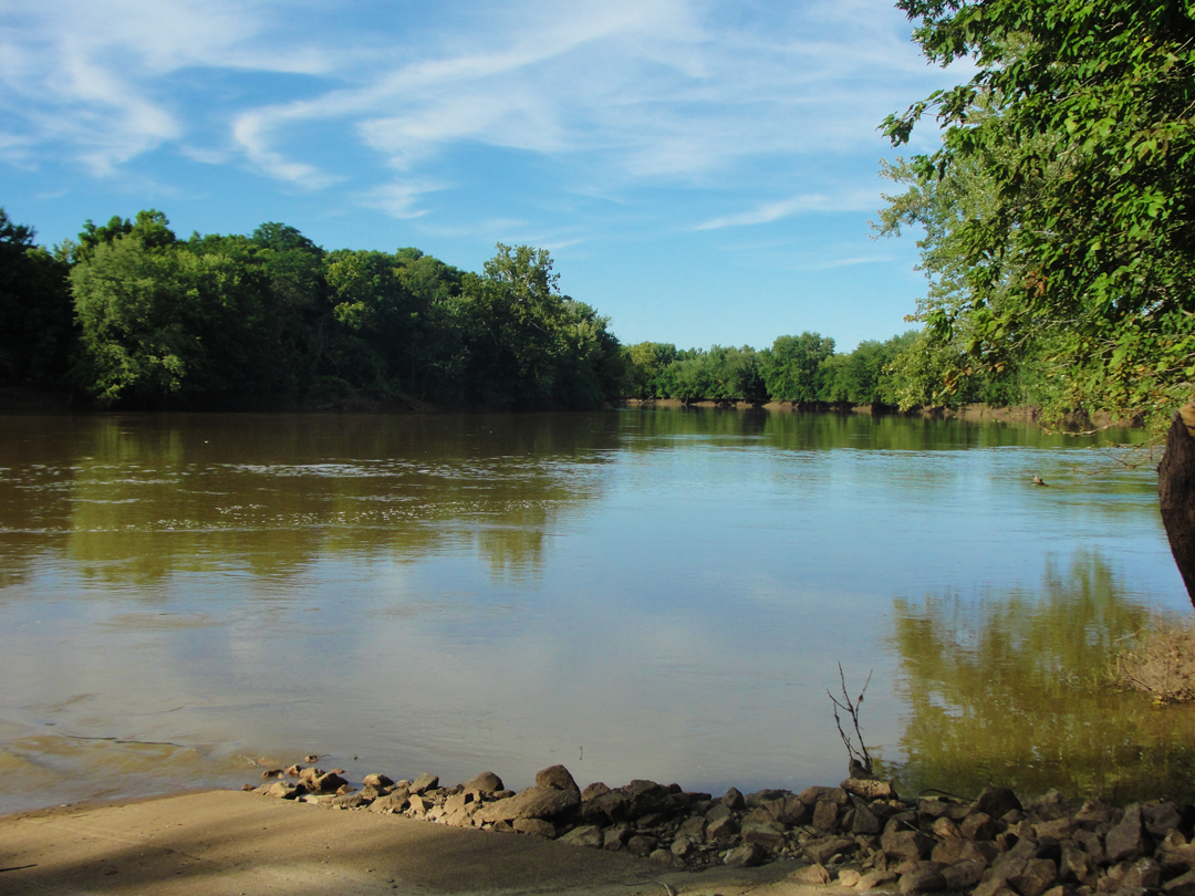
The highway has a clean, fast, concrete span across the White River, with barely a glimpse of the water. Shortly after making that crossing, I saw a sign indicating a public access via the next left turning. I drove right by. Then I thought, "Well, why not?" and turned around. The road led me to Hazelton, and a boat ramp on the White River.
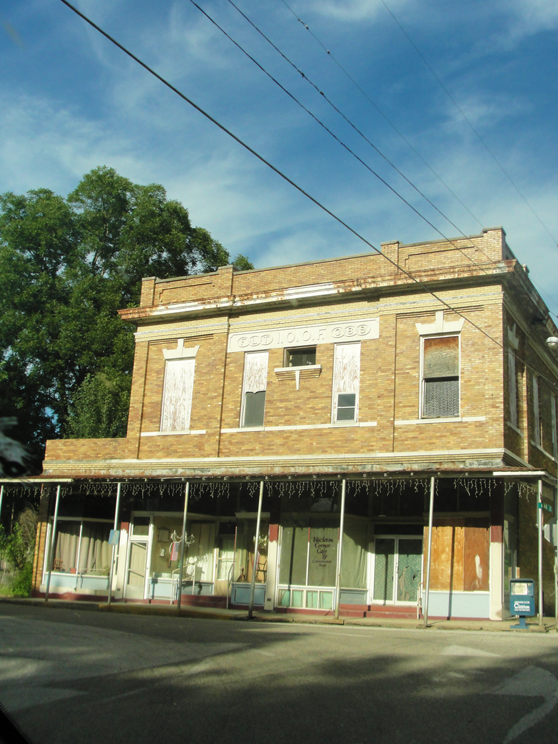
At right: the old lodge of the International Order of Odd Fellows in Hazelton. The IOOF: an organization that you might think would welcome me with open arms! Though I'd probably say "Maybe not," because, like Groucho was supposed to have said, I wouldn't be a member of any club that would have me.
I think the church across the street was taller, but this might be the largest building in town today.
Below: the scene along the White from the public access ramp.
With that, I decided that a stop was in order. It was more or less time to eat, and I needed to stop driving. The mileage to Evansville noted on the highway signs was not great, but I would get there after dark; and since I had been seeing signs, too, for riverboat casinos, I imagined that rates would probably be high where rooms were easily had. After passing under an Interstate, though -- I-64 -- I saw that by-now familiar cluster of motor hotels and roadside eateries so commonly found alongside the highway interchanges. Yay! a room and a bed. It was an Evansville address at the least.
Dreiser & Co did not make Evansville, either. After crossing the White River, they got to Princeton, stopped for a late dinner, and stayed the night. The restaurant where they ate must have done a good business, for as Dreiser observed to Booth during their meal it was "after eleven" and people were being served. Booth observed that the place served cantaloupe, or musk melon, and he decided that he would eat one, if not more.
"He went to the counter and persuaded the waiter maid to set forth for him two of the very largest...
'These look like fine melons,' he observed.
'They're splendid,' said the girl. 'This is a melon country.'
A traveling salesman...at another table exclaimed 'I can vouch for that.' "
Dreiser had to persuade Booth to stop at two melons for the night.
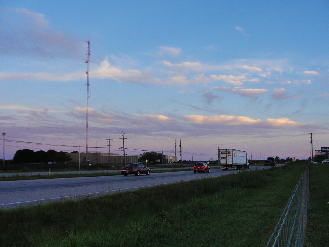
Having secured a room for the night (at a reasonable rate to my mind, what with the rates I had found in Fredonia too easily recalled) and got some dinner for myself, I ambled about the car parks between the buildings of my immediate vicinity -- from the entry to the motor hotel I could see two others, plus an Arby's, a McDonald's, and a Denny's.
At left: sunset light over US 41, North of Evansville.
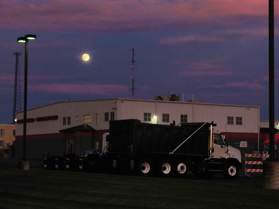
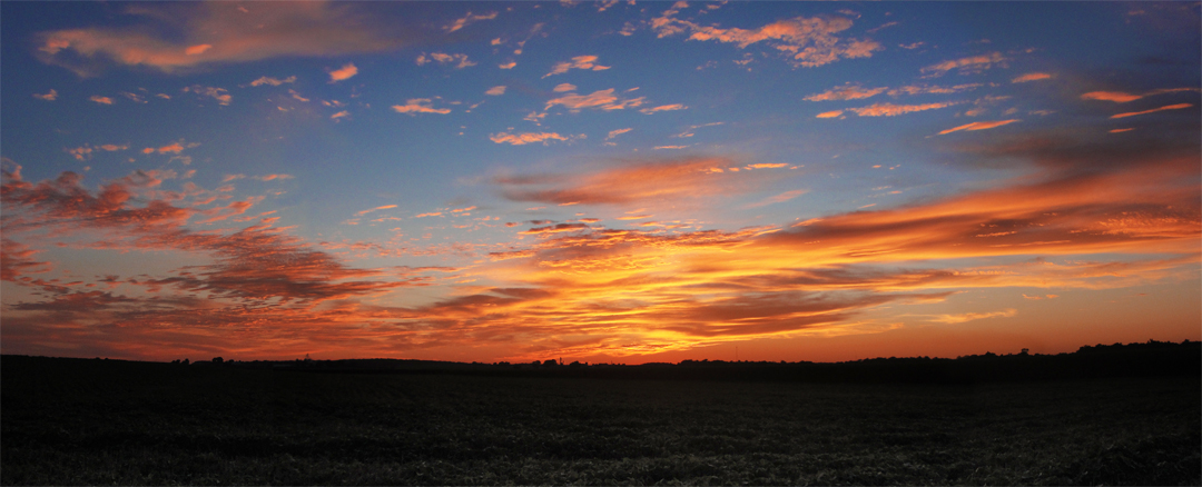
Turning away from the highway, I saw that the access road between all those car parks was short, terminating at a guard rail, beyond which were farm fields. So I went for a look, and I was glad I did: the evening proved to supply quite a number of pleasant views, including a beautiful sunset (below), and the rise of a full moon (left).
After darkness settled in, I repaired to my room and searched through Dreiser's book, looking for "places of interest," and comparing possible addresses to my maps, and thinking I might have some luck in Evansville.
Tomorrow: down to Evansville and the Ohio River, and then back North for a turn through Bloomington. Well, that was the idea, anyway.
