
At left: I-64 to Evansville.
After breakfast, I turned off of US 41 in favor of Princeton Road, a mile or so to the West. It was not the improved highway, and it would take me directly into the vicinity of Evansville's downtown area. The locations Dreiser was looking for were all within a few blocks, all in what was clearly the old part of town. As with so many other cities and towns that can count their existence from some year in the 19th Century, the street grid springs up from alongside the river; Evansville sits on a large bow in the course of the Ohio.
"Those favored souls who enjoy rising early...and looking after their flowers were abroad...It was a cheering spectacle...I began to brush up my local geography and list in my mind the things I must see -- the houses in which we had lived, the church and school which I was made to attend, the Ohio River, at the foot of Main Street..."
Besides those more personal places, Dreiser also desired to observe a number of industrial places -- a pottery company, an iron foundry -- but was principally interested in Evansville for the role taken by oldest brother Paul, who "...came to my mother's rescue in the nick of time." Paul had become famous, and, by many measures, very well off.
"In late spring 1882 Paul, Jr., came and put [Theo's mother] Sarah, [sister] Claire, Theodore, and [youngest brother] Ed aboard a train for Evansville...After the somnolence of Sullivan, they had been plunged into the hurly-burly of a small city...It seemed like a 'fairy land'...
Paul piled their luggage into a jitney and they clopped out Main Street to 1415 East Franklin...To Sarah it was a palace -- new furniture, carpets on the floors, and a well-appointed kitchen...The wandering boy and the mother who kept the light burning in the window -- it was the stuff of a sentimental ballad, and Paul would write it often in the coming years."
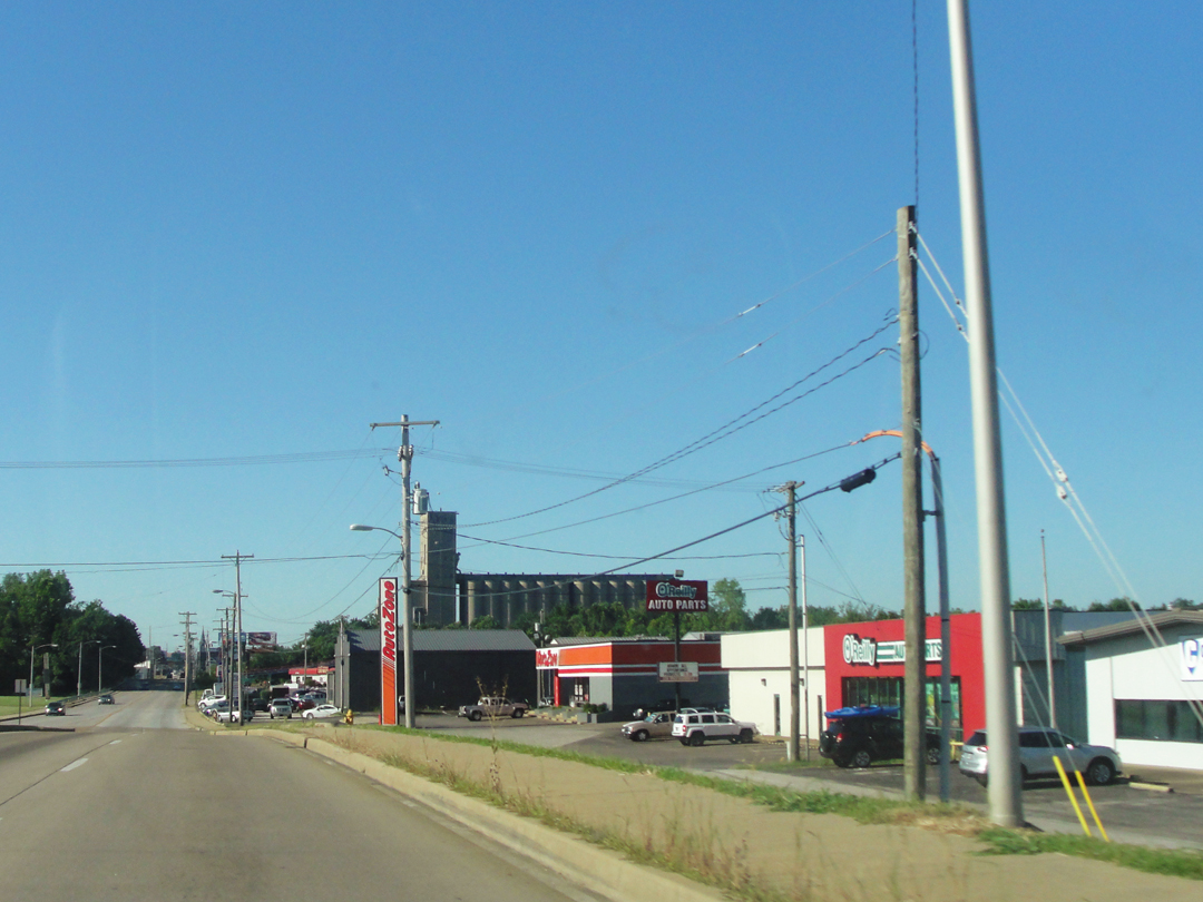
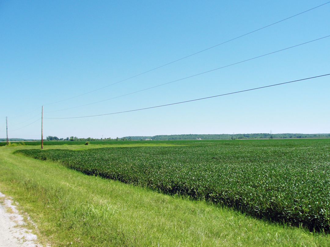
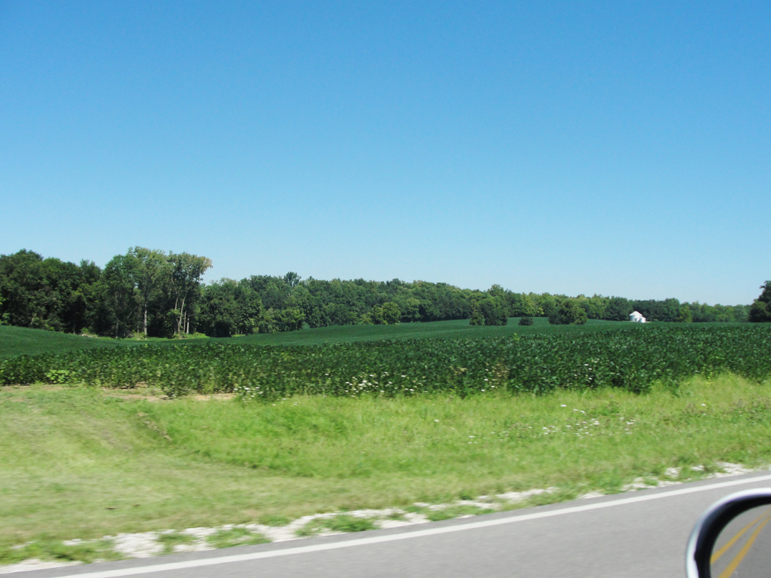
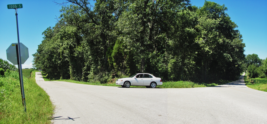
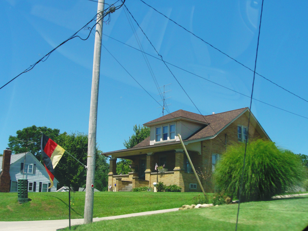
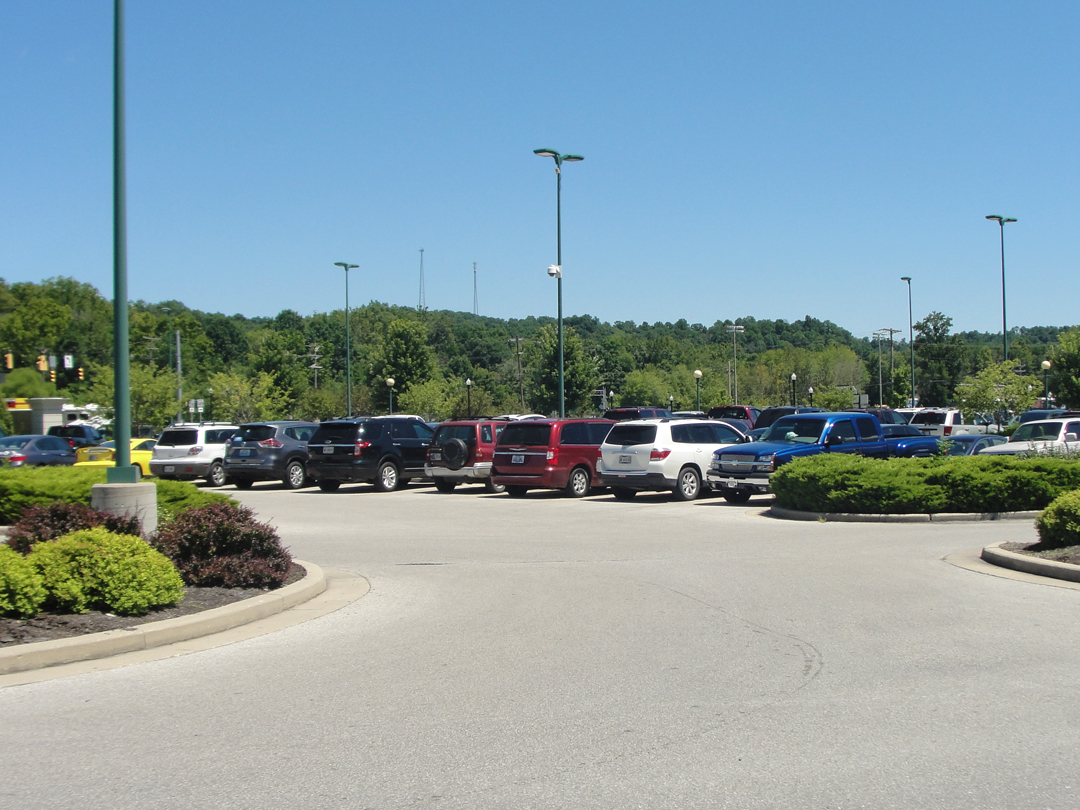
Along Princeton Rd, the scenery was pleasant enough, the agricultural flatland merging, bit by bit, with a more folded, wooded, and developed area of Northerly 'burbs. Density increased, until I was driving through the familiar tree-rings of the various decades' construction: newer houses or older; Zoned Commercial tracts and some old-line industrial buildings; the road was widened; more stop lights appeared.
Below: the outer reaches of Evansville:

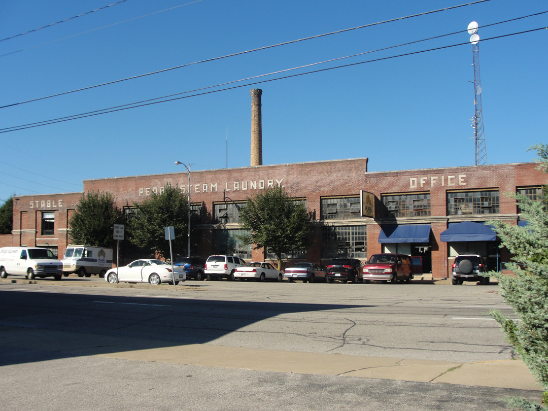
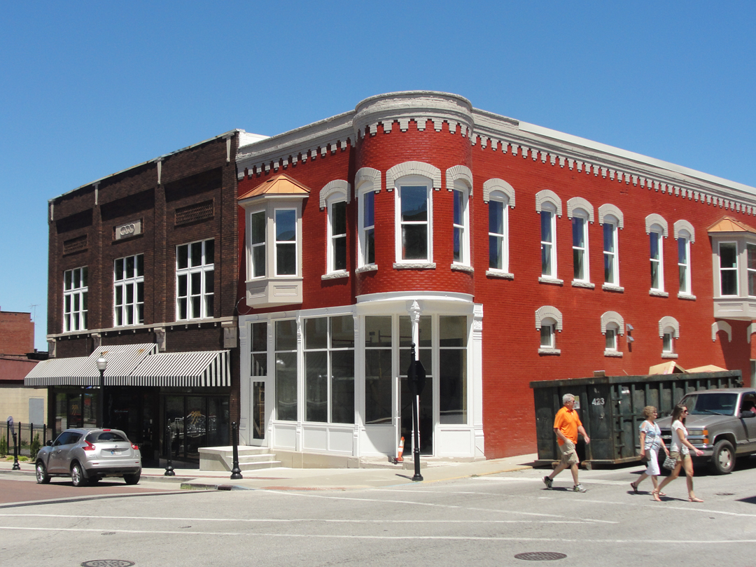
Passing under a highway, I found myself in the downtown precincts, and as soon noted this old laundry company building, so I "just had to" go around the block -- a couple of times -- to find a place to park and get a shot.
I really liked that "stable" had been set in the brick-work; I guess no one has seriously considered re-doing the facade, fortunately for me!
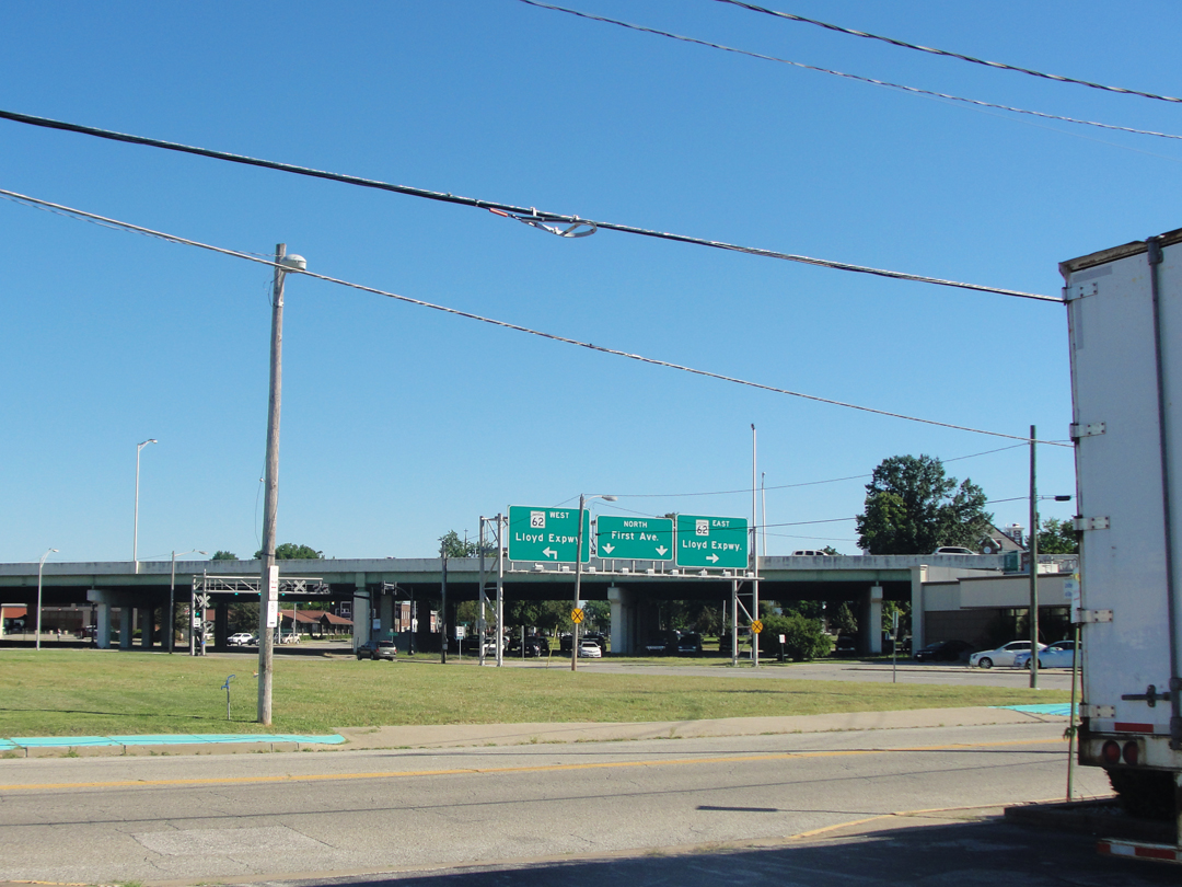
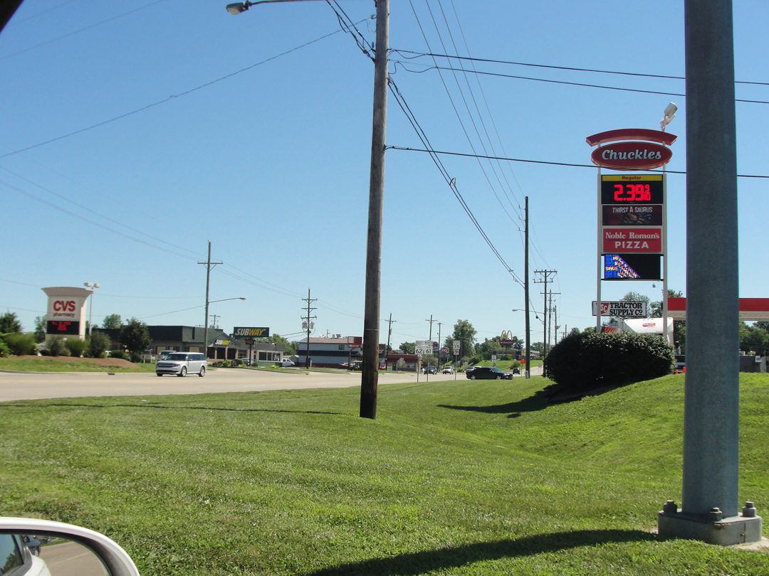
The Indiana Hwy 62/Lloyd Expressway: road improvement! Thinking about it now, I recall, again, the conversation Dreiser and Booth had regarding trees in towns, and how if Indy or Chicago had no trees in town, neither would Carmel. So with improved highways a few decades later: it was the "thing" you did to facilitate traffic -- put in an expressway to alleviate traffic jams, which never really worked the way the city fathers hoped.
But now, well, there they are, often separating neighborhoods and who's going to spend the money to take one down? No one, because where would all the traffic wind up if they did? Back on the surface streets, where there's probably too much traffic already.
I left the saloon in a multi-level car park thinking I would be better off on foot -- for once I got out of the car! -- and looked about from the pavement. There were a few things that struck me pretty quickly: something about this downtown area reminded me of downtown Pittsburgh, perhaps from its compact quality, and its mix of older and newer buildings; that there were people working in offices -- autos occupied several surface-level car parks; that there had been some "re-development" along a couple of streets, probably to encourage people to "come downtown" to shop and play; and that the place seemed under-occupied. It looked like it could have, or should have, had people in some numbers ambling along, but I didn't see that many people out and about. I don't know if it was because it was before noon, or because it was early in the week, but I felt strangely solitary on several blocks.
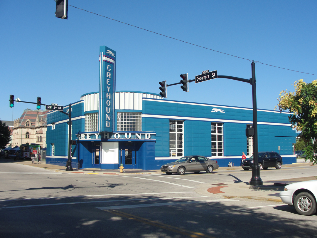
The "classic" Greyhound Bus Station:
(Update 2018: the bus station, built in 1939, has found a "new lease on life" as Burgers and Brews. The exterior was restored, and the interior adapted for re-use as a restaurant. More on this story can be found on the Indiana Landmarks' news page "Big, Blue, and So Cool!"
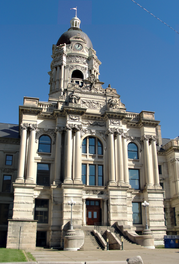
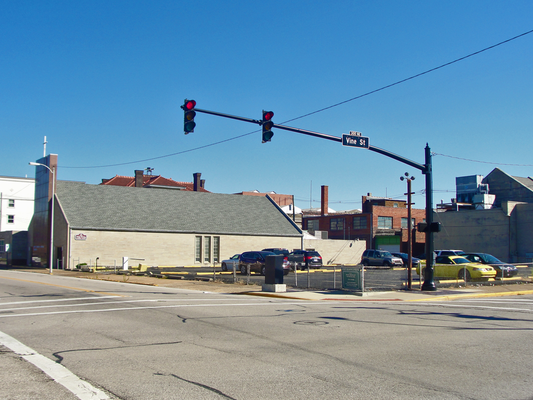
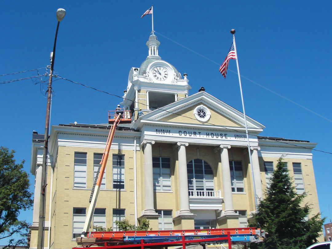
"...facing my much beloved Vine Street, where stood Holy Trinity Catholic Church and School, and along which, morning and evening, I used to walk, I discovered the Vanderburg [sic] County Court House, filling a space of ground which had once been our public school playground. It was very large, very florate, and very like every other court house in America."
Indeed, it is very large, and very florate. Also a bit difficult to get a satisfactory image of. Too many new things stand in the way, one way or another: traffic lights, dumpsters, the building at my back on the far side of the street. I settled for shooting from the entry of an alley to get this (composite) image.
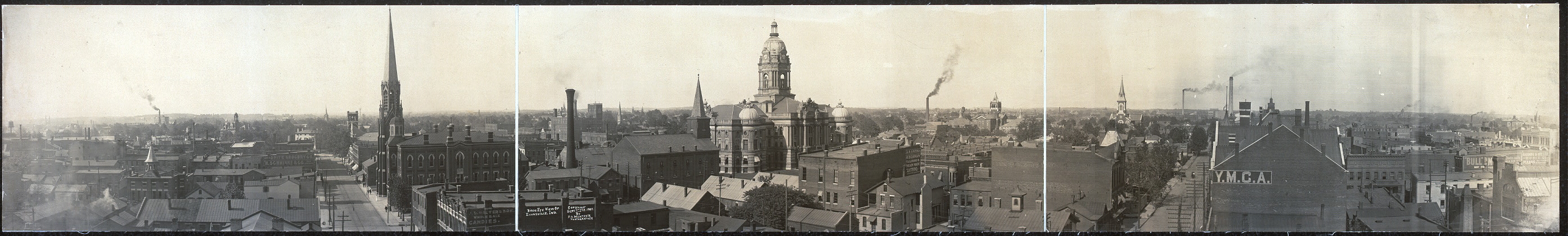
Below: Evansville panoramic, circa 1907 (LOC), the city much as Dreiser would have encountered it a few years later. This panoramic covers much of the area of his interest. At center is the court house, while to the left can easily been seen the mass and spire of Holy Trinity.
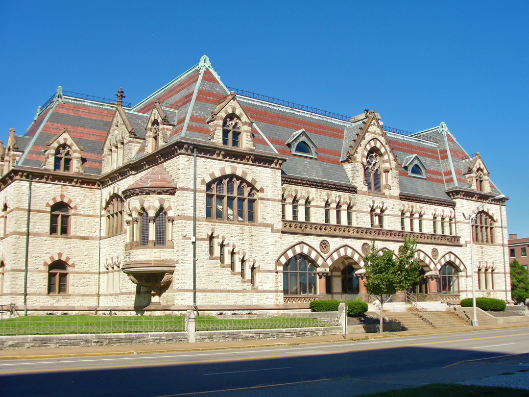
"Only a block or two from our restaurant was the St. George Hotel, my brother's resort...he loved to disport himself here with all the smart idlers of the town!..Then came Holy Trinity (church and school), at Third and Vine, an absolutely unchanged institution. It had shrunk and lost quality, as had everything else nearly with which I had been connected."
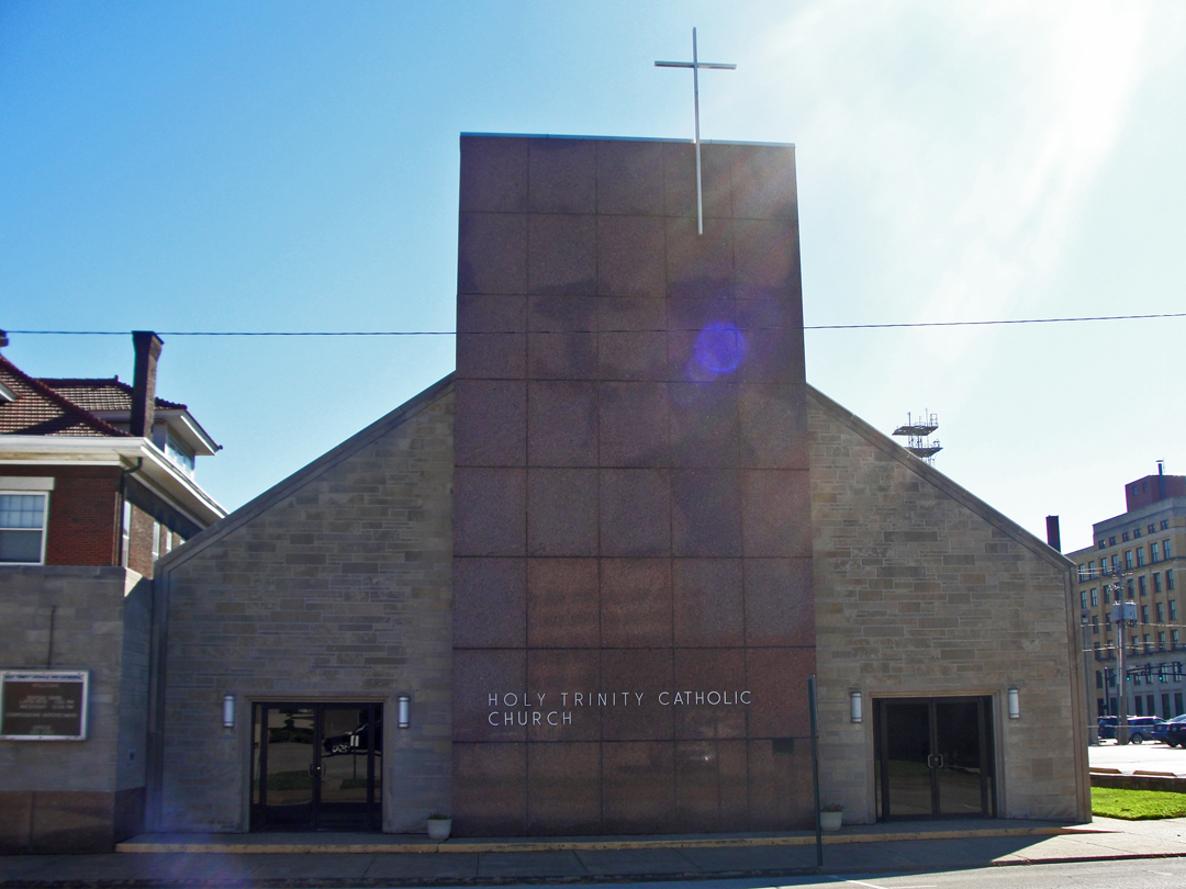
Oh! if only Theo might know how his words foreshadowed. He reacted to the difference between the point of view of a child as compared to that of an adult -- both in physical stature as well as in temperament. I found, a block away from the court house, only where Dreiser's Holy Trinity had once stood. What Dreiser remembered has been replaced with a much simpler sanctuary.
Walking down Court Street, and turning onto 3rd, I was looking for a large church. There were buildings along Court that indicated they were part of the Holy Trinity complex, but I was not seeing a spire or anything that bespoke "Catholic Church." When I looked up and saw the low, marbled face of this building, I did a "double-take." "Whoa - what? Really?" I frowned, then crossed the street to take the photo. The world has moved on, I guess.

Above, at left: Holy Trinity today near the intersection of 3rd Street and Vine. At right: detail of the 1907 panoramic.
Dreiser visited here, stopping in to the school building to have a look at the classroom where he had once sat for instruction. Speaking to a young nun, he asked after the teachers who had taught him and his siblings, thirty years before. They were long gone, or had died. "I smiled. I was only fortyfour [sic], but how old I really was, after all."
After Holy Trinity, I meandered toward the river. On the way, I passed the largest group of people I would see in Evansville, setting up for a farm market. Across the street was the Old Post Office (left), which has been re-purposed for small business offices or some such.
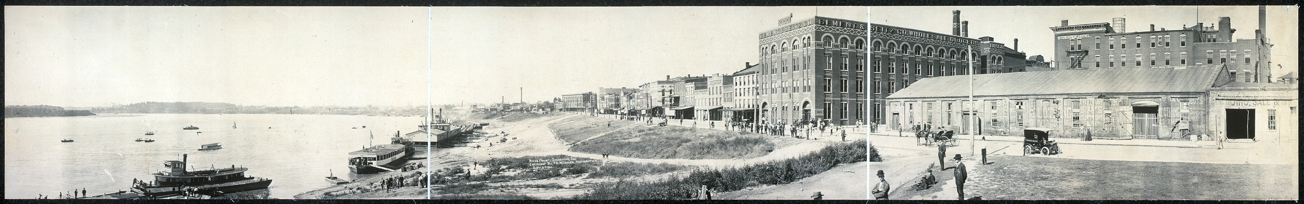
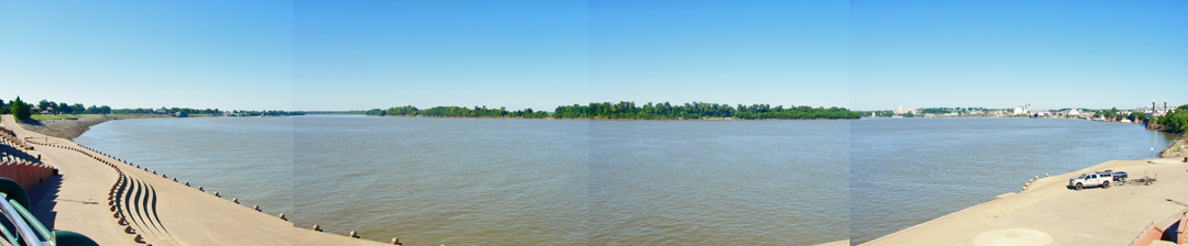
Evansville: Ohio River levee and city water front, circa 1907 (LOC).
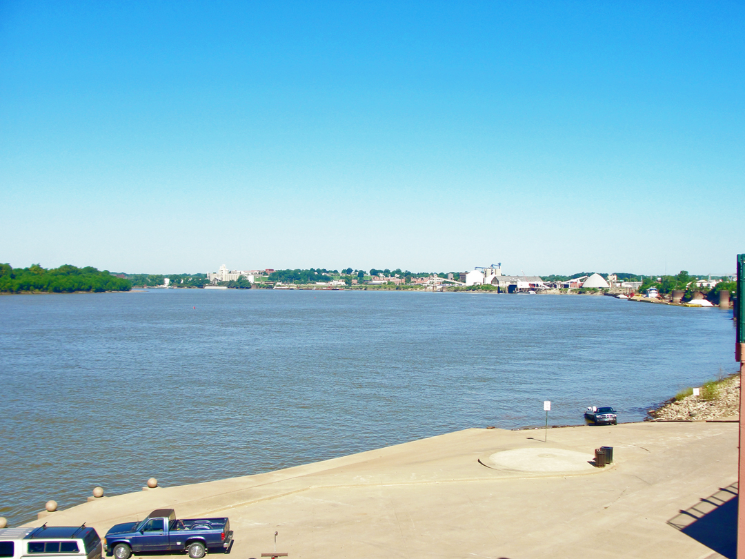
I had no expectation of finding anything resembling the above image. In downtown Pittsburgh, the levee on the Monongahela River has been car park for something like 80 years, while the on Allegheny River there is a roadway and walking trail. The riverboats are smaller (if more powerful) and don't lay up gang planks to sloping berms any longer (they also don't explode as frequently as they used to, either!).
In Evansville, the river frontage at downtown has been completely redesigned to make public river access and allow for public entertainment on the water.
At downtown that is; a short way up and down river, the waterside commerce still exists.

"Before getting [breakfast] I had to take Franklin to view the Ohio River from Water Street (I do believe they have changed the name to Riverside Drive, since New York has one) for I could not rest until he had seen one of the most striking American river scenes of which I know anything...this sweep of the Ohio, coming up from the South and turning immediately south again in a mighty elbow...is tremendous. You know this is a mighty river...It speaks for itself."
Below: the sweep of the Ohio
This area was inundated twice in the last Century: in the Great Floods of 1913 and 1937, and was also home to the Evansville Shipyard during World War Two, producing LST's for the war effort. In the early years of the 21st Century, the area was redeveloped as the Dress Plaza and Esplanade.
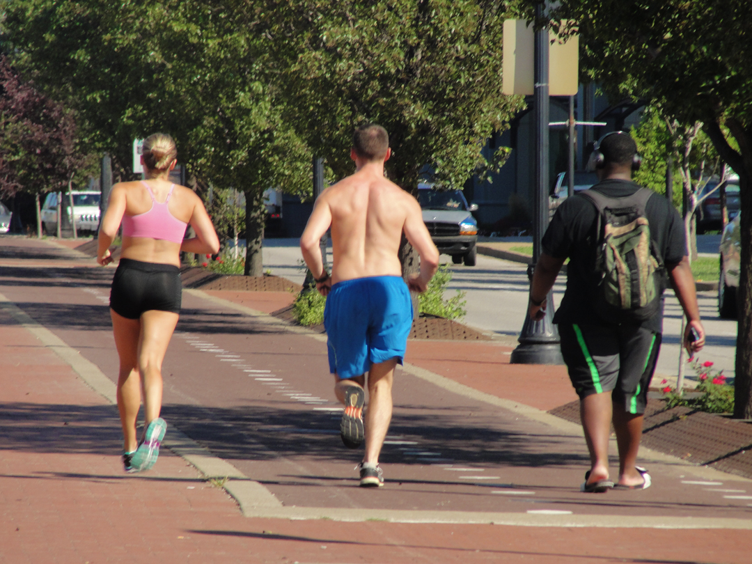
The Esplanade: my fellow Americans.
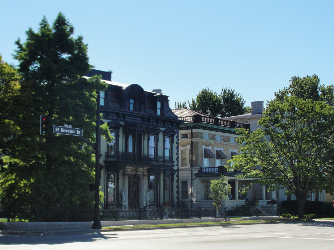
The Evansville Convention and Visitors Bureau is a short walk up river from where I shot these, and I figured I'd at least drop in. There are displays of the various boats that have plied the waters of the Ohio, and I asked after the location of Union Station, where the Dreiser family had arrived from Sullivan. Across the street were these fine examples of the houses that face the now-named Riverside Drive:
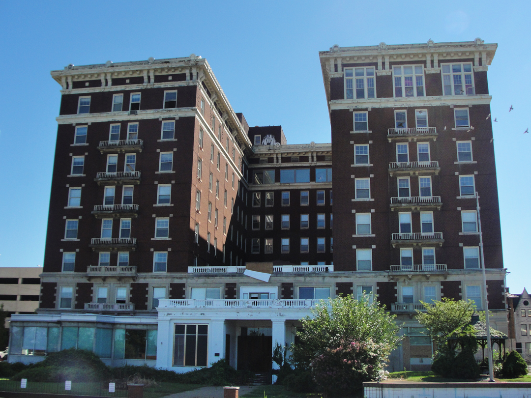
As I walked back to the car park to pick up my saloon, I saw this old hotel looming over the street (below). It has a plaque noting its inclusion on the National Register of Historic Places, which probably accounts for its continued existence, but it is boarded (the door there under the porch roof is actually covered with a steel plate!) and derelict. I could find no name for it on the building itself. According to a National Register listing, it is the McCurdy Hotel.
The website Historic Evansville has this:
The McCurdy Hotel was developed as "a luxurious facility to aid the city's expansion efforts"...The aging St George Hotel...was razed in 1915...The hotel was built in [sic] opened for business on June 17, 1917...
Business at the hotel dwindled in the late 1960s and McCurdy fell into bankruptcy. The hotel closed its doors March 16, 1969...
Local businessman Robert E Green bought the hotel and reopened it. By October 1970, however, Green sold the building to Medco Corp, which stated its intention to turn it from a hotel into a residential facility and retirement home...
It has changed hands a couple more times, and was closed by the local board of health for violations, and is now the target of redevelopment for "upscale apartments."
If I had the money! As I walked away, I imagined a compete restoration with complimentary car service to the casino just down river -- y'know, a little Mad Men, a little Boardwalk Empire, maybe a pinch of American Horror Story for Halloween: make the place a destination. But upscale apartments are the fad these days. I wonder what will happen to it really? Evansville had some life lurking about that day, but "upscale apartments?" I suppose local developers are looking at cities like Cleveland where the old downtowns are being "revitalized" and younger people are moving back in -- but those revitalizations are accompanied by people bringing new businesses downtown, too.
I suppose it's fitting that I was walking about the location of the St. George Hotel, where Paul, Jr., held forth during his hey-day. Ironic that it was razed in 1915; I guess Theo saw it in its last days.
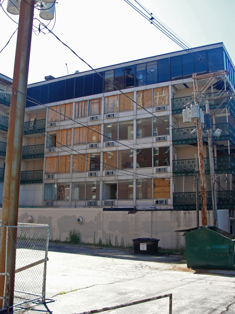
Across the parking lot from the McCurdy were the remnants of another, later hotel, in rather more dilapidated condition. This was only one end of a much larger, and just as terrible, building complex. In my world, this would be eradicated from the landscape, replaced with something either pretty or useful, if not both. An underground car park topped by a small convention center, with roof-top park/restaurant, surrounded by formal gardens perhaps. Hey, if you're gonna' dream, why not dream?
After picking up the saloon, I motored up to where the Union Station had stood: yep, as warned by the woman at the Visitors Center it was a surface lot:
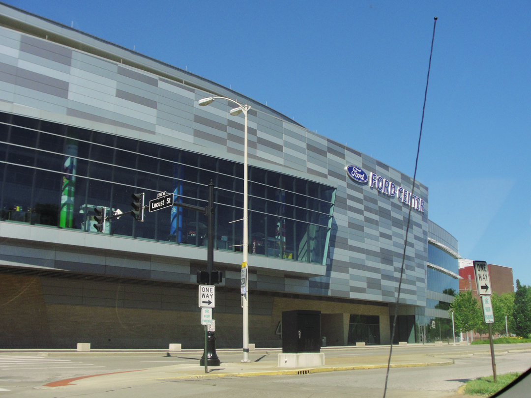
Not far from this was the Ford Center, a multi-use venue for university sports and concerts. This, I thought -- as I did when looking out at Jersey's Meadowlands Complex -- surely would have had Dreiser frowning. So much of a much, and does it really improve the city? Maybe, maybe not.
Dreiser & Co also visited the house Paul, Jr. had set up for the family. The following image has no date, but could be a photo of Booth's taken on the trip (DWS).
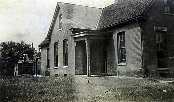
"We turned into Franklin Street and rode such a little way...The house was easy to identify, even though the number had now been made 1415. It was now crowded in between a long row of brick and frame houses...and the neighborhood had changed entirely in physical appearance though not in atmosphere...
I remembered how I used to run, kicking my bare toes in clover blooms in the summer...I recalled how Ed and I played one old cat here with Harry Trochee, the gypsy trader's son, up the street, and how we both hated to have to run up the street to Main Street to the grocer's or butcher's for anything."
This house, as it happens, became part of the Dreiser family saga for more than just being a refuge from their reduced condition. Paul, Jr. was not solely responsible for retaining it, after all. According to Lingeman, Paul was, during the Evansville years, living (mostly) with a woman named Sallie Walker (actually, Annie Brace) who was the madame running "Evansville's most elegant brothel." The house on Franklin was not owned by Paul but rented, though he may have purchased the furnishings. While the family was able to do fairly well for itself in Evansville, Paul had a wandering eye, as they say; in 1884 he fell out with Sallie and moved to New York City. Shortly after, the rest of the family moved to Chicago.
For a wonder I didn't go looking for this address. I have no idea why, since it was right there in the book. But, oh well, the world moves on, and so did I. Evansville is, on the map, certainly enlarged from that old river front downtown. When the Dreiser family moved into the Franklin Street house in 1882, that area had only just been opened up for construction, and was on the edge of town. Today, that address is a not quite in the middle of a much wider municipality, and has been surrounded.
Like I did of Terre Haute, I wondered how much more lively the place is when the local university has its classes in session.
"We followed hot, wet bottom lands to Boonville, a poorer town even than Sullivan...Then we struck northeast through a region where the roads were so bad that is seemed we should never come through with the car..."
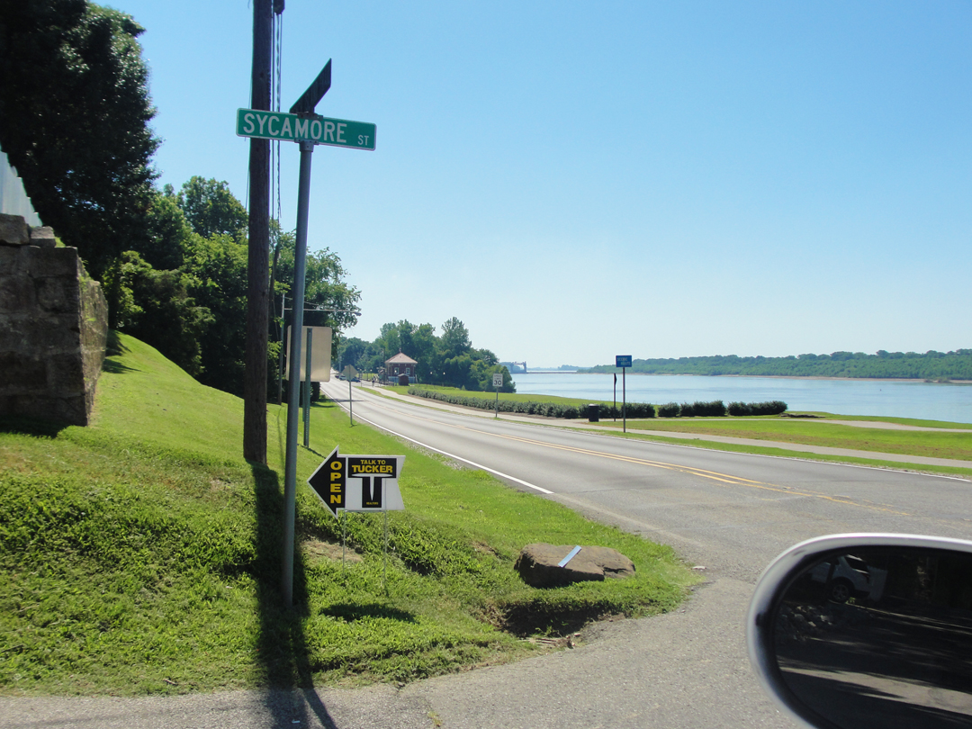
I had no such concern for my saloon. For all that we can complain (and in many cases justly) for the state of the infrastructure in this country, it is so much the better now than it was -- even the "dirt" roads are pretty good in all weather. I took advantage of one of the improvements at Evansville, and left town on I-69 where it curves around to the South of the city. I was looking for Indiana 662, which would lead me to Newburgh and beyond where I could pick up IN 61 to Boonville.
Dreiser recounts a few things about a few small towns passed through on the way to French Lick: Selvin, Huntingberg, Holland, Jasper. They all still sit on the map, with small roads leading between them which route I believed I could find, and mostly did. Mostly.

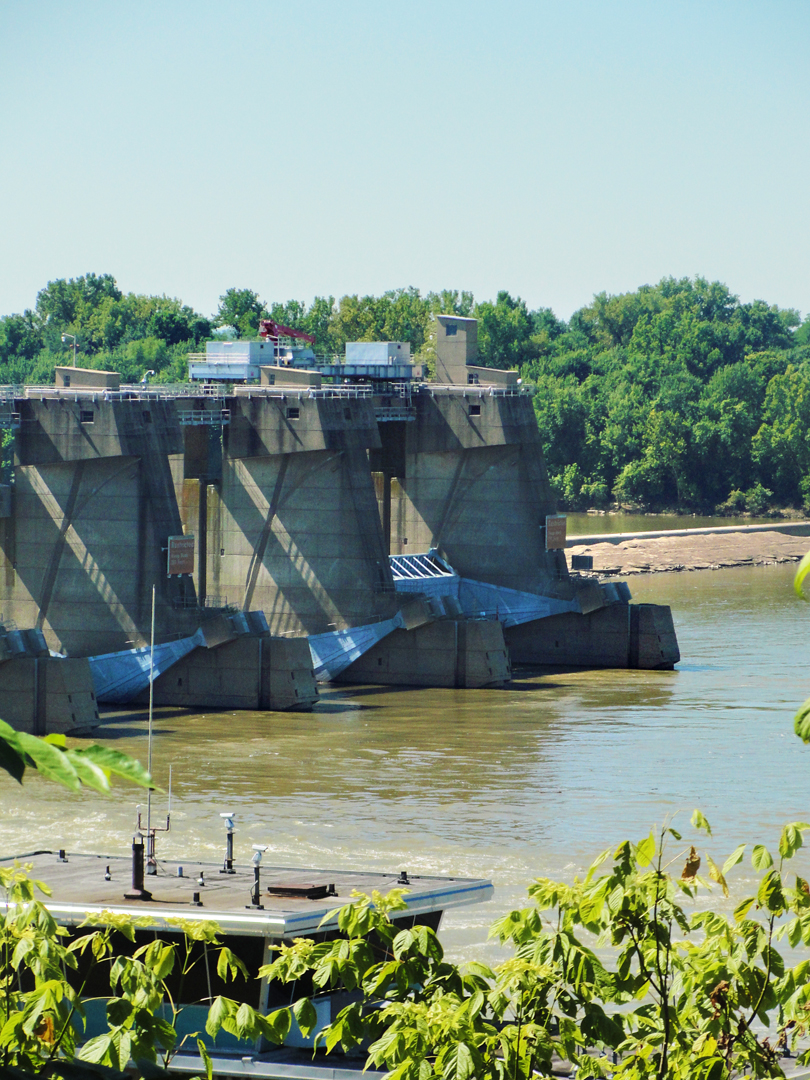
In Newburgh I encountered the Orange Cones again; someone was resurfacing 662 right through the middle of the old business section necessitating a detour. Where the detour came back to the main road I took the above photos of the Ohio River. Just visible in the photo at left is the Newburgh Lock and Dam, right at the horizon on the water.
IN 662 quits at IN 66, but just shy of that intersection there was a sign indicating an overlook. So I went. It was a pleasant and shaded place and did sit on a bluff overlooking the river and the dam, but the trees had grown in such wise as to prevent it being too much "scenic." Still, I took this (left) just 'cause.
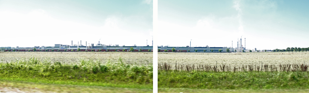
Once back on 66 and looking for the road to Boonville, I was startled to see an Alcoa plant taking up a great swath of real estate between the highway and the river. I snapped the photos in some haste, so the following composite isn't what I'd call one of my better works, but it works after a fashion.
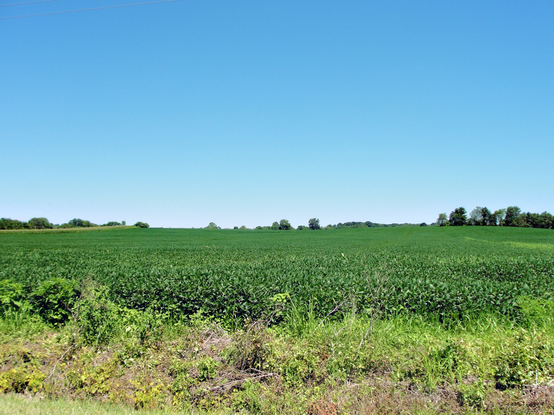
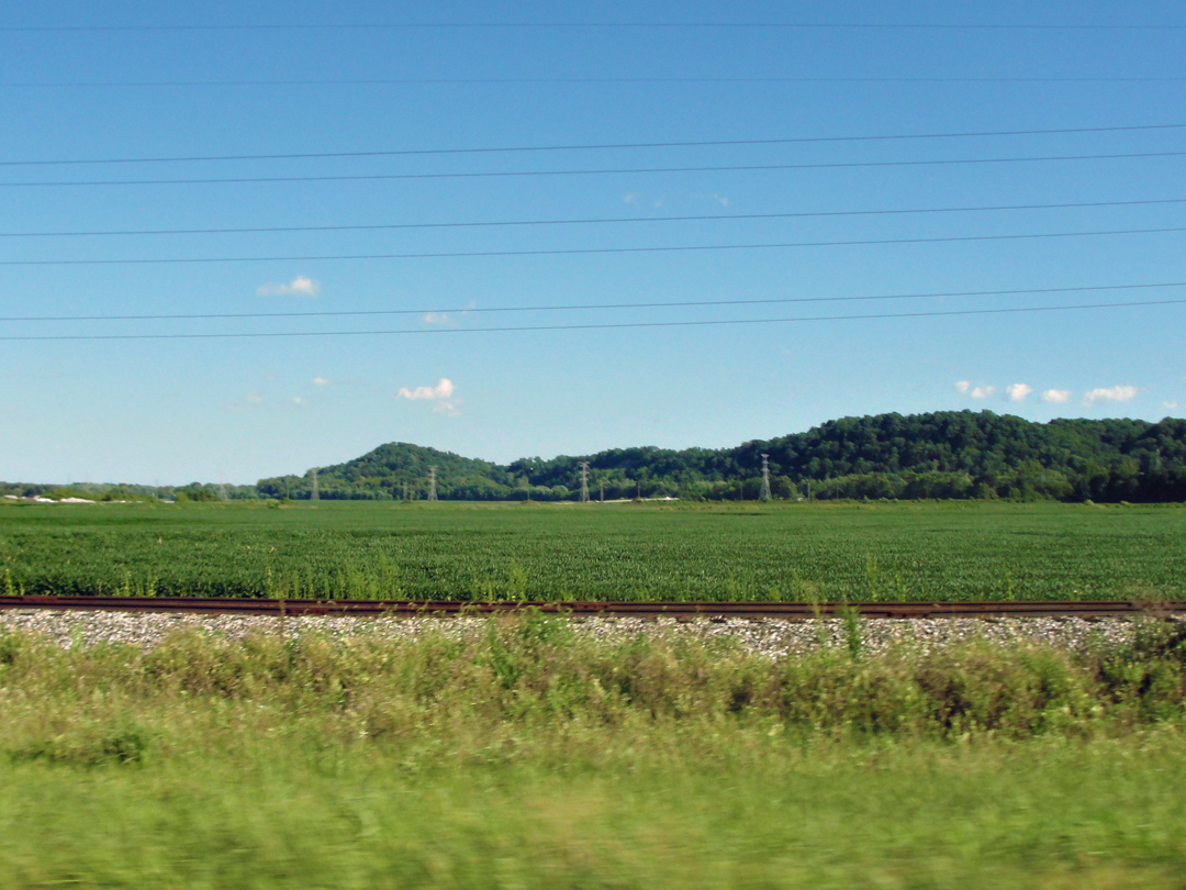
Then came the sign for Boonville, up IN 61. On the way I stopped for this landscape. I was taken by the low ridges in the distance, their low lines encompassing the pancake of the farm fields.
Putting on my armchair natural historian hat I imagined the water courses of millennia inexorably wearing through, leaving the alluvial deposits favored by farmers, leaving rises like these, before finally settling into creeks that drain to the mighty Ohio. Then I went back to driving.
Boonville (above). How many towns like this had I seen? Have I ever seen? I never counted. It looks today to be in better shape than it did an hundred years ago.
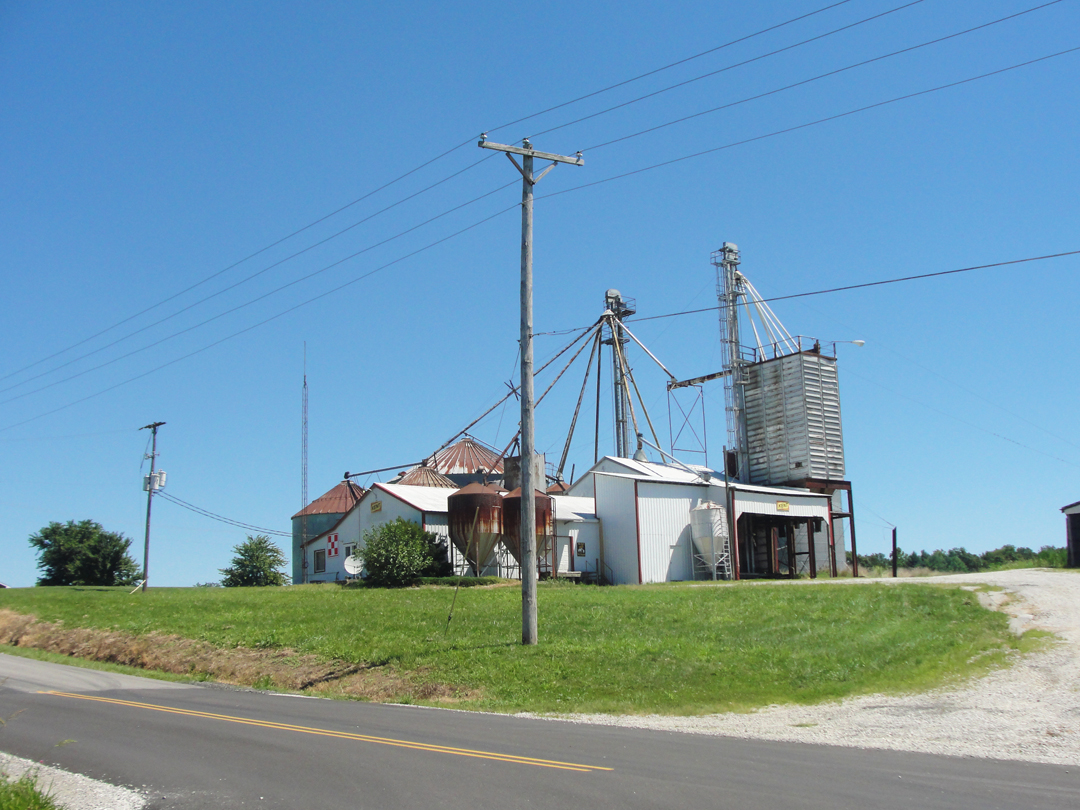
My pet theory, having driven around some fair amount of country, is that for any given population in a geographic area, there has to be a town of some size. Out in the "sticks" that may be a gas station and a bar at a crossroads that has a flashing red light, but it's a place to fuel up after your wants. As the geography and population increase in size, the towns get bigger, until you widen the view to include some place like Boonville or Indianapolis, Fresno or San Francisco. Commerce and automobiles can skew this to some degree, some spill-over effects from the large municipalities, but looking at a map I think this holds up to some extent. Boonville is large enough to have done more than continue to exist just because it's there; I think it may get some spill-over effect from proximity to Evansville, too. And that Alcoa plant.
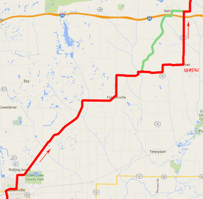
After passing the court house, I was bound for Folsomville. There was noting in particular about Folsomville, Dreiser hadn't mentioned it, but it was roughly half-way between Boonville and Selvin, with a road leading more-or-less diagonally between them.
At right, the road to Selvin, or near to Selvin. The red is the actual route; the green indicates where I meant to travel, but missed a turning. There was something about that intersection that had me not making a left -- a change in road surface I think. Somewhere along the way I thought, "Nah, this aint right," and I knew it when I came to IN 161. It was too nice, but I figured I'd turn left so I'd keep heading North anyway.
This was more pretty country, and I drove happily up hill and down dale (as the saying goes) looking out on trees and farm fields. The roads were, as mentioned, much improved since 1915.
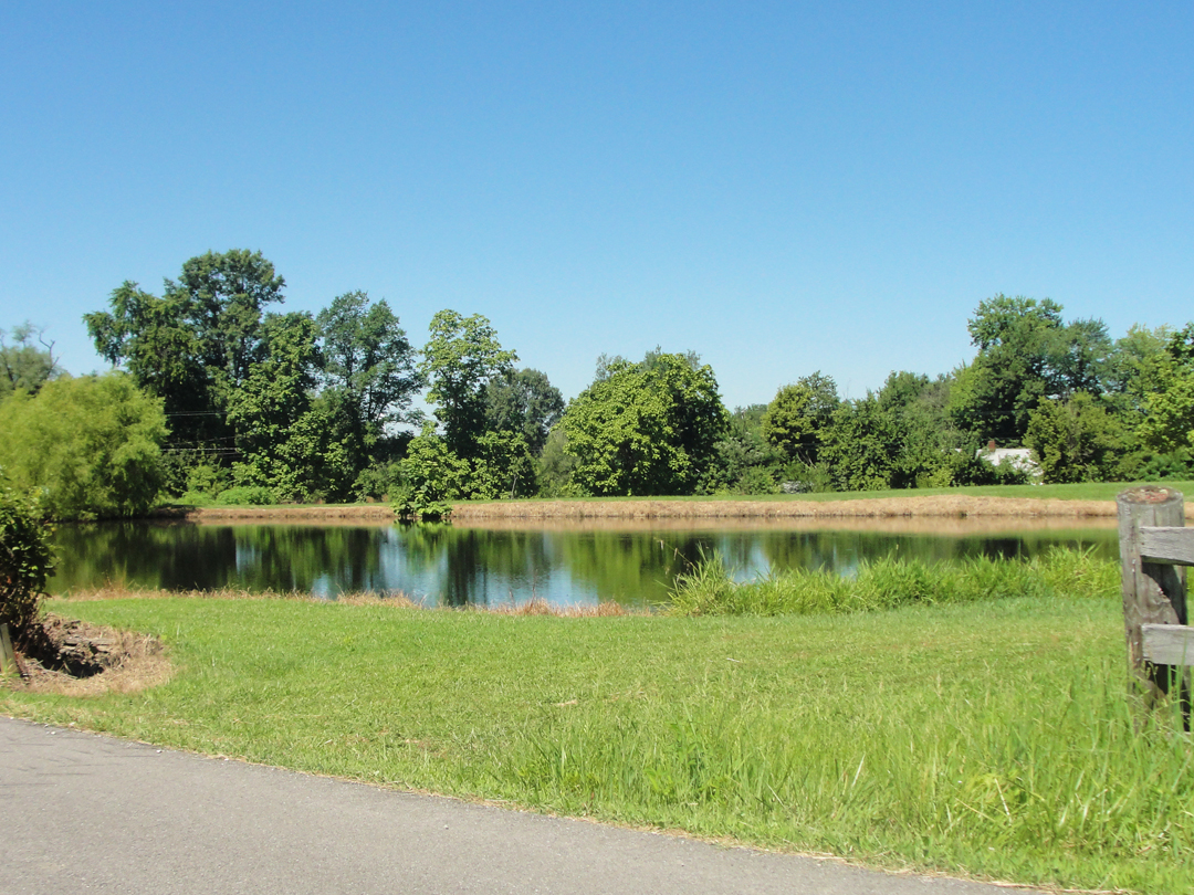
At left: on North Folsomville Road, outside Boonville.
Below: a farm pond on the edge of Folsomville.
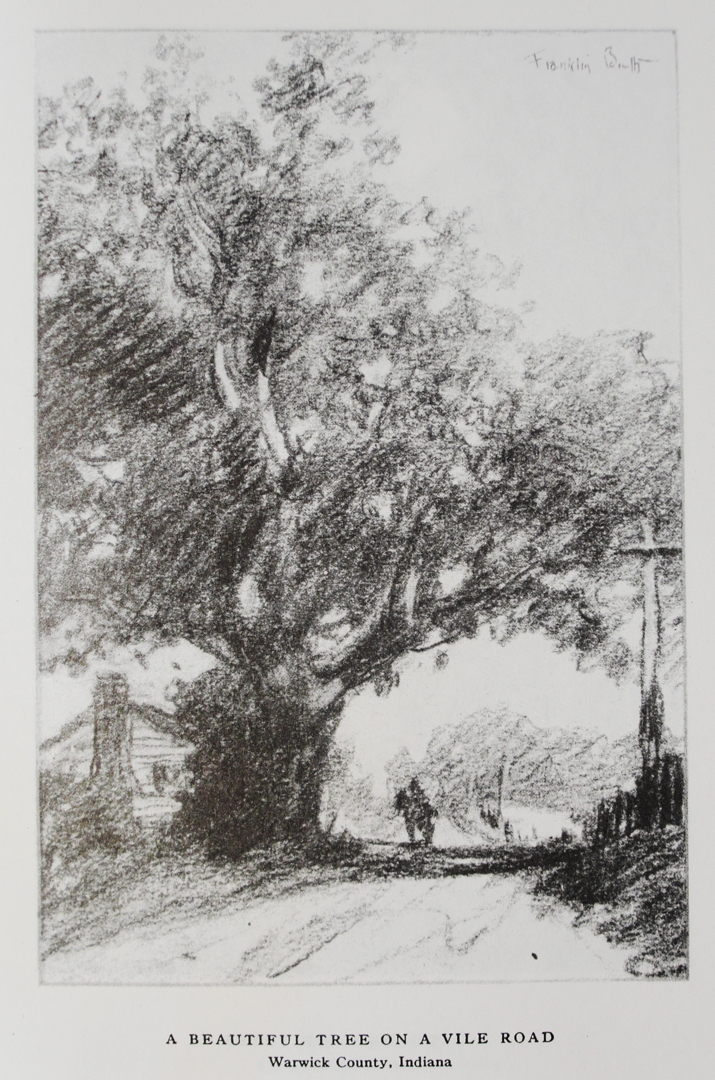
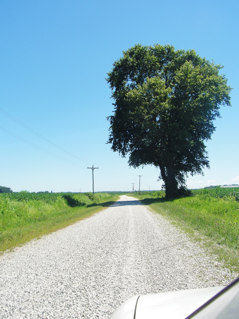
Dreiser doesn't mention a stop, but somewhere beyond Boonville on one of the roads "so bad," they either paused for Booth to sketch, or Booth was impressed enough to make a drawing later of "A beautiful tree on a vile road." He's noted it as Warwick County, but there is no Warwick that I can find; I was driving through Warrick County, though.
There weren't any trees quite like this on any of the roads I traveled, but I kept shooting anything that might be similar.
As to the vileness of the roads:
"Water puddles, and streams even, blocked the way. At one place we shot over a bridge the far end of which sank as we crossed, and a ditch of nine feet of depth yawned beside the track...
You can imagine the isolation of this region when I tell you that our automobile attracted universal attention...dogs and horses ran away frightened at the horn...children ran out to see. This did not seem quite possible."

At left: the best contender in the "beautiful tree" category, on a road not so vile any longer. I wasn't really sure which of several trees I shot along the way would "win," but this one does the best approximation, so, yeah, this one.
After making my turn to the North on the not-quite right road, I came to an intersection with a sign indicating Selvin to the left. Looking that-a-way, I thought "Probably just over the hill, there."
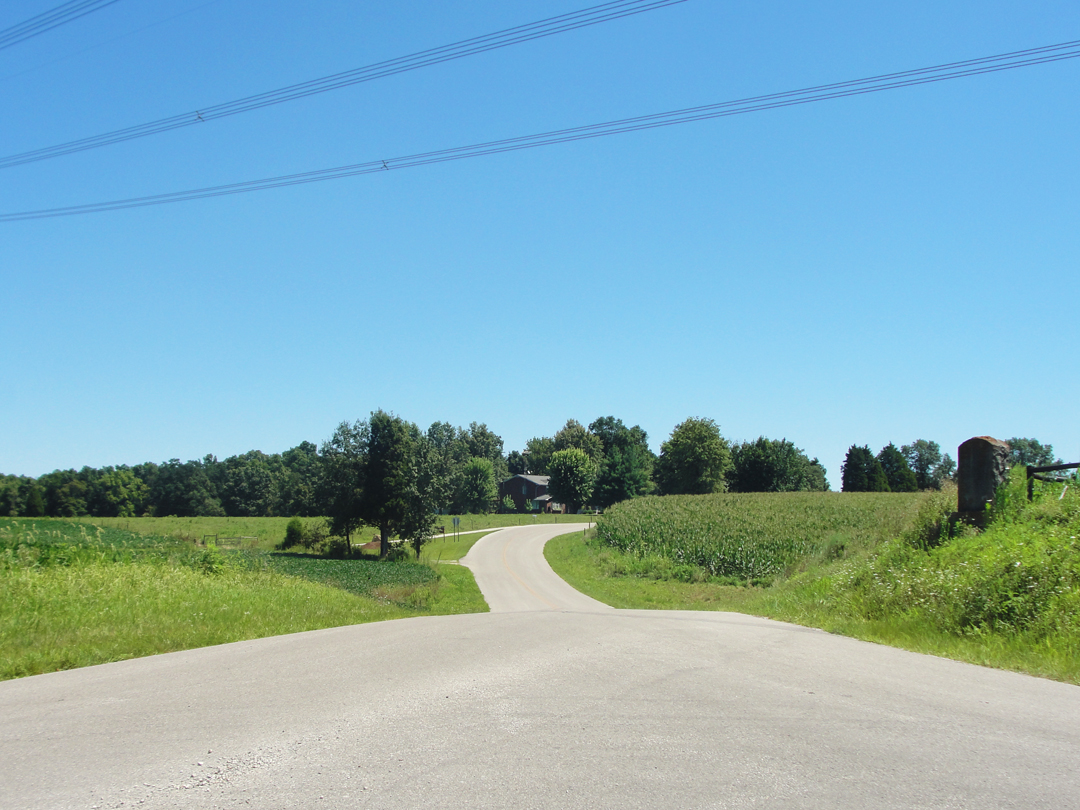
A quick right and left took me on to Holland Road, which, conveniently, would lead me to Holland.
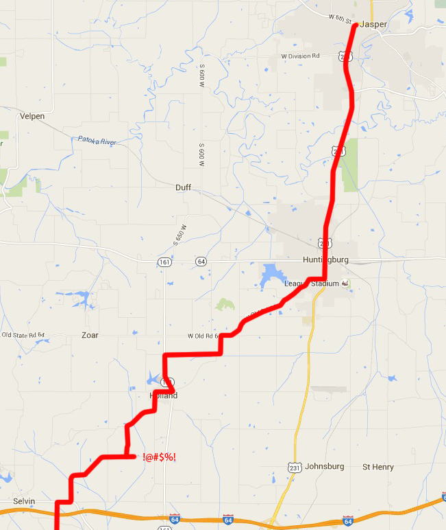
Near Selvin to Jasper, including Holland and Huntingburg. Yet again, I had a moment of "Oh -- I think I wanted to turn back there." When I doubled back, I saw that was the case. Fortunately, I had this realization before I'd gone too far.
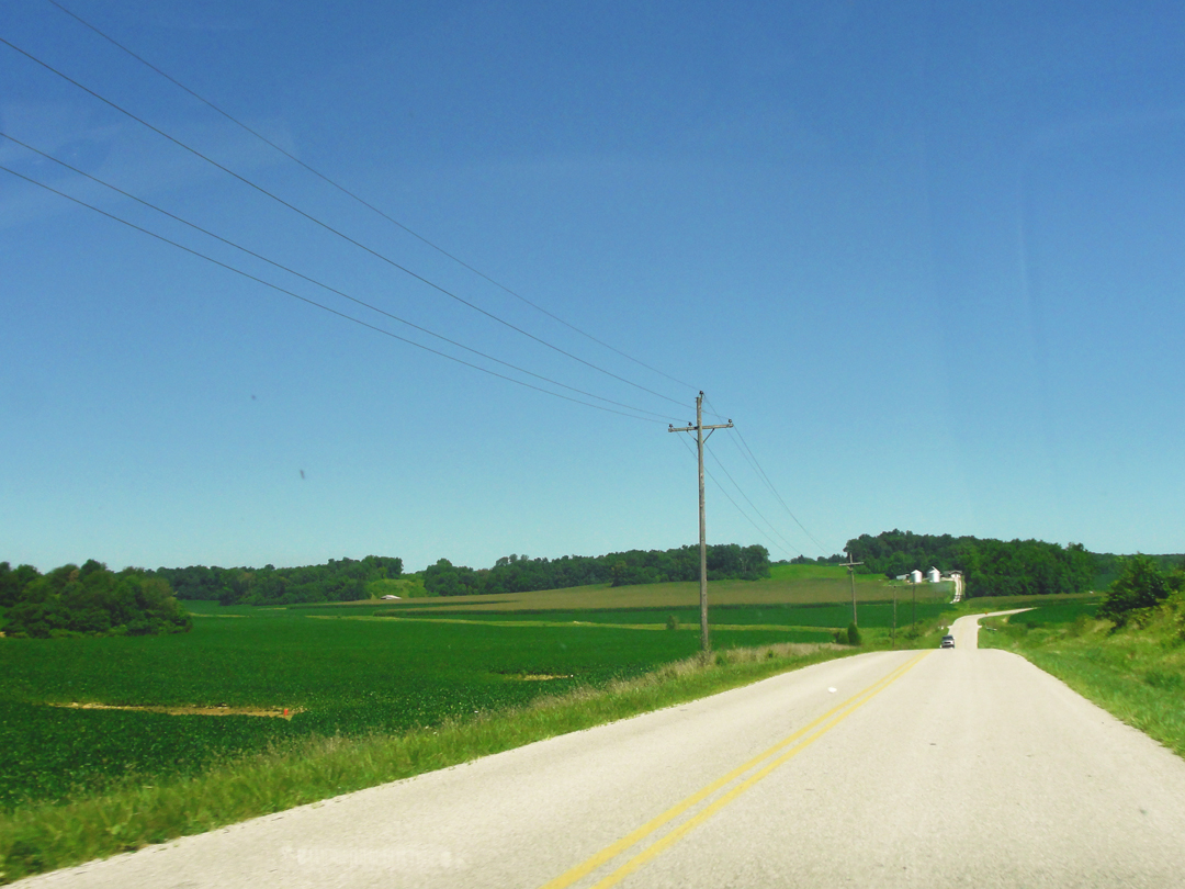
On Holland Road.
A couple miles South of Holland, I saw a wide "Y" intersection and an historic marker (perched on the rise to the right). Thinking of the historic marker on the Pennsy/Ohio state line, I pulled around to have a better look, and of course, take some pictures.
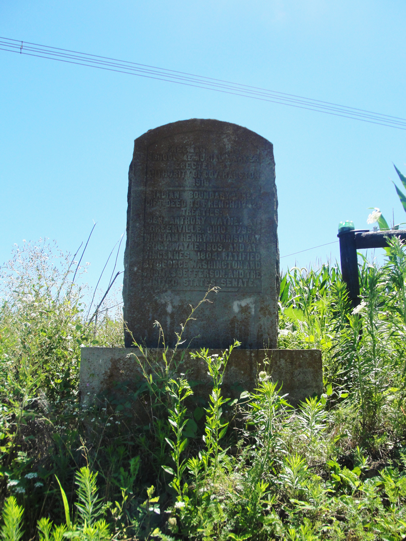
Indeed, it was another marker in that vein, though its message has a rather different resonance than where the other line was drawn. It reads:
Freeman Line School Memorial Marker.
Erected by Authority of Gov. Ralston 1916.
Indian boundary line.
Gift deed to French 1742 treaties:
Gen. Anthony Wayne, at Greenville, Ohio, 1795.
William Henry Harrison, at Fort Wayne, 1803. And at Vincennes, 1804. Ratified by George Washington and Thomas Jefferson, and the United States Senate.
Hmph. Yes, indeed -- treaty lines.
Below: looking back at the "Y."
On the edge of Holland.
Holland was one of those good sized for a small town places, and had at least a dairy concern doing business. As I drove by, I recalled the interiors of dairy warehouses I had been in back in my delivery days, and also what spoiled milk smelled like if the vending machines went without power. That is a powerful odor, I can tell you.
I wended my way through to the highway on the East side of town, and then got confused about what road I wanted to turn onto.
I couldn't quite make out from the map what road I wanted to take, what would "go through" to pick up Old State Road 64. So I went up IN 161 a bit and turned right on a county road. There I saw another candidate for the "beautiful tree" competition.
It's actually 3 trees, which I saw as I passed them by. Then, of course, I found the road I wanted and turned left. On the map later I could see where I was, where I wanted to have been, and how they connected. Like that "hindsight is 20/20" thing, it was obvious -- but too late. Oh, well, that's the way it goes.
"At Holland...we encountered a splendid road, smooth and white, along which we tore. Indeed, this whole county proved a revelation, for whereas the two preceding ones were poor, wretched even, this was a prosperous and delightful to look upon. Great meadows of emerald were interspersed with splendid forests of ash and beech."
Great meadows of emerald, indeed! This was across the road from the 3 beautiful trees.
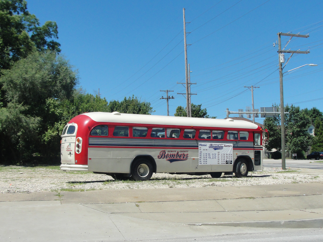
"Huntingberg [sic] was alive and clean -- a truly handsome little town with well built houses, wide streets, attractive stores, a brisk, businesslike atmosphere." Pretty much sums up Huntingburg today. I didn't linger, but only to get gas and a couple snacks. I did like this "booster" bus, though.
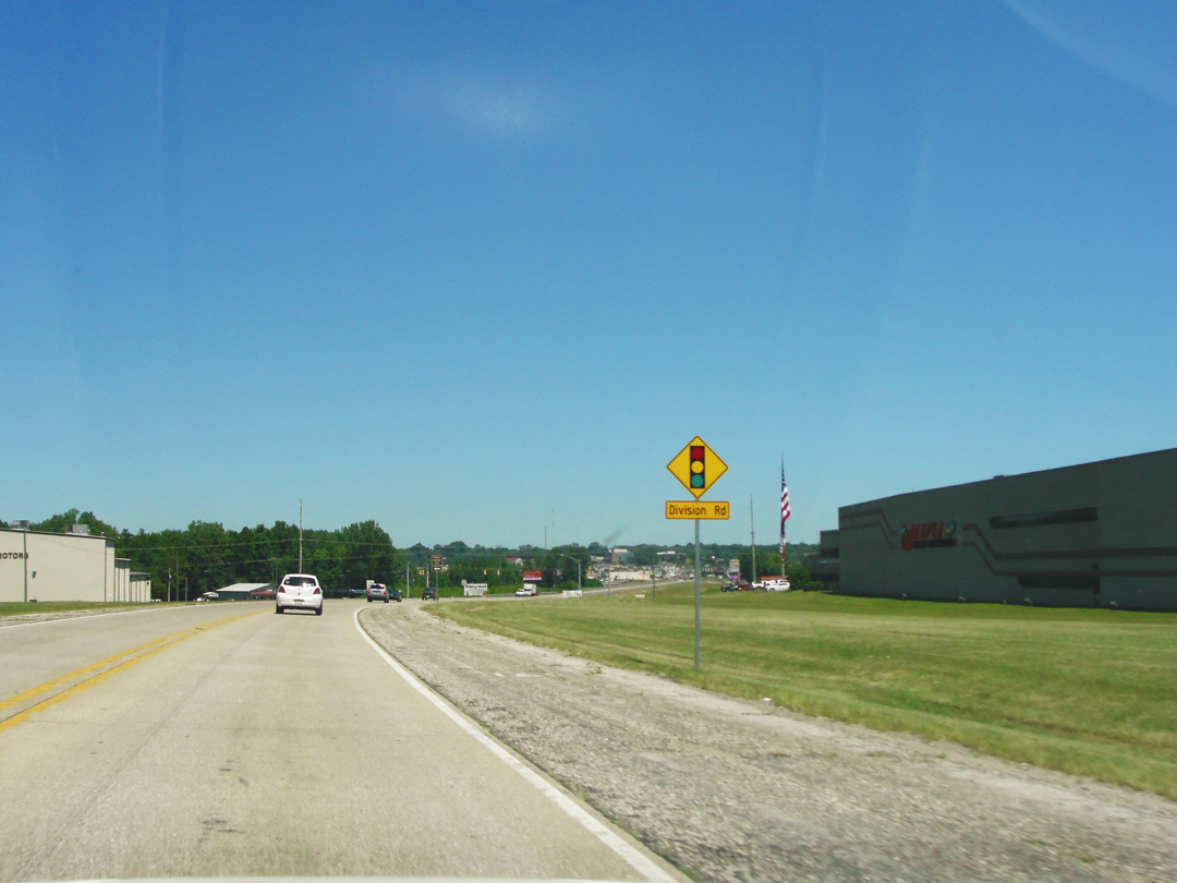
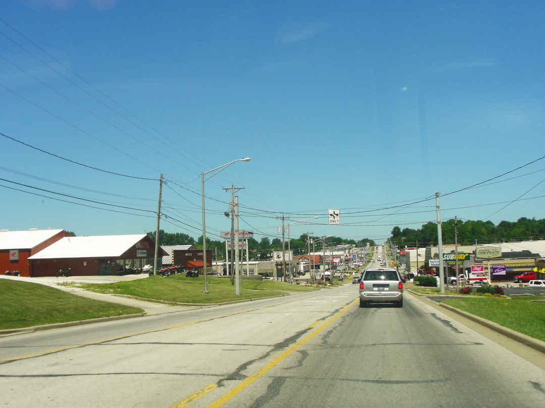
Then I got up US 231 (yep, that's correct: US 231 that I crossed on the way to Terre Haute, the same one that runs past Lafayette) to Jasper, and I'll admit I was impressed. "This place is doing all right," I said. As noted elsewhere, I sometimes think there is a "feeling" you can get from a place when it's doing well for itself. Jasper just had a prosperous air to it. It's something in the houses, the cars, the number of people out and about, the general appearance of being kept up that endears a casual passer-by. I detest traffic when it's overly full on the streets -- who doesn't? -- but let's face it: traffic means people who can afford the cars and keep and run them. So was I impressed. I hate to admit that it was the Zoned Commercial that did it to begin with, but it was.
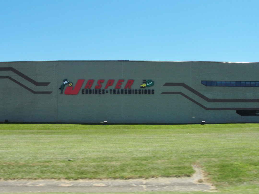
Below: entering Jasper. the Jasper Engines - Transmissions factory was a good sign I thought.
It was the view of the Commercial area I think; it looked deeper, if that makes sense, than just a few lots along the road. This area was serious about its commerce! There was some population that was ready to turn over its hard earned cash to buy, and that does mean something, like it or not. But when one of our our leading economic indicators is money moved by the "service industry" you just can't discount it. As 231 wound into town, I pulled off and rambled about, having no idea where I was going, just going to look around.
"Jasper...was beautiful, like the rest of this striking county...What a charming place to grow up, I thought!
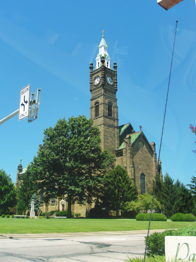
...there was a church here -- St. Joseph's Roman Catholic -- which was a triumph of taste. Most Roman Catholic Churches...build and build, slavish copies of European models...This Church was built of a faintly greenish gray stone, and possessed a soaring, yet delicate bell tower at one corner. It stood on a considerable rise, in an open space and at right angles with a low flat brown convent...which gave its entrance way a plaza-like atmosphere."
I saw the spire as I rambled, and thought "That must be the church!" It was, and it is a striking building, and I was glad I saw it.
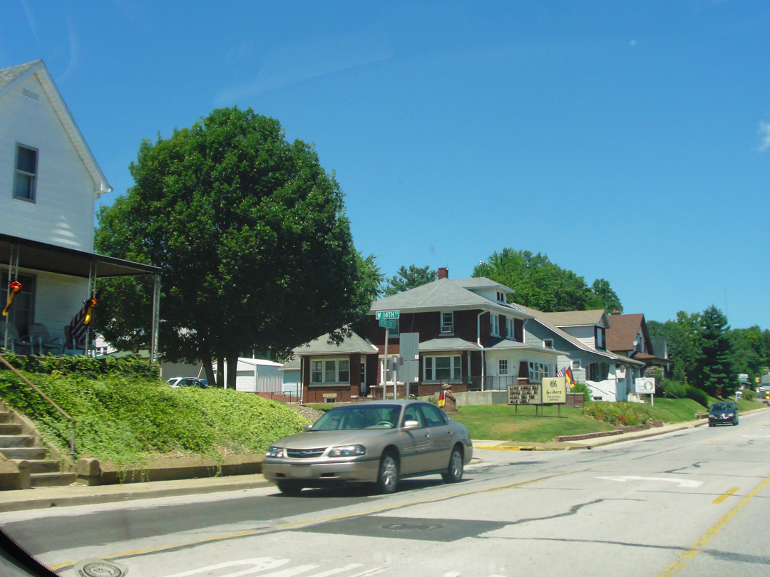
As I turned around a few blocks, I was reminded again of some neighborhoods in Pittsburgh, as the houses looked of an age; I'd guess around the Century mark, or a little younger, some from the go-go '20s, some from the boom '50s. They were neat, with nice yards, and the streets were clean. I thought "I could see living here."
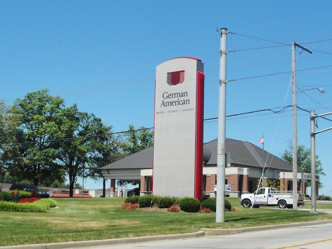
Dreiser noted of other towns in this area that there was a strong German immigrant population, and Jasper certainly demonstrated that still. I've seen national flags in a few places, but never one for Germany, and I don't think I've ever seen a German American Bank, either!
I literally came over a hill and saw one of the reasons, perhaps the main reason, for the prosperity of Jasper: the Kimball plant.
Kimball International makes commercial furniture: for businesses, hotels, restaurants, and the like. The name Kimball is actually that of the Chicago piano company, yes that Kimball, which -- through a series of business transactions -- eventually gave its name to a company that was growing through the post-war years, from making kitchen cabinets to the aforementioned furniture, automotive electronics and other commercial products. It has 3,000 employees world-wide, and is still headquartered in Jasper. It generated $540 million in 2014. That's not chump change.
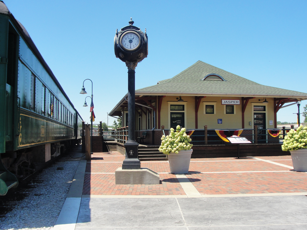
I also rambled over the train tracks -- again, literally -- and looked around to see the old railway station with a couple of restored rail cars sitting next to it. "Hey! old train!" I said -- yes I did -- and turned in for a look. Unfortunately, the train wasn't running until 6PM, so I would miss a ride, but maybe "one of these days."
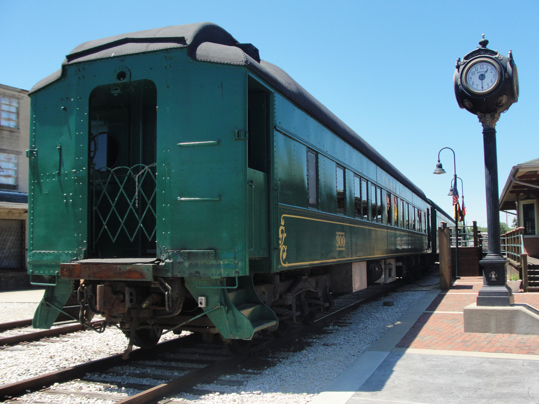
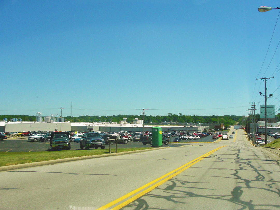
I had to sigh a bit for the want of taking a train ride. But, as before, that's the way it goes. For this moment, it was back on the road. As I headed North, I found yet another Zoned Commercial. "This is," I thought, "serious. There's enough commerce to have a strip like this on both sides of town!" Whether or not it's actually warranted I can't say, but both sides of town looked like they were doing business.
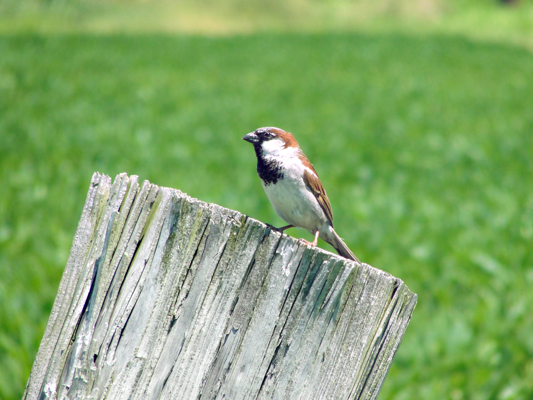
A couple miles out of the city, I left 231 for a road with a sign indicating a recreation area. I thought that was a good place to stop and consult the map. I believed that US 231 and IN 56 shared the pavement through there, but I hadn't seen a sign that confirmed IN 56. The map showed I was on the right road, and had only to go on a few more miles to cover before 56 peeled off for French Lick. O.K.
Before I pulled back out on the highway I saw this guy sitting on the fence post (right):
"After passing through Jasper and Dubois Counties...our luck in roads left off.
And now the landscape changed rapidly...Here in Orange County I had impression of great hilsl and deep ravines and steep inclines which quite equalled anything we had seen. It suggested the vicinity of Stroudsburg...we were at the bottom of a ravine...we were on some seeming mountain side...More than once we shot the machine through a tumbling, sparkling, moonlit stream."
From Jasper to Bedford, through French Lick.
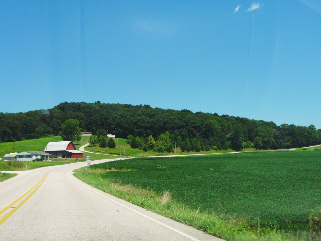
Well, as picturesque as that evening drive may have been, mine was during a beautiful day, with most of the variance "ironed out" of the road. Still some ups-n-downs, sure, it's that kind of landscape, but hardly anything to "write home about." IN 56 might not have been the most accurate choice, but as before I thought maybe it was the improved version of the Pathfinder's route. I could be wrong about that; where IN 56 runs might have been the best route to lay down a new road when roads were being improved. But -- so it goes!
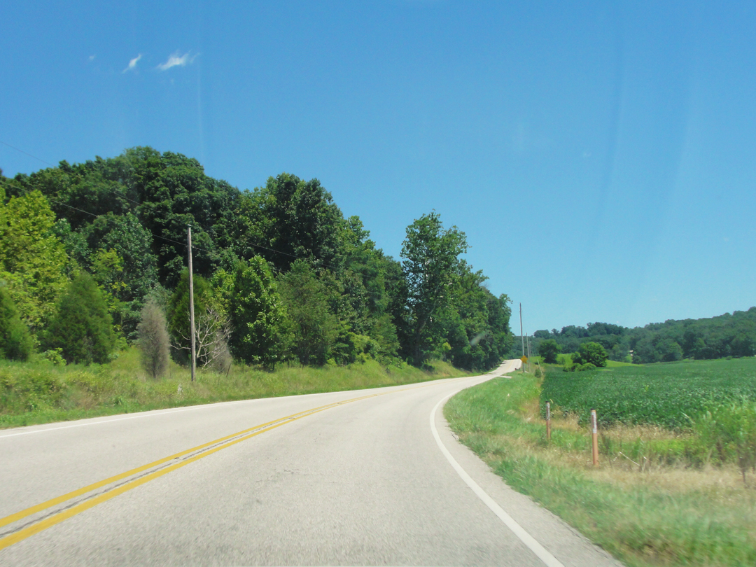
Below: IN 56 between Jasper and French Lick. It is indeed more pretty country.
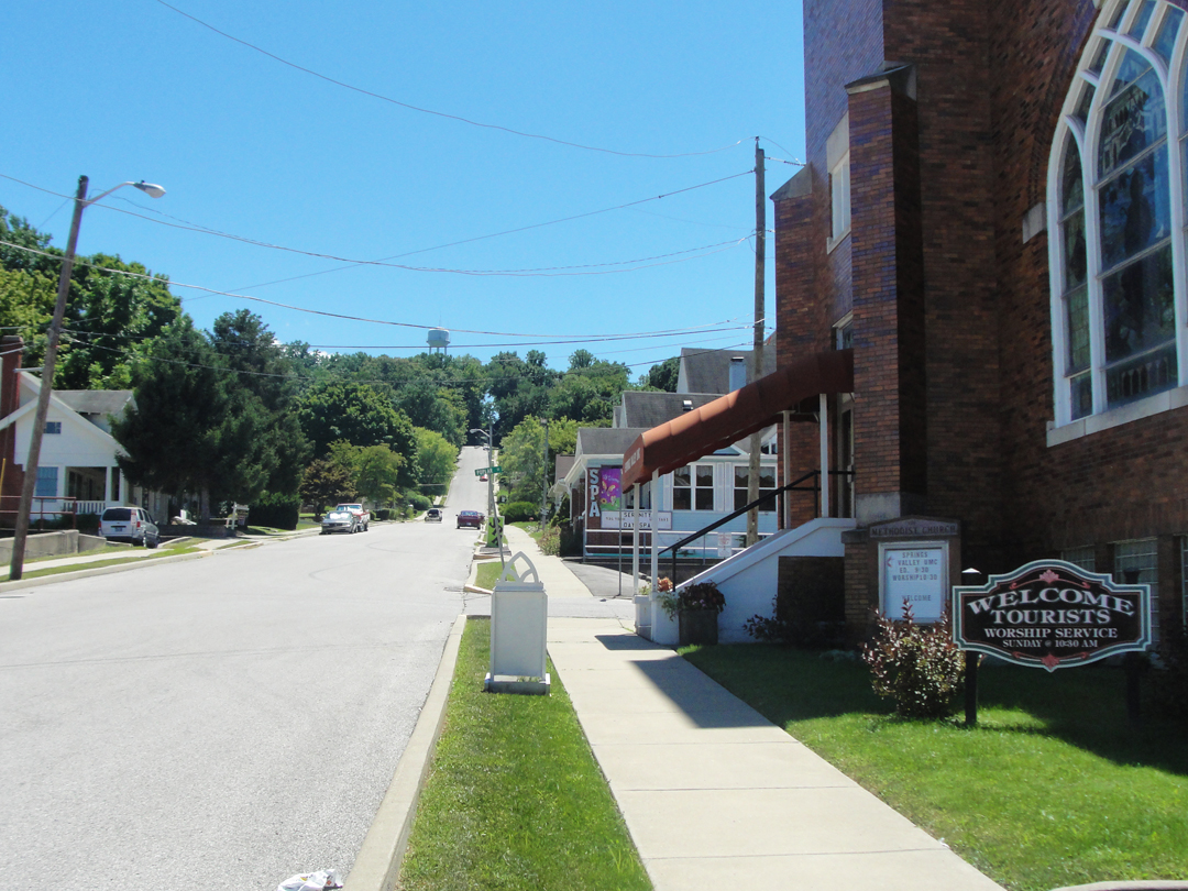
I had no idea what to expect in French Lick. It would, I thought, go one of two ways: dusty and passed by, with its famous hotels replaced by modern boxes, or touristy with its hotels intact. It was the latter. If the hotels live up to their old reputation I wouldn't know, but the current owner certainly wants that to be true. The town around them looks like it exists to serve, mostly catering to the hotels' patrons, but also some for the passing traveler.
At left, one of my favorite signs; looking up Maple Street.
There were, I was happy to see, quite a number of the old buildings still in use, and several were under-going some sort of reconstruction.
Maple at College Street.
But of course, what made French Lick "French Lick" was the resort hotels. There are three -- French Lick Springs, French Lick Resort and Casino, and the West Baden Springs Resort. I paid some attention to the first of these, as it saw Dreiser & Co for a night.
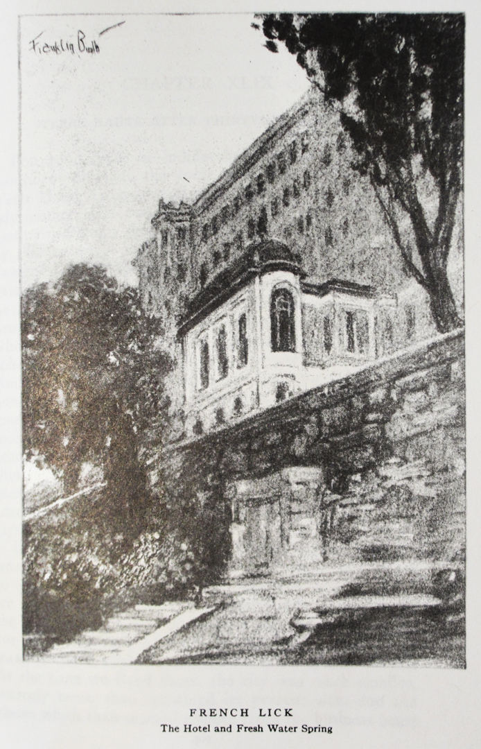
"Who had not heard of French Lick-West Baden?..
I expected, somehow...to see some evidence in the way of improved maintain conditions -- better houses, more of them, possibly -- now that we were in the vicinity of such a prosperous resort, but not a sign was there...We were told...nine miles, seven miles, four miles...still no houses to speak of...Then suddenly, at the bend of a road, came summer cottages...A great wall of cream colored brick, ablaze with light arose at the bottom of the ravine into which we were descending. Then we approached gardens and ground most extensive and formal in character...This was THE hotel. The other was an annex for servants!"
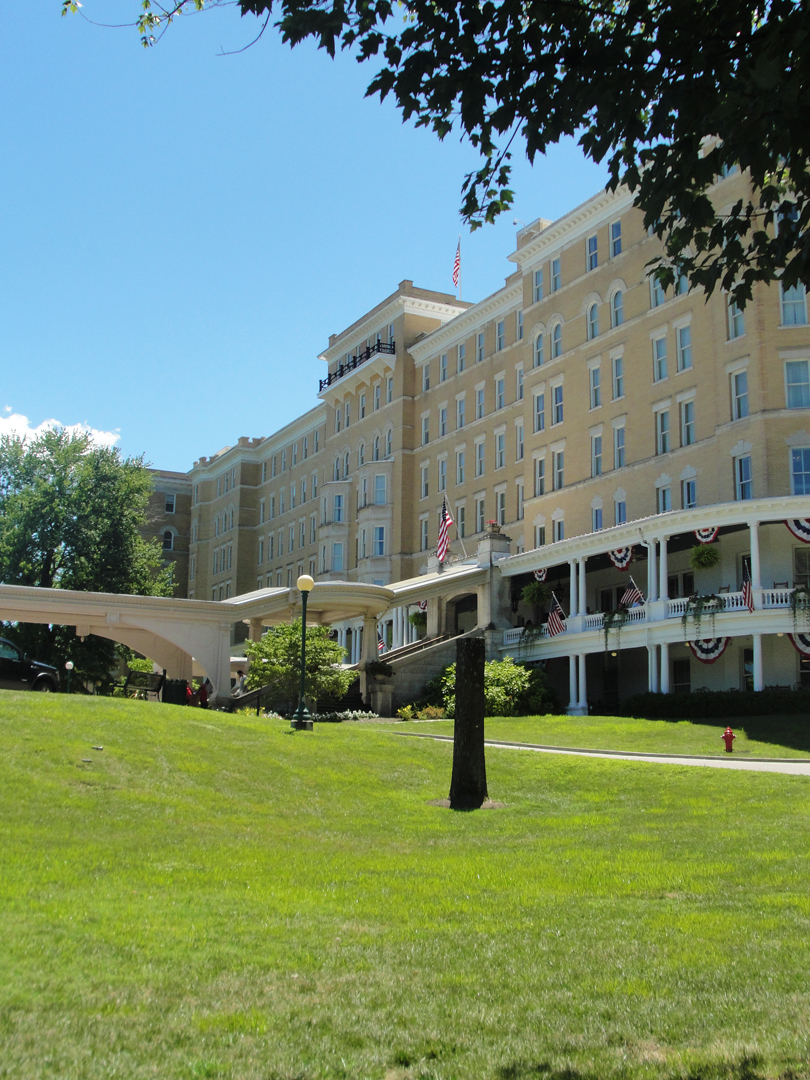
My approach was, actually, similar. I wondered for a few minutes, thinking I might find dusty and passed by after all, then the town appeared, and then the hotel. Nope, not dusty!
"All the gaudy luxury of a Lausanne or Biarritz resort was here in evidence...At the foot of a long iron and glass awning, protecting a yellow marble staircase of exceeding florate design, a liveried flunky stood waiting to open automobile doors...Various black porters pounced on our bags...We were escorted through a marble lobby such as Arabian romances once dreamed of as rare, and to an altar like desk, where a high priest of American profit deigned to permit us to register."
And so it remains, or has been recapitulated. The porters this day were mostly young and Latino, I thought (I didn't approach the main entrance too closely), valet parking was available, and the lobby has been kept or restored to its full glory. The altar like desk is also in evidence.
The interior, beyond the lobby, is clean, with full appointments of millwork and what look like the original doors, or at least the door framing -- either way, the doors are larger than standard.
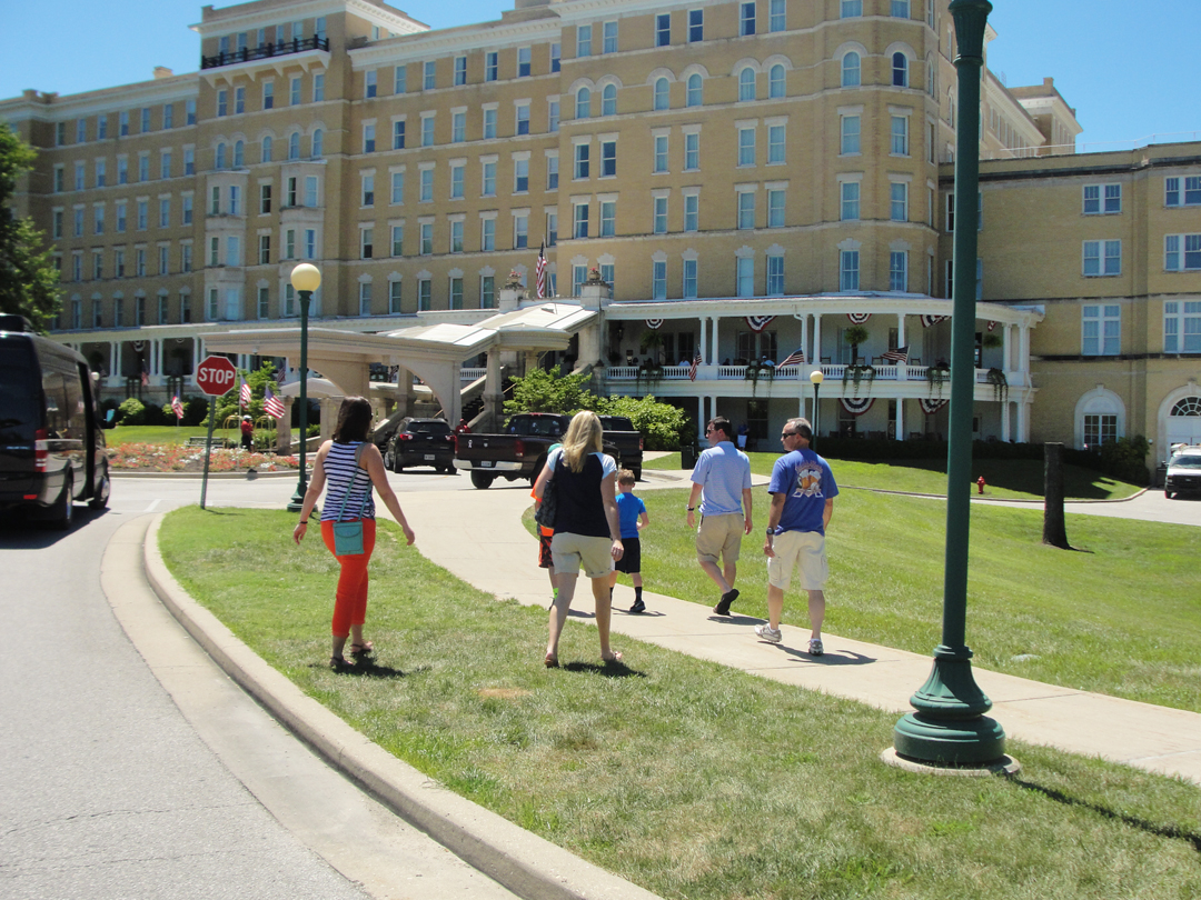
As can be seen in the photo at right, there is a two level promenade/porch/gallery with rockers for guests to lounge on, and at least one Black porter serving drinks.
Below at left, the requisite modern car park; at right, guests who chose to park and walk.
The structure is also on the National Register of Historic Places, though some of the more striking details have been done over. The majority of the building seems pretty intact.
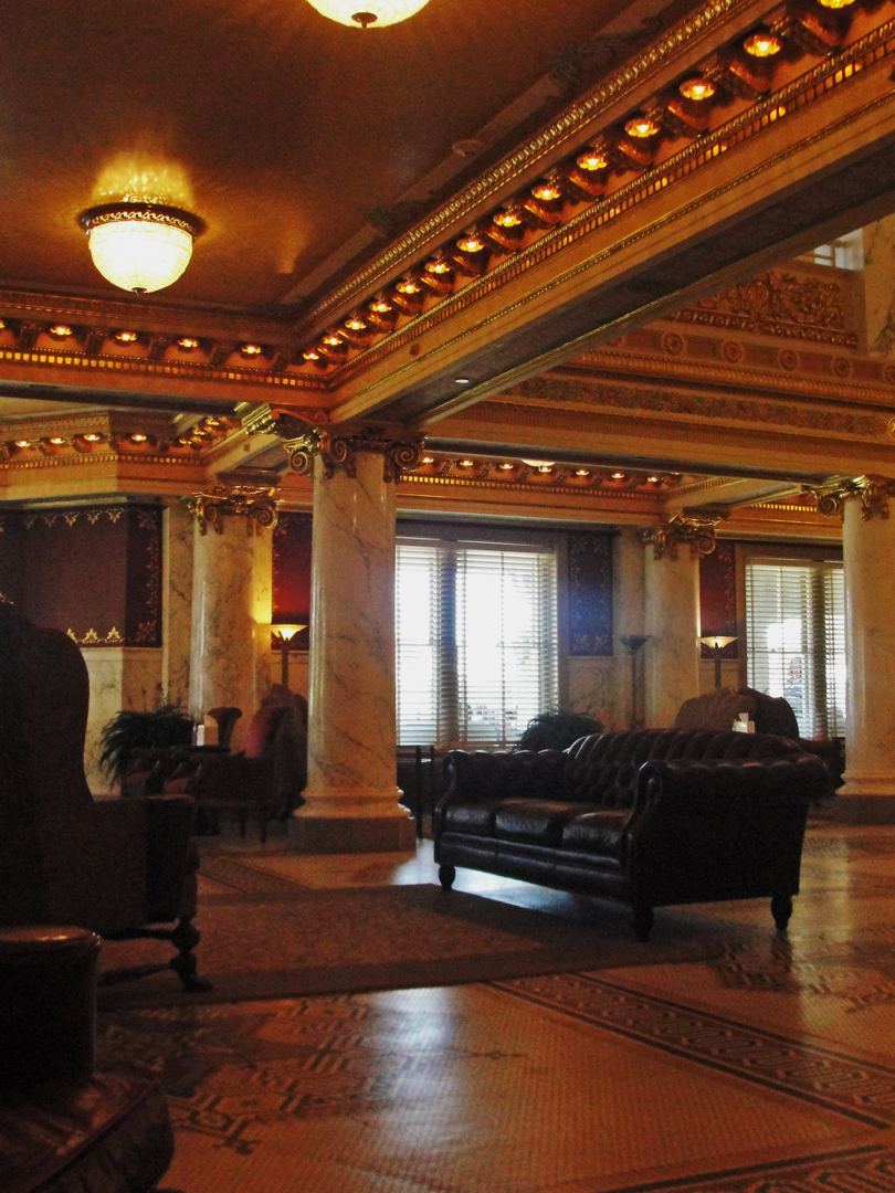
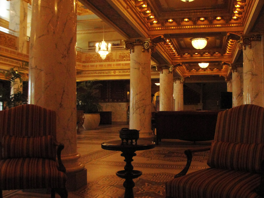
The sitting areas off the main registration lobby.
Thinking myself sneaky, I entered through a corner door into a very modern pizza dispensary. Beyond that were the "family oriented" rooms, with arcade games, a snack bar, a bowling alley, a "news stand" where I got a bottle of soda water. Connecting these to the main portion of of the building was a passageway hewed out of the bedrock under the foundation. Once inside, I took a seat to "play with my 'phone," since that's what people do these days. During that pretext, I snapped a few photos. I don't know if anyone paid attention to me. If anyone did, it would have been because I was the only man in a hat and tie besides the staff. Sometimes my style is too obviously not in step with the clientele, who were, in the main -- no, let me correct that -- who were universally turned out in "contemporary American casual" as in the photo above. No one dresses up to go to a resort!
Anyway.
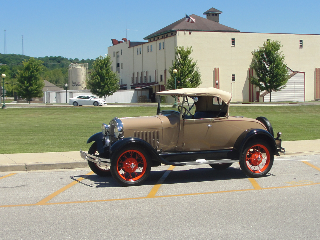
Of course there was an old Ford sitting idle on the drive:
French Lick, as a business encompassing the three resort hotels, does its business catering to golfers and people who want a "Vegas style" gaming experience at the casino. There are spas, fine dining, wine tasting -- "the works," I guess. It's one of those places where I would take a great amount of private satisfaction to stay in, knowing that my fellow guests would never actually know who I was, or why I was dressed "like that." HA! One of these days ---
To its credit, the resort has been in operation in some form since 1845. It gradually grew into the opulent establishment that it remains today, and has only been closed for a renovation once -- for the year of 2005. They have a website of course; I would direct anyone interested in the place to delve into their web presence.
"I may seem to be exaggerating, but I say it in all seriousness. These enormous American watering place hotels, with their armies of servants, heavy, serious-faced guests, solemn state diningrooms [sic], miles of halls and like, more of less frighten me...I don't seem quite to belong...if I dare say a word, some one might cry -- 'That man! Who is he, anyhow? Put him out.' And so, as I say, I 'kinda-sorta' slip along and never make any more nose or fuss or show than I have to."
I really appreciate that Dreiser actually used the term "kinda-sorta" there. After taking my photographs (as surreptitiously as I thought I could be; I didn't know if they had rules against such and I wasn't going to ask) I slipped down one of those mile-long hallways, looking for the back door. In so doing I passed one of those in the armies of servants -- a day maid turning a room -- and I might be reaching a bit, but I think she appreciated that I bothered to smile at her as I went along. Y'know, handsome, well dressed, and a winning smile for "the help!" I have more in common with her anyway than whomever occupied the room, so I can spare her a kind face, can't I. Shortly after I turned down a notably shorter corridor and out one of the back doors, to make my way down the hill via the service drive. By that time I had stopped caring if anyone "caught me out;" I was already leaving, what would they do? Insist I go faster?
Well, enough of that. Elsewhere in French Lick I stopped in a antique store that I saw before parking the saloon. It was -- well, how can I be generous? It was a dump. BUT -- the dusty stuff on those shelves! The proprietor -- I'm so bad with names, so we'll call him George (which might even be right) -- George was retired, paid off, and liked to move some stuff, which was all cash and "gravy" for him, really. George flipped through some pages in a photo album, displaying old photos and post cards of the resorts, gave me some history of the place, told me a little about the Pluto Water Company (still in business) and opined that the Germans down in Jasper really were an industrious bunch who kept their yards clean all right! He seemed interested in talking and I didn't mind listening. For a time --
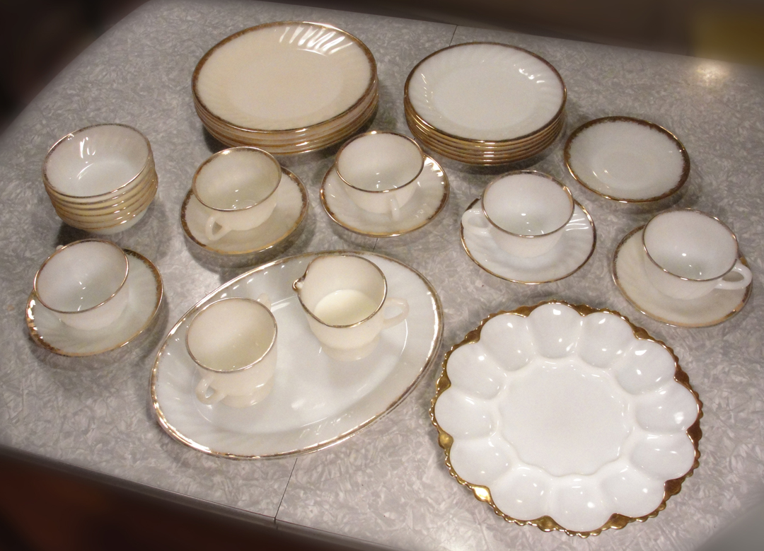
What got my attention -- and my business -- were the stacks of Fire King plates and what-not that sat on one of the shelving units. Once upon a time, these were what I ate dinner from as a kid. My stack of them that I went off to the world with has slowly dwindled from six to four (though only three remain usable as one is cracked) and I had been considering enlarging the collection, but had not got around to it much. I happened across some saucers in a Good Will here a year back, but no cups. George had cups, and a creamer, and plates, plus one of those deviled egg trays for good measure. I got a "jackpot" after all! They aren't exactly identical to the ones remaining from my family, but close enough. There was probably a couple years difference in production run or something, but I didn't care.
O.K., the deviled egg tray maybe not so much, but I thought "what the hell" and I said I'd take it, too. Unfortunately, I do need to find one more cup.
I had also found a few Fire King pieces at a flea-tique in Lafayette around this same time, but honestly I don't remember which are which! And, no, I never thought I'd get excited to be so domestic as to find such satisfaction in the purchase of some plates, but "there y'go" Next on "the list" is to reconstitute the "family silver;" I have, over the years, come up short on the forks. The company appropriately named Replacements has the pattern, but that stuff don't come cheap.
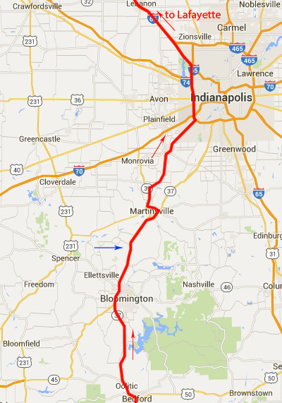
Bedford to I-65 North.
By the time I carried my box of "new" plates out to the car park and tucked them behind the seats, I was, as the saying goes "done." I was still willing at least to give a passing glance to the towns between French Lick and Bloomington, but this day I would only give a "wave" to Bloomington before heading on back to Lafayette. Not withstanding my return to my "day job" in a couple of days, Bloomington would have to wait. And so I got a chocolate shake at the local Dairy Queen and got on with it.
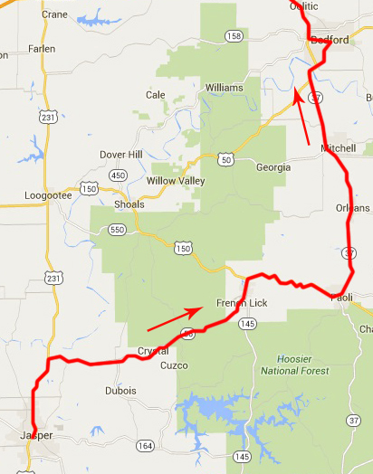
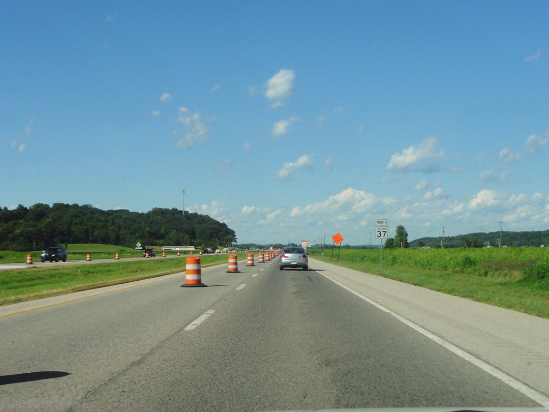
All went well enough for the first part of the drive. Paoli (check!) Bedford (check!) Road construction (check!) Wait - what?! Damn -- the Orange Cones were back. Outside Bloomington the state is busy with the extension of Interstate 69, the building of which had come near to intersecting Indiana 37, and there was a slow-down at the nascent interchange. "O.K., I can handle the slow traffic," I thought. Not too bad really, just a little "bob and weave" to get around the construction zone. "Wouldn't be the first time."
Then came the back-up. At the blue arrow in the map at left.
After passing Bloomington (yep, I waved) the traffic was moderately heavy but moving, until it passed one of those fluttering orange work-zone signs that warned of surveyors ahead. The traffic slowed, the traffic crawled, the traffic stopped, as can be seen below to the left.
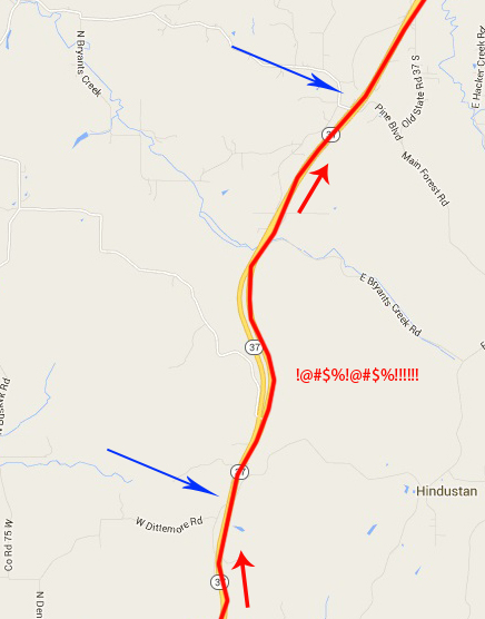
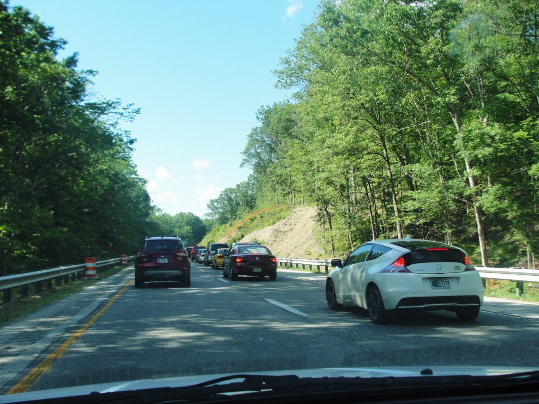
Between the blue arrows on the detail map to the right are perhaps 5 miles of highway. It took over an hour to crawl that distance. About 3 of those miles, where the highway was divided, I was in the shade, which was nice, but that was the only thing nice about it. Well, I had the radio to listen to, but still -- Was I "done" in French Lick? Oh boy! I was "done" now! And I still had miles ahead. I guess the survey crew had done, because I saw a work truck turning around and heading the other way but that was all.
Eventually, Orange Cones and all, the traffic got going again and I made my way to the Interstate.
I did take a few more photographs, since that was one of the reasons I was doing all this. Right?
The sad thing is, once I was on Indy's perimeter, I almost wanted to get the hell back off! There just wasn't anything that I liked about my fellow drivers on the multi-lane expressway, but at least the traffic was moving. I took one last photograph, 'cause it was closing the loop:
I suppose I might have taken a photo where I met I-65, and closed a lop-sided "figure 8," but it just didn't occur to me at the time. I was more interested in just getting my tired backside home in one piece, cleaning off my "new" plates, and sitting down where the seat didn't move.
Next time out: an afternoon's drive to Bloomington, and the end, really, of the Summer's journeys.