
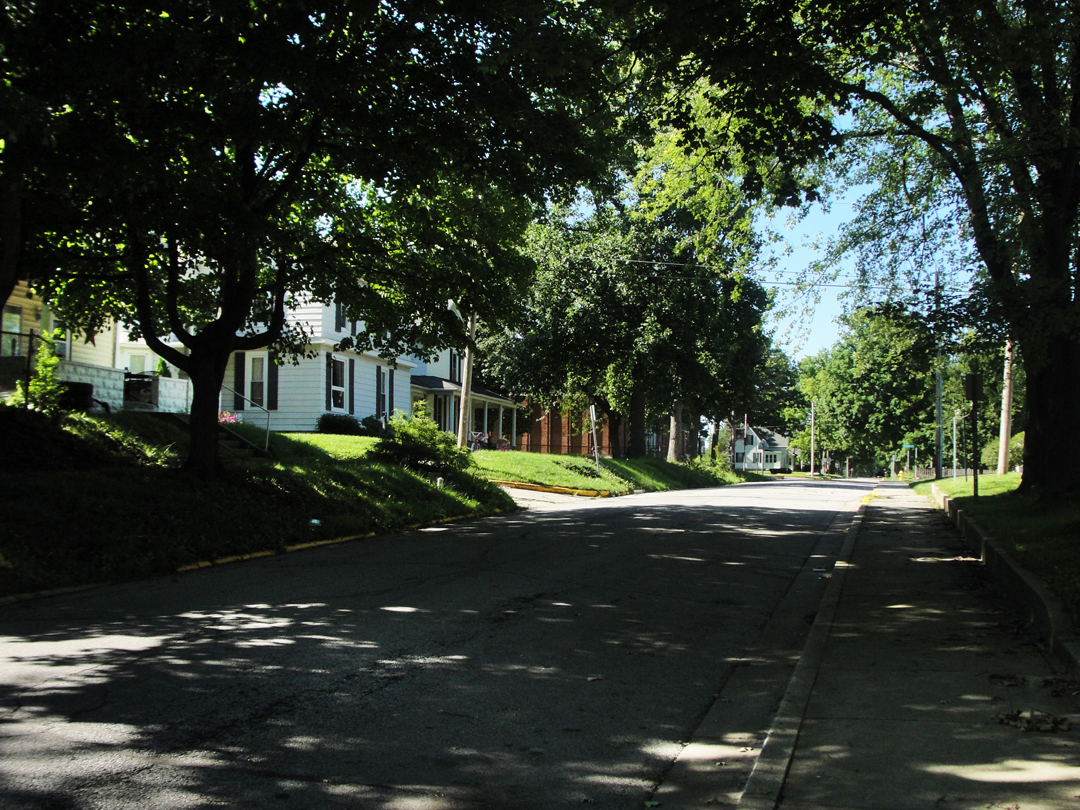
Tuesday morning. It was a strange feeling to be out there still on the road for, as Dreiser was anticipating Warsaw in 1915, so I was in 2015. Warsaw was an odd goal, probably for both of us at this point. For Dreiser, Warsaw had become something of a mythological place. It was the last town in Indiana that he would call "home;" the last time that he would live alongside an idolized mother, with others in his family under one roof, before lighting out to find his future. For myself, I knew that Warsaw was but about two hours from Lafayette and my own home in Indiana.
It was a melancholic moment: the relief of knowing that I would soon be in my own bed and no longer eating in restaurants, commingled with some rue that I could not simply continue "going" indefinitely. So, packing my stuff away in the trunk one more time, I turned out of the motor hotel car park, and aimed the saloon back at Vermilion.
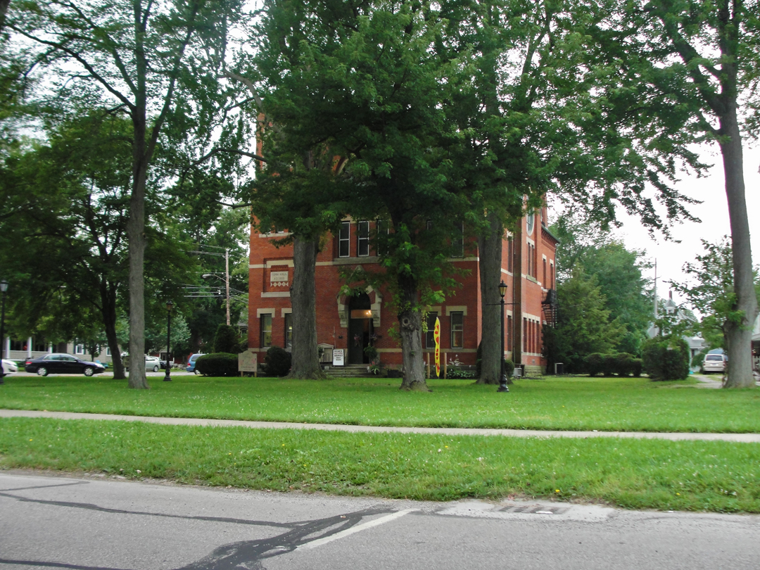
While waiting for a train to cross, I took this shot of the old town hall, built circa 1883.
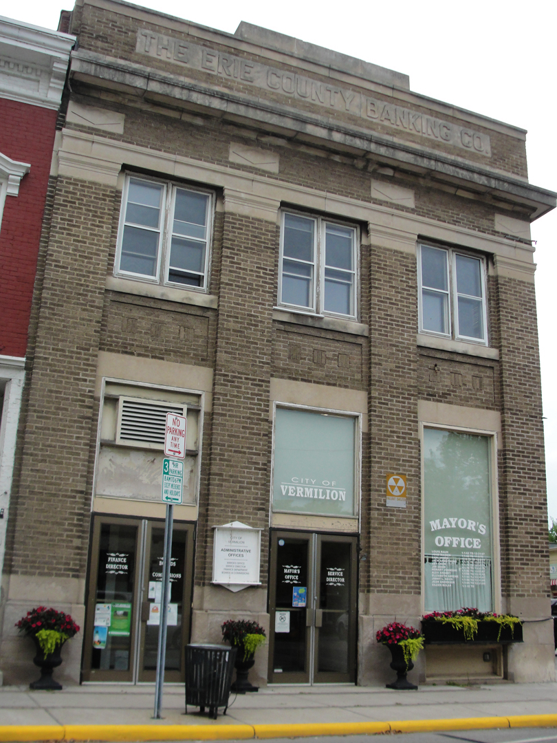
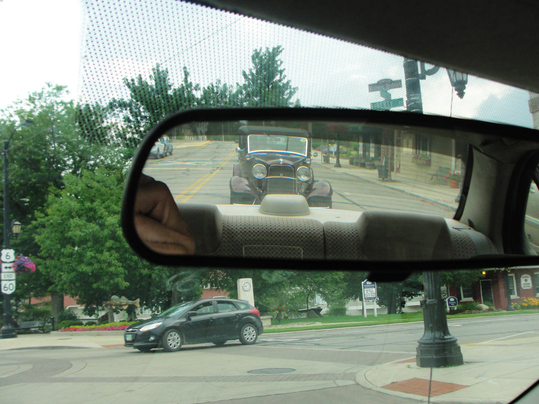
I was motoring through the historic district of Vermilion, and there were a number of structures remaining from earlier in the town's history, though many had become host to new concerns in their later years. The old fallout shelter sign makes me chuckle uncomfortably. And naturally when I saw the old sedan behind me, my thoughts immediately were "covet covet covet!"
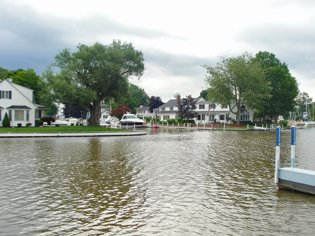
Below: at left, some of the older homes closer to the waterfront, some of which portion is pictured at right. They are serious about the living arrangements here! Owning one of these houses, you could walk out your door and within steps embark on your boat. There are thousands of slips lining the lower reaches of the Vermilion River, whether in the "lagoons" near the lake, or up-river some ways where there are the more common marinas.
It was in Vermilion, Dreiser wrote, that they learned of the lynching of Leo Frank in Georgia. Convicted of the murder of a young factory worker on his company's payroll in Atlanta, he was assaulted in prison, abducted from the hospital ward, driven to Marietta, and "strung up" with the usual crowd of on-lookers. Dreiser and Booth discussed the Frank case and other stories over lunch, remonstrating the actions of the South, with its strange mix of chivalry and prejudice. "...this sort of thing always strikes me as a definite indictment of the real native sense of the people. Have they brains, poise, judgement? Why, then, indulge in the antics an furies of children and savages?"
The Frank story would be the inspiration for the musical Parade, which played on Broadway in 1998.

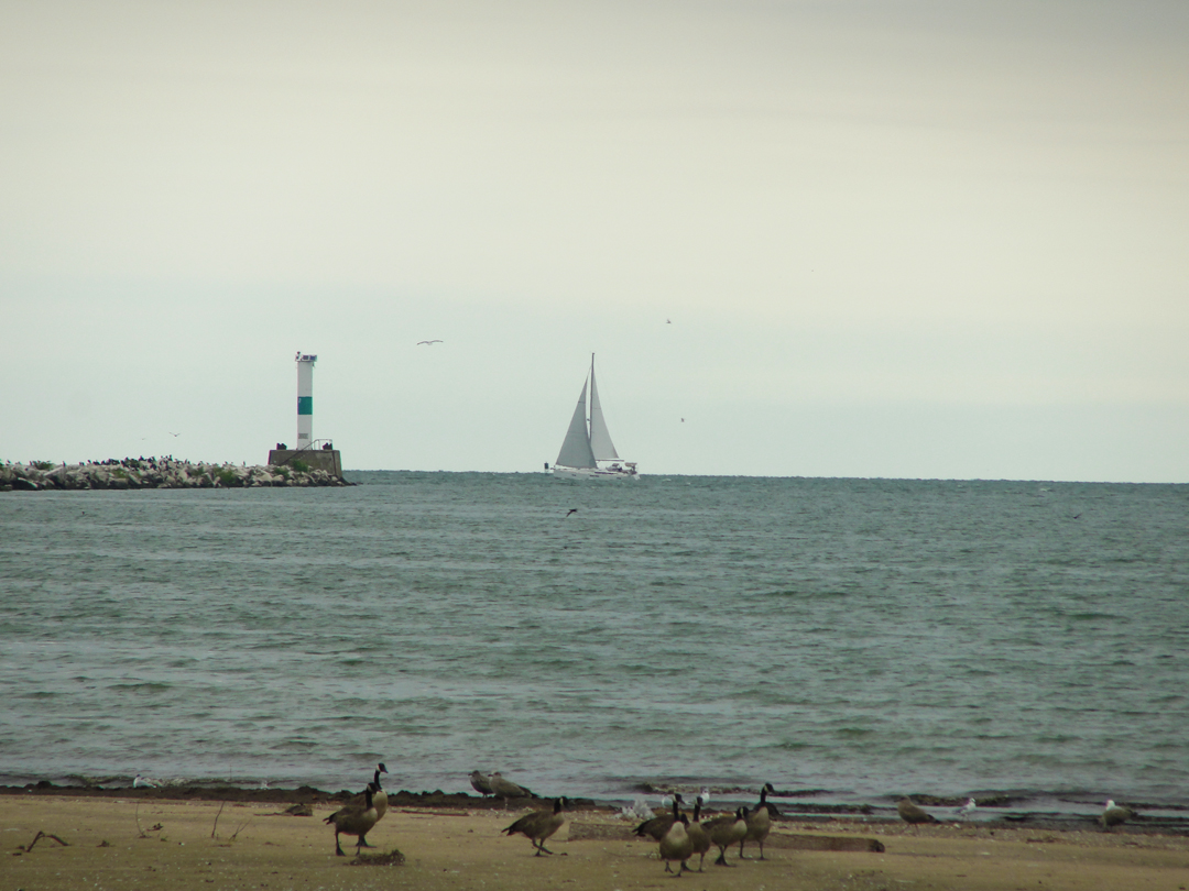
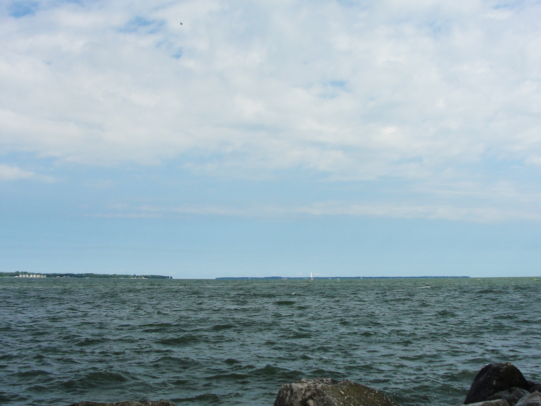
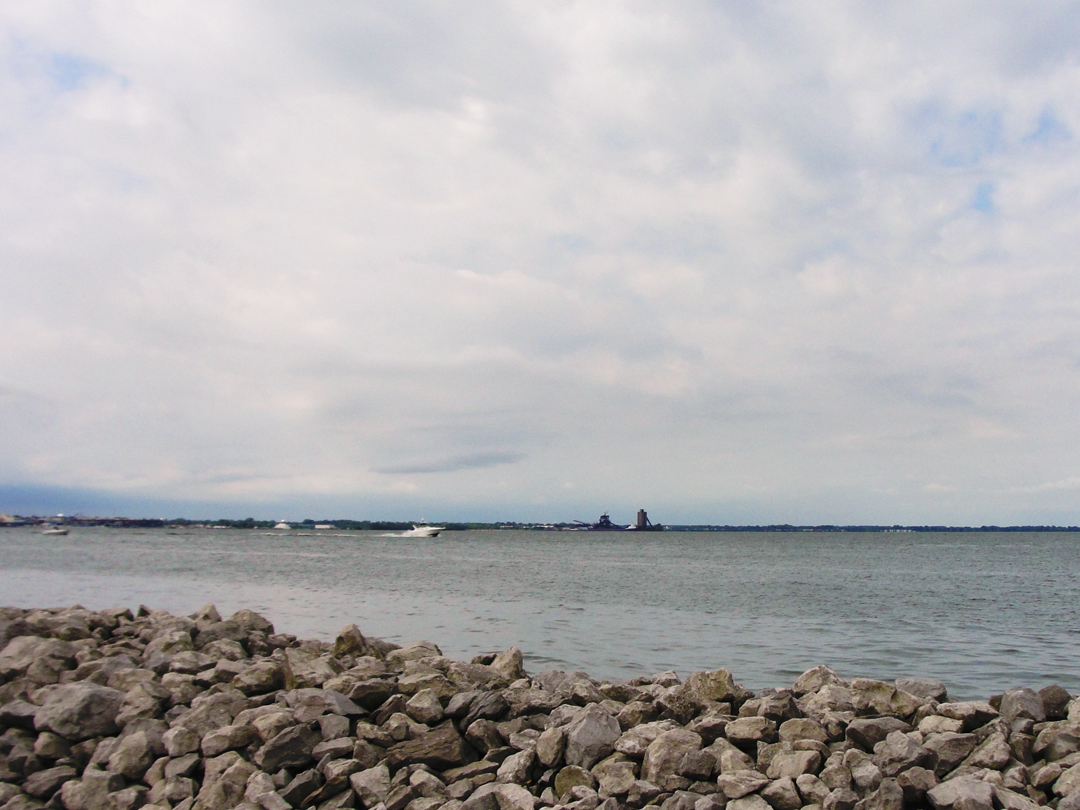
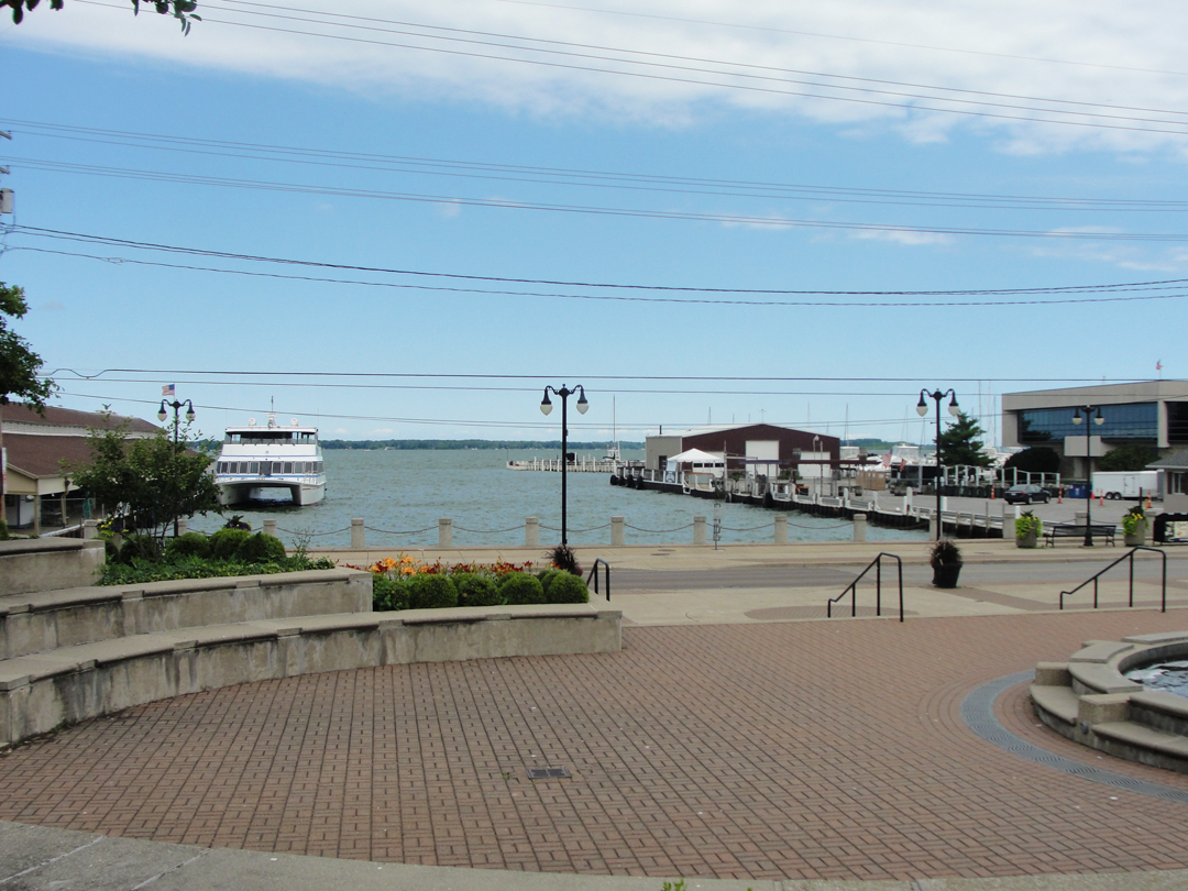
Looking past the police boat toward the entry off of Lake Erie. The lighthouse and museum are in this vicinity, to the left from this quay, and up the road just a bit.
Below: West of Vermilion, at Sherod Park, looking back toward the entrance to the coves.
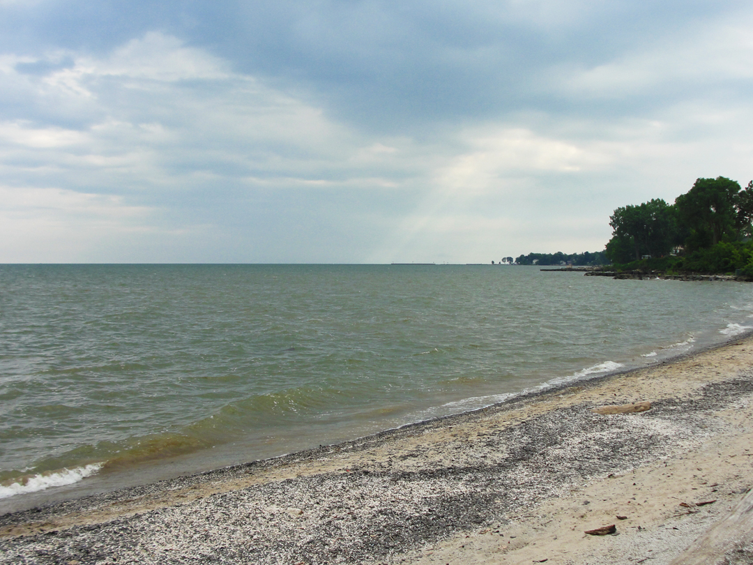
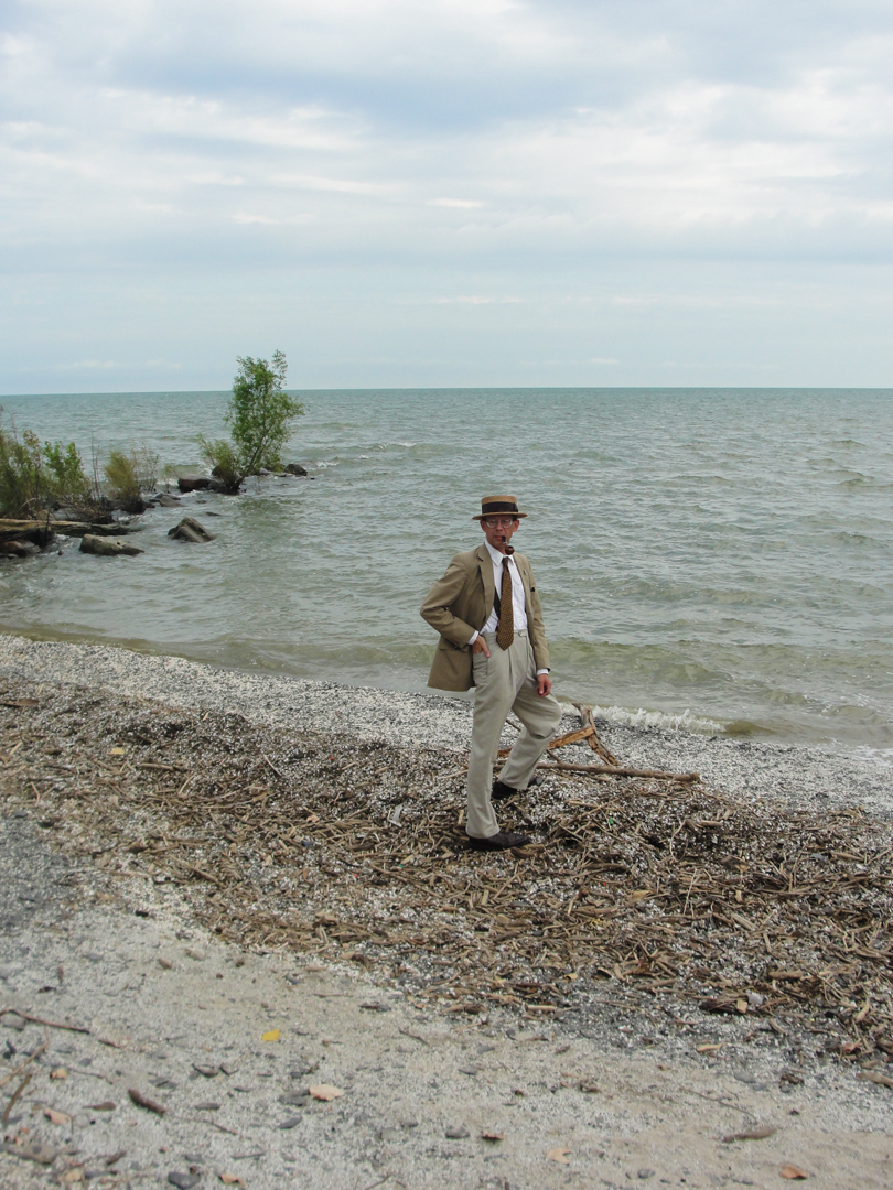
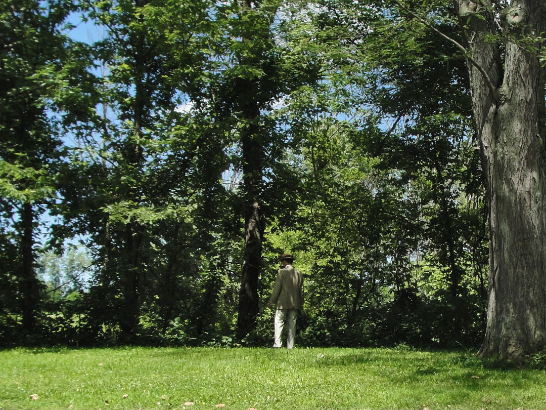
This was the beach where I stood for my self-portraits by the lake. Seemed like as good a place as any.
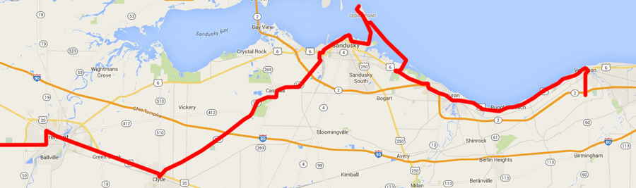
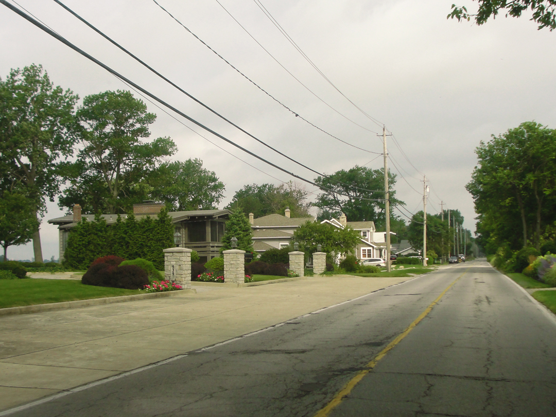
Above: Holiday Inn Express to Vermilion, Cedar Point, and on through Fremont.
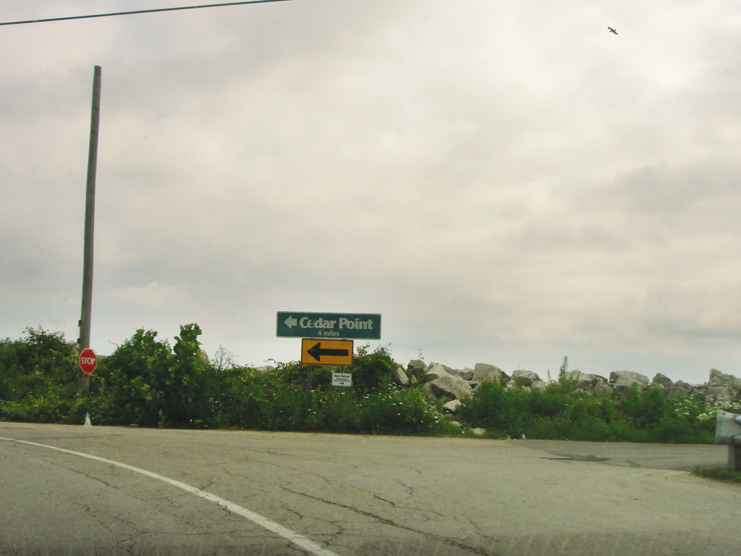
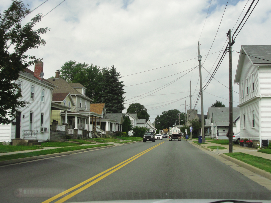
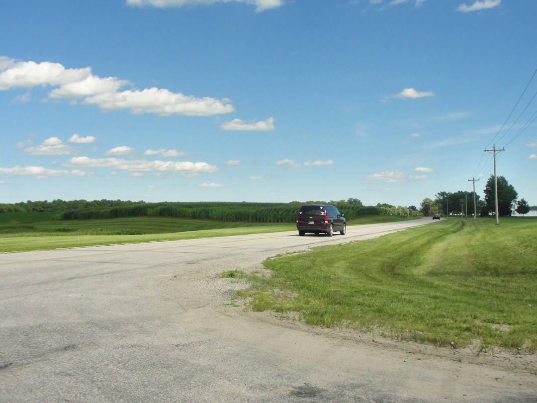
Back on US 6, rolling through the summery, resorty stuff I had passed the night before, and wondering if it would be another day of gray. I was looking for the turn-off for Cedar Point Road, which would lead to the Cedar Point amusement park. That route follows a narrow spit of land with just enough room for the shoulder-to-shoulder houses along it. I wondered if it would be an open road, or if it would be closed to through traffic. I fully expected the latter.
For a moment, I got a glimpse of sunlight.
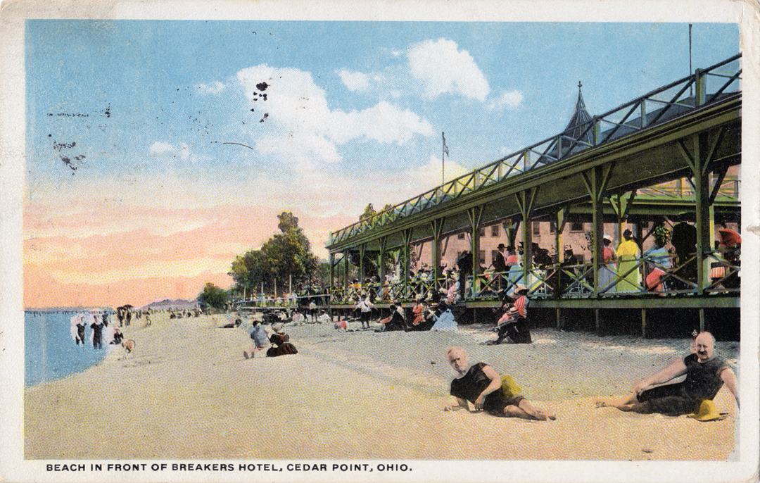
Dreiser & Co, once in Sandusky, (having quite skipped through Huron) learned of Cedar Point and its resort because they were looking at postcards depicting it in various guises: "...Cedar Point Beach in a storm, Cedar Point Beach crowded with thousands of bathers, Cedar Point Beach Pier accommodating three or four steamers at once, and so forth..." It was, he thought, "...a world of Monte Carloesque proportions." They also discovered that they could drive out, if they back-tracked to the beach road, which they did. "...you can ride for seven miles along a cement road which parallels exactly the white sand of the beach...It is backed by marsh land, some of which has been drained and is now offered as an ideal and exclusive residence park."
An hundred years ago, and already dividing drained marsh land for expensive houses! Honestly, I had forgot that by the time I drove out there, but such is the situation today, that long line of houses, with ample notice that the beaches along the lake side of the island are for residents' use only, and, by the way, NO PARKING.
Below left, the Cedar Point Road causeway leading from the mainland to Cedar Point island. Well, it was an island; this causeway and the Cedar Point Drive causeway have pretty muchly permanently linked it to the rest of the state. At right is a view of the lagoon to the West of the causeway.
Above left: I guess I'm going the right direction! Starting up the causeway I kept looking for the sign that warned off the tourist traffic, directing vehicles bound for the Point and its attractions to use Cedar Point Drive. I can easily imagine such an arrangement, but it never showed. Above right: a few of the houses on the road. With a couple of exceptions, there is that much room on the island -- a bit of beach (just out of view to the right), the road, a little yard, and the house; behind these houses is the lagoon.
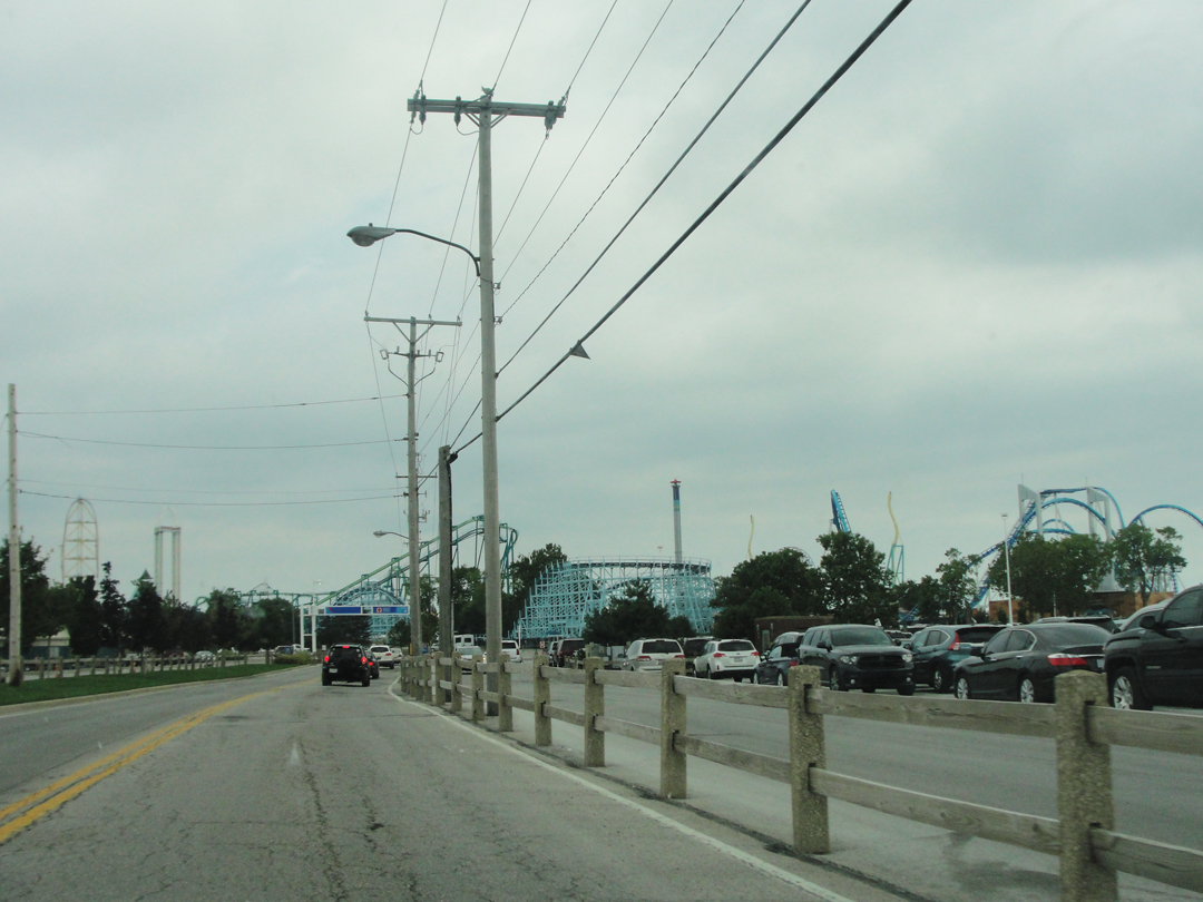
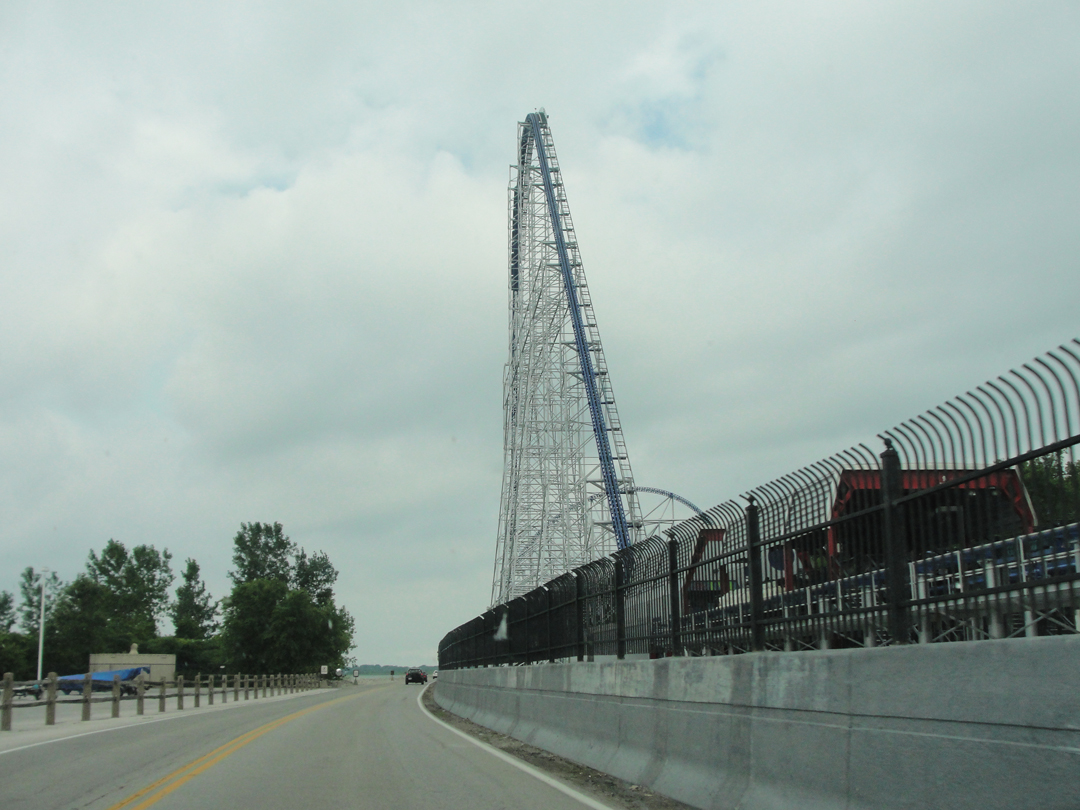
I also had no idea about the Perimeter Road that skirts around the amusement park; fortunately it was only fifty cents to drive there, and there weren't any other options. Once to the acres and acres of car park, there's a toll booth, and that's they way on to the point. Up Perimeter Road, and firmly outside the park, the view is of roller coasters; they really do want to be the "Roller Coaster Capitol of the World." There are 16, as well as midway amusements and a water park. Beyond the bounds of the coaster park proper were a hotel and a camp ground; I can't speak to the hotel, but the campers were aplenty.

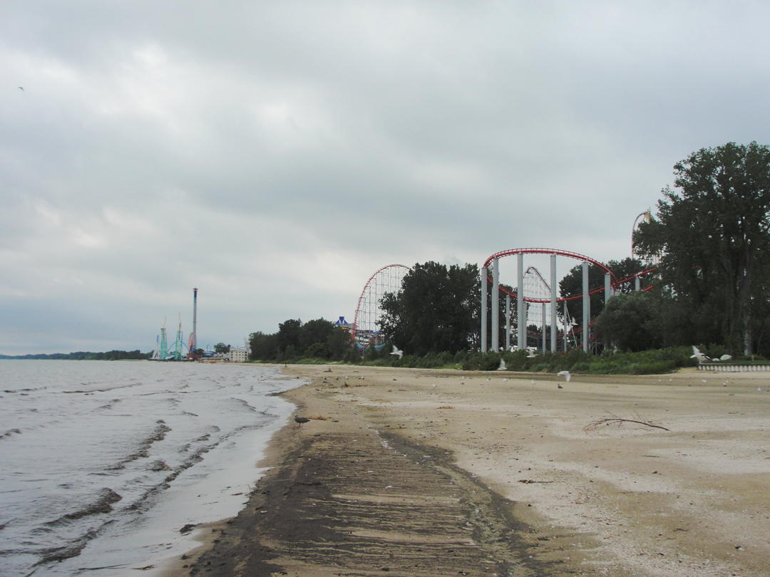
Above, at right, is a view down the beach. This day, the beach was far from sandy and pretty; it looked rather like any sand had been washed out in a storm, and there was a sign announcing no water entry. The maritime fowl liked it however: plenty of sea gulls. Also, plenty of Canada Geese. I don't care much for geese; they have a habit of flocking in the same places over time, and leaving their goosey feces in much abundance.
The absence of sand, coupled with the gray skies -- and it being a Tuesday, too, I suppose -- meant that there were no other tourists out on the shore this morning. A work crew was laboring near the breakwater at the very head of the point, and they were the only other people I saw. Well, save for the riders of the coaster visible in the middle distance above, but they were never around for long!
I had the view all to myself; me and the geese:
Above, the breakwater; below, looking back along the island.
Cedar Point actually is pretty substantial, and well sited for a summer resort. The steamers Dreiser noted previously came over to the Point not only from Sandusky, but I'd venture from Cleveland and Toledo as well.
Passenger steamers were big business at the turn of the last Century, carrying day-trippers and week-enders across the Great Lakes from most of the major shore cities to resort towns and sites like Cedar Point in a manner far removed from the work-a-day world of many of those paying passage.
Some Progressive, or at least somewhat more mindful, employers, whose works were within a short distance of the Great Lakes would sponsor weekend outings for their employees, allowing them a day or two of summer holiday or company picnic away from the factory.
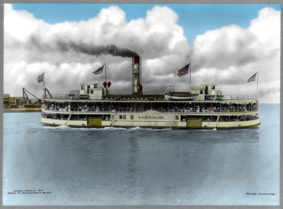
The G.A. Boeckling, under steam to Cedar Point circa 1910. Given that this ship is constructed "double-ended," it's more likely a ferry departing from Sandusky, and not a "deep water" lake boat.
Interestingly, the note to the bottom right indicates that this was "hand colored;" the card was probably photographed, in black and white, before being submitted to the Library of Congress. The image as it appears here was re-colored by your truly (LOC).
This postcard was mailed with an August of 1915 or 1916 date, so it's about as perfect as I could ask!
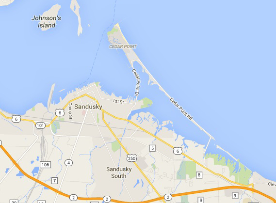
The view across Sandusky Bay toward Bay Point and Marblehead (Bay Point is the un-named island in the map above).
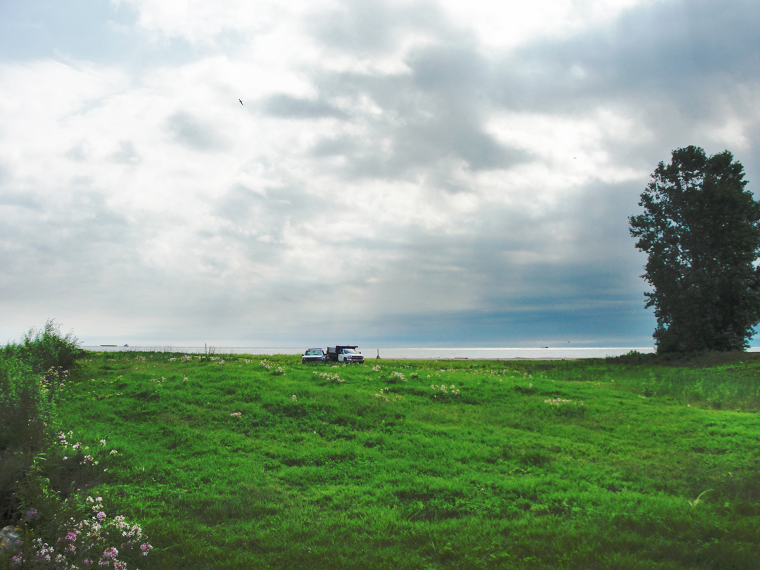
Below: Lakeshore Landscape with Work Trucks
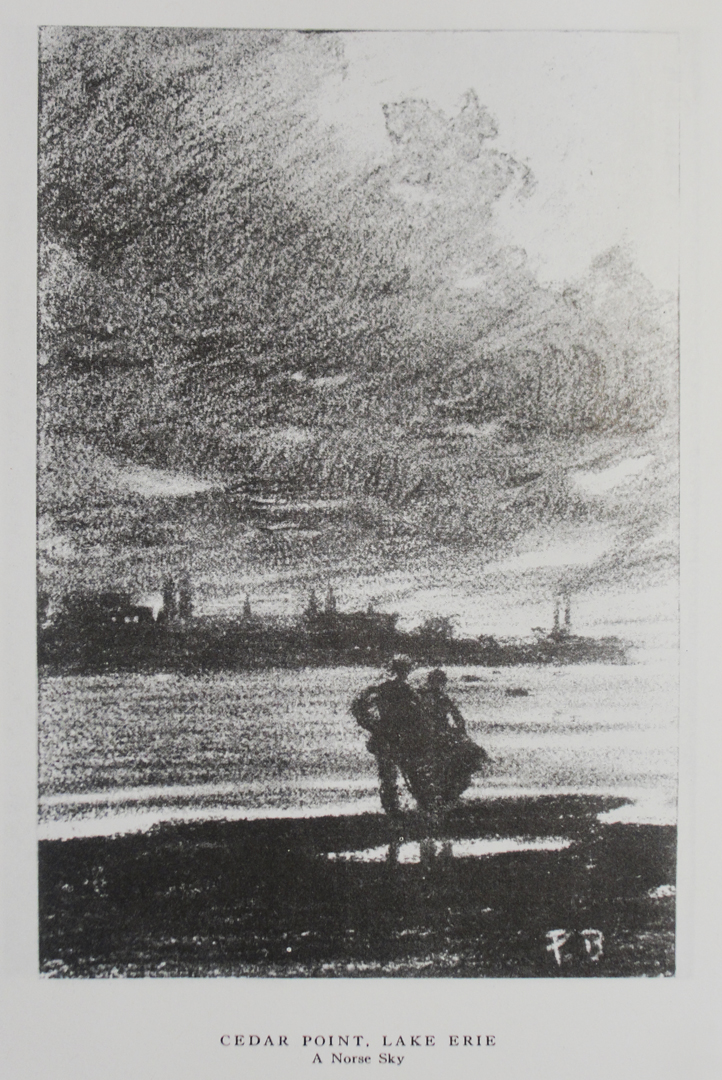
Dreiser wrote of the sky-scape in 1915 as having "...tattered, wind whipped clouds," which at sunset provided a "...fabled, almost Norse aspect." which I thought fitting for my visit as well.
As with Geneva-on-the-Lake, Cedar Point had hotels large and small for the visitors, the broad sandy beach, a casino, dance pavilions -- "Shades of Atlantic City and Long Beach!" -- though quite without the "vice and sensuality" of the East Coast. These, Dreiser observed, were the people of the Middle West, and while "...of a simple, inexperienced character..." there were yet "...a vivacious, hopeful crew, and as such deserving of all praise."
Quite the contrast across those hundred years. These days amusements are just vastly different, I guess. Who am I to say? I grew up in Southern California, only an hour or so away from Disneyland which got more than a few of my family's tourist dollars. What was it that caused many of us to go from our homes in search of "thrill rides?" Roller coasters were hardly unknown in the previous decades, but for entire parks to be filled with coasters? Or "coaster-type" rides as the Disney parks are? Coney Island reigns supreme! Perhaps it was a combination of middle-class income and leisure time going in search of that "something extra" beyond the day-in and day-out of the humdrum office or auto assembly-line job. A little extra in the pocket could find its outlet at some amusement that offered an adrenaline rush that suburbia simply lacks; a bit of a "kick" for your summer vacation. An attraction to be photographed in front of and recalled in the dull gray Winter.
What-ever the reason, the draw is still clearly in evidence.
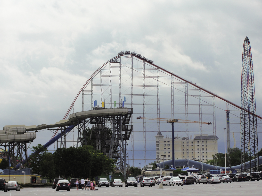
Get ready to SCREEEEEEEEAM! And oh! scream they did.
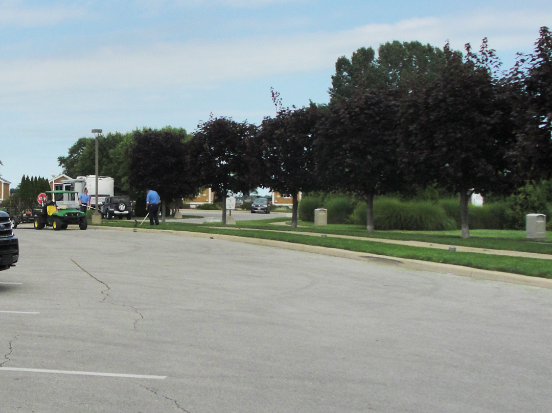
Of course, no amusement park can actually turn a business long if someone isn't taking care of things like keeping the grass cut. Sometimes I still find myself surprised at seeing the people who perform the "unsung" or "thankless" tasks.
The view across the bay toward the Sandusky waterfront, from the Perimeter Road nearing Cedar Point Drive.
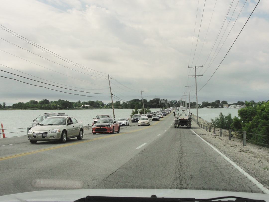
Here, the traffic on the Cedar Point Drive causeway. The two lanes will become four lanes prior to the visitors reaching the parking toll booths standing before the car parks. The creeping traffic covers well over a mile, more if it goes all the way back to US 6.
I was glad I was going the other direction.
After leaving the Point, I turned into Sandusky, as I was looking for an antidote to the amusement park-air, and because it was time for a fresh cup of coffee. After the self-induced disappointment of Geneva Beach, I hadn't held out any hope for Cedar Point, so I was not disappointed this time. Slightly taken aback, perhaps, but not disappointed. I had no expectations for Sandusky, other than it would probably be much like the other smaller older cities I had traversed.
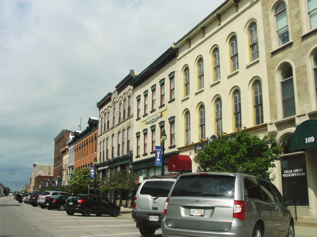
In some respect I was right on that count; Sandusky might even have a bit "more" on some days. It's older downtown and waterfront district still has businesses in most of the store fronts, and I can imagine that a sunny Saturday afternoon sees a goodly number of people shopping or eating before or after taking out their own boat, or taking a ferry to one of the Lake Erie islands.
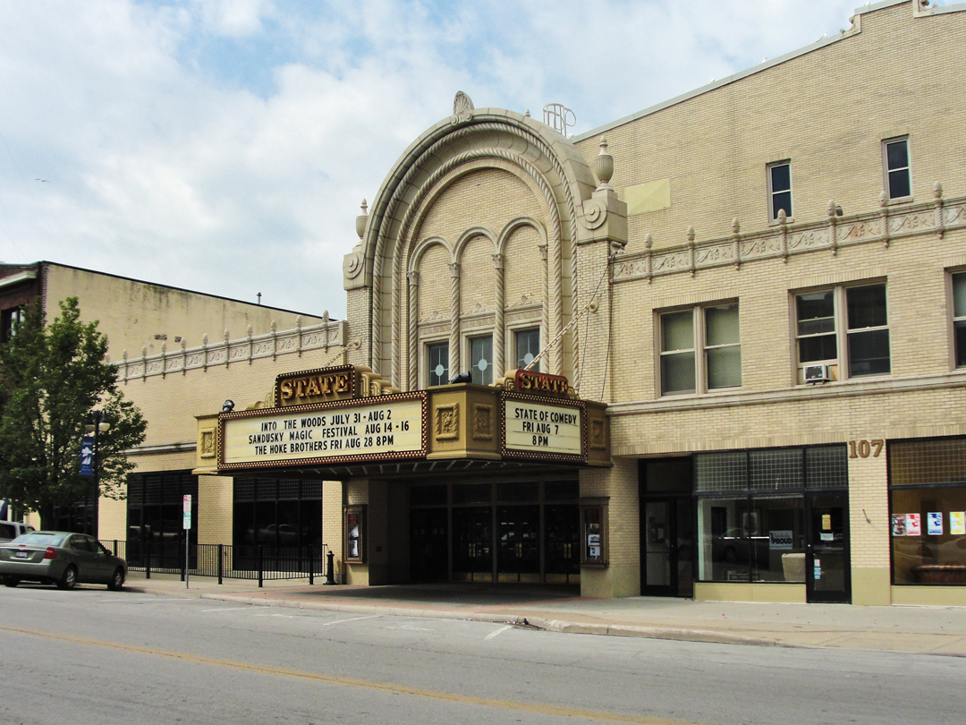
And of course it's always nice to see an old venue in use still. It's nice to see most any old buildings still in use!
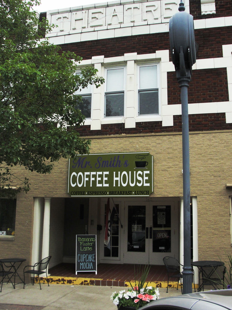
"But first: coffee!" I'm not sure what happened to the "theatre," but Mrs. Smith's Coffee House had good coffee. This looks like my perfect place, don' it? Well, no, on second thought, if I could just have the coffee please -- I don't have to have the theatre.
I noticed here, and back in Ashtabula, that the patrons of some of these coffee houses were quite varied: young "hipsters" to grandmothers, sometimes in company, partaking of the offerings both liquid and solid. A good thing, I believe.
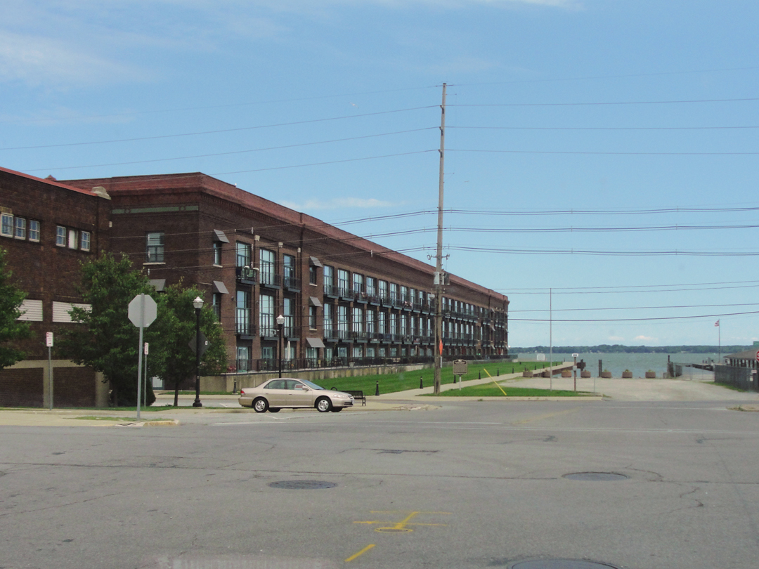

Some views of Sandusky near the bay. The old industrial building above at left has been reconceived as residential, I think.
The old industrial building at left is still industrial.
I filled the gasoline tank in the saloon, and made my way out of Sandusky, bound for another string of towns that would lead out of Ohio. This was my last view of the lake -- well, the bay -- the water -- and as with the melancholic consideration at the beginning of the morning, I again was struck with the odd thought that I would not be seeing Lake Erie again for some span of time as the route was now angling to the West and South toward Indiana. Having been this far, I also had the strange want to drive this course again, only to spend more time in some of these places -- Sandusky, for instance. Is there really anything here to "write home about?" I would like to think so.
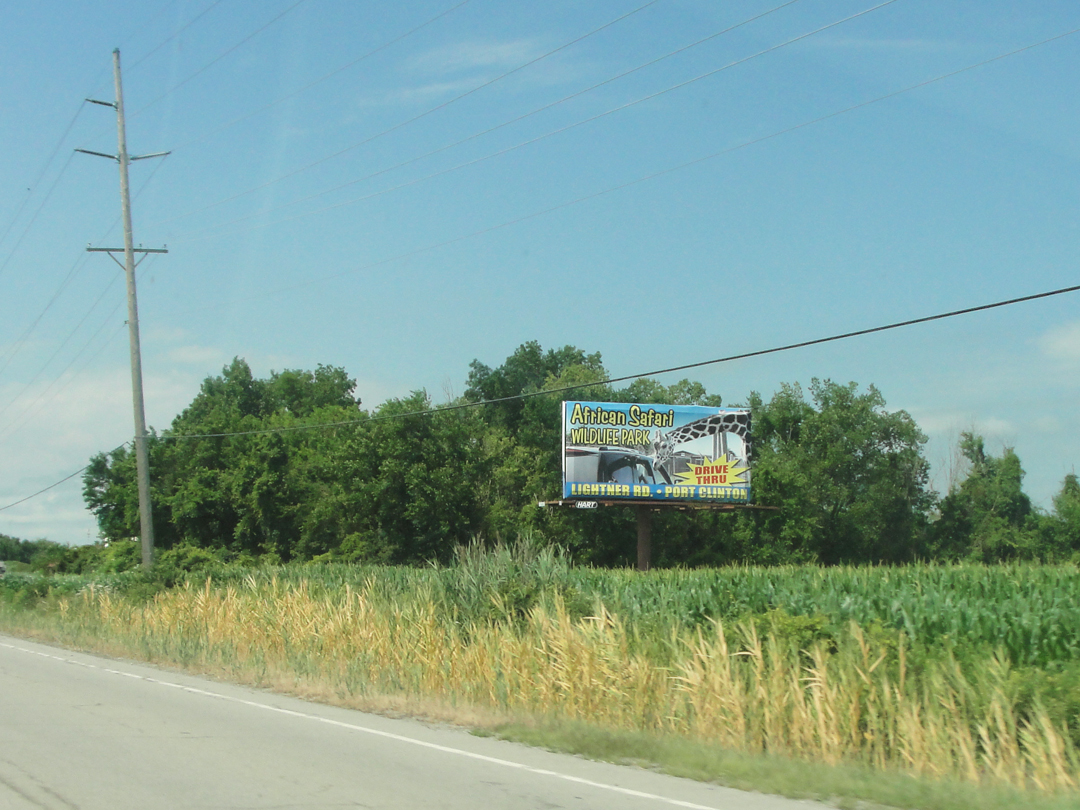
When you've had enough of water adventure and roller coasters, you can head over to the African Safari "drive-thru."
On Ohio Highway 101.
"After we left Sandusky I began to feel at home again, for somehow this territory southwest was more like Indiana than any we had seen -- smooth and placid and fertile -- it was a homelike land. We scudded through a place called Clyde...And then we came to a place called Fremont...
And after that we drove through places called Woodside and Pemberton and Portage -- you know the size -- only in these towns, by now, I was seeing exact duplicates of men I had known in my earliest days."
So there was my list for many miles to come. The trouble I had was linking some of these. Sandusky through Clyde to Fremont were easily enough done, but after that I had to make a few choices of place, and also made a couple of inadvertent choices.
Iterating the map from earlier: from Sandusky at top center, Ohio Highway 101 makes Clyde, where I picked up US 20 for Fremont, to the left.

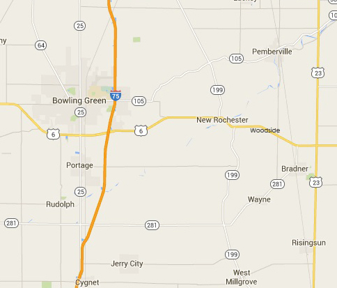
Somewhere West of Fremont either some towns have changed names, or disappeared, or Dreiser recollected incorrectly just where in Ohio they were. "...Woodside and Pemberton and Portage..." after which the Pathfinder entered Bowling Green. Woodside I found on the map, though I completely missed it on the road (I've added its name to the map for location's sake). Pemberton I could not find though Pemberville was there, but as it was due North of Woodside, I adjudged it to not, after all, be the same place -- unless it is, and there was some other confusion of locale. Of Portage I chose to simply skip. While there is a road that I could have followed down there after Woodside I just said "Um, no, thanks anyway."
I had planned to turn off of US 6 a little East of Bowling Green, and so enter along East Napoleon Street, one of the town's side streets. Naturally, I totally missed that turn, and wound up going too far and having to double back to OH 25 and drive up from due South along one of the "main drags."
BUT anyway, back to Clyde, of all places, which seemed to have "a bit more" going on than some smaller cities, though what I wasn't sure. It was "the usual mix" of older and newer houses and commercial buildings, with some national chain stores. What is it that marks out some places as still retaining some of the "verve" that they might have enjoyed in their earlier years? Is it simply that there are apparently more stores occupied? That fewer parking lots look deserted? That people are out walking dogs, maybe, or the automobiles are, for the most part, newer or more well kept. Maybe less litter blowing along the gutters. All of the foregoing, and more. There does seem to be something "in the air" about towns or small cities that bespeak of some prosperity however large or small, or maybe it's just me. Clyde seemed to have that "air."
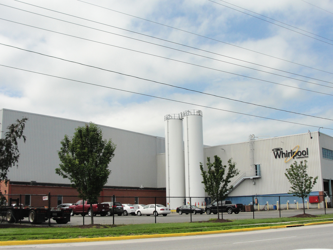
Turning toward Fremont, I passed this: a massive Whirlpool plant, and I said to myself "Ah! That's why Clyde feels so well!" There may be some other concerns in town, but I doubt of this scale. A manufacturer of this size may easily employ three- or five thousand people, which would be a great boon to any municipality.
Back to the improved road: US 20 heading West (or, West by North here), and then into Fremont.


Fremont, on the map anyhow, looks bigger than Clyde, and there's still some life there I think, but I actually like Clyde better. At least to pass through.
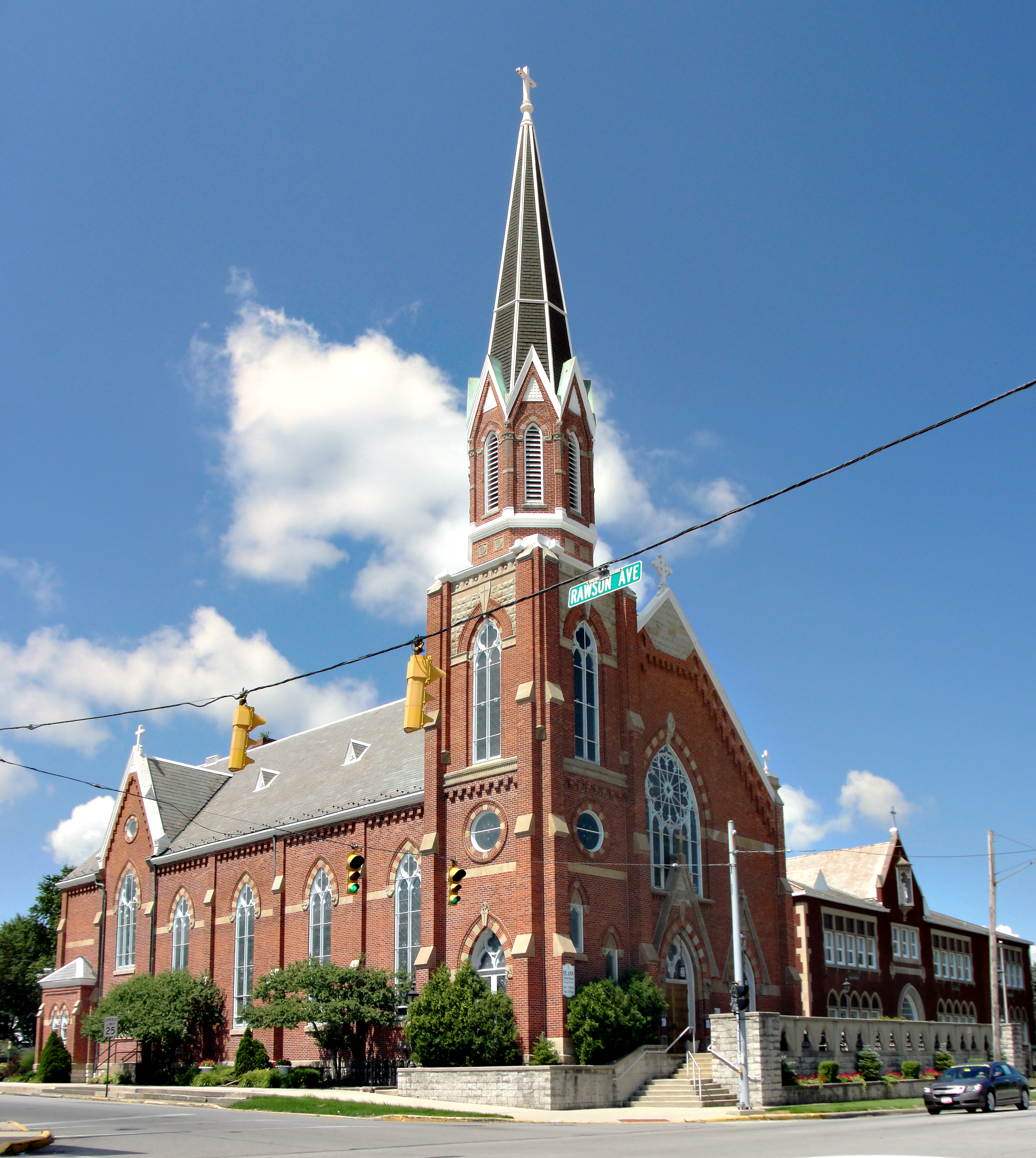
And I do rather appreciate the architecture of a church, as this one.
Making toward US 6, I passed an old industrial site (below left), which as many have, has been converted I believe to a "mixed use" zone. Once the original owner/manufacturer has gone, what do you do with the buildings? Rent 'em to as many other businesses as you can. Shortly after, I came to an intersection with Napoleon Road; I turned right, thinking that it was the Napoleon I wanted (below right). Unfortunately, Napoleon Road no longer connects with Napoleon Street, if it ever did, so I would shortly be back on Hwy 6 after all.
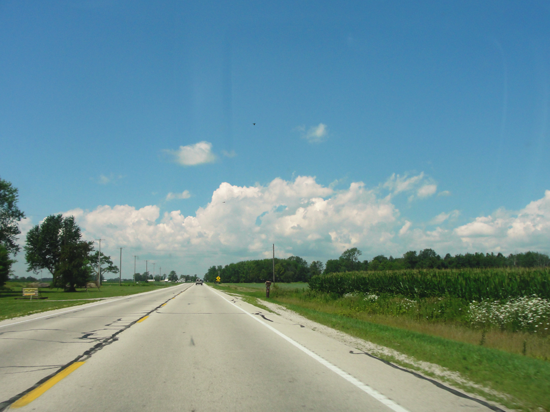
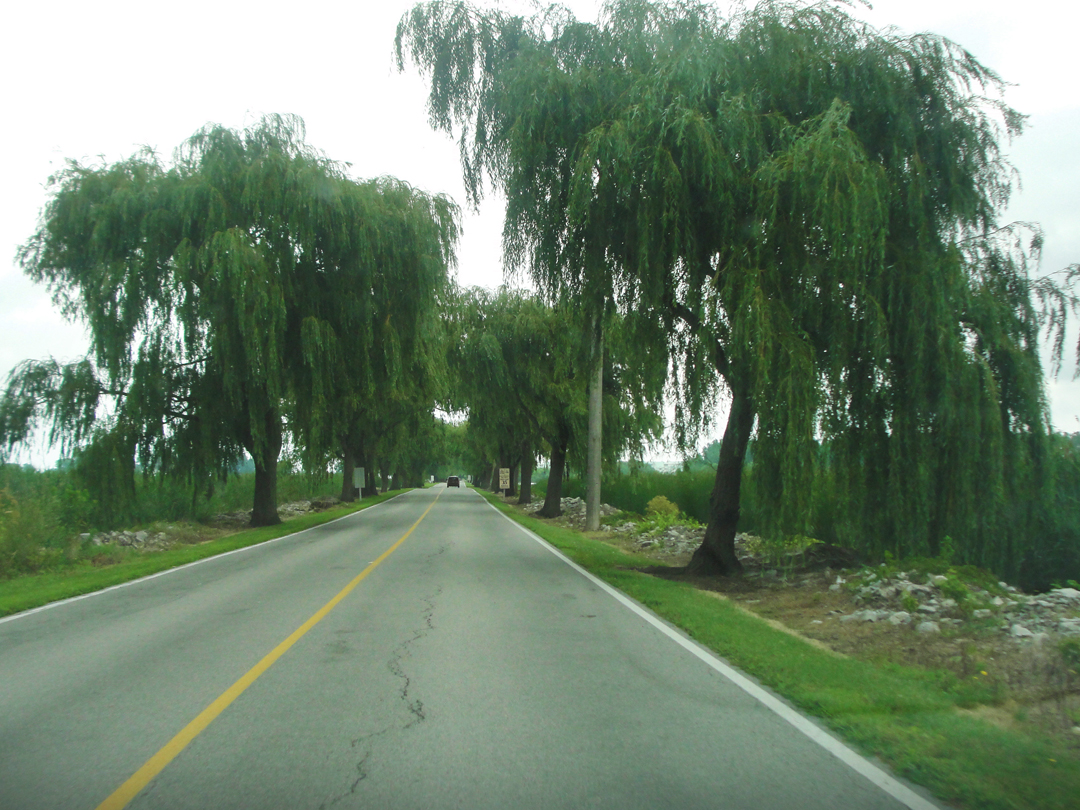
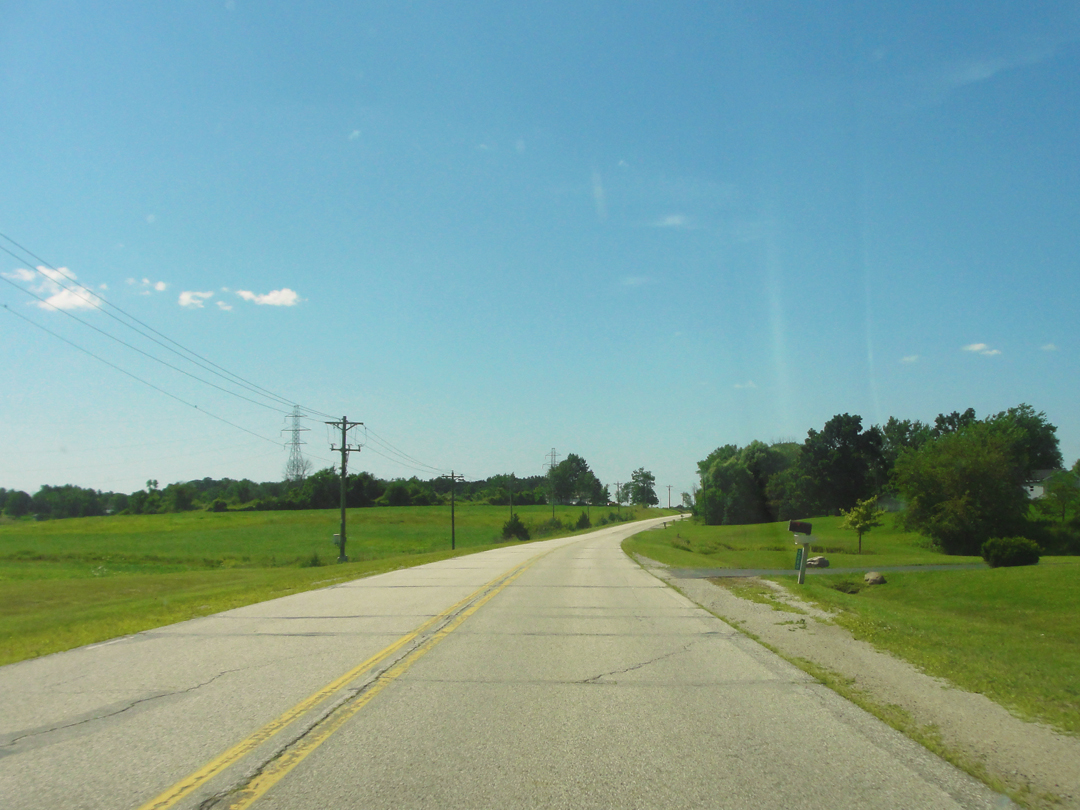
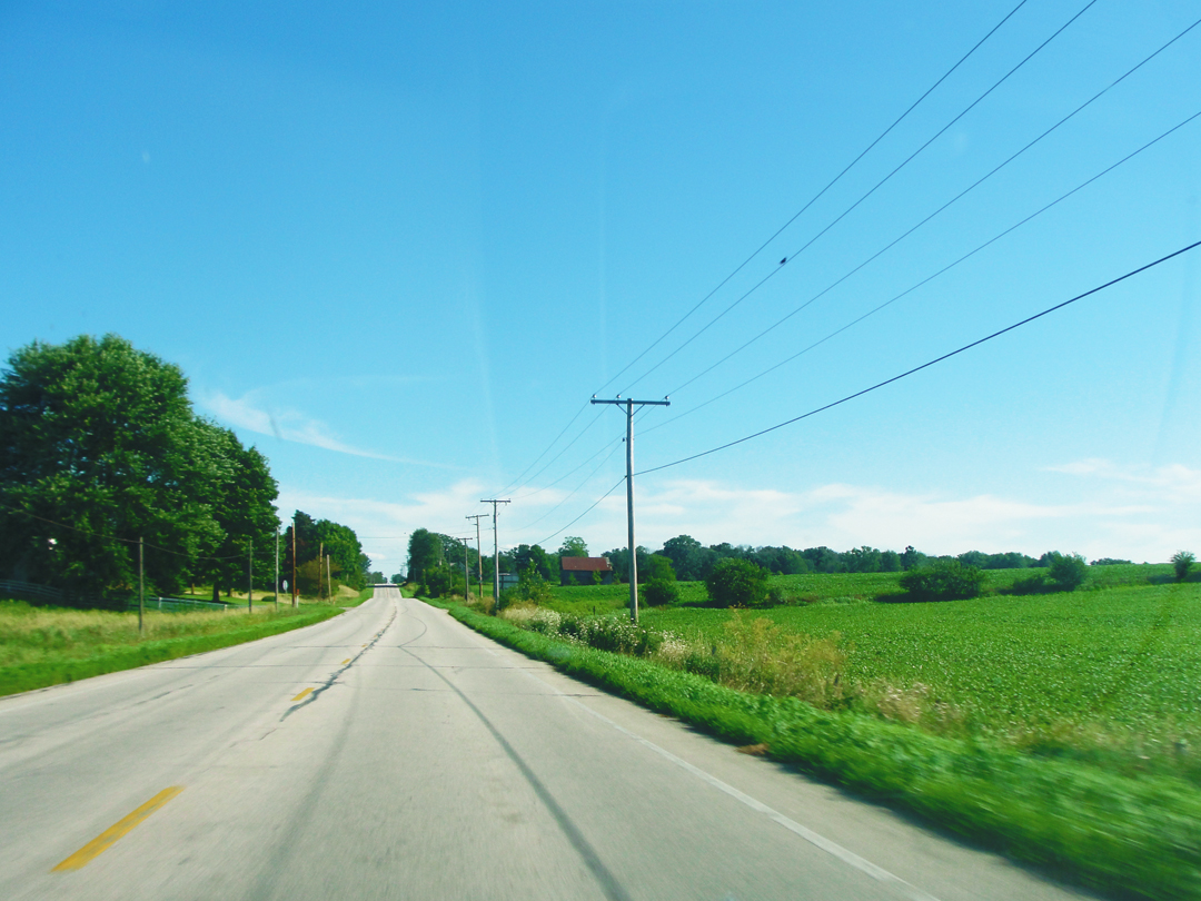
Views from US Highway 6.
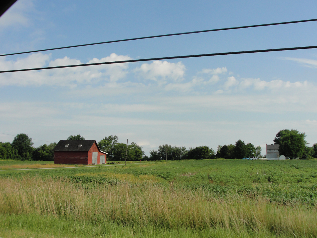
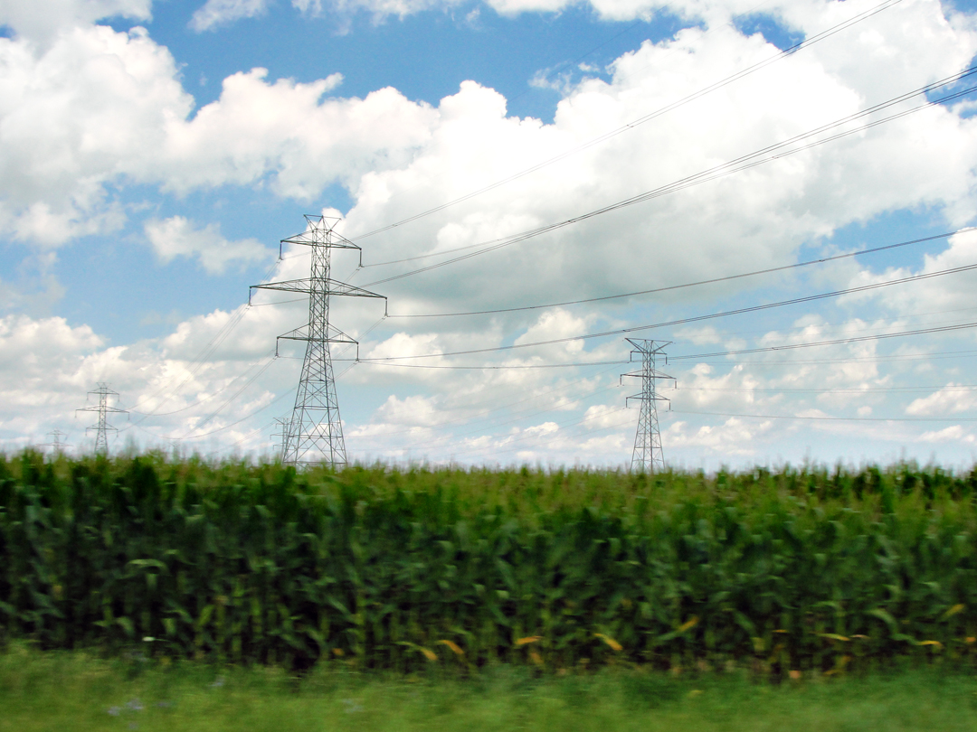
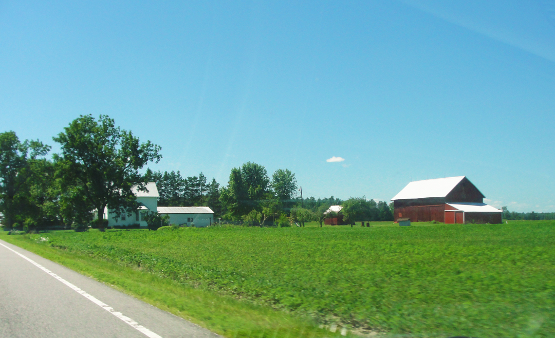
Rural Electrification! I find it funny to think today that it's been well less than a Century since farms like the one pictured below right would have boasted of having electric anything. Today it's pretty well taken for granted that there are amenities like dishwashers, vacuum cleaners, and central heat and air, but they've only been around for a few decades.
Call me a landscape photographer, I guess. I'll admit my guilt. I do like scene as the one below.
And turning around to shoot the other direction:
After many miles, I came across my old companion the construction zone, though sans the orange cones, here at least.
I did wonder what Dreiser would think of the large riding mower (for such was in the back of that pickup truck). Would he praise its labor saving qualities? Or lambaste it for being yet another mode of the human sitting on his backside? I don't know.
After missing my turn, and coming about, I got into Bowling Green. The name painted on the building there is "Kaufmann's?! Hey that was a Kaufmann's!" Kaufmann's, you'll recall, was the Pittsburgh department store and whose owner Edgar, Sr., had Fallingwater built.
"When we entered Bowling Green...by a smooth macadam road under a blazing sun, it was really not interesting at all; indeed it was most disappointing...after one sees town after town for eight hundred or a thousand miles, all more or less alike, one town must be different and possessed of some intrinsic merit not previously encountered to attract attention."
Dreiser & Co did stop in Bowling Green, as Theodore wished to see if a newspaper man he knew twenty-plus years before might be located. In the book Dreiser refers to this man only as "H___," which probably indicates one Mr. Hutchinson, who had in St. Louis (where both were working) stated his desire to own a country newspaper in this, his home town-area of Ohio. Dreiser had thought of buying-in on the concern, but after journeying to see the nature of the area and the newspaper in question, begged off and continued on his way, landing in Toledo for a time.
"H___" proved not in immediate evidence. Dreiser had asked after the man in one newspaper office, and was going to ask in another, but "...the sight of the bare street, with a buggy or two and an automobile, and the low, quiet store buildings, deterred me...I climbed back in the car and we fled."
The intervening years may have been salubrious for Bowling Green. Like Clyde before, maybe like Corning, it seemed this day to have some of that "bustle" that affects people. This principal street I rode over had a fair amount of traffic, while standing alongside were its "quite store buildings" which were home to many smaller businesses. It does, too, have Bowling Green State University, which probably accounts for something.
Reaching my next turning, I started west for Napoleon, through some mid-century neighborhoods that could have been used by real estate boosters in 1962, and also encountered the "orange cones." Below right, there at the tree-line, like it or not is a sign of some prosperity: the housing development.
This, above, is Poe Road, which once out of town is parallel to US 6 headed toward Napoleon, and in my map book would become part of the "Buckeye Trail," or the North Country National Scenic Trail. I didn't know what the Trail was, but Poe was off the main road and ran all the way into Napoleon with little variation, which recommended it to me greatly.
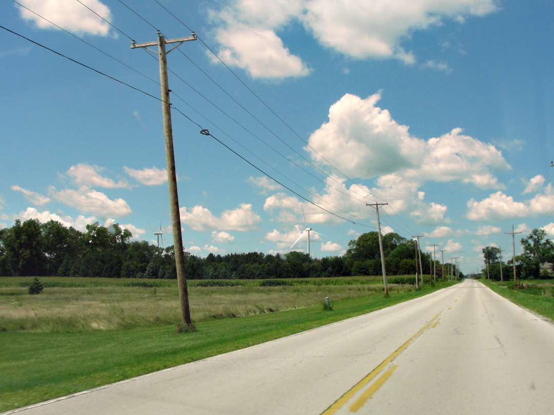
Below, the modern rural landscape: Poe Road with wind turbines. Why these two turbines are facing different directions is beyond me.
Above: Bowling Green to Napoleon, down the Maumee River to Defiance, and West toward Hicksville.
Scenes along Poe Road. Maybe these views are the real reason I took this drive. I've oft opined that there are a lot of places, a lot of lands, that are quite beautiful in their various guises, what-ever I might think of the towns or people that inhabit them.
It was somewhere along here that I finally realized that I could, in fact, see a more delicate shading in the color of the sky than I had noted before. Nearer the horizon I noted a slightly green -- or perhaps "cyan" -- aspect, shifting toward a violet cast overhead. I've endeavored as best I may to maintain this coloring in the photographs, as it is present in many of them.
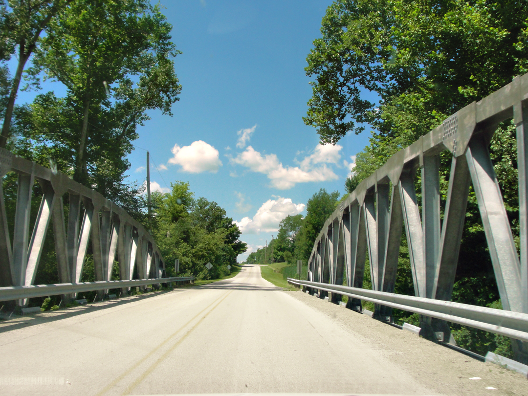
And the saloon came to a near-screeching halt so I could take this photo of the old bridge. I likes me some old bridges.
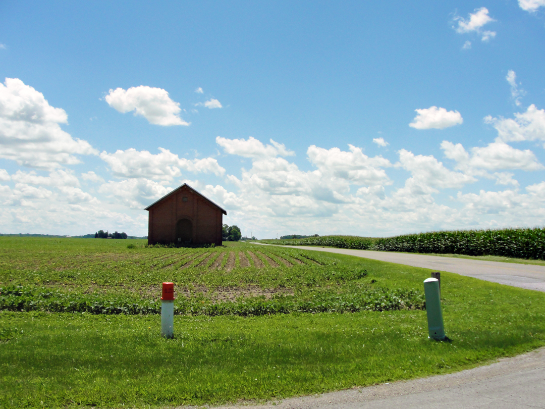
I also likes me some old barns, especially when they're standing near a cross-roads. If only the more modern additions of utility what-ever they are weren't sticking up out the ground. Oh, well --
Nearer to Napoleon, I thought I'd finish a nice, easy drive only to discover too late that there was a detour. I was reminded of Dreiser's exclamation "Detours! Detours! Detours!" as I swore in the general direction of whom-ever was in charge of the road construction that completely blocked the street where it entered town. There was a sign, sure, but it had been put up beyond the intersection where an alternate route could be taken. "Shouldn't the sign be back here?" I asked no one in particular as I back tracked to make the turn to go around.
Making the turn, though, onto that alternate road, I got to see a couple of reasons for Napoleon's continued existence:
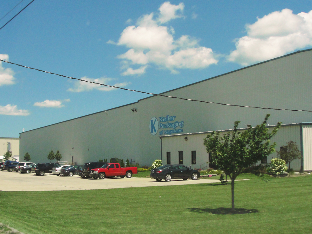

Keller Packaging of Napoleon, above at left, outside of which stood at least one WalMart trailer -- gotta' be a good business there! -- and Campbell's Soup Supply, at right. Between them I can imagine that there are a goodly number of employees.
Just past the Campbell's plant, I turned toward the construction that had blocked my path a few minutes before.
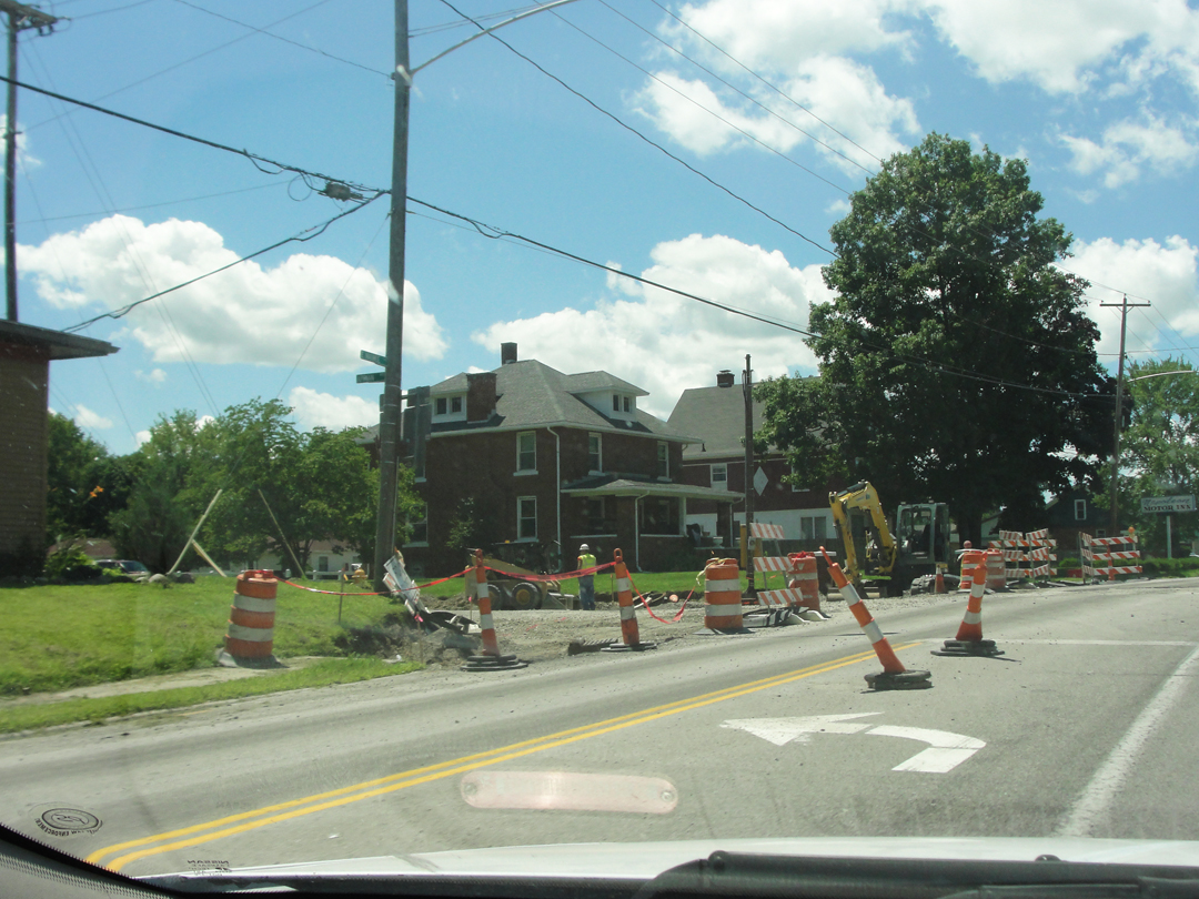
For this? For this I had to detour -- you can't do better than destroy the intersection -- grr! Hooray for the orange cones. Well, blank blank blank, at least I didn't have to go far, and I did come out on the other side right where I would have been, but still --
Then it was over the Maumee River and up to Napoleon.
As I crossed the bridge I had a "Dr Who moment," wondering aloud "Are you my Maumee?" No one answered, thankfully.
Dreiser complained of the landscape between Bowling Green and Napoleon, deriding the 'scape and the environ as "...oh, so very flat. Not a spire of an interesting church anywhere, not a respectable piece of architecture, nothing." However, things did change for the better:
"It was only when we reached the region of the Maumee that things began to brighten up again. We were entering a much fairer land -- a region extending from the Maumee here at Grand Rapids, Ohio, to Fort Wayne, Warsaw and North Manchester, Indiana, and indeed, nearly all the rest of our journey. We were leaving the manufacturing section of Ohio and the East, end entering the grain growing, rural life loving middle West."
Of the youthful residents of Napoleon, Dreiser once again waxes enthusiastic. A-wonder with their vigor and dreams, commingling his own young dreams perhaps with theirs, clearly deepening his own nostalgic thoughts as he looks at the people parading the streets.
"You have no idea what a charm these places have...to one who has ever been of them and then gone out into the world and changed and cannot see life any more through the medium -- the stained glass medium, if you will -- of the time and the mood which we call our youth...
How good it all tasted after New York! And what a spell it cast. I can scarcely make you understand, I fear...The air felt different...The intervening years frizzled away and once more I saw myself quite clearly in this region, with the ideas and moods of my youth still dominant...
Oh bright young hopes! Oh visions! visions! -- mirages of success that hang so alluringly in amethyst skies!"
And as soon I was leaving Napoleon. Dreiser and Booth, looking on at stores' wares displayed in their windows, asked after the best road to Defiance, and were recommended of the route by the Maumee and a canal alongside. Thither was I bound. Ohio Highway 424 it is now, and was after all a pleasant drive.
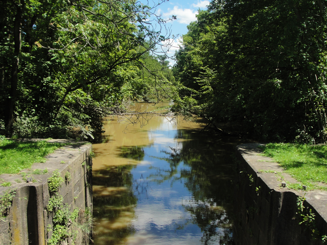
When I came upon a sign announcing Independence Dam State Park, I turned in there, and shortly saw that there was still extant at least some of the canal. Well, having already found a bit of the old Morris Canal, exploring a bit of this one seemed a fine reason for lingering.
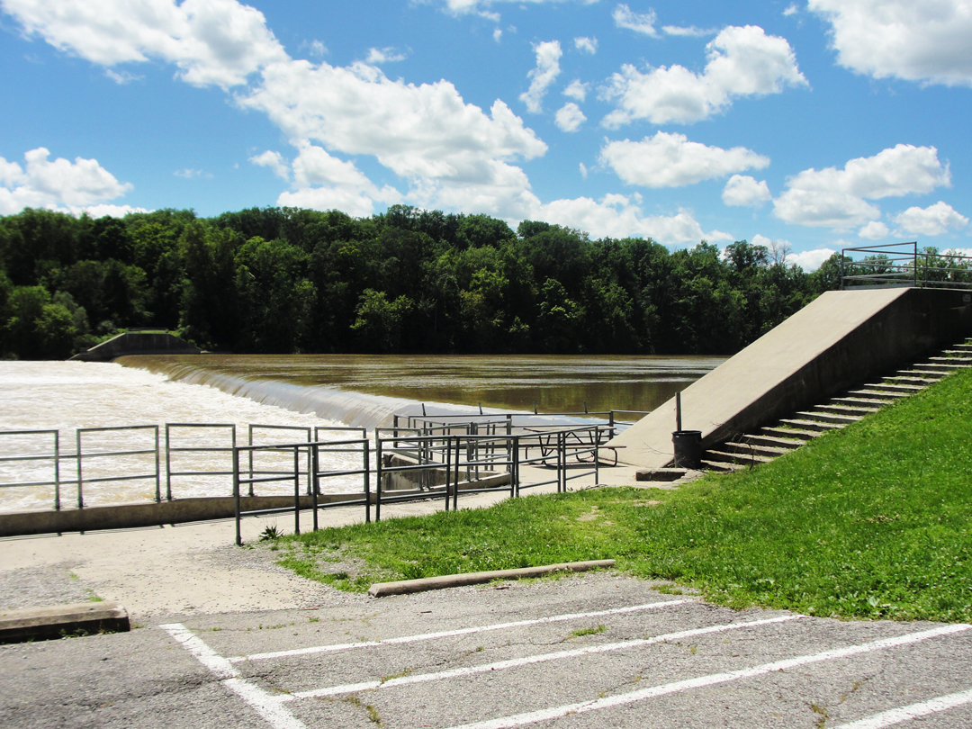
According to a sign erected by the Daughters of the American Revolution in 1954, the Independence Dam was built to "provide slack water for the canal." This looks to be a more modern version, but still supplying a "pool," though likely for water level control since the canal is a bit under-utilized today.
The canal itself was built to allow commercial passage from Toledo to Cincinnati. The DAR sign displays this elevation:
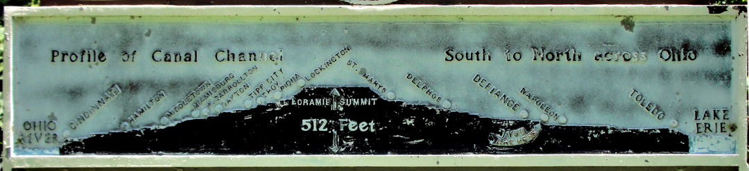
Curiously, there is no name mentioned for this canal. Turns out it's the Miami & Erie; at least what's depicted above, that is.
In Delphi, Indiana, some 18 miles North of Lafayette, is a short section of the Wabash & Erie Canal that still holds water, and has a Canal Interpretive Center, among other things, alongside in a canal park. I visited the Center in late September of '15, and found that this canal outside Defiance is, after all, a portion of the W&E, which when operating was the second longest canal in the world at 468 miles! Somewhere West of Defiance, though, was also constructed the Miami & Erie Canal "leg" that led to Cincinnati, though I was told that it did come later. The DAR of Defiance clearly wanted to highlight the Ohio waterway.
When I found that I had, in July, been looking at a section of canal that once conveyed boats to within a mile of my apartment in Lafayette, I'll admit I was a little astonished.
Back to the canal at hand; below, a look up the canal from the park drive bridge:
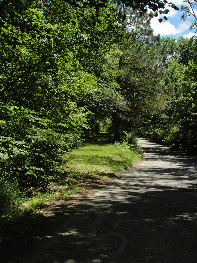
At left, in the center of the image is what I take to be the tow-path, or what remains of it; a leafy tunnel now.
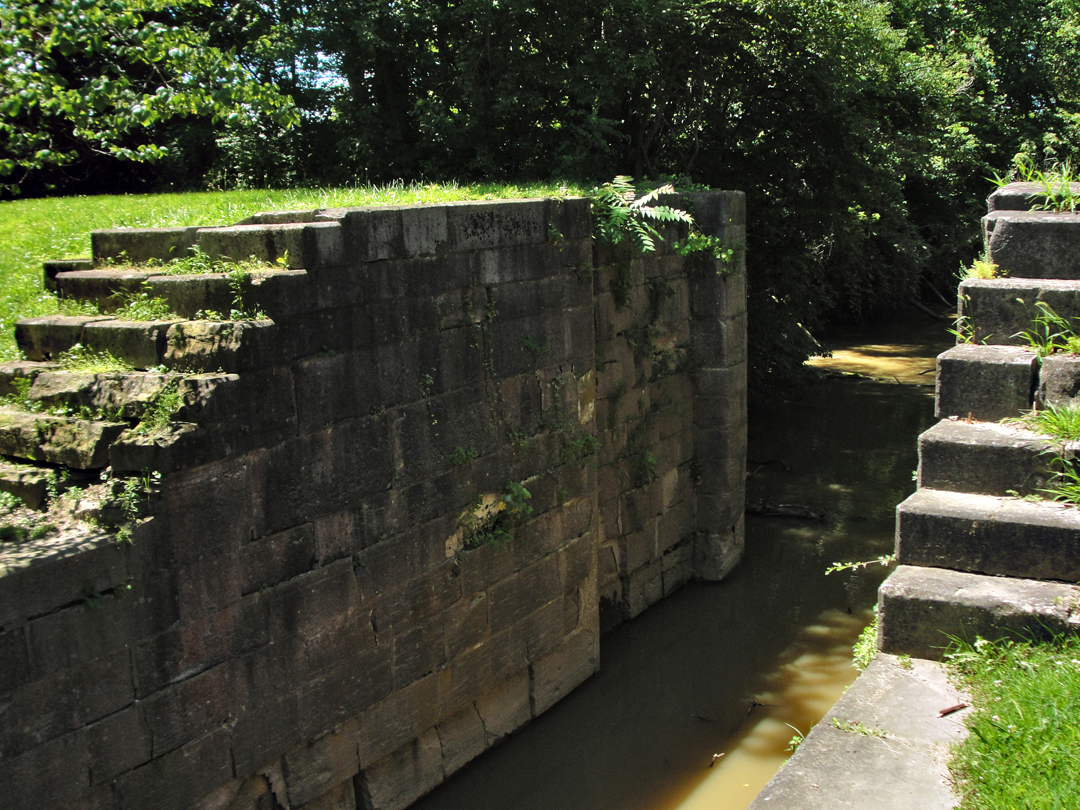
Above, some the stone-work of this Lock No 19.
"Yep, that's a canal, all right!" The author marvels at the determination inherent to construction of such things in the 19th Century.
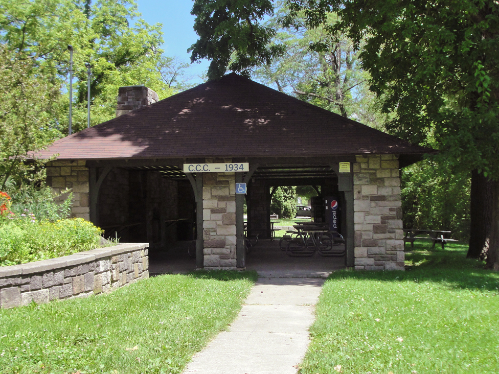
The park stretches for a good distance between the canal and the river, and includes this shelter near the dam. With that sign indicating its construction, I had of course to take a photograph.
In Defiance, Dreiser wrote, the company "...indulged in shaves, shoe shines, drinks." Here, speaking to Defiance, Napoleon, and Hicksville, he notes again the more rural life, a little slower, less consumed with, well, consuming, with business; the people were, he felt, removed from the "...all too-evident feeling that they must get on." Well, Defiance to-day is much as any other place, with as much obligation to all things contemporary to the early 21st Century. You'll have seen it, in these chapters as well as in your own life, I'm sure.
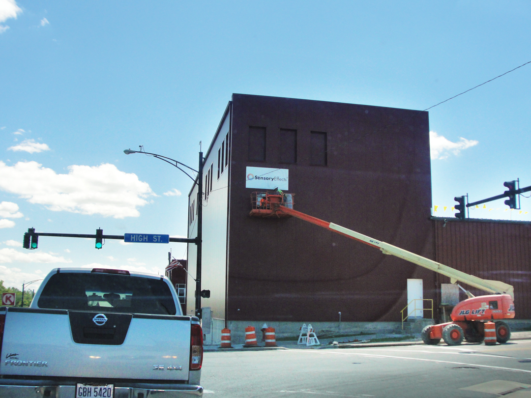
The only thing that rally caught my attention were these two, affixing a sign to a building. The sign reads "Sensory Effects," and that I found entirely apropos to the noise the workmen were producing!
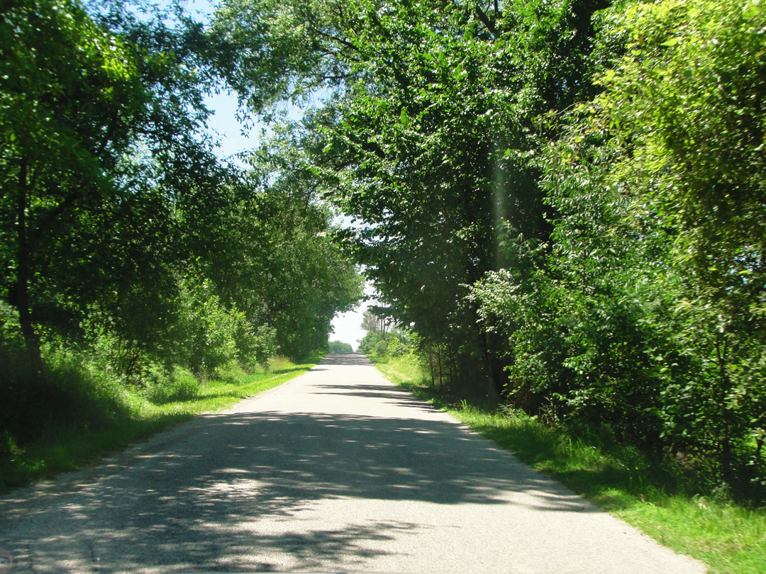
That was also my turn, at that intersection, on to High Street and out of town. Beyond US 24, I made a couple of turns to pick up Roehrig Road, which after a couple of miles brought me near to OH 18, or "Defiance Ave," and a straight shot to Hicksville. Below: on Roehrig outside Defiance.
Somewhere in between, Dreiser & Co paused on the road.
"Once we stopped the car to listen to the evening sounds, the calls of farmers after pigs, the mooing of cows...That evening hush, with a tinge of cool in the air, and the fragrant emanation of the soil and trees, was upon us. It needed only some voice singing somewhere, I thought, or the sound of a bell, to make it complete. And even those were added."
I can easily imagine such along through here. Indeed, I've indulged myself of the same on some of the county roads about my quarter of Indiana. There is "something" too an evening in summer when you're outside the urban environment.
At right, and below: scenes along Ohio Highway 18.
During their pause on the way, the company was approached by a pair of farmers on a hay wagon, with whom they held some happy, desultory conversation. The farmers told them that nearby Squiresburg was a good place to stop as " 'Y'kin have a better time there.' ... 'There aint no license in Hicksville.' "
Squresburg doesn't show on my map, though Sherwood might be in the right place. Maybe Dreiser changed the name to "protect the innocent?" Don't know.
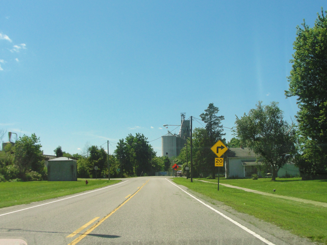
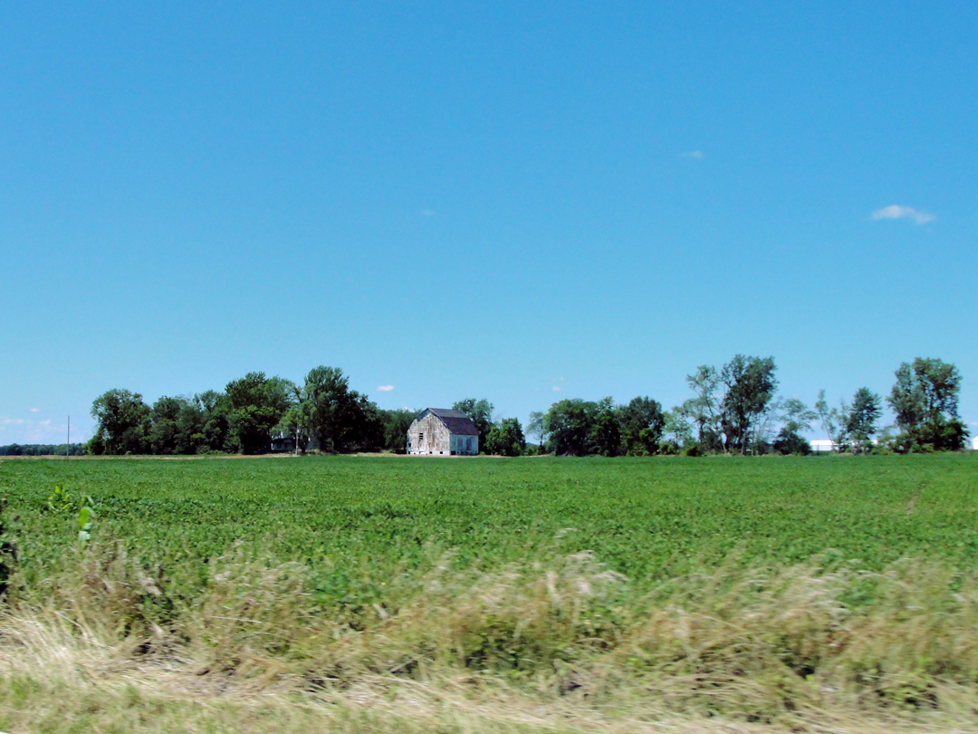
Near to Hicksville, I saw this, the most quintessential of MidWestern structures, the grain silo.
I'll take a moment here to relate that for the majority of this trip, as I've done oft before, I had been traveling with my own coffee, brewed before I took to the road each morning, and stored in an old Thermos. Alas, Monday evening in Vermilion the Thermos had fallen to the pavement in the lot at Sherod Park, and the liner had fractured at the mouth. Ah! the disappointment! For so many miles that vacuum bottle had carried my decanted drink of choice; had been to so many places, only to have the glass filler come to such an ignoble end at a drop from the car to the asphalt paving. And not even a terrible fracture; the majority of the bottle remained intact, holding the last half-cup of coffee -- only the very lip had shattered in such wise that I dared not pour that last for fear that I might inadvertently drink some fragments.
I consoled myself that, after all, I had carried the thing for as long as I had, and that I had but one more day on the road, so surely I could "make it up" by purchasing individual cups of "joe" as I went along. So, in Hicksville, I stopped for a cup of coffee, and while there purchased some of my favorite beer -- Yuengling -- not available in Indiana (there is a Facebook page entitled Hoosiers for Yuengling, so I guess I'm not the only one). So much for Hicksville not having a license!
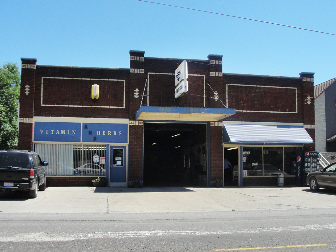
Hicksville did not seem a large town, but pleasant enough. I went around a couple blocks to return and take a photograph of this, "Bob's Auto Repair" shop; it was just too "perfect" not to:
It was easily enough done, though in traffic, for we were all slowed to a crawl-and-stop for that old favorite: road construction:
Dreiser notes that he had his first piece of banana pie in Hicksville, and that it "...filled a long felt want and a void." He could not get the recipe at the lunch room where they had a meal, and was unable after to find a recipe that suited him to match.
The road construction at the intersection depicted above only delayed my motion for a short time, while the Pathfinder ran onto a detour outside of town. Instead of heeding the warning sign, they continued, only to find that the road was still in a state of improvement. "Scarcely a mile had gone before the road broke into fragments...mud, rubble, and ruts, and we began to think we had made a dreadful mistake." They decided, though that it was just part of the adventure, and continued on, shortly passing construction equipment in a farm house yard. After that they were on to Fort Wayne.
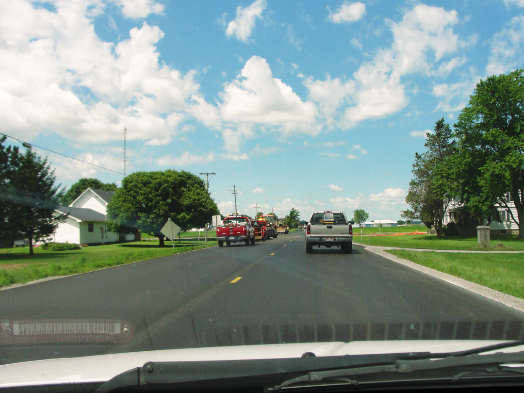
What I didn't realize was just how close the Indiana state line was to Hicksville, OH. In a matter of minutes after exiting the town, I saw the sign announcing my return to the Hoosier State. "What? So soon? Wow!" Of course, there was still the matter of gaining and passing Fort Wayne, and the transit to Warsaw -- not to mention the miles between the latter and Lafayette. Still, it was another of the melancholic moments to return to Indiana and know that before the sun was gone from the sky I would be back in my apartment.
"Though a city of seventyfive [sic] thousand...Fort Wayne made scarcely any impression upon me. Now that I was back in Indiana and a few miles from my native heath, as it were, I expected, or perhaps I only half imagined, that I might gain impressions and sensations commensurate with my anticipations. But I didn't...
When our family, such as it was...came north to Warsaw, Fort Wayne, so much nearer than Chicago...was the Mecca for the sporting youth of our town."
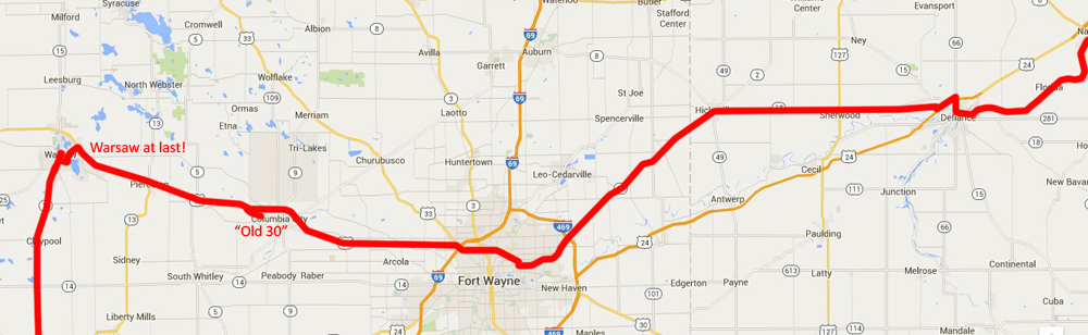
Above: from Napoleon, at the extreme right, through Fort Wayne to Warsaw. At last!
The company stayed the night in Fort Wayne, a city Dreiser compared in 1915 with any other of the like, much as he had done to Scranton, and was concerned that he would be likewise disappointed with Warsaw when they reached it. With three times the population today, Fort Wayne is indeed much as any other the like, and as had happened to Dreiser and myself in the past, I was want to push on, though entering in I had no notion of where to go, or how to get out. I simply went, and trusted to what-ever that I would find my way.
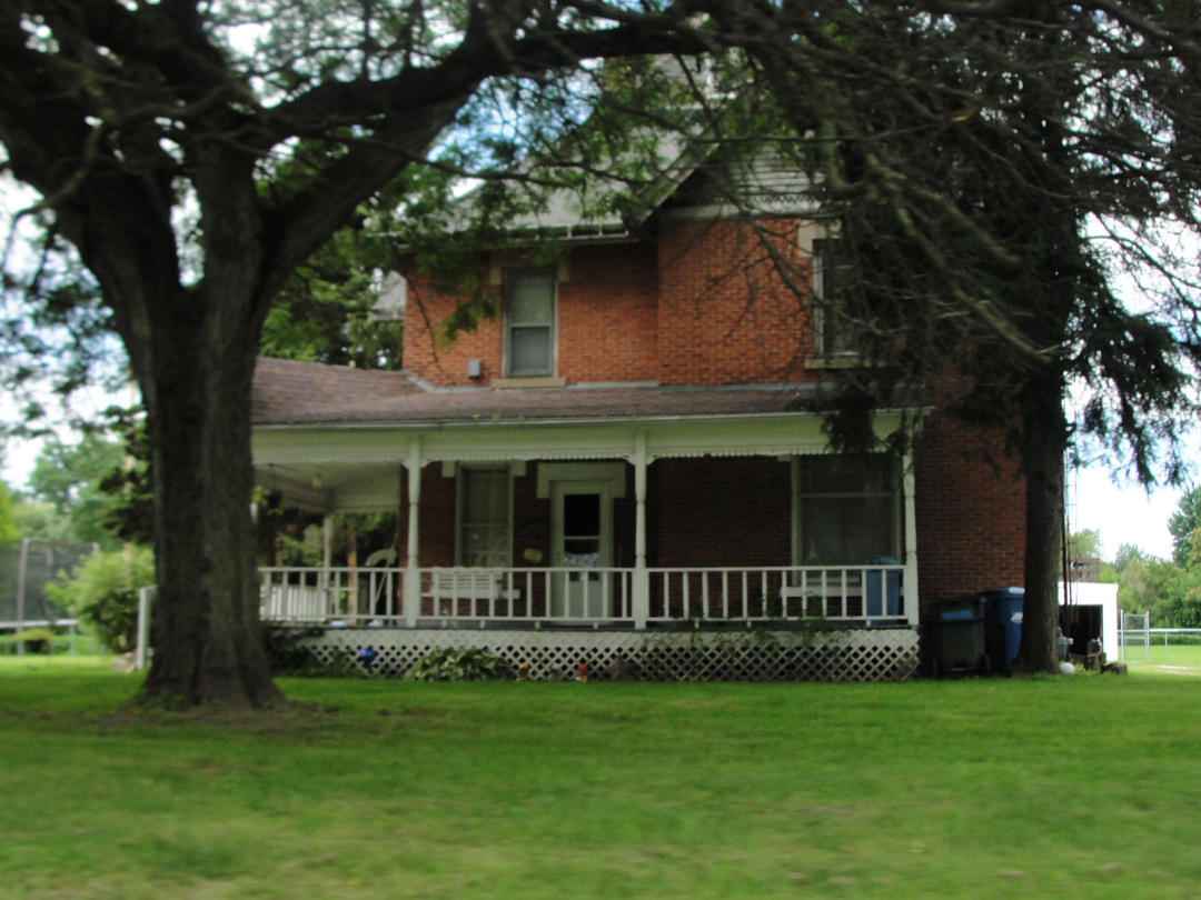
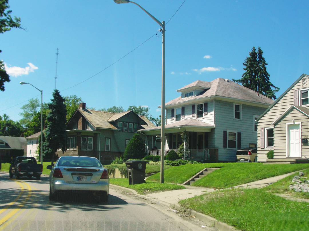
Shortly after getting into the city, I did a turn-about to take this photo, as this fine, and lone, example of a classic brick house was surrounded -- indeed on all sides! -- by newer development comprised of single-level houses and duplexes. I don't know if I've seen the like.
Otherwise: welcome back to "civilization!"
Cutting across the more Northerly section, I noticed at the last moment before the turn, that I was at an intersection with the Lincoln Highway, or US 30, which I knew to make Warsaw to the West. A smaller sign indicated this as the "1915 Route." How much more did I need?
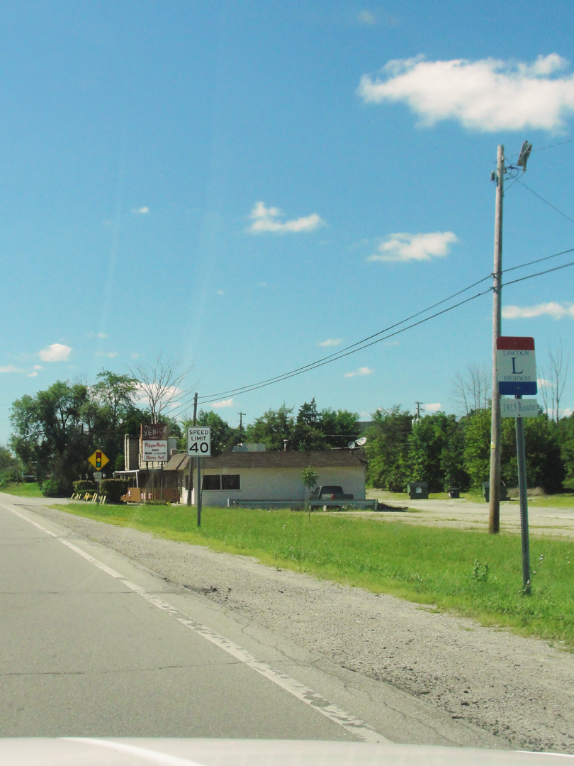
The Lincoln was, indeed, the first of the named trans-continental routes to have serious interest and planning for its lay-out, and named for the President whose Memorial in Washington D.C. had just been completed in 1913.
Tours were made in 1913 to discover the best roads to incorporate into the Lincoln, one departing from Indianapolis, and one from New York City. Speed, driving the Pathfinder two years later, made the tour from New York, where-by came his recommendation to Booth as a driver/mechanic.
"Incorporated" because in 1913 the notion was yet to simply designate already existing roads, so mark them, map them, and there-with allow drivers to make their way from coast to coast. The problems encountered from this program, the Lincoln and its ilk, would lead to the planning for a system of roads specifically designed and built for "interstate" travel.
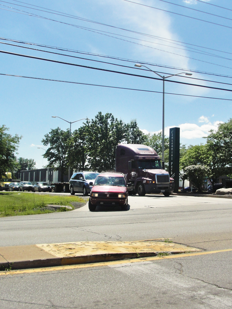
Nearing one of those later Interstates, I 69, I drove through the expanded Fort Wayne, with all the newer accommodations for the driving public and their commercial or recreational needs, like the Centennial business park.

Brandy's Exotic Dancers aside, have you ever considered how astounding all of this is? What it represents?
Infrastructure is a frequent topic of national observers, mainly for its deterioration as a network of roads and bridges, but beyond the pavement there are all the poles, wires, fixtures and lamps; the electricity that powers the signs and streetlights; the striping indicating lanes; and the fuel that is required not only by the drivers utilizing all of this but also used to supply them with more fuel and food. And coffee!
As I observed last year of one of those elements:
"All the ever-present power poles had me thinking one day of what must have been the millions of man-hours that it took to install them, not to mention the millions upon millions of straightest-trunked trees that were harvested to make them. Plus all the time and material that is represented by the uncountable catenary of cable between each pole. For every pole stuck in the ground, for every swag of line, some crew had to bring these things out, dig the post-hole, set it, string it, test it, and on and on, and nearly every road I've ever driven on has these standing and hanging alongside. Rare is the rural road that has no pole, at least in this half of the continent. This doesn't consider all the steel high-tension towers that carry the really large loads from station to station to sub-station, either. That would be a whole other set of numbers.
Such is the way my mind wanders."
It boggles the mind the sheer amount of stuff that we use every day, whether we realize it or not.
Such is the way my mind wanders, indeed.

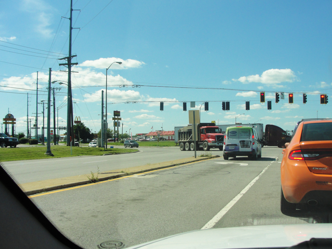
Beyond Fort Wayne and US 30 has not only been around for a Century, but it's seen its improvements. Like US 40 to the South, which I drove some many miles over in 2014, the Lincoln has drifted its location slightly as it was brought up from a simple two-lane route, to a modern, though not Interstate, highway. The only difference between them really is that Interstates have restricted access; US 30 and 40 have many more cross-roads intersecting them, and businesses alongside.
Just to the West of Columbia City, I noticed a sign indicating an "Old" Lincoln Highway. It was the Business Route, and I turned onto it. Dreiser & Co made a stop in Columbia City, and quite possibly had traversed this way after departing.
Above and below: Business 30 West of Columbia City
Nearing Warsaw, I thought "I've been here, I can find my way into town!" So I turned off of the "new" US 30 and promptly missed the turn I was looking for. Instead of Wooster Road, I rambled about muttering to myself "Nope, this isn't it; how 'bout this way?" Looking at a map now, I can't tell you where I was, but it was an odd mix of ex-urban backed by agrarian lands which somehow seemed out of place. Has Warsaw become a "bedroom" community for Fort Wayne? I guess it's possible?

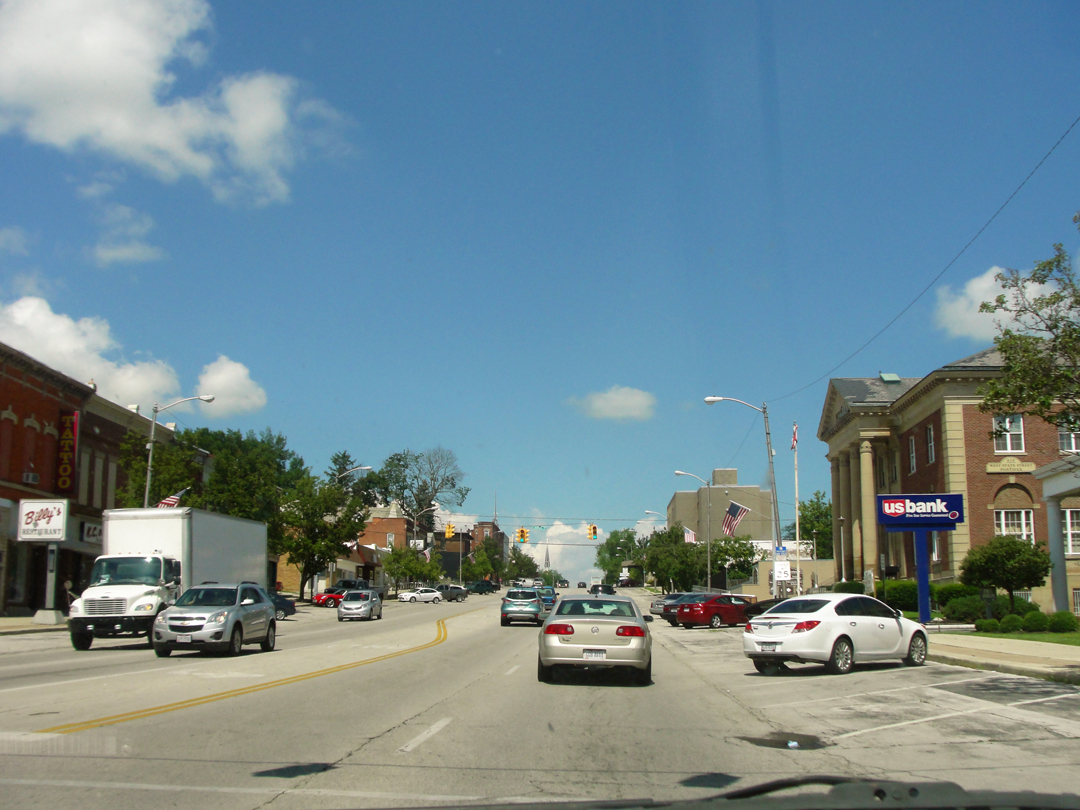
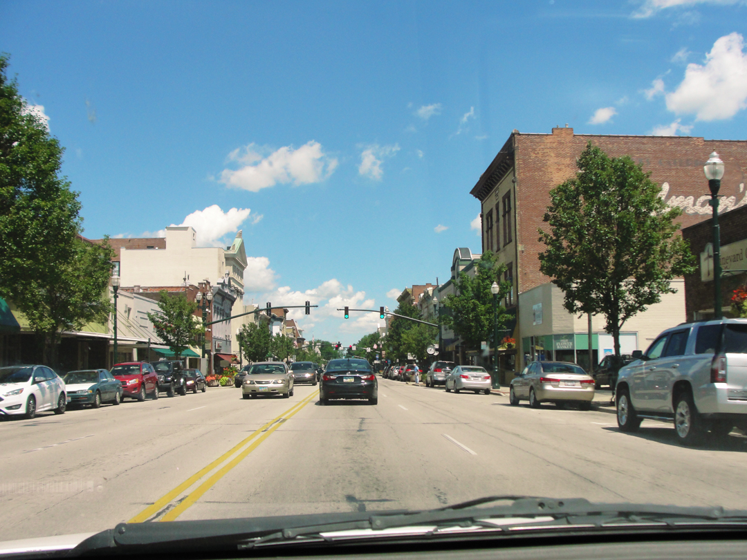
But, eventually I discovered a road which looked to take me the correct direction. In a few minutes, I was at the edge of town, and saying with some relief "Warsaw at last!" At right:
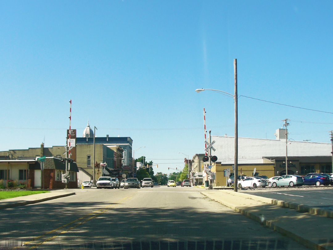
There! That's the view I'm looking for! Looking up Buffalo Street, with the roof of the court house just visible.
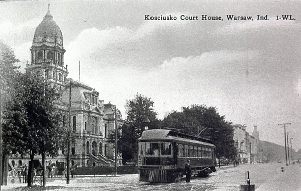
The Court House as seen from Center Street. While this post card is undated, I'm thinking it's about the right era (DWS).
And here, on his return after nearly three decades to the Indiana town he fled from, Dreiser finally has to face his nostalgia, and to some extent, the nostalgia wins out.
"Approaching Warsaw after thirty years, my mind was busy gathering up a thousand threads long since fallen and even rotting in the grass of time. Here was the place, I said to myself, where we, the depleted portion of our family that constituted 'we' at the time, came to stabilize our troubled fortunes and (it was my mother's idea) to give the three youngest children, of whom I was one, an opportunity to get a sensible American free school education...
And I want to get back to my mother, for she was the center of all my experiences here. Such a woman!..Warsaw, in fact, really means my mother to me, for here I first came to partially understand her, to view her as a woman and to know how remarkable she was."
That just about sums up everything about Dreiser's want to come back to Indiana, and his whole life after he left it. But anyway --
I knew, driving into Warsaw this sunny, nearly perfect afternoon in 2015, that I had "done it." "Warsaw at last!" How strange to be there and look about and think that I had been considering that moment for more than two years. Maybe in the "grand scheme" of things it is kinda' low on the scale of accomplishment, but for me it was something that I could "point to" and say "Yeah, I did that!" To Warsaw, anyway. There were more towns to see yet, but Warsaw! The days on the road, the looking around, the missed turns, the happy exhaustion at being where-ever I had got to. Warsaw at last. Even if I didn't for some reason visit the towns to the South, I had got there.
Got back there: there was also the slightly odd feeling I held, as I had visited Warsaw the year before, so I knew where I was, could mostly recall where I was going.
There is more concerning Warsaw from my visits in 2014 but I had a specific intersection to visit this year. I wanted better views of the places where the Dreisers had lived, where Theodore had visited in 1915; there were two, across the street from each other, and close to the first public school -- the West Ward School -- that the last of the Dreiser children had attended.

This detail from an 1879 map of Warsaw indicates the location of the houses and the school. The Grant house, which was most likely on plot "1" on the corner of the "Grants Addition," was a frame structure where Theodore lived while in the seventh grade, and attended the school adjacent.
The Thralls Mansion, "...as I understood it, actually the first -- brick house to be built in the county..." was directly across Center, again likely in plot "1" of the "Thralls Addition." From here he attended high school, a few blocks away.
In 2014, for what-ever reason, I neglected to photograph these plots very well, though I did get photos of the schools' locations. In 2015, I motored to the intersection -- complete with a detour of all things! because of high water in this case -- of Center Street and North Union to remedy this.
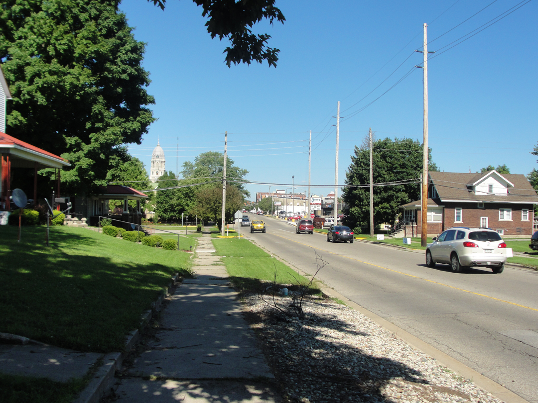
The view looking East along Center from N. Union to the court house and down town.
Dreiser recollected listening to the bells in the court house tower chiming the hours from his bedroom.

Above, looking across Center St to Thralls Addition. How many times have these lots been built over? Twice? Three times? Of the first brick house in Kosciusko County there is nought left.
Below, the No 1 plot of Grants Addition.
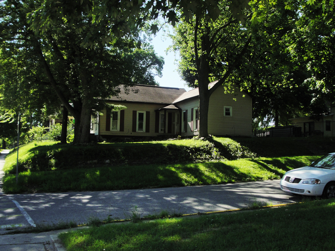
Dreiser wrote that by 1915, the Grant house had been moved closer to the school and other houses built around it. I don't believe anything remains of that house either. But, as has happened everywhere, the oldest of the "old" houses still extant date from maybe an hundred years ago at most; they supplanted the structures built in the early- or mid-1800s, those that were already old in 1915. Like the house where my flat is located in Lafayette, those structures that pre-date 1900 are around certainly, but are not so plentiful as they were. Ironically they are now expensive again, where they are still single-family dwellings.
Looking back up N. Union toward where the West Ward School once stood, now replaced by not one, but two newer educational buildings.
"Well," I thought. "I guess that's it." I looked about and drank some iced tea (from a bottle -- yeah it was O.K. but mostly it was cold; I do like cold and sweet sometimes) and took the photographs and very briefly wondered what the passing drivers thought of the guy standing on their street corner in a jacket and a straw hat -- but only briefly -- and took a breath. I had the urge to linger, but for what? I wanted a "connection?" I already knew that wasn't going to happen any more than it had for Theodore. To quote Stephen King "The world has moved on." Sometimes things do linger, some emanations, some energies, some things too subtle for naming with our language, and sometimes we can feel them if we're quiet and responsive to them, but much of the world has "moved on," and our lingering may only bring about tired feet and hunger.
With two hours, more or less, ahead of me, I piled back into the saloon and made my way out of Warsaw (at last!) and betook myself to Indiana 15, headed South.
Not that that was quite all the end of the tour: IN 15 had a detour! Of course it did! 'cause what else you want? But I took a shot on most of the roads about being of the mile-square layout and avoided the closed section.
It was good to return to my flat and unpack (and sweep out the dust and cobwebs which always accumulate in summer when I'm gone -- well, I don't have to be gone as they'll accumulate anyway, but not to the same extent -- usually) to get home to the things I knew and all that, though I still had with the urge to be "out there." But since Dreiser & Co would spend a few days at Booth's family home in Carmel before sojourning father to the South of Indiana, I figured I was justified in relaxing at my home for a few days, too.
Tomorrow: Wednesday -- after sleeping in, you bet! -- I started working through all these photographs, and figuring out how I was going to create this edition!