
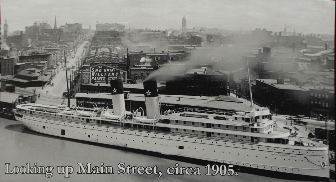
Dreiser spends a little time on Buffalo in the book, but mostly spurred by his pondering on his earlier self, and the experiences there as a young man in search of a newspaper job. Dreiser & Co were in the city long enough to get a meal, observe life there for a brief span (which would inspire later conjuring on the state of the Americans as a people), and then they were off down the shore of Lake Erie.
They had pondered the idea of traversing Canada to Detroit, but were told that because of the War, the inspectors at the border were being more nosy than usual. They had no desire to be detained at the crossing to have their luggage searched.
As related in the last chapter, I desired of a bit of a break from chasing the Pathfinder, and so got a room for two nights. The Pathfinder did not wend its way to Niagara Falls, but since I was in the region at least, I figured "why not?" The sun shining on the car park across the way from my room was heartening, and after a bite I was off -- up I-90, on the New York Thruway to Buffalo and points North. I dithered for a moment, actually, trying to decide on the Thruway or returning to one of the local highways; but having turned out of the lodge's driveway, the entrance ramp to I-90 was straight ahead of me. O.K., how bad can the toll be? The 40 or so toll-miles amounted to less than 3 bucks I think. Not bad at all, really, and pretty fast.
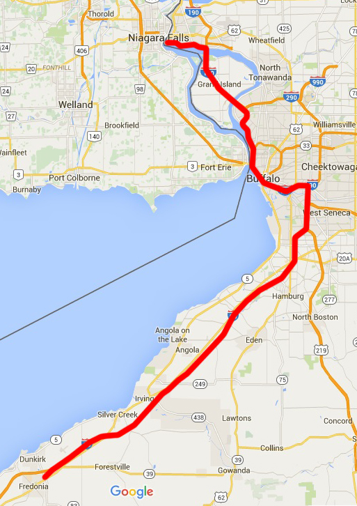
At left: Fredonia to Niagara Falls State Park.
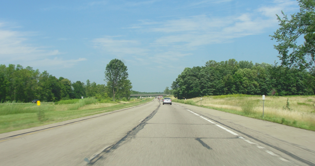
Below: a view up the New York State Thruway/I-90. The Thruway has been attributed to the insistence of Governor Dewey, and is an example of an already existing highway that was added into the Interstate System.
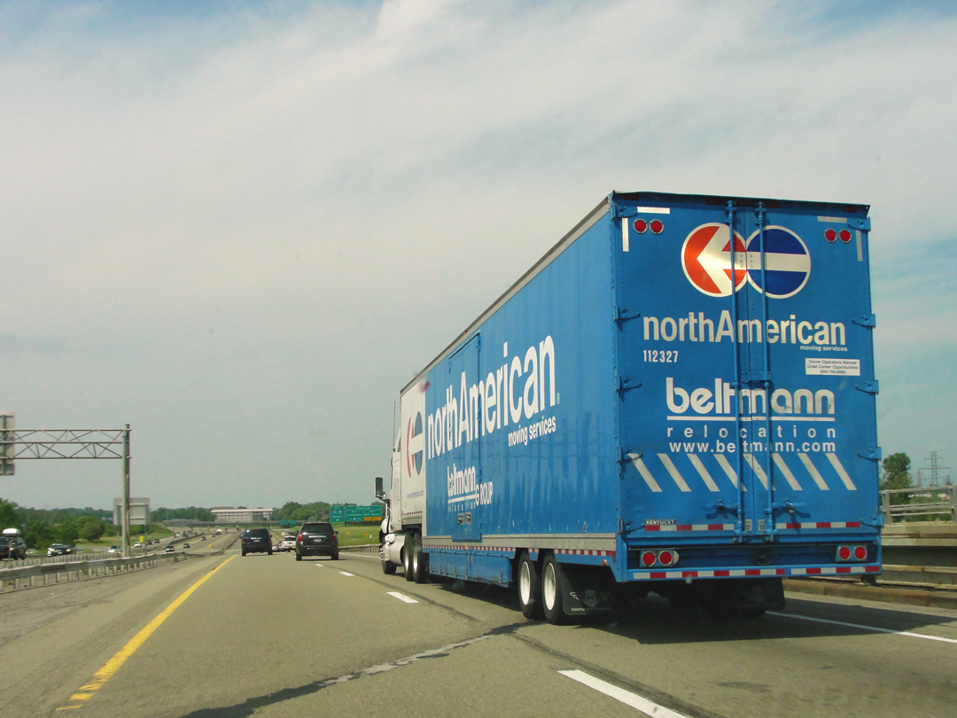
Another one of those moments of thinking: "What would Theo think of that?!" Like the self-storage units, huge semi-trucks are now a fact of American highways and by-ways. I really can't imagine what Dreiser and Booth would make of such massive moving machines. I somehow can't imagine Booth wanting to draw one of these behemoths; I can't find anything particularly Romantic in such.
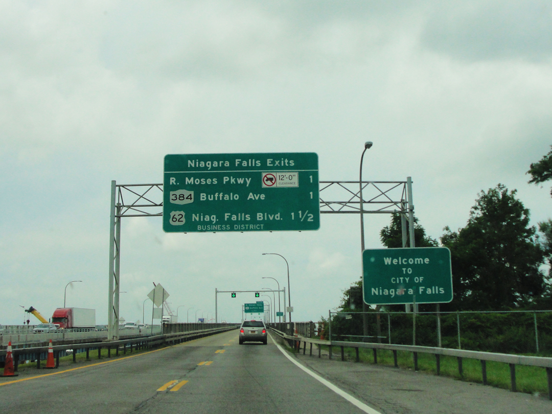
After passing around Buffalo's downtown and outskirts, I approached my exit toward the state park. It was with some eye-rolling on my part that I discovered my route would pass over the Robert Moses Parkway.
It's crossed my mind that maybe in 2016 I should attempt to drive over the highways -- oh! sorry parkways! -- that Moses had built, and maybe visit some of the other works that bear his name. They are many. It might be more than one Summer's adventure, since much of my time would be spent stuck in traffic around New York City.
Moses and his parkways really are another story. Oh my are they ever.
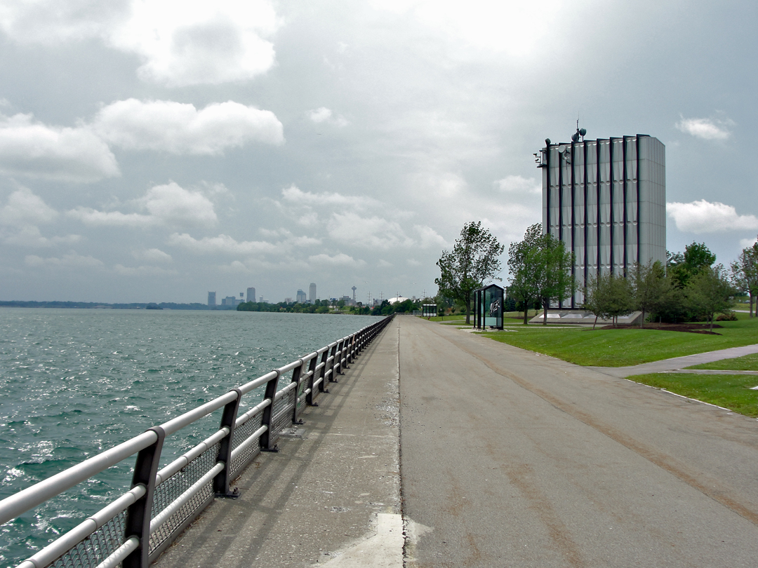
What a place for a scenic overlook:
above the intake pipes for the New York Power Authority's Robert Moses Niagara Hydroelectric Power Station. You can't really see anything except the pump station buildings, and an O.K. view of the Niagara River. By this time the clouds had pretty much socked-in the area.
The actual power station is miles away from here in Lewiston, where the water is discharged back into the river well below the Falls.
In the distance can be seen the towers surrounding the Falls on both sides of the international line.
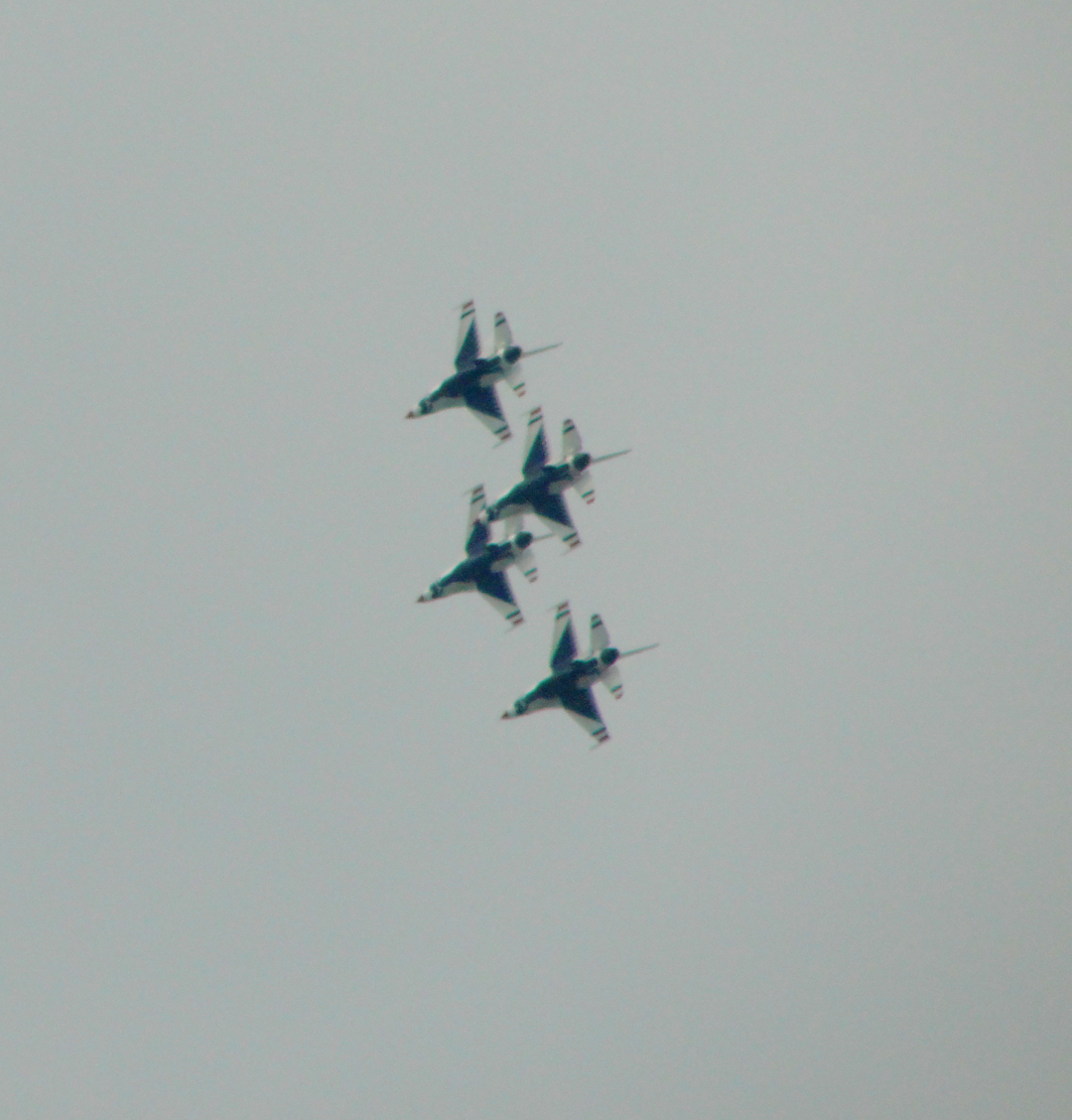
Surprise! The U.S. Air Force's aerobatic Thunderbirds making a pass overhead. Turns out there was an airshow in the area: "Thunder of Niagara," flying out of the local air reserve station. Who knew? Well, I'm sure a lot of people knew, but I wasn't paying attention to air shows at the time. Still, formation flying even for the short time they were near over-head was awfully impressive. I mean -- look at those guys!
A view of the Parkway, emblematic of the manner of roadway-cum-greenway construction that old man Moses pioneered for the masses of auto drivers. The irony? He never learned to drive.
Of course, the whole way up here there was a song that kept going through my mind: "Let's take a trip in a trailer / Let's take a plane to St. Paul / Let's leave our hut dear, get out of our rut dear / Let's get away from it all. / Let's go again to Niagara / This time we'll look at the Falls ..." and -- well, I'm sure that I've got some of the words out of place, but you get the idea.
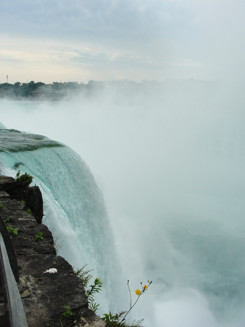
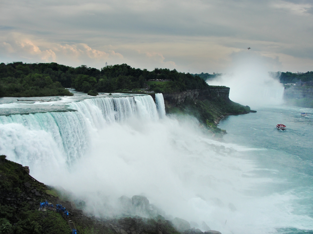
I wasn't sure what to expect when I got to the Park, and had no good idea where to begin looking about after leaving my saloon in the lot. As it happened, I wandered right out to the Terrapin Point Overlook, adjacent to the Horseshoe Falls:
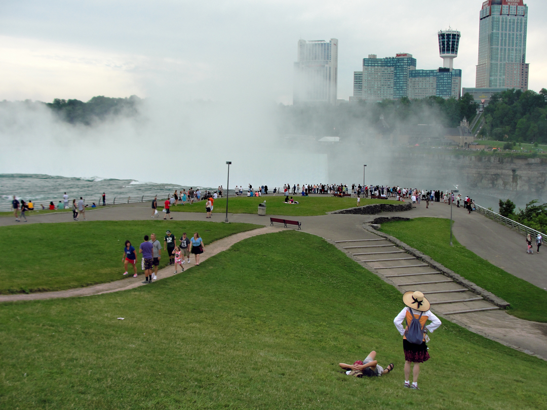
I didn't recall until I got down there toward the water that the Horseshoe is actually mostly Canadian, and so is the view -- and I don't have a passport -- so I had to settle for the "close up" look. Which is actually remarkably close. Below at left, the view from right beside the river gets you within about 8 feet of it, just before it goes over. Below right, looking back toward the falls from the rail.


Tourists!
I mean, what did I expect anyway? Of course the park was awash with visitors. No, I did not take any photographs of the black squirrels. Squirrel -- I saw one, surrounded by people with their 'phones out snapping pictures. Damn, what a life -- get a piece of popcorn and hang out a sign that reads "Photo opportunity!"
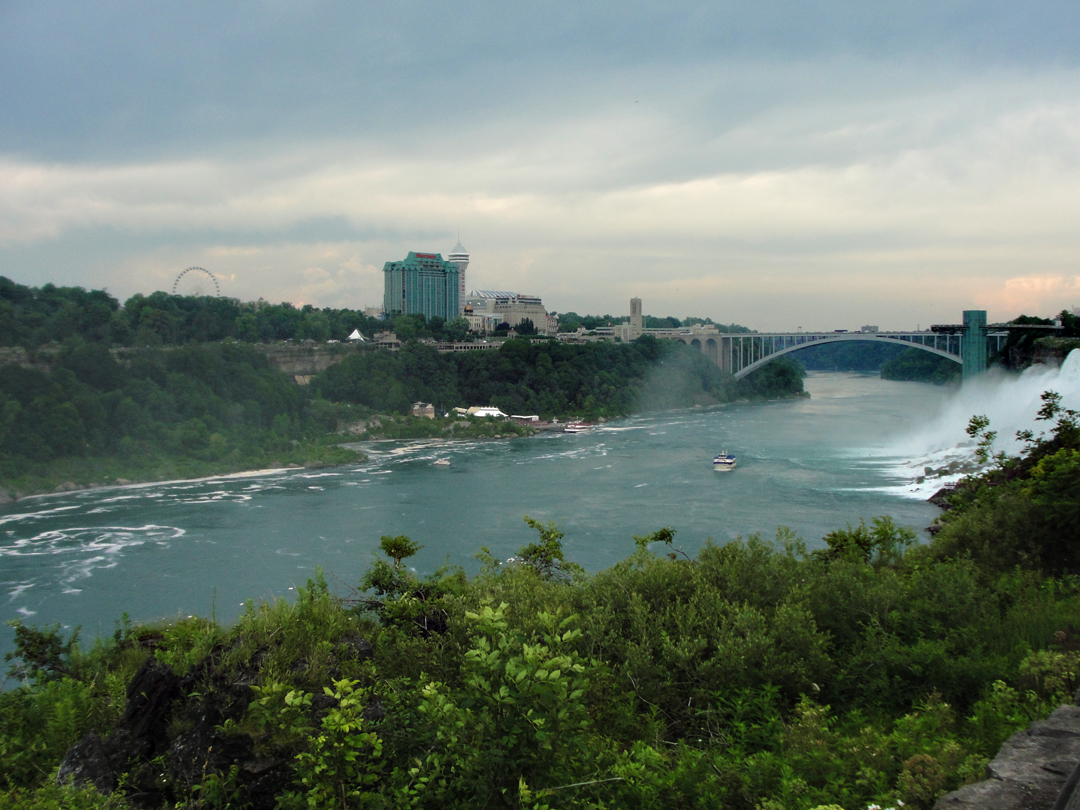
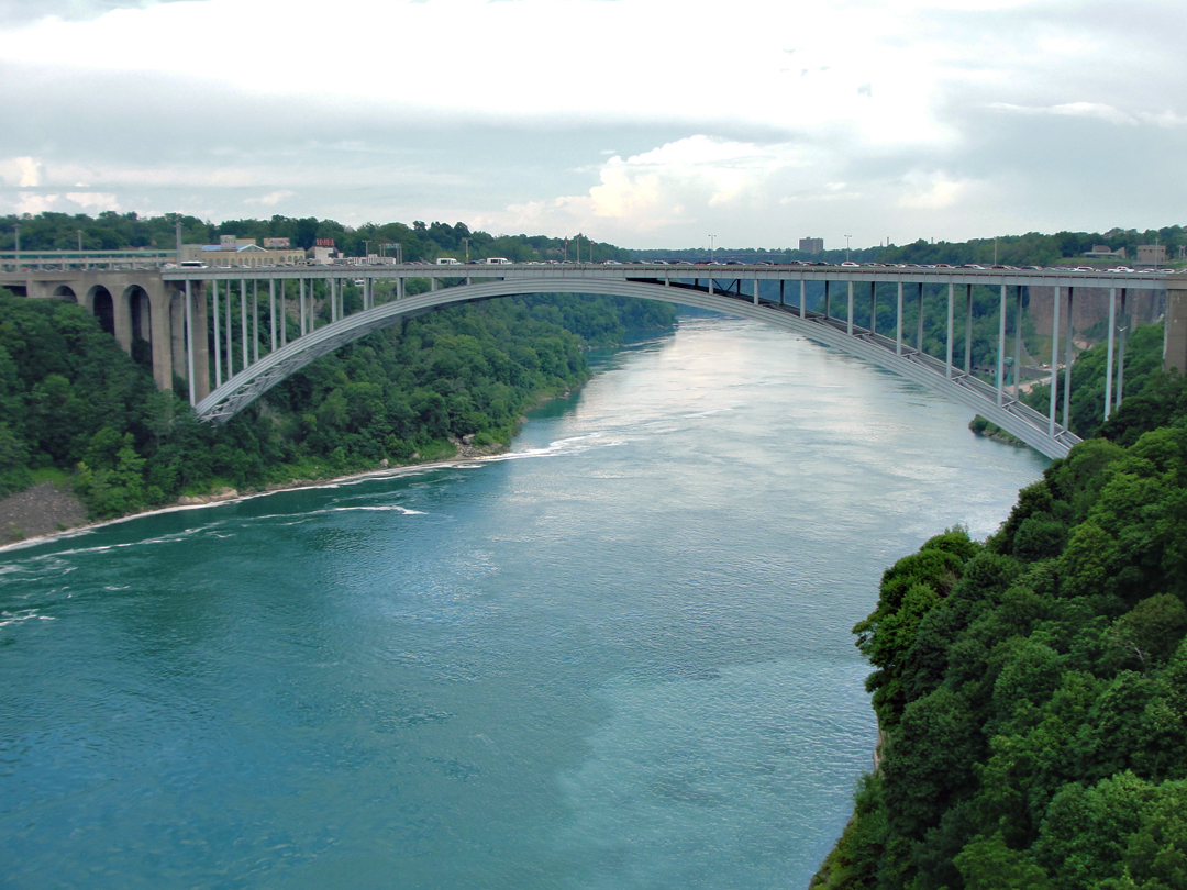
Looking down the Niagara Gorge toward the Rainbow Bridge; the American Falls are at the extreme right of the image. And whoa! that's Canada over there?! The tour boats that run into the mists at the foot of the Horseshoe Falls are marked out by the colors of their plastic ponchos: US = blue, Canada = red. I wonder if they alternate by days?
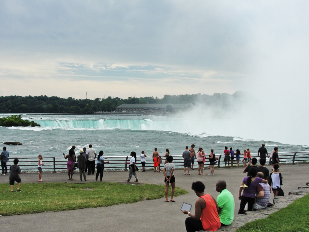
The scene above the Horseshoe.
And because it's me, I'm going to take photographs of clouds and old buildings, too. Because "Jake," right? But then, since the view of the Falls is somewhat limited, I'm going to start looking at other things pretty quickly.
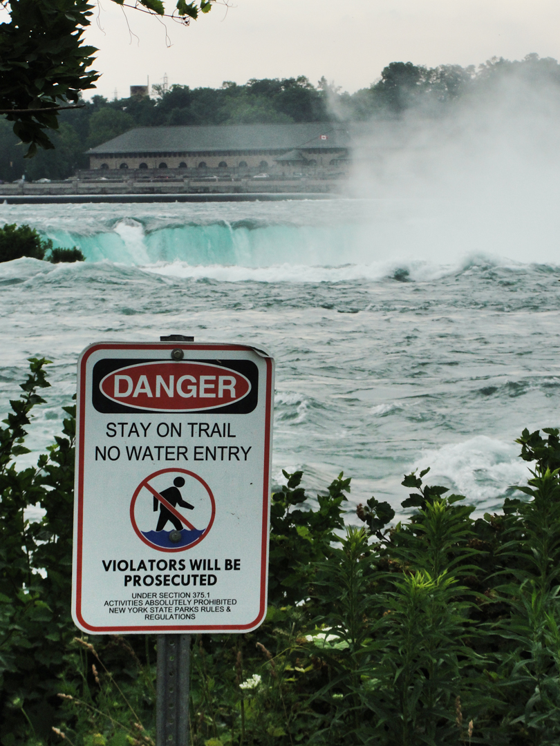
I had to laugh at this sign. The first thing I thought after reading VIOLATORS WILL BE PROSECUTED was the unstated PROVIDED YOU ARE STILL ALIVE.
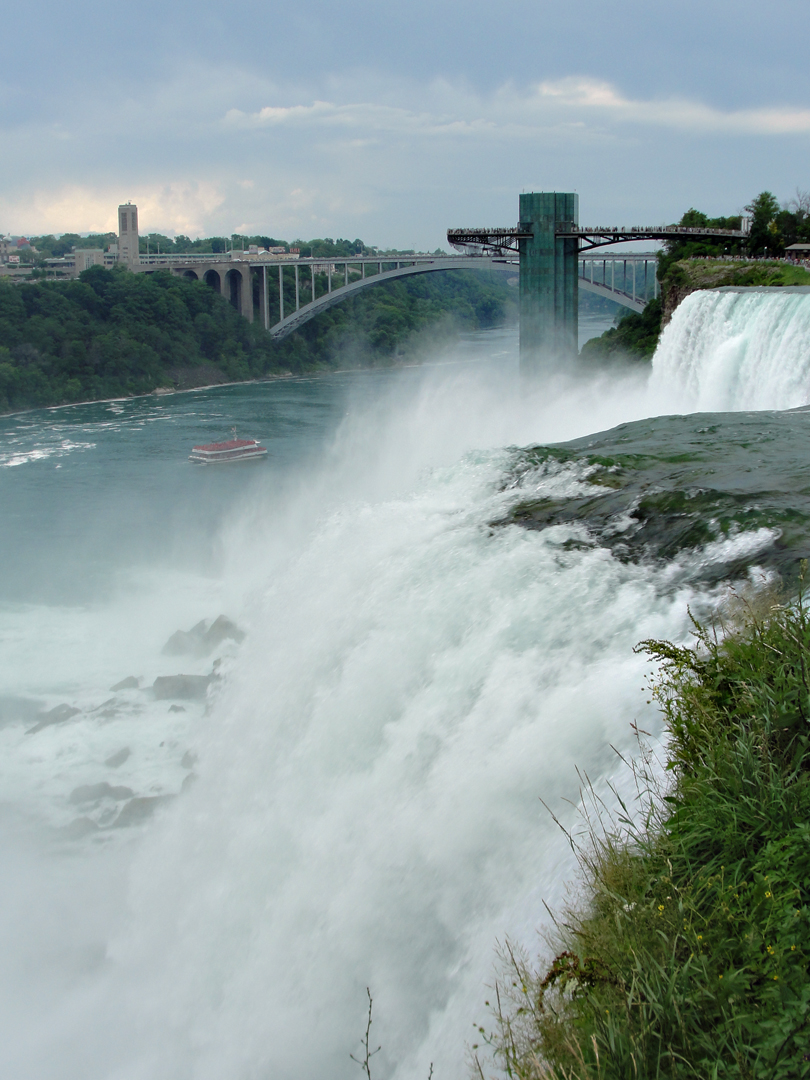
Looking over the rail at the American Falls. That tower/bridge structure beyond is the elevator to the Gorge floor, where the Maid of the Mist tour boats dock.
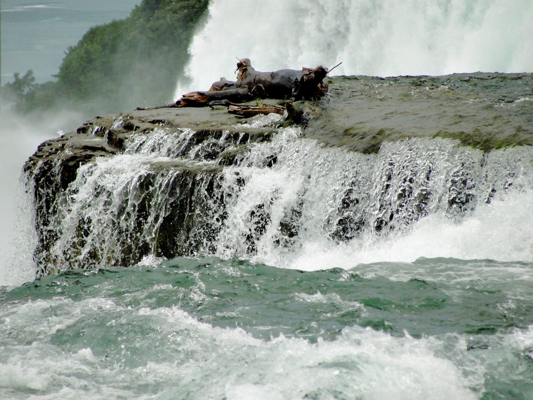
Because "Jake:" you just know I'm going to take a photo specifically of the logs that have not quite gone over the edge yet. There were a few fallen trees that found their way to high spots on the rivers and just hadn't yet been swept through.
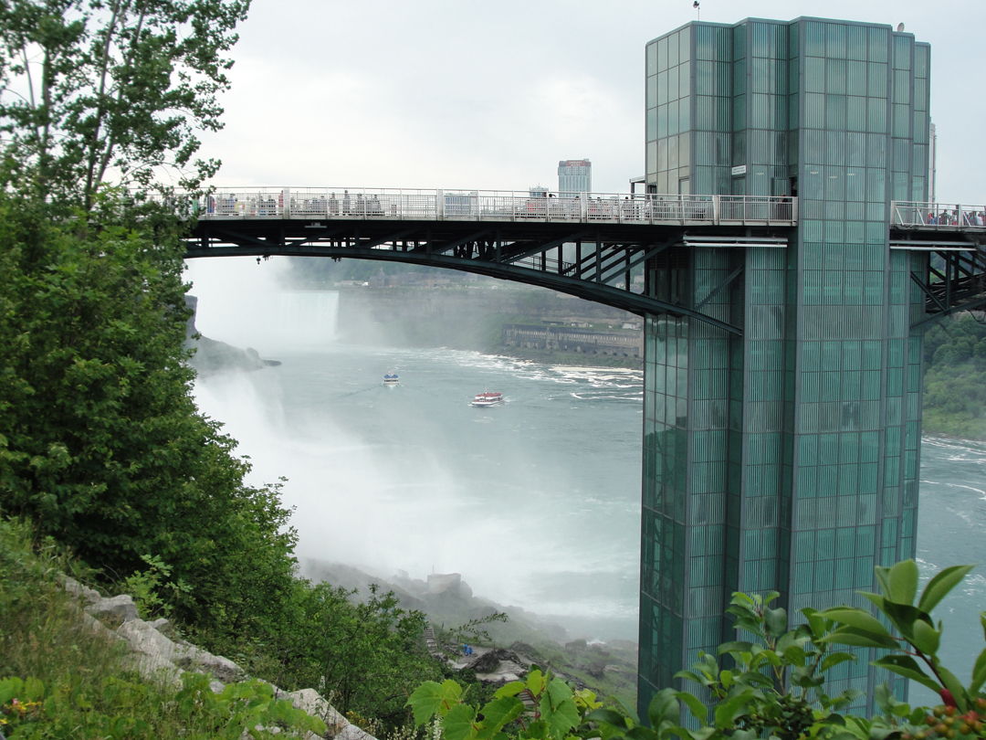
The elevator tower again. I was actually more than a bit "miffed" that someone got to build a monstrosity like this, and that the only way out there was by paying. Fortunately, it's only a buck if you're not taking the boat. Still, that's a buck! It's not as if my walking out there is going to induce a dollar's worth of wear. Oh "why must everything be turned into business?" Indeed!
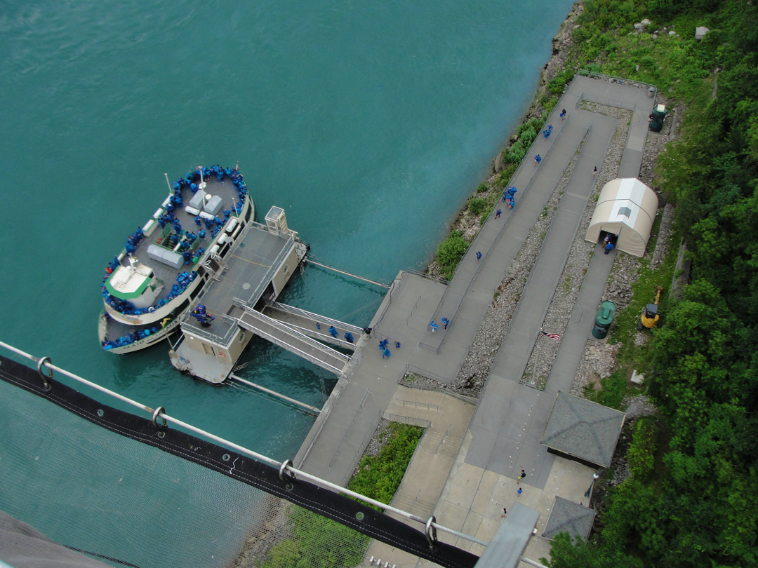
What a buck buys you: a view of the dock!
Also a nice view of the Gorge. Yes, the water really was that color, or damn close.
Biding my time for a spot at the rail finally netted me turning my camera back up toward the Falls. For something like a sense of scale, note the people in the blue slickers at the bottom left of the photo. They're getting as up close and personal as they can while staying on the ground.
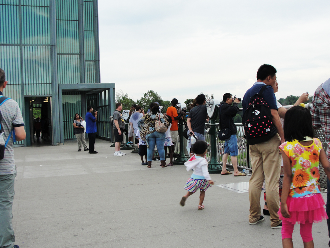
A buck also buys you nearly intimate contact with your fellow man! In retrospect, it's amusing that we take for granted that engineers have designed something like this out over a very deep gorge and without a thought (well, other than that buck!) we walk out here and stand at the rail and take pictures. I doubt that anyone in this photo ever once spared a thought of the very remote possibility that the thing might collapse and send us to our deaths. I didn't.
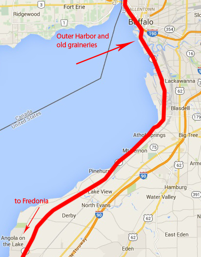
After having my fill I turned out to make my way back to Buffalo's Outer Habor area.
It was here that the Pathfinder did pause on the road, as Dreiser and Booth were both intrigued by the many industrial structures that lined the river-and-canal area south of the city.
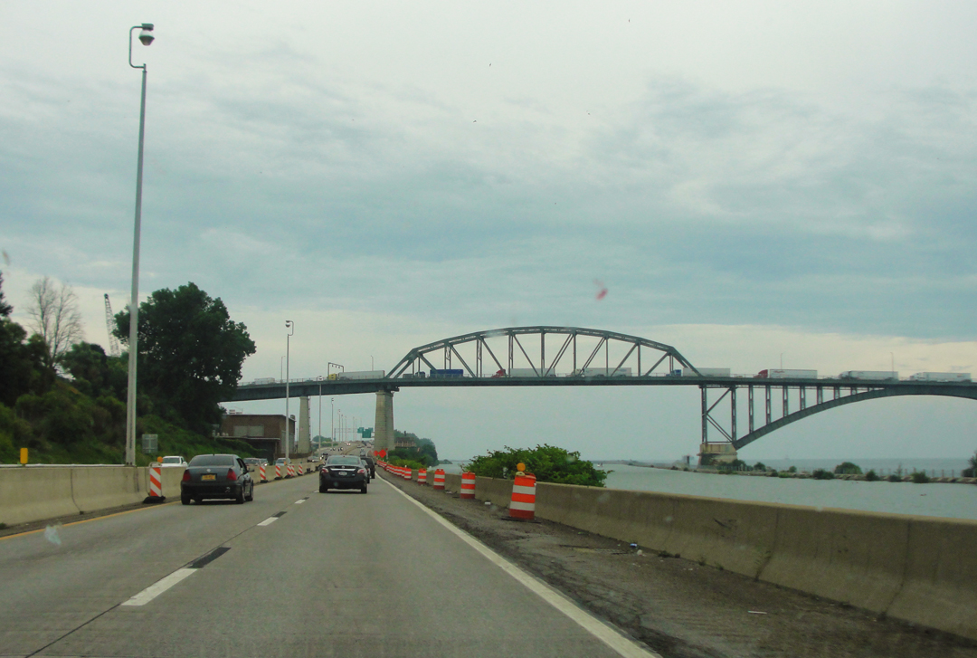
The Buffalo & Fort Erie Public Bridge, also called the Peace Bridge: international truck traffic stacked up entering the U.S. And oh my were they stacked up!
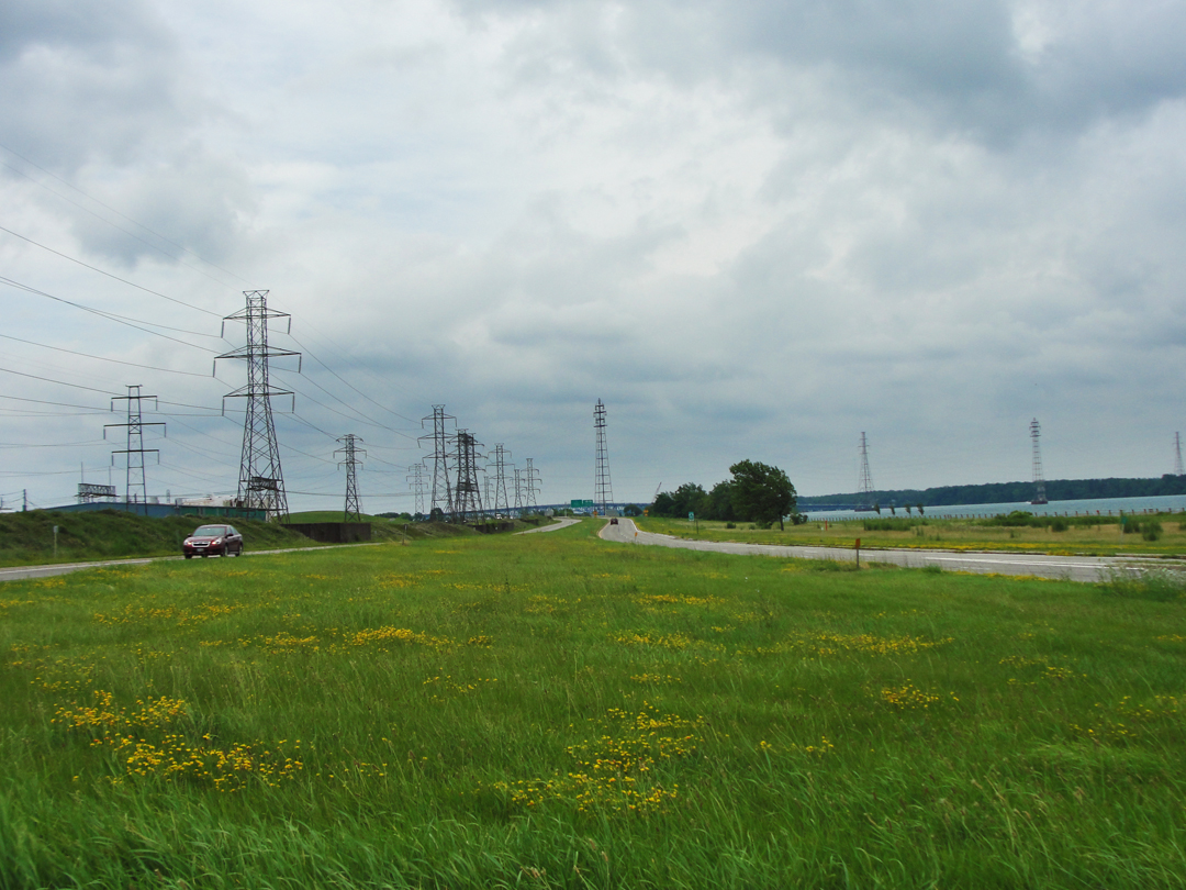
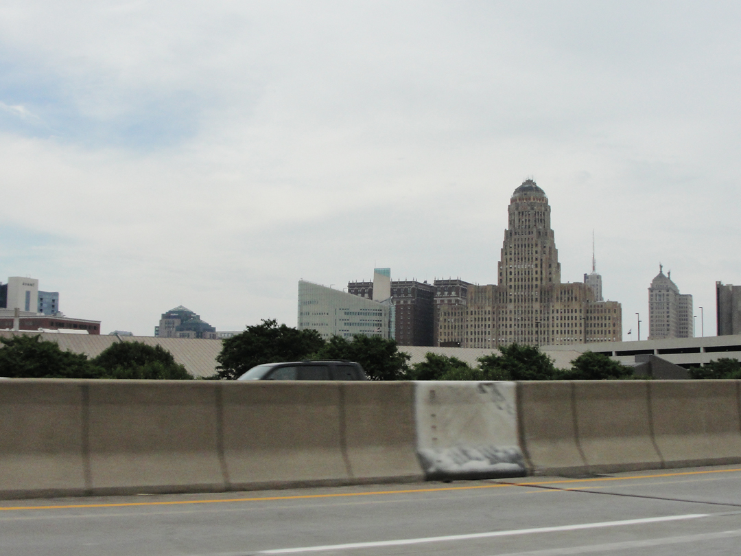
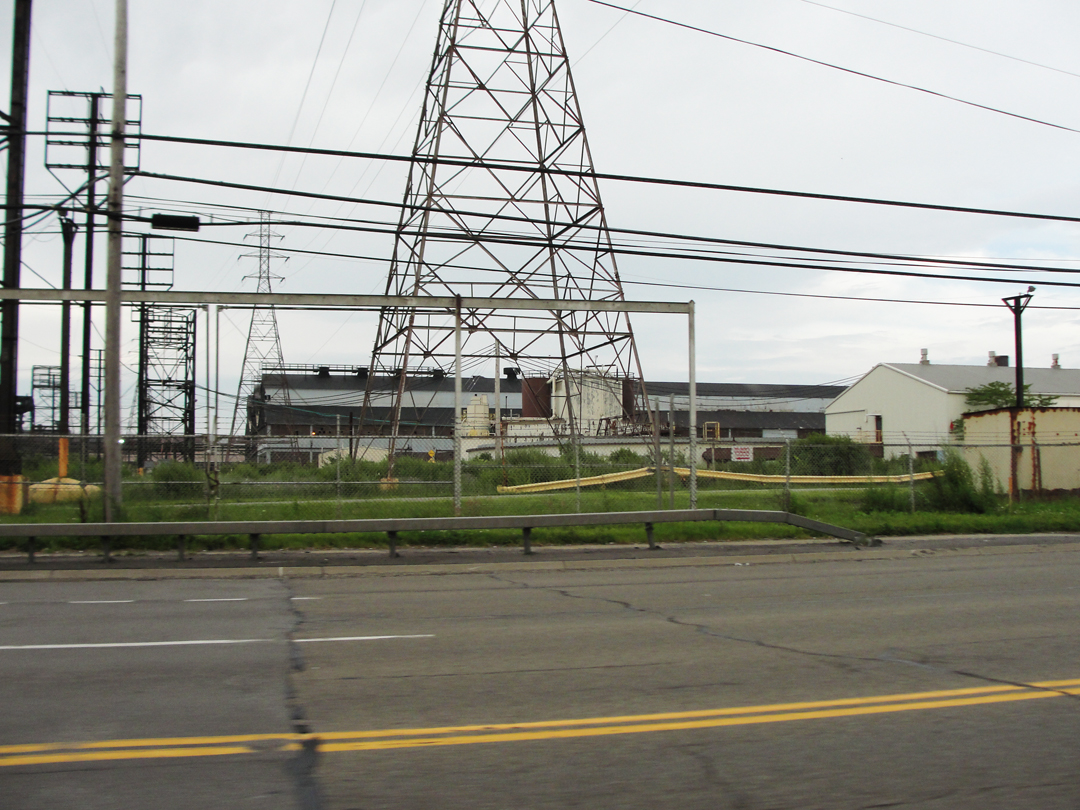
Below: passing Buffalo on I-190/Niagara Thruway.
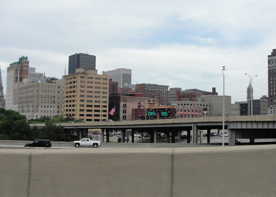
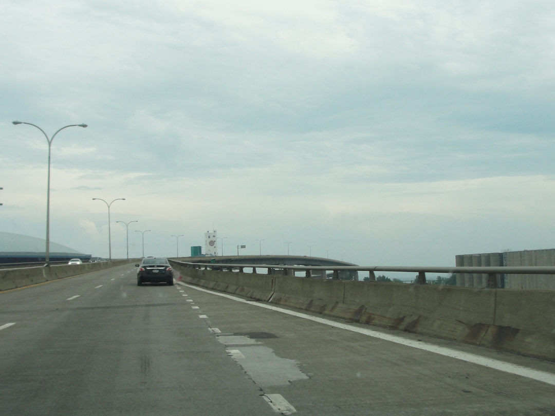
Leaving I-190 for NY 5, here elevated on piers over the Buffalo River, and after as a limited- access "Skyway" for a few miles past the Outer Harbor area.
(IHCI)
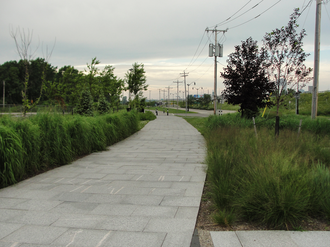
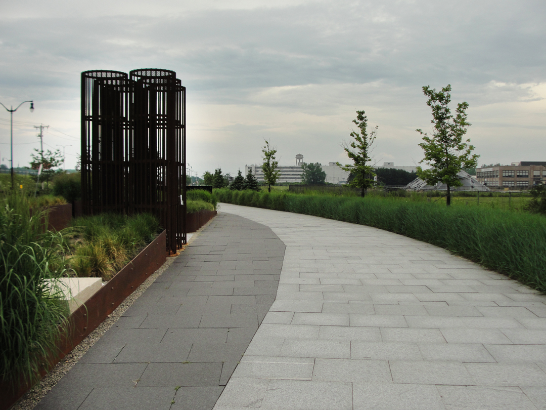
When I toured through here in 2014 I remembered the image of Booth's that was published and entitled "Egypt at Buffalo," a sketch of a large grain elevator. I also turned off the Skyway to enter the Outer Harbor area, which is a swath of reclaimed "brown fields" along the Erie shoreline, which have been made over for the public's more leisurely pursuits, and took a few photos there.
In 2015, remembering that the Outer Harbor had its principal street, Fuhrmann Boulevard, with spaces to park one's auto, I availed myself of it a bit more. When I stopped this time, I went looking for a few better angles on the old industrial buildings. Maybe it was the still mostly cloudy afternoon, but there weren't a lot of other people out and about this Sunday.
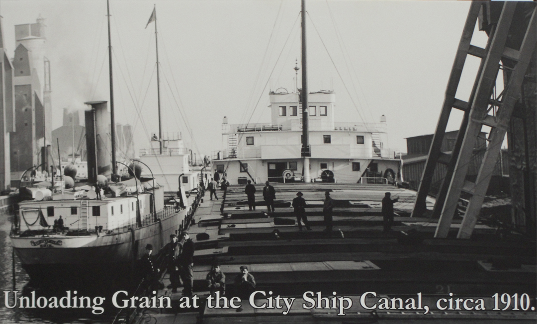
"Then we came to a grimy section of factories on a canal or pond, so black and rancidly stale that it interested us. Factory sections have this in common with other purely individual and utilitarian things -- they can be interesting beyond any intention of those who plan them. This can or pond was so slimy or oily, or both, that it constantly emitted bubbles of gas which fave the neighborhood an acrid odor. The chimneys and roof of these warehouses rose in such an unusual way and composed so well that Franklin decided he should like to sketch them."

In the middle of all that structure is the old Spencer Kellogg Elevator, one of several still-extant grain elevators (indicated below) that dominated the skyline along the Buffalo River/Ship Canal starting in the 1840s, with the opening of the Erie Canal.
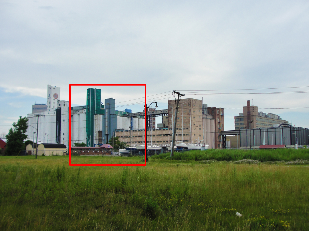
The original structure was built in 1911 for the Spencer Kellogg linseed oil mill.
Below, an at-present unidentified industrial building in center-right, while to the left is the remnant of the Wheeler/GLF elevator, originally constructed in 1909.
These two photographs were actually taken from under the NY 5 Skyway.
After making a turn at the end of the street, I drove down Fuhrmann alongside the Skyway a distance to stop where there was an underpass. There are bicycle or walking trails next to the Skyway, and a few underpasses that give on to an old rail road yard next to the Ship Canal.
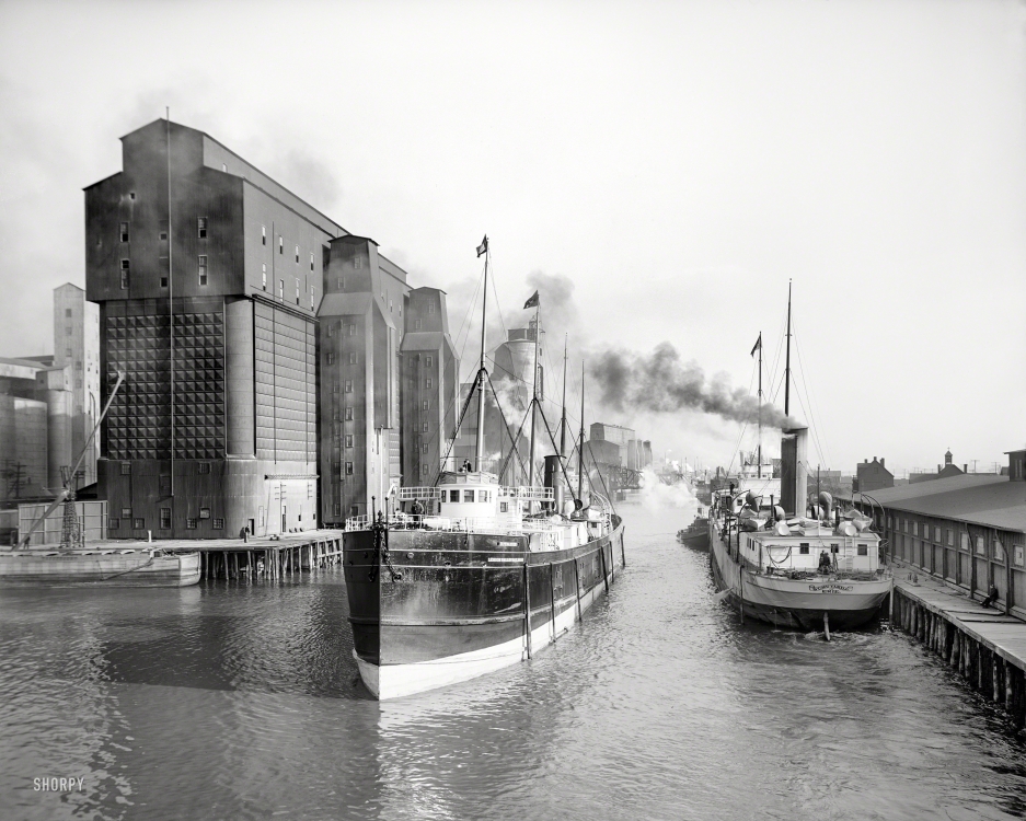
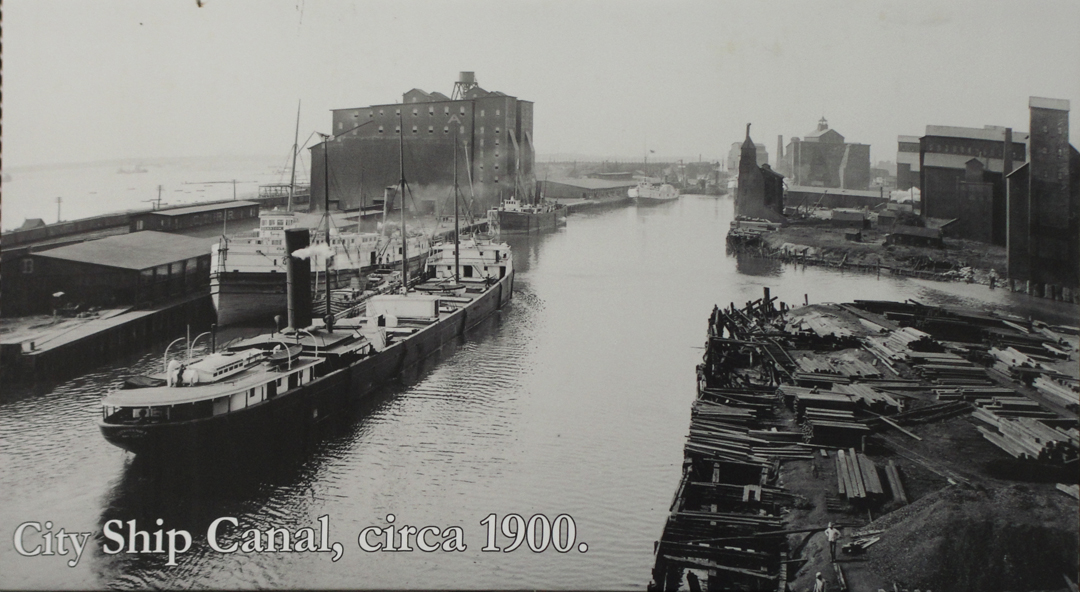
Buffalo Ship Canal, circa 1911 (Shorpy).
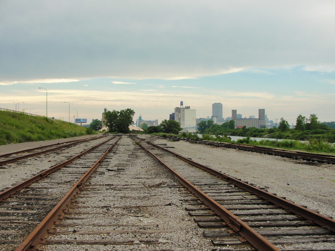
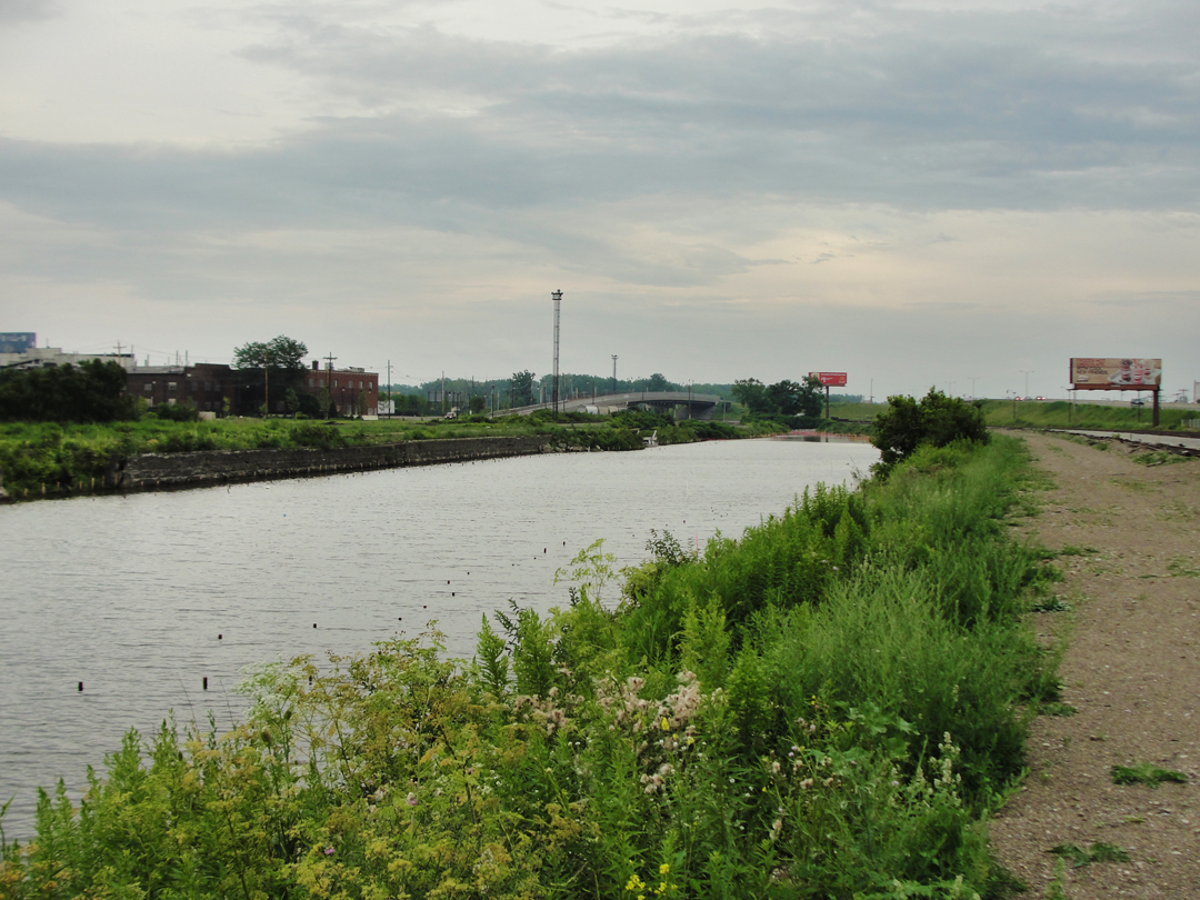
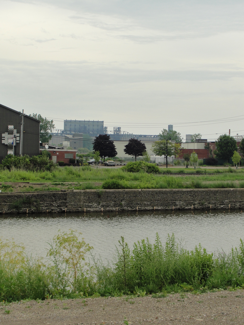
Above, what remains of the yard. I'm sure some company still owns this, but the rails have been left to rust, and some have tipped over -- perhaps been tipped over -- and some are just plain gone. In the distance are the taller buildings of Buffalo; to the left is the embankment of NY 5; to the right, just below the greenery, the Ship Canal, a finger of the Buffalo River.
Below is, well, looking the other way.
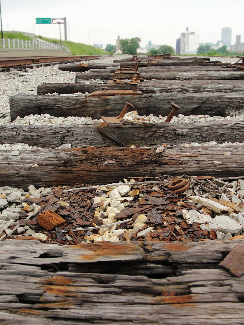
Below, my "artsy" shot of the old rail road trackage. As with the old stations and terminals, the end-of-the-line rolling stock that awaits refurbishing at Steamtown in Scranton, I looked at this old yard with a nostalgia -- however unwarranted. I want there to be active rail lines, and seeing these alongside the canal I despaired a bit for the future of rail travel.
(IHCI)
(IHCI)
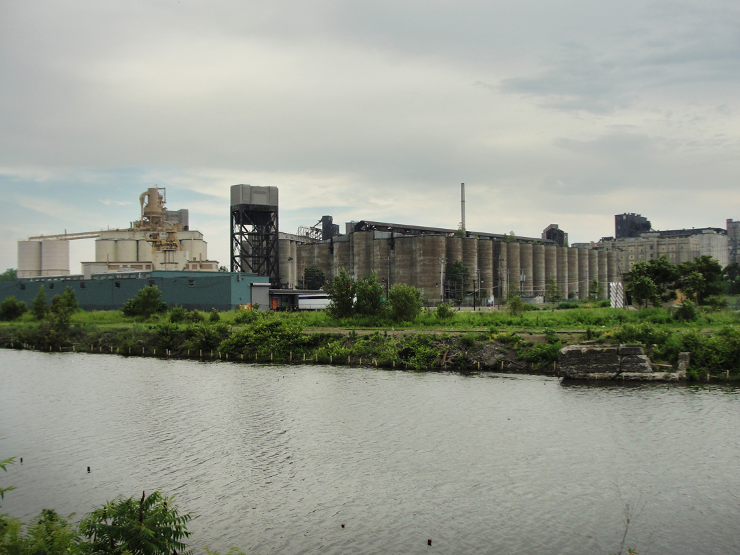
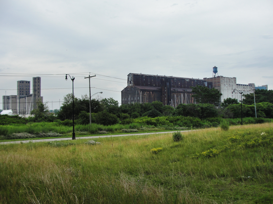
Here, looking across the canal. The tan colored elevator to the left (seen above the lower-built blue-green structure) is, I believe, the Electric Elevator Annex, built in 1940 by Cargill. The original Electric Elevator was built in 1897 and made of steel; it was demolished in 1984.
"A few blocks farther on there came into view an enormous grain elevator, standing up like a huge Egyptian temple in a flat plain. This elevator was composed of a bundle of concrete tubes...capable of being separately filled or emptied, thus facilitating the loading and unloading of cars...Before it, as before the great bridge at Nicholsen [sic], we paused, awestruck by its size and design, something colossal and ancient suggested by its lines."
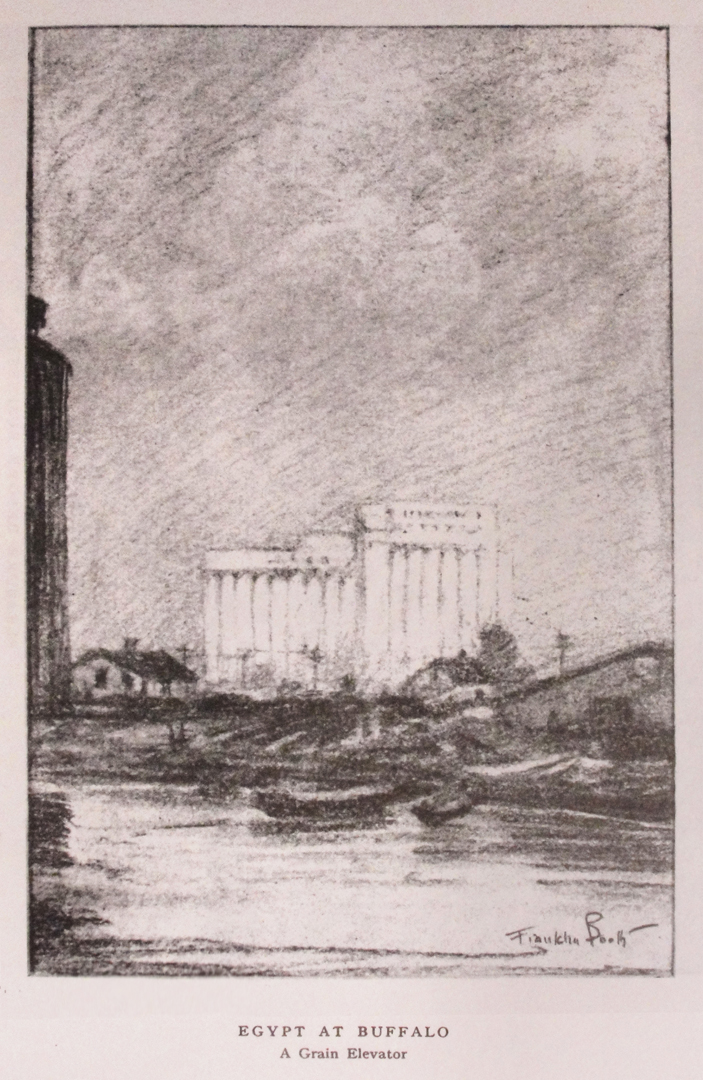
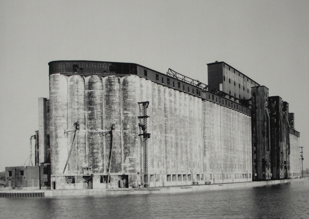
In the distance in the photo above I believe is that same elevator that Booth sketched (at left): the Concrete Central Elevator, built 1915-1917, finally achieving a length of one quarter mile.
Below is a photo of the elevator as it stood when finished.
(IHCI)
Below: the Industrial Heritage Trail, Outer Harbor.
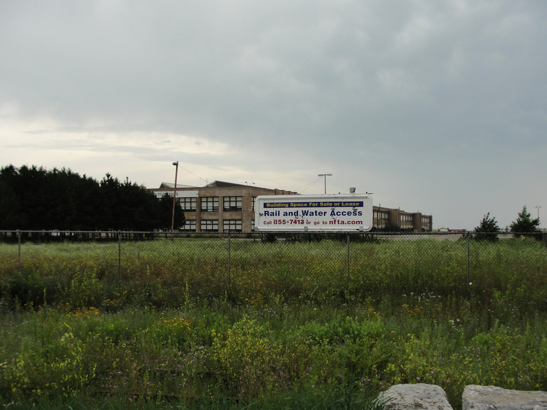
Not that any heritage will necessarily stand in the way of the contemporary free market:
On down Fuhrmann, I returned to the old elevator that reminded me, last year, of Booth's "Egyptian" sketch:
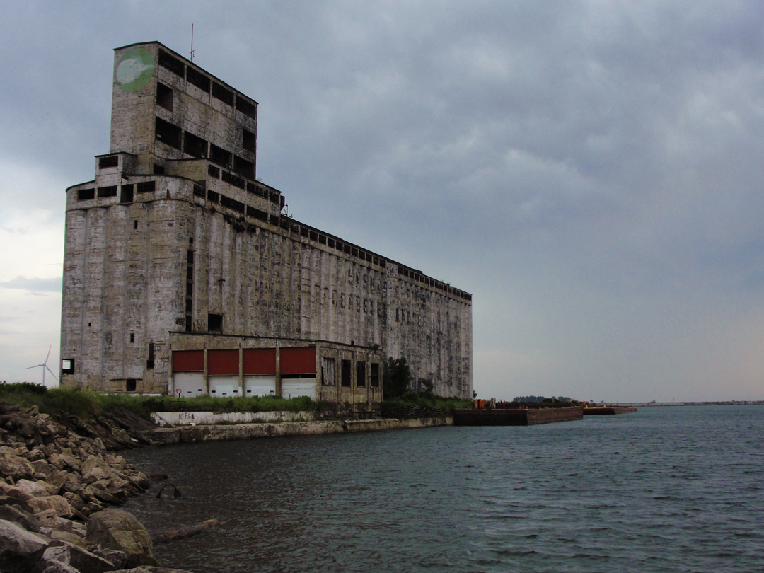
In 2014, this scene of the Saskatchewan Pool Elevator (1925) was brightly lit by the afternoon sun, and backed by white clouds. Having taken a shot of it last year and knowing that it was not the subject of Booth's drawing, I almost refrained from taking another photo. Then I looked again, and thought that this scene was in such contrast -- the elevator here appearing almost as an old lake-side fortress under the gloom of the day -- that it was worth taking a shot after all. I rather like the result.
Looking North-West from near the Saskatchewan Pool, this view across the harbor and lake toward Fort Erie, Canada.
Again, clouds. Y'know, because clouds!
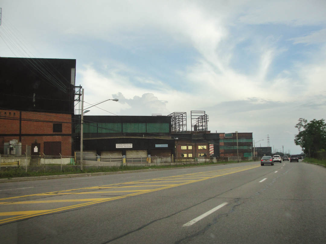
Shortly after revisiting the Saskatchewan, I continued down NY 5, to return to Fredonia and my lodging. On the way, I snapped a couple of shots of the old steel works that still stand in the Lackawanna or Tackawanna area:
It was through here, as the Pathfinder rolled South and West along the lake shore that Dreiser observed:
"...women were hanging over gates and workingmen plodding heavily about with pipes in their mouths...clothes too loose covering their bodies...The came the lake shore, lit by a sinking and glorious afternoon sun...enormous steel plants on either hand...lines of foreign looking workingmen going in and out of cottages...
Just outside Buffalo...we came to the Tackawanna Steel Company, it's scores of tall, black stacks belching clouds of smoke and its immense steel pillar supported sheds showing the fires of the forges below. The great war had evidently brought prosperity to this concern, as to others. Thousands of men were evidently working here, Sunday though it was, for the several gates were crowded by foreign types of women carrying baskets and buckets, and the road and the one trolley...were crowded with grimy workers..."
Sunday this year saw no such welter of workingmen. I had to wonder, as I did in 2014, how much of these steel works are still "in the business," and how much have been let for "mixed use."
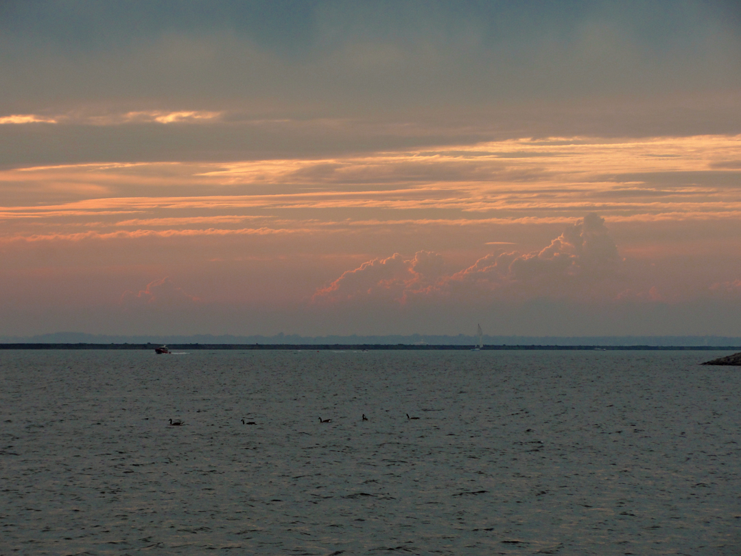
There was one other place that I wanted to revisit on the way back to the motor hotel: Eagle Bay, about 6 miles North of Dunkirk. It is one of the few places where NY 5 comes close to the lake, and without any apparent restriction on access to the beach. I took a few shots there last year, and thought, if the clouds parted enough, I'd like to maybe take a few more. I was glad I stopped:
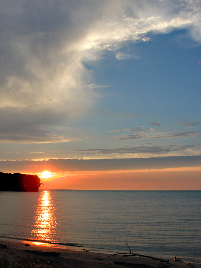
There were already 3 or 4 cars at the sandy turn-off, and for a moment I thought to just cruise on by. My inclination is to not join in where there are already populated spots, but this evening I told myself to "hang it", and stop anyway. Most of the people who had stopped before me had dispersed along the shore anyway, and so were not in much evidence. Certainly not to get in the way of the photograph above.
Like the amazing color of the Niagara River below the Falls, the color here is pretty damn close. It was breathtaking to see.
Shortly afterward, I was back in my room, and happily availing myself of the shower. Only another look out the window:
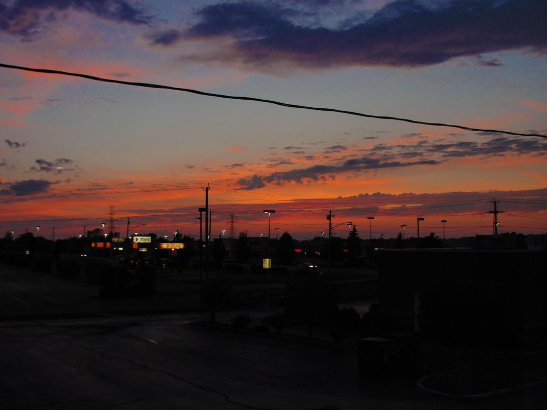
Because, y'know, sunsets!
Tomorrow: the journey continues along the Lake Erie shoreline, as I try to keep to the old like-side roads.