Friday morning: to catch the track of the Pathfinder, I needed to run North, toward the Delaware Water Gap. Dreiser related that somewhere up close to the Gap, they had crossed the Delaware River to the Pennsylvania side by ferry. From my drive in 2014 I knew that there was a bridge across at Portland, PA, which is one of very few crossings available. I-80 crosses, but nearer to Stroudsburg, and there is one at Belvidere, which is too far down stream. Any likely ferry locations would be closer to the bridge between Portland and Columbia, NJ, so that-away I went.
As the Pathfinder had been en route from around Hackettstown more-or-less directly to the Delaware Water Gap, I was going to re-connect with their route back on US 46, via county highways. Or that was the plan.
Between my lack of knowing quite where I was the night before, and clouds obscuring the sun in the morning, I started out thinking "North!" only to find that I was heading "South?!" Of course! I kept looking for one of the regularly posted signs that informed me what county highway I was on -- it amazes me how often those signs are not apparent when I really need one. The sign, once I saw one, proved that I was heading the wrong direction. I pulled over in a hamlet and consulted the map. I was in Bloomsbury!
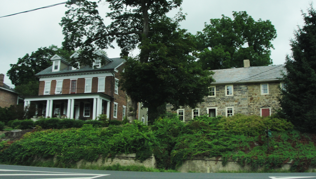
Well. Wondering if any progressive English poets were in town, I took a few photos, including this one (at left). Nice examples of early American houses. If Dreiser & Co saw these I would be surprised at their route, but they surely saw a few structures similar.
Then I turned around -- again -- and headed back toward Phillipsburg.
At least I had the odd comfort of knowing that having to turn about and go back was in keeping with the original trip!
Dreiser, as he describes their passing through this portion of New Jersey, can't quite make up his mind how to consider it. In one passage they went through "...a forlorn, decadent, gloomy hamlet about which I wanted to write a poem...Poe might have lived here and written 'The Raven'...Still farther on...we came into a mountain country...not an ultra prosperous land..." But maybe, as he will later, he was simply waxing Romantic when he continues (in the next paragraph!):
"Something -- perhaps the approach of evening, perhaps the gloom of the great hills which make darksome valleys wherein lurk early shadows and cool damp airs; perhaps the tinkle of cowbells...the presence of dooryards where laborers and farmers...were washing their hands...the smoke curl of evening fires from chimneys...was very touching about all this...I was greatly moved. Life orchestrates itself at times so perfectly."
My route this morning was not through those more mountainous lands; farther South and West, I was closer to the river valley, given to rolling hills with some abrupt rises.
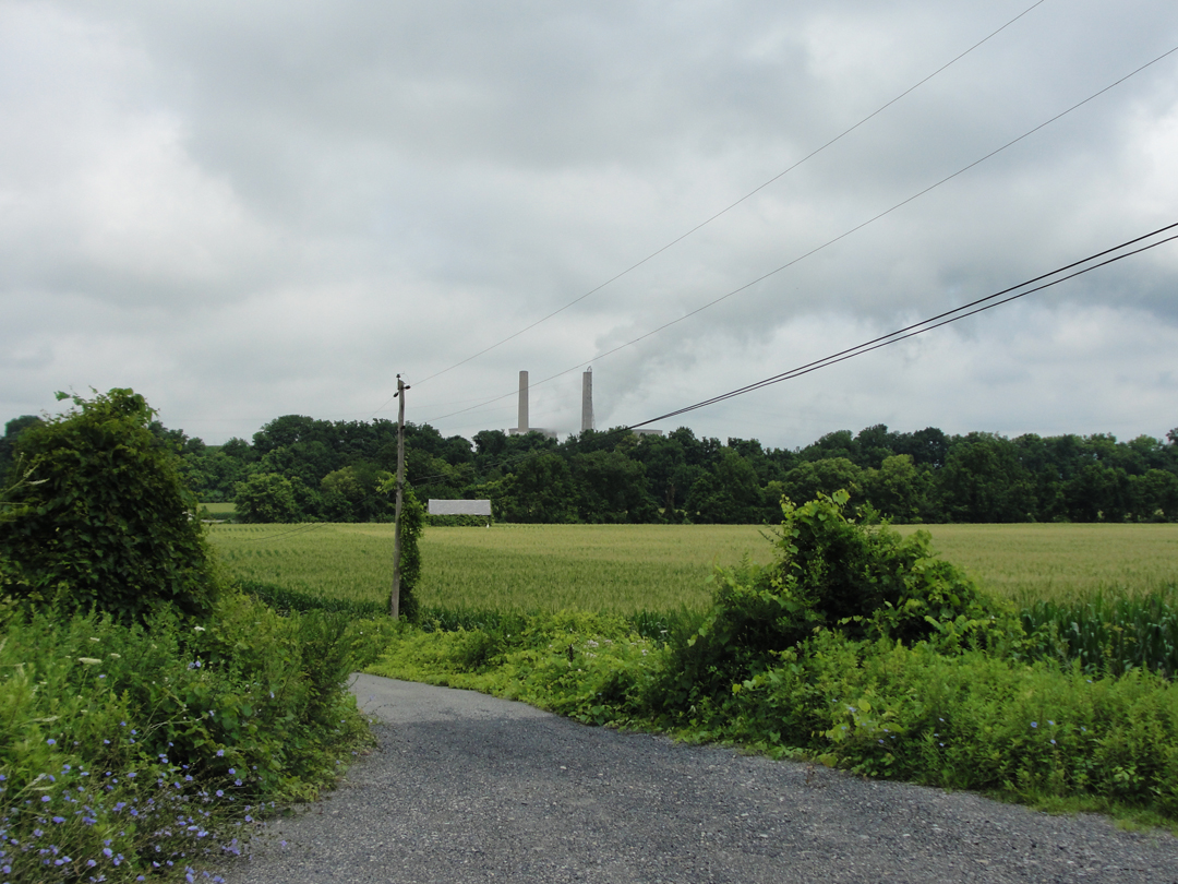
Above one farmer's fields I saw the smoke stacks of the Martins Creek Power Plant, over on the Pennsy side of the river.

I immediately remembered stopping for this photo in '14, and had a moment of waving to myself back through time.
"We passed thick forests where in this mid-August weather, one could look into deep shadows, feeling the ancient childish terror of the woods and of the dark. I looked up a cliff side -- very high up -- and saw a railroad station labeled MANUNKA CHUNK."
Amongst Dreiser's descriptions of the drive toward the river was that place name, which, surprisingly, still existed on my map. I honestly didn't think it would, being connected with a small-town rail road stop, but there it was - though noted that that ZIP code area was "boxes only," so I guess it's not what it was.
Manunka Chunk also lies alongside US 46, further reinforcing the idea that some of that highway covers Dreiser's route.
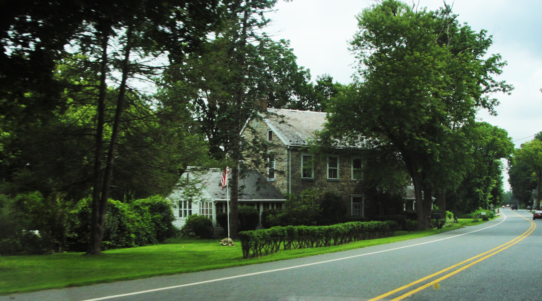
Old house! I do like to make the attempt to capture the image "on the fly;" sometimes it comes out O.K.
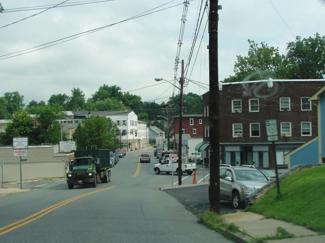
Shortly after that, I entered the town of Belvidere. In my inimitable fashion, when the highway made a "right" at an intersection, I continued straight through. "I think I shoulda' followed that truck," I thought. Yep, shoulda'.
After putting myself to rights (or lefts in this case) I left the town, and shortly saw this:
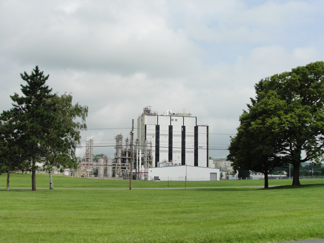
I know it's pretty common now for corporations to buy lots of land cheap out here in the back-of-the-beyond, but I still shake my head in surprise when I see an installation like this amidst the corn and wheat fields.
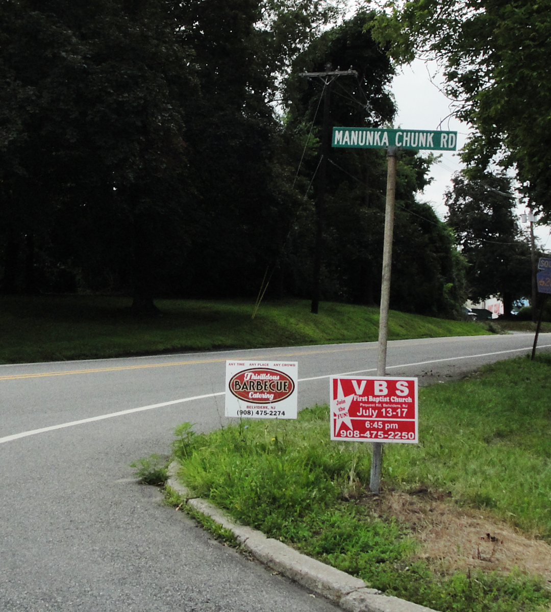
As I closed on the intersection with Hwy 46, I looked up to see a sign that proved I was, after all, in the right place. Turns out I had been on Manunka Chunk Road since leaving Belvidere.
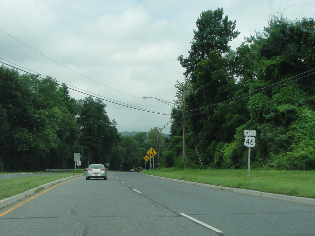
And back onto US 46, just before the end of its 4-lane incarnation.
I was looking for a sign of some kind that would indicate "Manunka Chunk" -- I've seen signs for less -- but there wasn't one, a non-event that would become all-too common as will be evident.
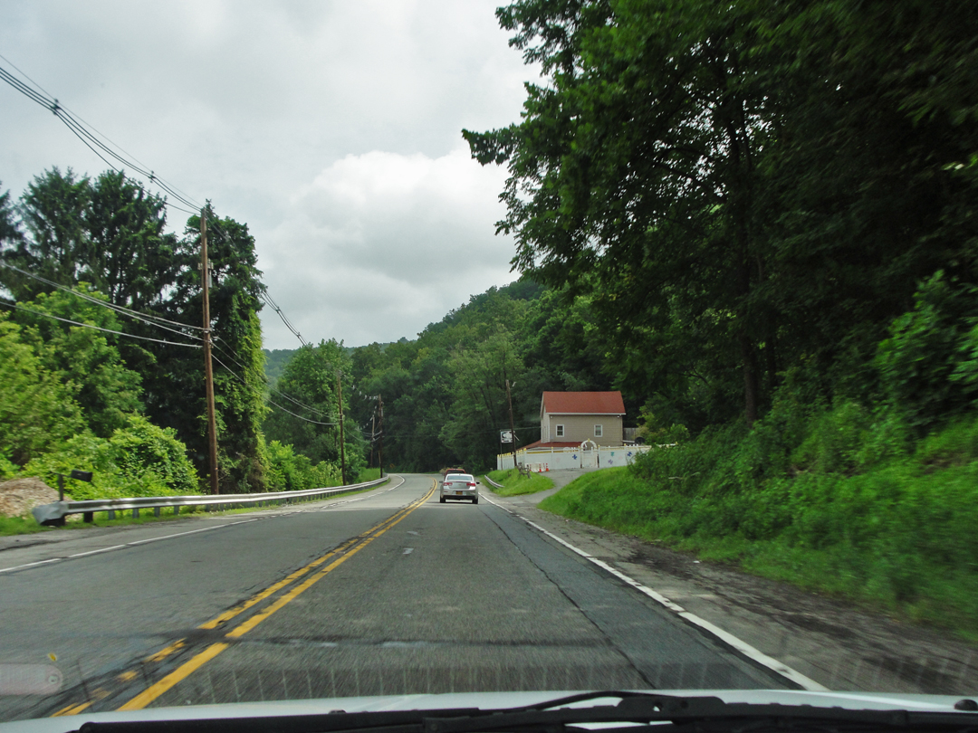
Here, I believe I was actually in the area designated Manunka Chunk, but didn't really know it.
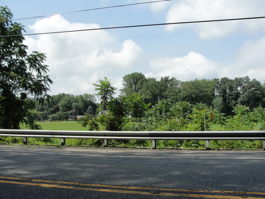
And here, after I had turned 'round, and gone back for another try.
What-ever it was, Manunka Chunk today is a few lanes leading off 46 to a handful of houses near the river. Getting a good view was difficult for all the little trees growing near the rail.
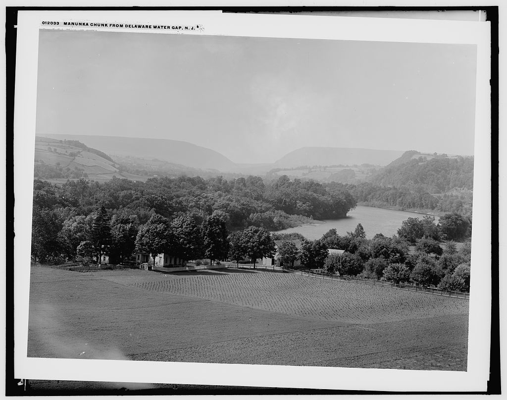
Manunka Chunk, circa 1900? According to the caption, this is "Manunka Chunk from Delaware Water Gap N.J." HOWEVER -- examination may reveal a misnomer.
That is the Gap on the horizon; I've compared this silhouette against my own photograph (which is shown a bit farther down the page) and it is as it should appear from down river. If that's the Delaware River, and it should to be, then this would be the Pennsylvania side -- so I'm not sure how this is Manunka Chunk.
Hmmph.
Anyway, it's a nice view of the countryside, in the right general place and time --
When I had got far enough to wonder if I had already passed "the Monkey" as I was thinking of it (thanks, Heather!) I started looking for a wide spot to stop. A Colonial era-looking house caught my attention, and in the door yard stood a sign proclaiming about something being PRESERVED, which was good enough for me. I found a place to turn back, and stopped in a turn-out before the house.
Consulting the map, I saw that the Monkey was indeed "back that-away," and would need a return trip. In the meantime, I figured since I was there I might as well investigate this old house thing.
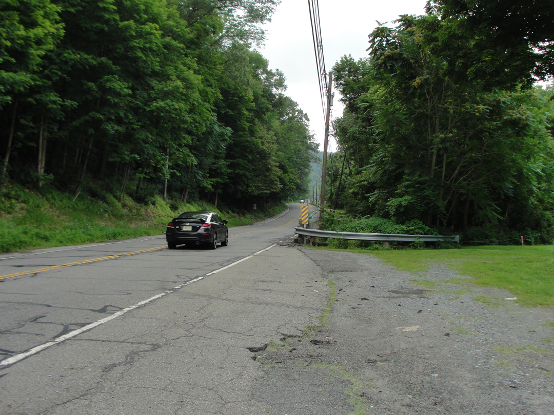
Like the "thick forests" with their "deep shadows" of Dreiser's description? Maybe. Save for the striping, the road is likely similar in appearance.
The old house was the John Ramsay Farmstead, established circa 1795. It is listed on the National Register of Historic Places, and various state and federal preservation institutions are providing funding for its preservation.
I saw nothing to indicate the the grounds were closed, and no impediment to my egress, so I wandered in to have a look.
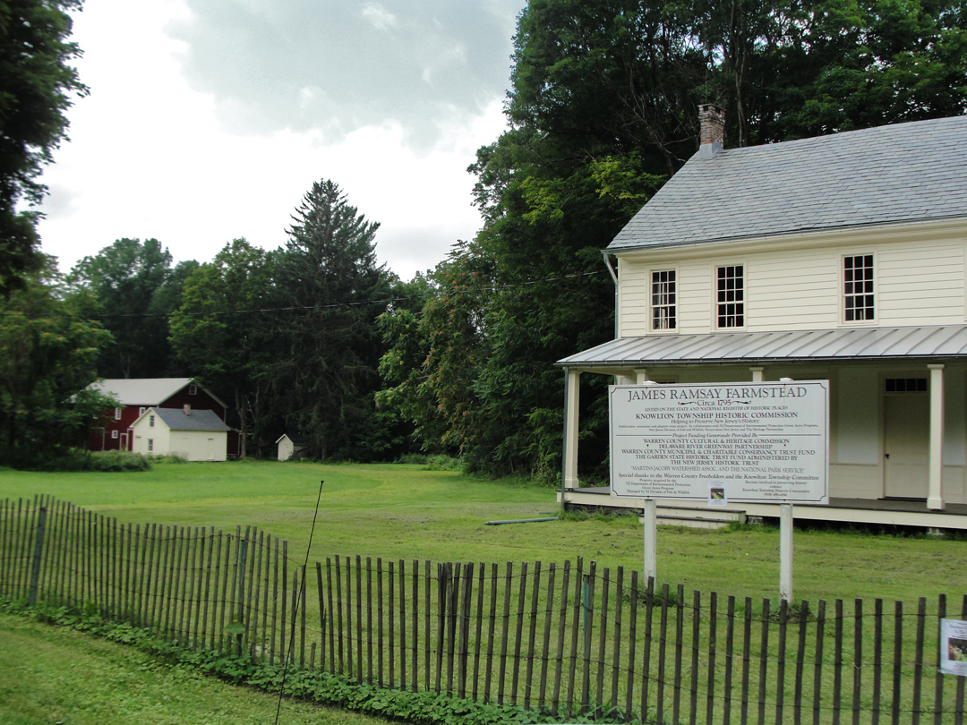
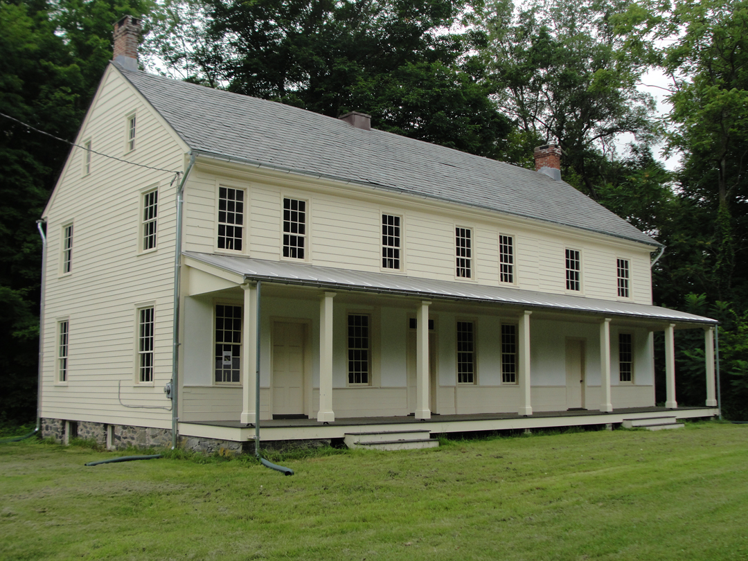
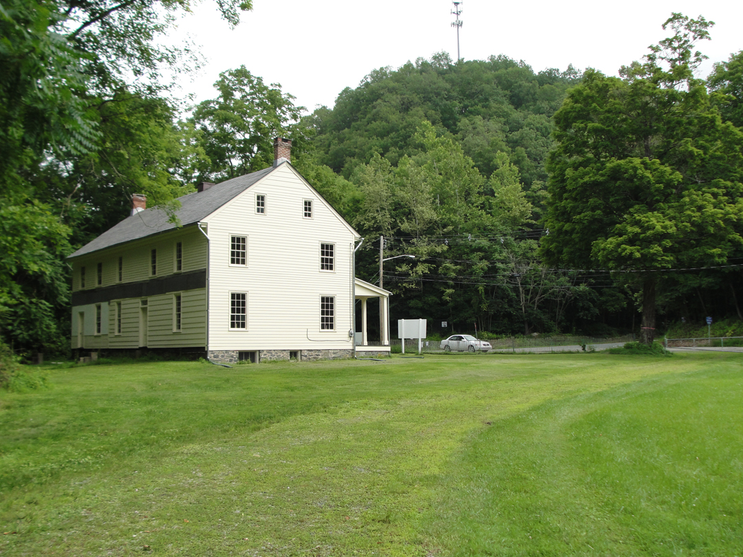
The exterior is in pretty decent shape, but the interior is still under construction. Above at right belies the Century: a cell phone tower stands atop the hill opposite.
Turns out the Farmstead was a good place to stop. As I meandered down the yard, I saw one of the information placards which deliver to the visitor some slice of the history about the locale. In this case, an overview of the use of the Delaware River as a shipping conduit during the 18th and 19th Centuries, and the note that the Ramsay place was a stop on that way. Included was the following photo:
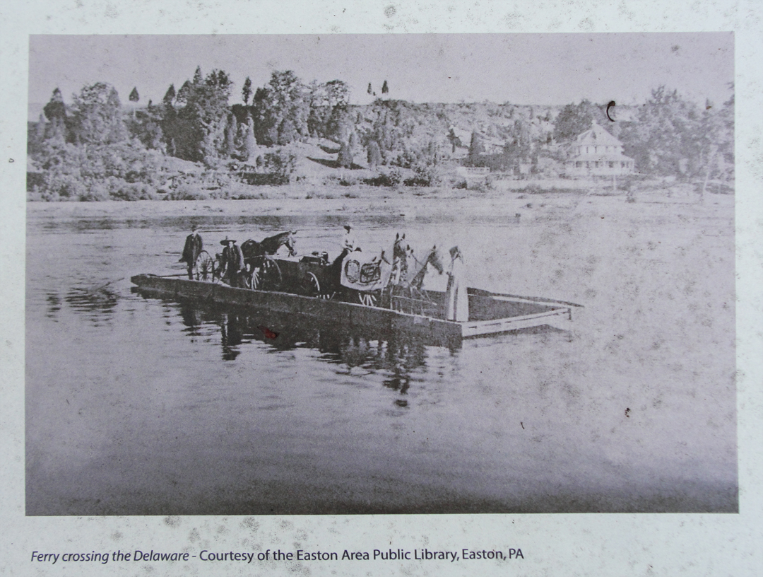
"Ah HA!" I exclaimed. Actually, I did. Somewhere along the Delaware, the Pathfinder was literally ferried over to the Pennsylvania side.
However, the only references supplied as to the ferry's location are these: the boatman tells his passengers that they are 7 miles from the Water Gap, and Dreiser relates the following observation: "In the distance was the Water Gap, a great cleft in the hills where in unrecorded days the river is believed to have cut its way through."
So if the two men are referring to the same landmark, and not the town of Delaware Water Gap, then the Farmstead might just be the place. At least on Google, the Ramsay place is about 7 miles from the Gap.
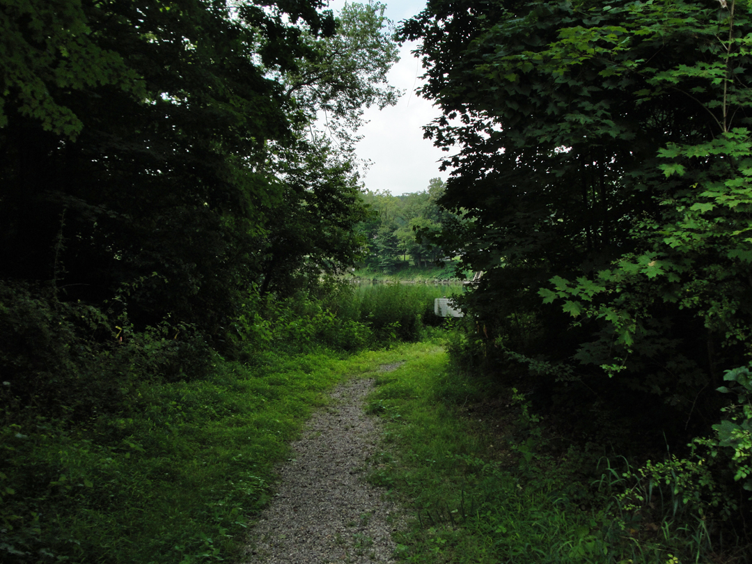
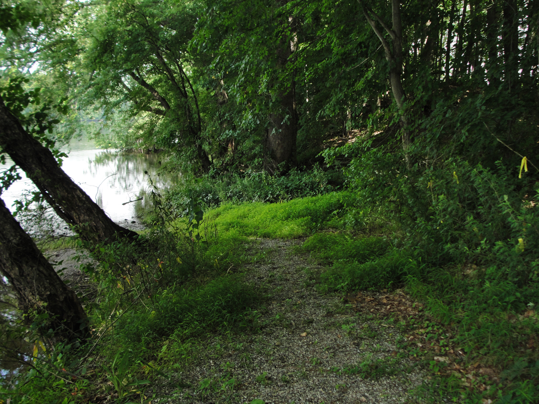
Above, the path leading from the Farmstead's yard to the Delaware's edge. It is much closed in today, with dense wood and second-story growth alongside. It's also quite possible that this path has no relation to any road to the river as it was in 1915.
Below, as at the head of the page, is the view to the Pennsylvania side.
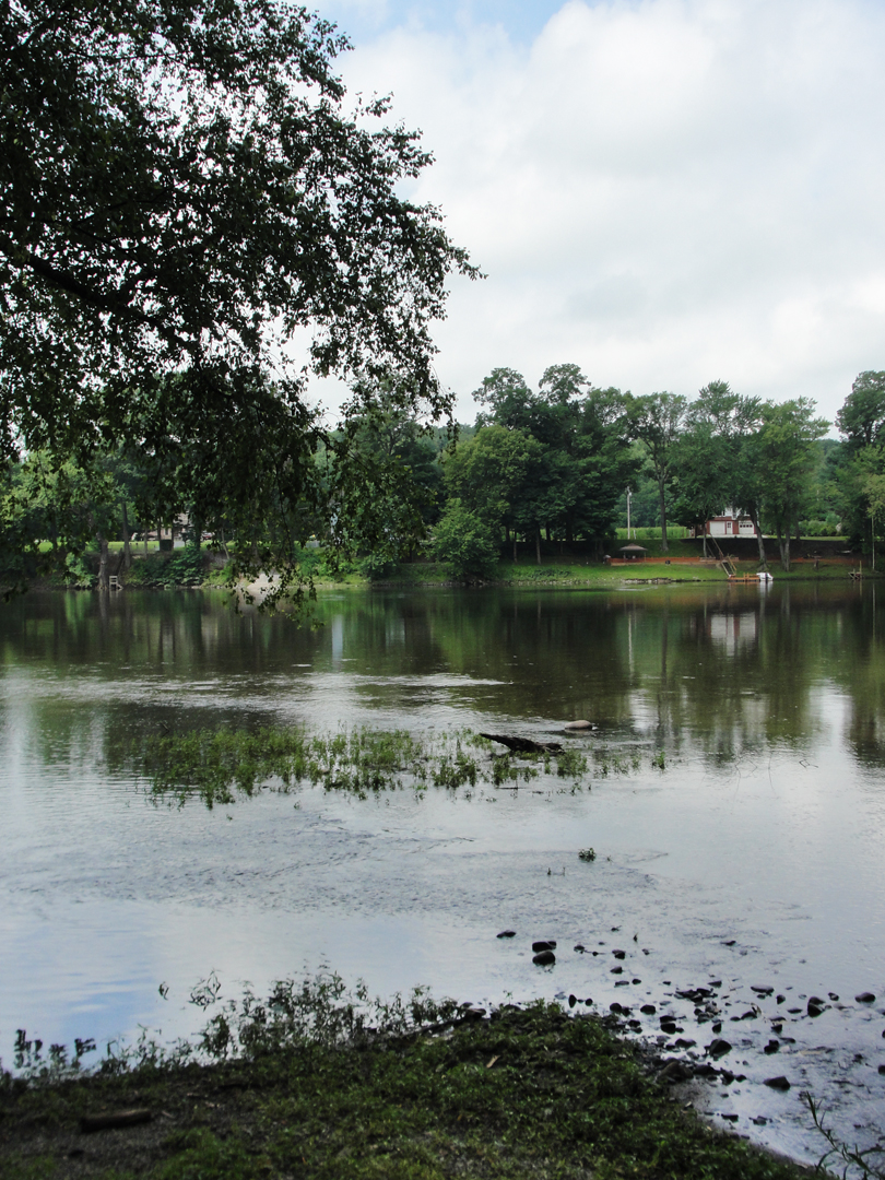
That's Pennsylvania over there! Funny, doesn't look different.
Whether or not the Ramsay place was the site of their crossing, I still had to get over. Before I could do that, I had to face more of the orange cones.
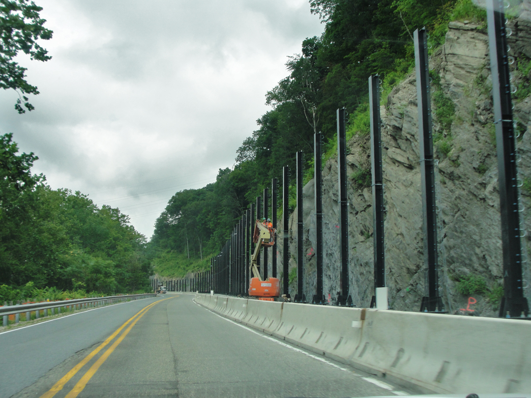
Or "Jersey Barriers" in this case. At least it was not a detour.
Here crews are in the process of putting up cable-barriers between the rock wall and the highway to prevent falling rock from landing on the pavement.
As I drew up to the bridge at Columbia (bridges are expensive!), the orange cones blocked my path: the approach ramp to the bridge was closed, and I had to drive under, up around and back, including a stretch along the ramps to I-80, making something like a figure-8, I think, before getting up over the river.
Once crossing, the view almost passed me by before I grabbed the camera for this, fuzzy-for-the-haste view of the Gap.
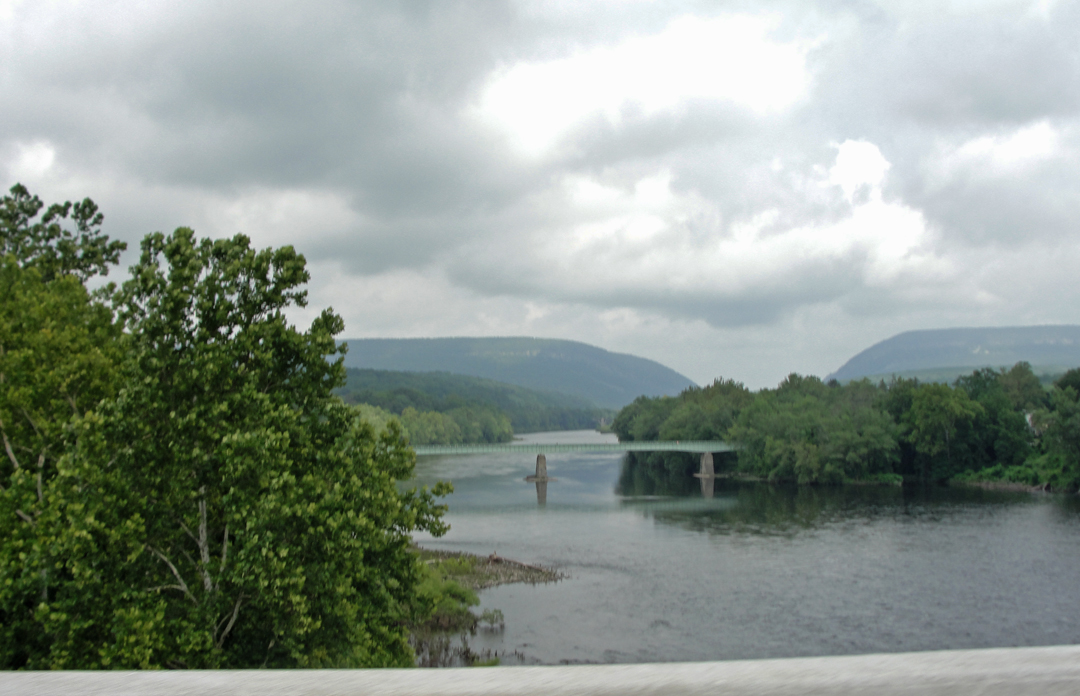
Upstream is what I take to be an old railroad trestle, but now is the Portland-Columbia Pedestrian Bridge. As a trestle, it could be "that old," since Dreiser states that during their ferry crossing they were able to see "...the vast masonry of some bridge which had been constructed farther up the stream."
These days it's common for old infrastructure like these to be put to "adaptive re-use" since it's cheaper than tearing them down. They built those piers really well "in those days."
On the Pennsy side, I had another "whoops" moment because either the connection to PA 611 -- my intended road -- was closed, or the sign was gone, but in any case I was going the wrong way (sense the theme developing here?). After flipping 'round I was on ground I had covered last year. I found it a bit odd to think that I was actually retracing to some of my own route.

And into Portland.
Portland, as such is not mentioned in the book, but then, the Pathfinder was winding its way into a resort area in the dark where "...we encountered endless groups of strolling summer boarders...'A land of summer hotels this, and summer boarding houses'..."
so that there was a town may have gone un-noticed amidst the tourist businesses.
Today Portland is a bit off the beaten, and has an air of being the last outpost of that once bustling summer resort land.
There are still some remnants of that era:

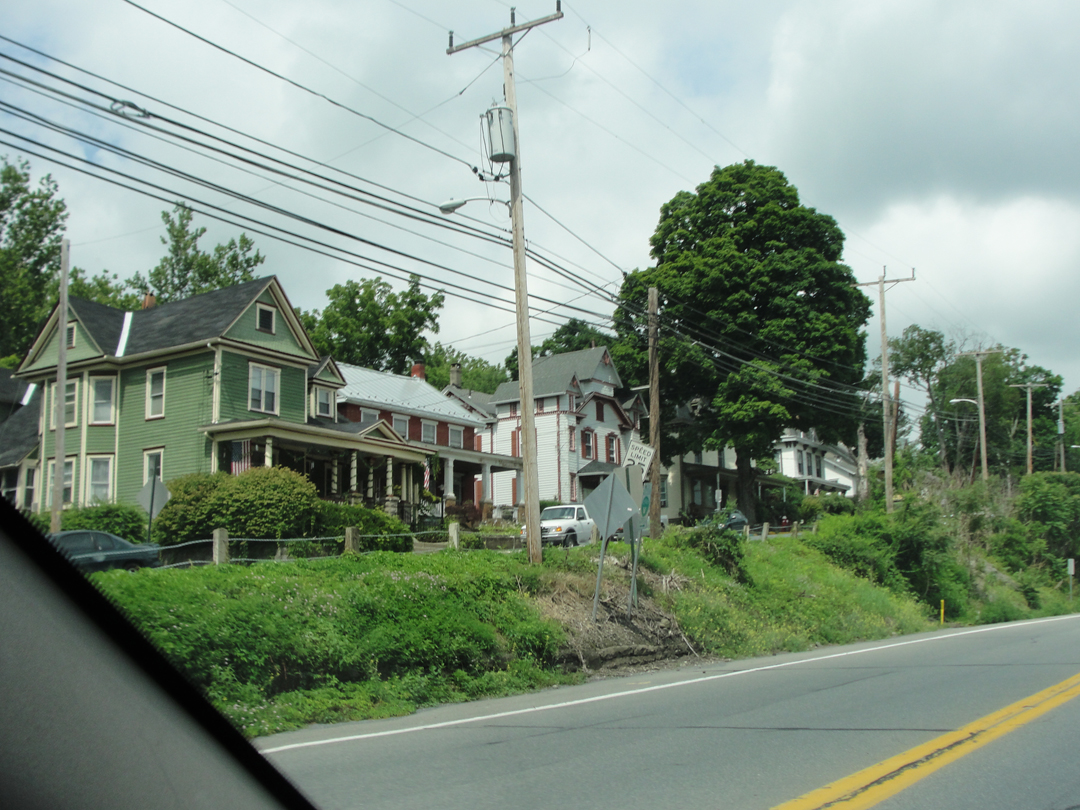
Beyond Portland, 611 enters the Delaware Water Gap National Recreation Area and the Worthington State Forest, and a more natural landscape has either taken back over, or been re-imposed. Bit of both, maybe.
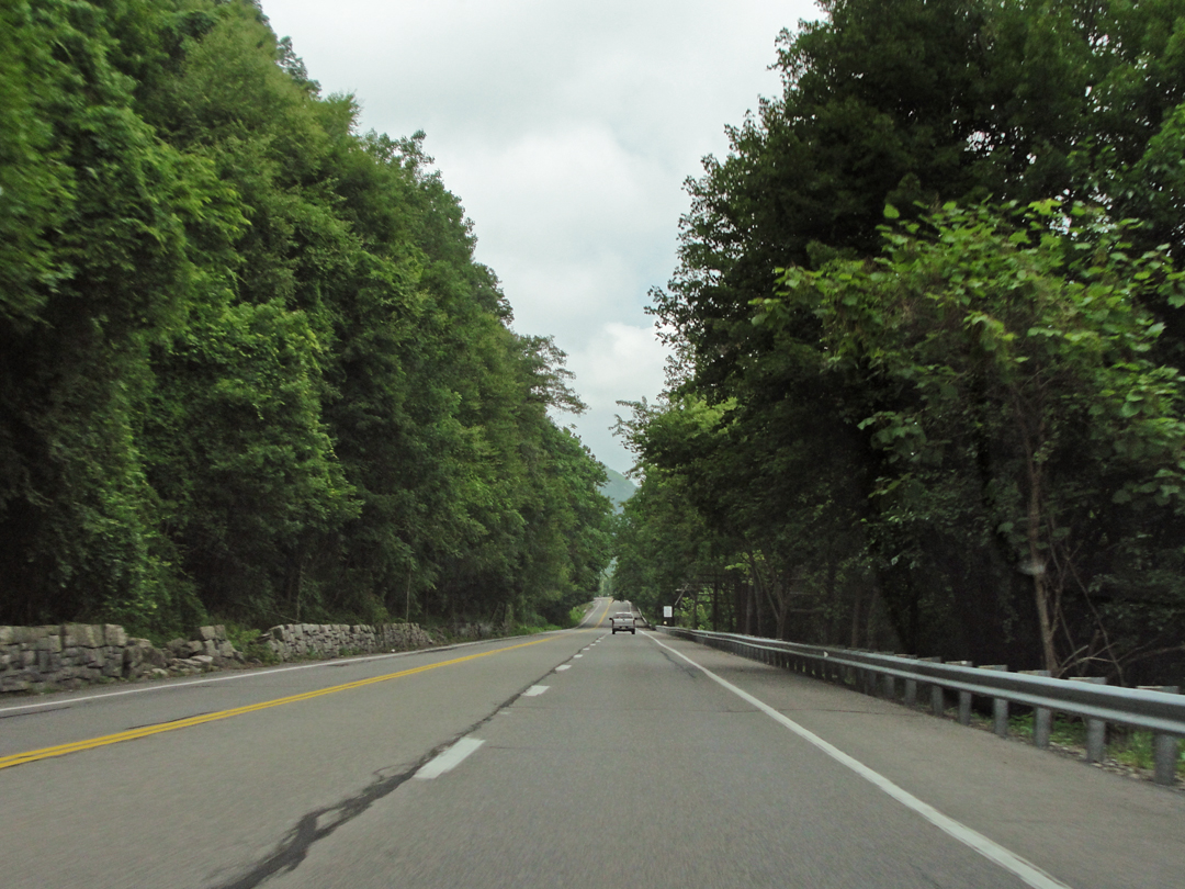

As last year saw, I made a turn-out to photograph the Head of the Gap, the mass of rock that rears over the Delaware. There is still rail road trackage a little beyond the guard rail, and the river a score of yards through the trees.
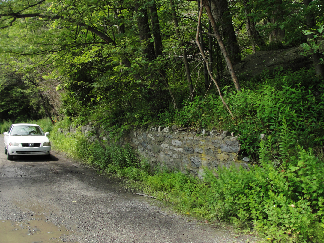
What caught my attention, as I wandered about the turn-out, was the stone wall. There are walls like this all along PA 611 that were placed to prevent a driver going over the edge and down a steep slope to the river, though today they are lined with Jersey Barriers and NO STOPPING signs.
Here, though, there are steps through the wall, leading up to -- the hill?
"...we were entering a region compact of automobiles...half concealed hotel windows and balconies which seemed to clamber up cliffs and disappear into the skies."

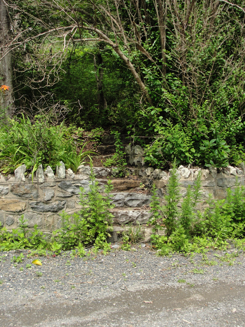
I recollected something of that passage as I looked at these steps, and wondered if some of those windows or balconies had once rested in buildings up this hill. I have seen similar steps-to-nowhere in Pittsburgh, where a neighborhood was displaced by a widening of a road or a new highway. Steps that led to foundations, or nothing at all but young trees.
Above, to the left, the narrow draw leads to a small cave, which can just be made out under the overhanging rock. The draw is similarly lined in stone wall, and I doubt any hostel ever rested there, but it might have been a "point of interest."
To the right, the steps lead up to only the new forest, with scattered rock tumbled down from the higher mountain face.
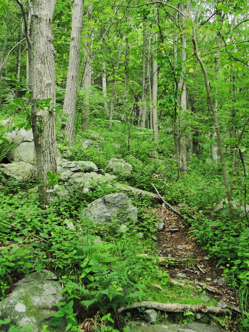
If there were summer boarding houses here, they have been completely removed from the scene, leaving only this new forest to assert itself.
Could be joke by the Department of the Interior, too, to make me think as I did!
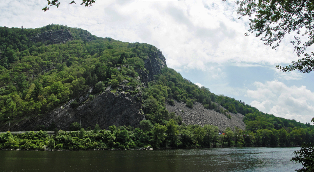
The Head of the Gap. I-80 is the smooth line a little way above the river.
"We were, as I could see, high on some embankment or shelf cut in the hill. Presently we turned into a square or open space which opened out at the foot of the hill, and there appeared a huge caravansary, The Kittatinny, with a fountain and basin in the foreground which imitate the colored waters of the Orient. Lackeys were there to take our bags..."
611 does rise onto a shelf after passing the Gap proper, and rises still to the Kittatinny -- Kittatinny Overlook, that is.
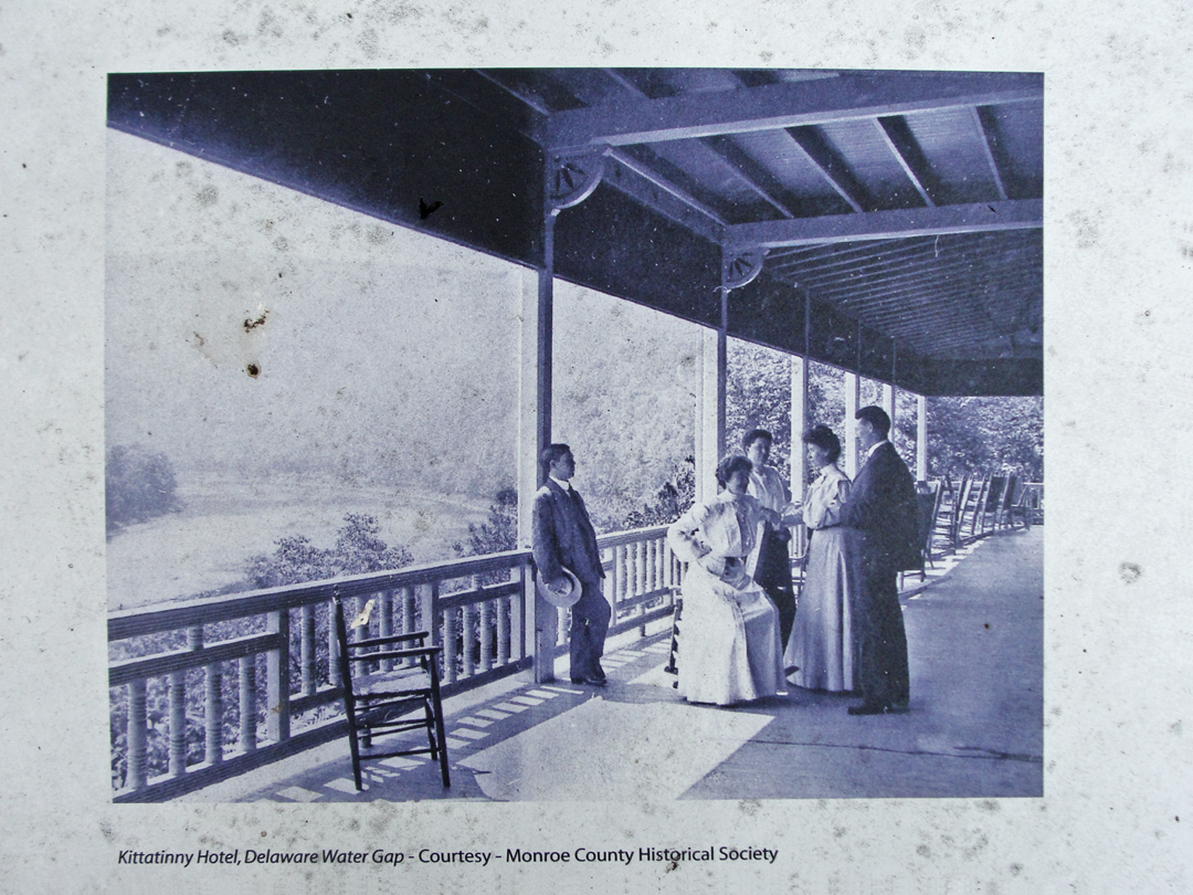
At left, the Kittatinny Hotel, or at least its porch and the view. Undated, but earlier than 1915.
Below, a photo of the hotel in 1909 (LOC). I should have known that it would have been pretty substantial of construction, but to actually see it perched there on the hillside -- well, let's just say I was surprised.
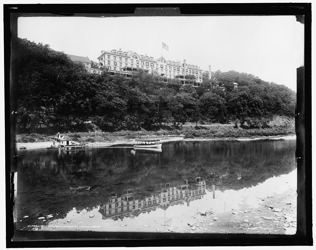
What's funny is that standing on the overlook the river seems much farther down hill than it looks here. The scale of the scene is hard to grasp, though -- the people in the boat are pretty small by comparison. "Huge caravansary" indeed!
In the photo, a short distance above the river bank is the horizontal line of the rail road bed, and just barely visible through the trees at left is the rail station.

The view from the overlook in 2015.
There may be some discrepancy in location, but not by much, I think. So with any other lodging that existed at the turn of the last Century, there is no trace of the hotel that I could see. The car park is not that big -- well maybe it's bigger than it looks -- and the hillside beyond the road is forested, with more of the same tumbled rock, a babbling brook, and a spur off the Appalachian Trail. Of that large "caravansary" there is nothing.

I can imagine, seeing the utter lack of a building, a crew working for the WPA or the CCC coming through here with steam shovels and spades, and obliterating all trace of habitation, from the wine cellar up, before planting saplings in the freshly turned earth.
According to an old Park Service publication, this turn-out is, indeed, where the hotel once stood. It burned down in 1931, but as it was failing anyway, partly due to the automobile, partly due to the Depression, there was never any attempt to rebuild here.
Past the overlook, 611 runs up a bit from here, then descends into the town of Delaware Water Gap.
"I wandered off into a region of lesser hotels and stores...American mountain resort gayety [sic]. American summer mountain life is so naive, so gauche, so early Victorian...yet with such a lilt running through it...The one street was full of idlers, summer cottagers, hotel guests, the natives -- promenading. All [the] maidens were so bent on making catches, apparently...decked out in all the fineries and fripperies of the American summer resort scene...Noses were powdered, lips faintly rouged, perhaps.
'Well, well,' I exclaimed, and bought me all the truly indicative postcards I could find."

On this day, the town was quiescent. No fineries or fripperies evident, though I would like to have seen such. Where the road bends through are the remaining, I assume, structures of that resort age, now purveying to "the natives," and such hikers as come through off the Trail.
Maybe half of a mile behind me as I took this photo of the Castle Inn is the Interstate, and a highway department yard at the foot of the street. With the installation of I-80, traffic and revenue were siphoned off to the nearest interchange, where are the gas stations and motor hotels common to those places.
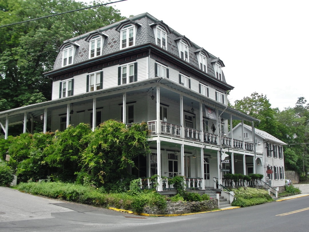
I do believe we have a match for one of Dreiser's "lesser hotels!"
Now the Deer Head Inn, and advertising rooms to let and a recording studio, it stands along PA 611 just down the hill from the Trail.
Compare this porch arrangement with the porch in the photo below:
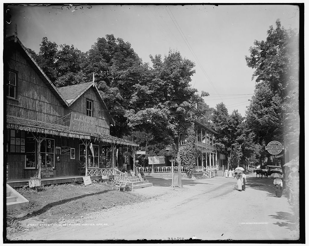
Titled as a "street view" taken some time between 1905-1915 (LOC).
I seems reasonable that's the same building standing just right of center in the middle distance.
Of Lamb's Curios there is nothing today.
If it had been later in the day, I might have inquired after a room at the Deer Head, but I had no need to linger, and it was early in the day yet. Sometime perhaps. So, minus any fripperies, or distraction of the like, I had a couple of coneys and a soda at the corner shop of the Castle Inn, which mostly sold ice cream to the passing hikers.
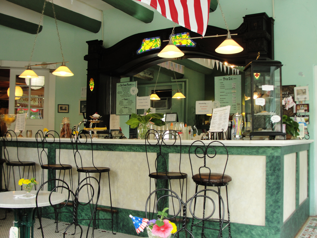
I'm sure the counter is considerably newer than 1906, but much else in this room spoke of some age. Whether dating to '06 I don't know, but probably before 1940. Good brownies!
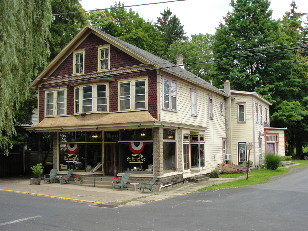
Across from the Castle Inn was "Bo Tangles" in this rather fetching older building.
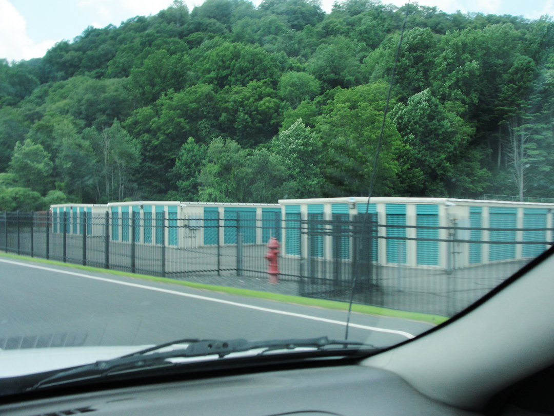
As I left, I passed this little complex, and a verse from a Jimmy Buffett song ran through my head:
"We had plenty of doctors / We had plenty of lawyers / We had people to make us things / We had people to sell us those things / Didn't have enough room for those things / We build lots of self storage / Calypso poet shortage..."
Yes, Jimmy Buffett. There was time when I could sing along to "Cheeseburger In Paradise," or "A Pirate Looks At 40," or "Boat Drinks," though it has been a very long span since. The sentiment expressed here, though, is one I think Dreiser would at least recognize, if not fully agree with.
"The run from the Water Gap to Factoryville was accomplished under varying conditions. The day promised to be fine...We were all in the best of spirits...Our way led first through a sting of small towns set in great hills or mountains -- Stroudsburg, Bartonsville, Tannersville, Swiftwater.

PA 611 climbing out of Delaware Water Gap toward Stroudsburg.
As we climbed and climbed out of the Water Gap, we felt a distinct change between the life of New Jersey and that of this hilly, almost mountainous land...We came upon long stretches of woodland...The air was much lighter here, almost feathery compared to that of the lowlands farther east. But the barns and houses and stock were so poor."
And so there was the list of towns: PA 611 would be my route for some distance.
Stroudsburg, described as a "stringy mountaintop town" catering to the tourist trade, is now a population center -- the largest municipality for many miles in any given direction. It was clearly large enough to remain viable, and with I-80 running right by has maintained its existence and even grown.
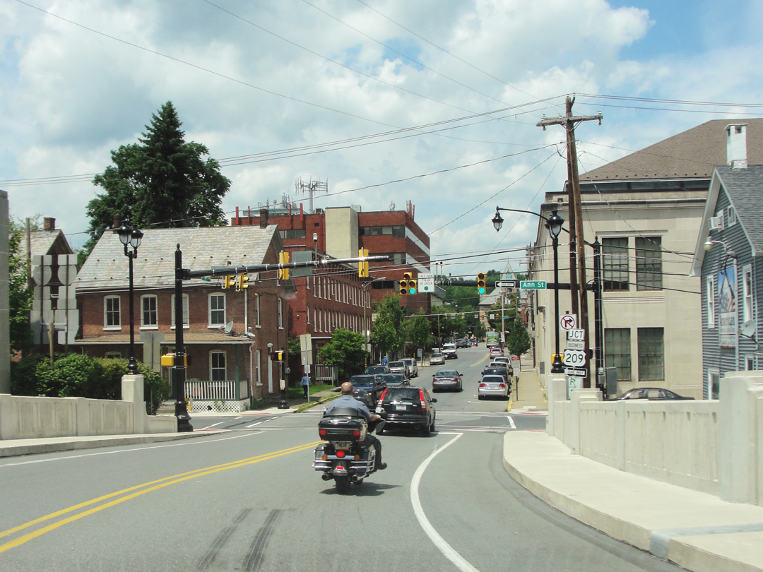
Entering Stroudsburg, where the highway followed along on Foxtown Hill Road, which seemed to be the Main here.

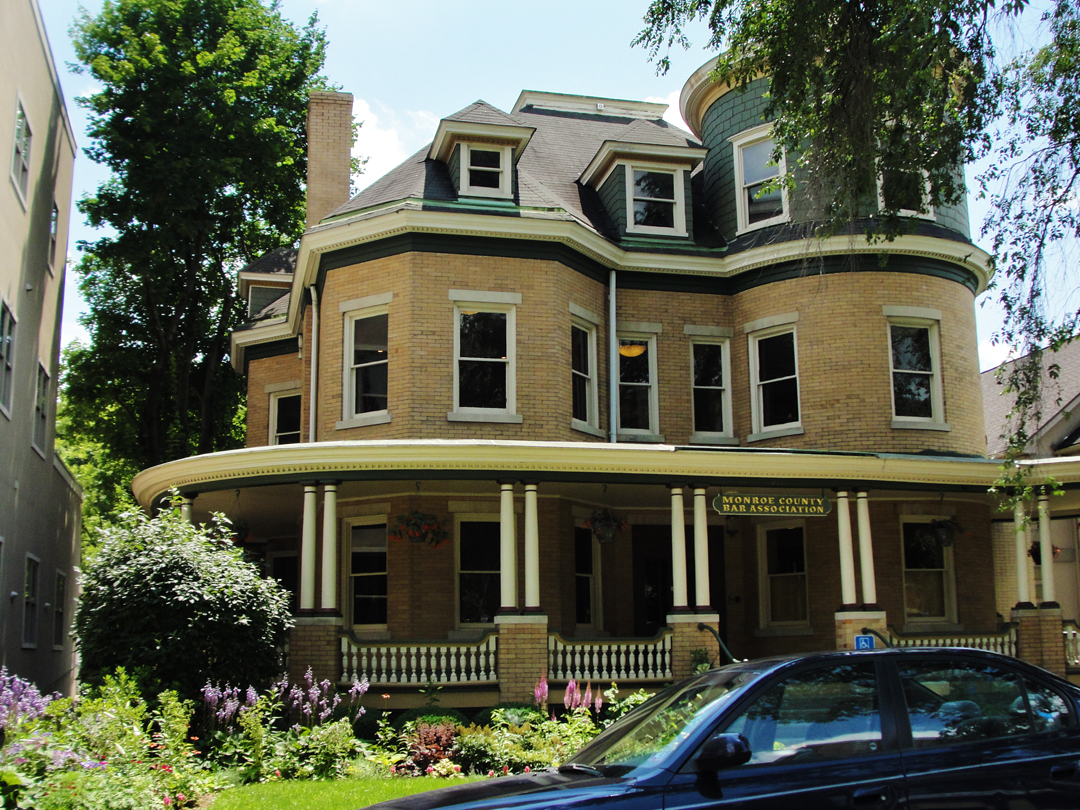
Stroudsburg, whether for its size generally or for its proximity to the Interstate, also has the Retail Area. The Retail Area is Zoned Commercial elevated to a "shopping destination." You know it all too well: acre upon acre of what had been marginalized town or farm field, leveled for the endless car park and bounded with the "brick-and-mortar" chain stores.
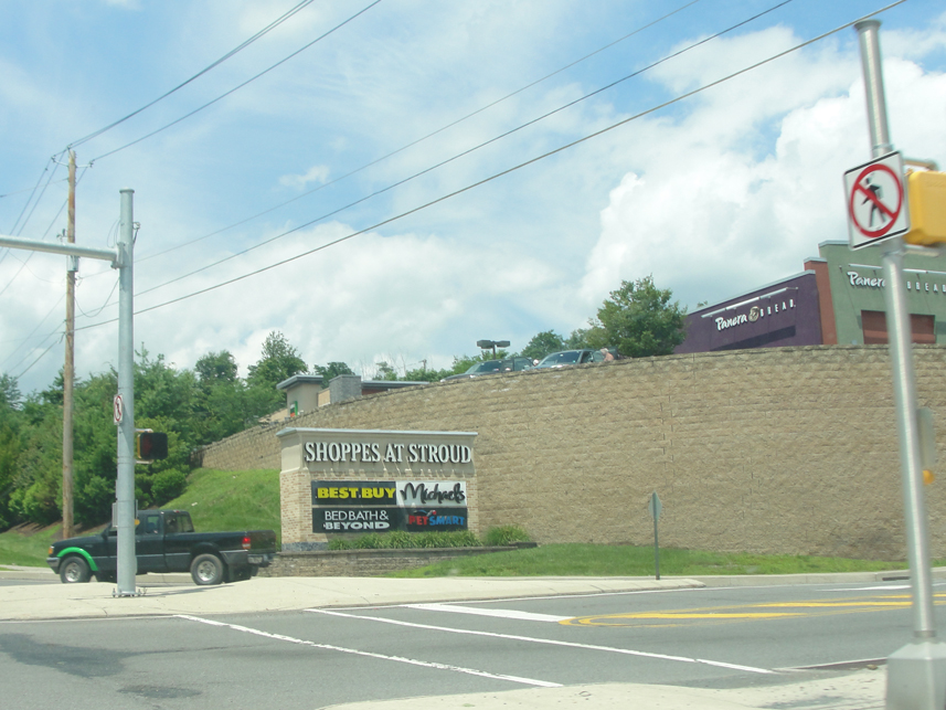
Really, if it was not stated "flat out" that this was "Shoppes at Stroud" this could be damn near anywhere. A bit of informed observation might pick out that tall, curved retaining wall, and the deciduous trees, and conclude that it was likely in the vicinity of the hillier regions of the Eastern U.S. -- but it could be in Georgia, the Carolinas, Pennsylvania, Virginia -- where contractors favor this sort of construction. If I had shot the plaza from up that driveway, I imagine that locating it on a map would be more difficult.
Compare that to the lesser Zoned Commercial farther out:
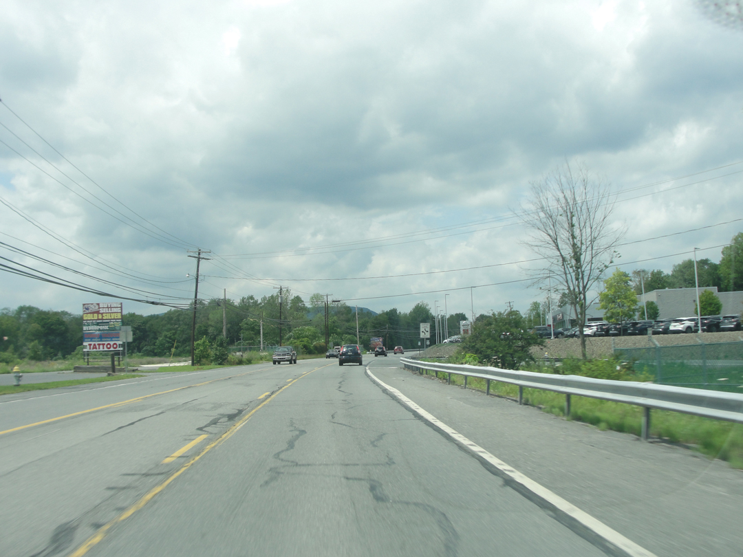
I've noticed that car dealers tend toward these kinds of locations. Probably the land is available for a song, so there's plenty of room for "our HUGE inventory of NEW and PRE-OWNED cars."
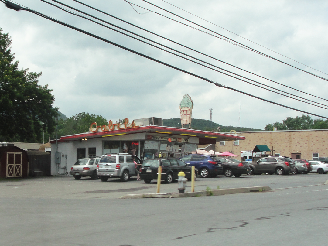
In Tannersville, I passed this ice cream stand, which enterprise I can appreciate. I really do like to see people standing outside the window, ready to make an order on a warm or hot day. Nostalgic I guess, but -- well why not? If that's what gets people together for a little while then let's go get a waffle cone!
Some of the traffic here this day was probably due to the installation of a fair on the county grounds just down the road.
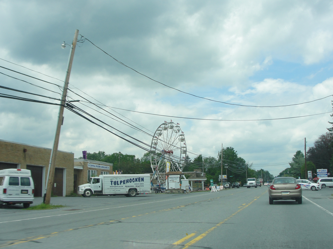
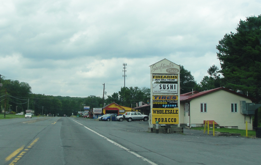
Swiftwater brought this strip mall of melting pot American retail, and I didn't see much else.
At least, not much else until I came upon SanofiPasteur:
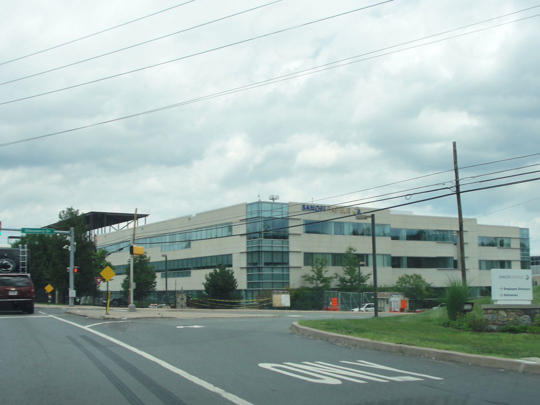
Headquartered in Lyon, France, SanofiPasteur has been in business since 1907, developing vaccines. The world-wide company has its U.S. operation in Swiftwater, where it employees 3,000 people. That's no small-change in semi-rural North-East Pennsylvania.
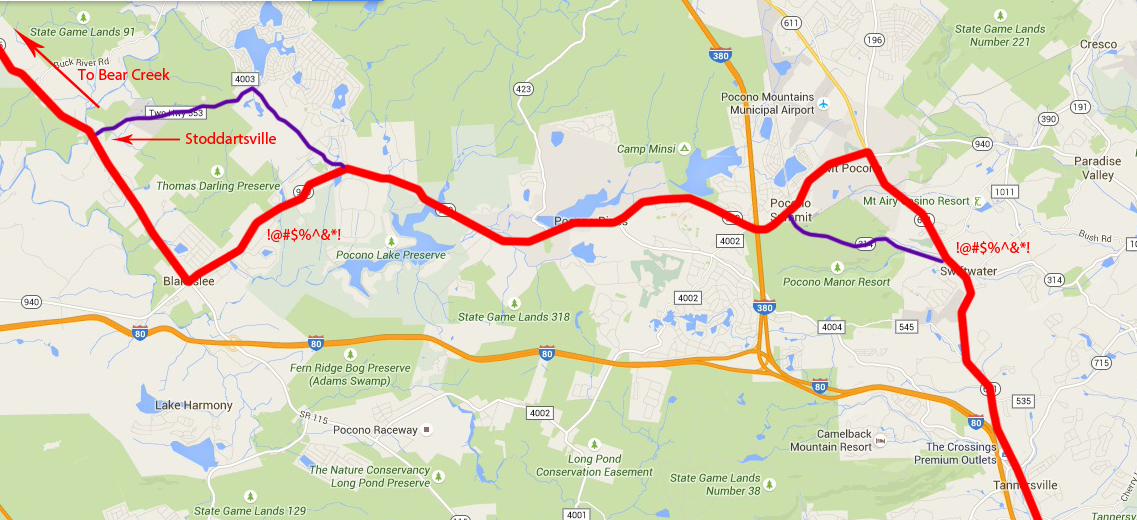
The next listed town after Swiftwater was Stoddartsville. Mt Pocono, though, was not, even while PA 611 winds to it. Looking at my map, I believed that I could bend my route around, via main and secondary roads, and skip Mt Pocono, but then the orange cones interfered:
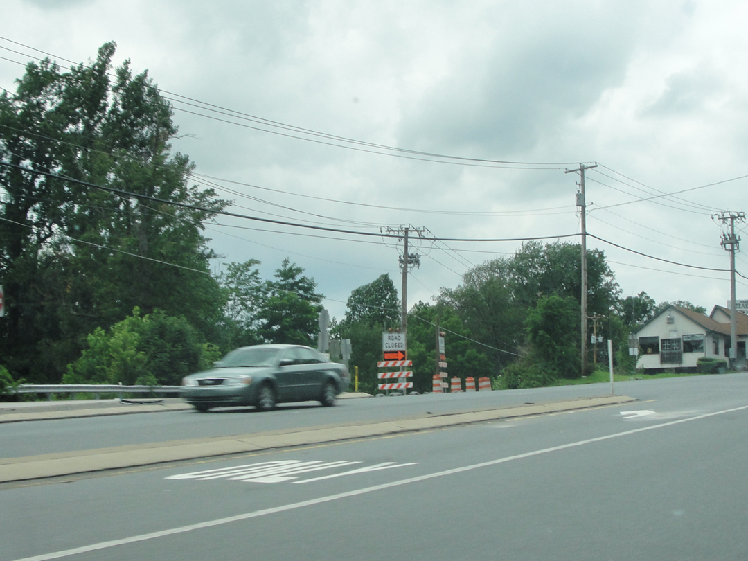
PA 314 was closed!
That way would have intersected with PA 940, on to which I would turn left; PA 940 also intersected 611, so my left simply occurred at a different place. Still, it's the idea!
I won't bore you with the photograph of the 940 and 611 intersection. You can well imagine it, I'm sure.
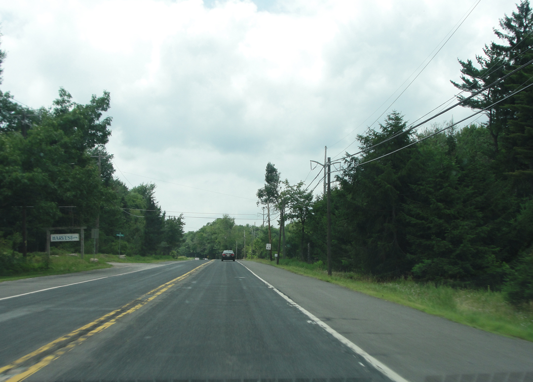
PA 940 (at right) would be my route for some miles before I looked for my next turning. I had in mind to make a right angle onto Locust Ridge Road, follow it for a mile or two, and a left to Caughbaugh, which would hit Stoddartsville spot on at PA 115. 115 would then be the road to Bear Creek, the next noted village, and then on to Wilkes-Barre after.
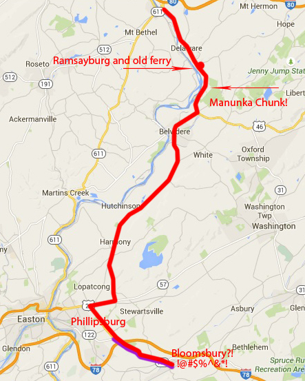
That was the plan, anyhow. In the map below, the preferred route is marked in purple, with the actual route in red as prior. Looking at this now, I still think my "plan" followed better the Pathfinder's drive.
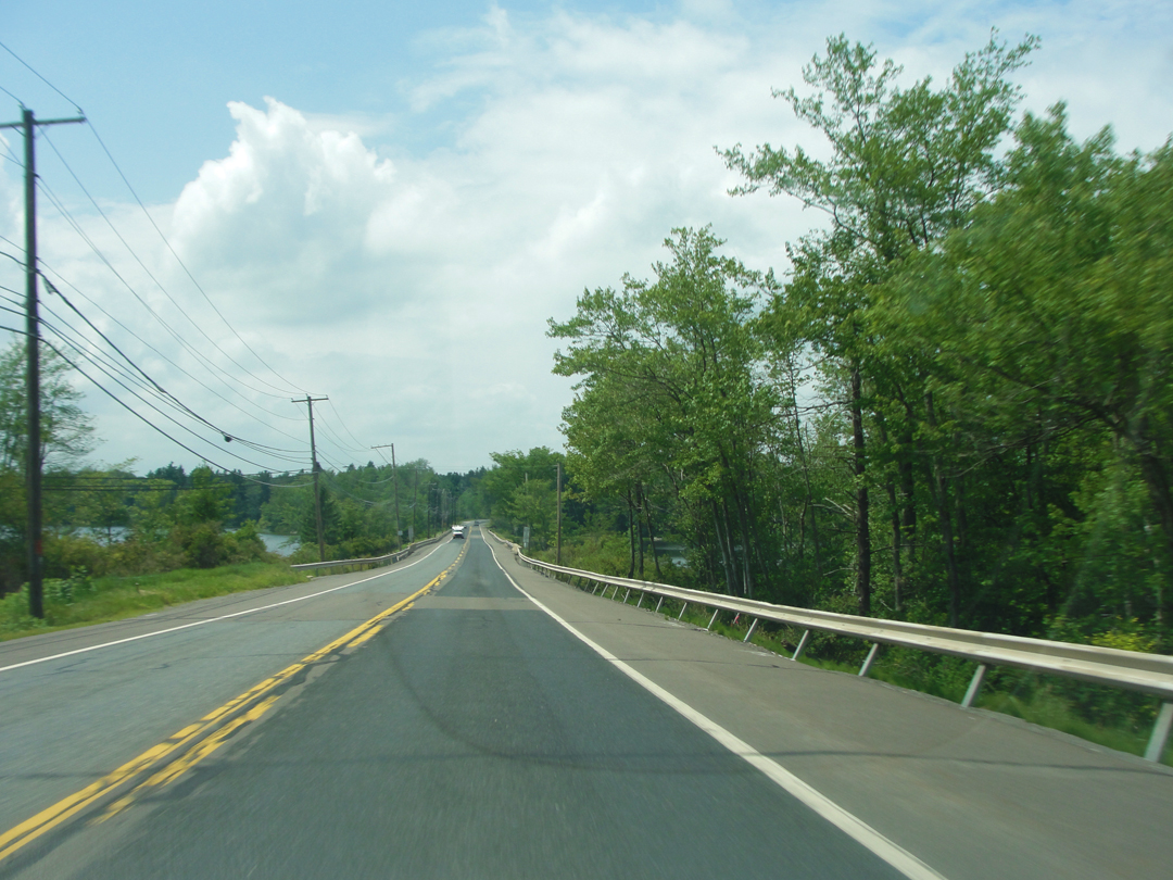
"A little while later we ran on to a wonderful tableland, high up in the mountains, where were a lake, a golf course, a perfect macadam road, and interesting inns and cottages..."
The description fits pretty well through here; it is pretty, though I was a bit distracted looking for my turn.
Dreiser goes on to describe their being astonished at the sight of a large group of women, younger and older, walking alongside hay ride-wagons, wearing "short skirts" and "a sort of gymnasium costume" which showed rather more of those so attired than the men might have expected to see, even in a summer resort area.
I saw no one afoot. But then, such is the modern highway, even a state road. People don't tend to linger beyond certain parameters, and a road like this, as above, is not within them.
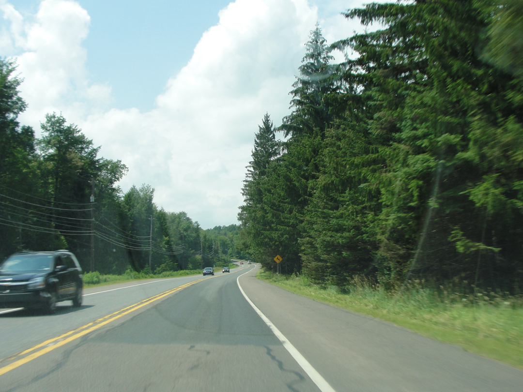
That stretch of road (above) is a little shy of where I wanted to turn off. But I think the standard for street or road signs must be based on the suburban model. Small and green with white lettering, they are typical in so many places, and easily enough read when driving at 25 MPH or pulling up to a STOP sign. At 60, with a background of trees, they are rather more difficult to perceive -- provided they are present to begin with. I don't know if it was hard to see or absent, but I could not discover Locust Ridge Road, and remained on PA 904 (at left).
Thinking I had missed the turn, I sighed and waited until there was a suitable place to pull off. That happened to be a Dunkin' Donuts in the town of Blakeslee.
The upside to this stop was that I could see PA 115 just ahead; and of course, there were donuts (because donuts!).
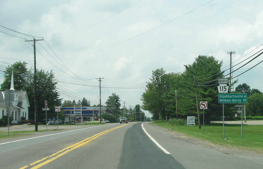
Taking up 115, I saw that Stoddartsville was but 4 miles away, and Wilkes-Barre just 19. Honestly, Stoddartsville came and went without my noticing.
Somewhere along through here, as Dreiser and Booth were discussing the relative undress of women in summer resorts and whether the future of sex in America was going to the better or worse, it began to rain.
"A few miles back, after some cogitation at a crossroads, we had decided to take the road to Wilkes-Barre...for a time it looked as though we had made a serious mistake...the fine macadam road ended and we took to a poorer and finally a rutty dirt road. The grades became steeper and steeper -- more difficult to ascend and descne. In a valley near a bounding stream -- Stoddartsville the place was -- we had another blowout...and this time in the driving rain."
Blowouts were common to auto travel, the Pathfinder not excepting. Today, of course, the conjunction of the works of so many engineers has improved the car and the road, has averted so much that was difficult, that we hardly notice the machine or the road it runs over. Hills are cut or shaved, and the valleys below filled, such that the up hill or down dale might be missed when taken in an auto with more horsepower "under the hood" than a score of earlier vehicles taken together.
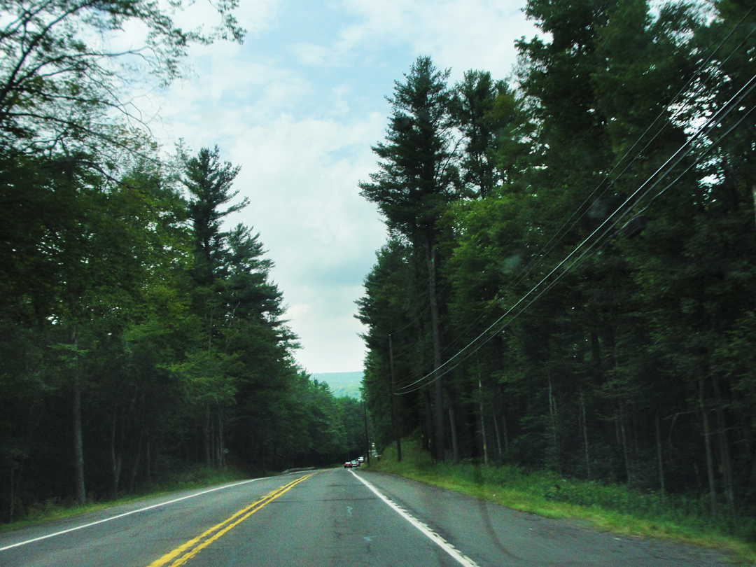
PA 115, heading to Bear Creek. Still hilly, but who really notices these days? The far side of the Susquehanna River Valley can just be seen in the distance between the trees.
"When [the tire] was repaired, and the chains put on the wheels we proceeded...past miles of apparently tenantless woods...Even with the chains the machine was skidding and our able driver kept his eye fixed on the road...We could see that it was a wonderful country that we were traversing...but a sopping rain makes one's spirits droop. Franklin sat in his corner and I in mine with scarcely a word...Franklin began to wonder if we were not making a mistake trying to cut straight across the poorly equipped state of Pennsylvania...I felt like a criminal trying to wreck a three thousand dollar car."
Bear Creek was better for Dreiser & Co, as the rain let off, and they were informed that Wilkes-Barre was only another 15 miles. The town was another of the summer dweller-variety, apparently. As I went through the now-named Bear Creek Village, I saw that it might have moved -- that is, the houses were set back off the road, with screens of trees between. There wasn't much else that I noted, save for what I think was a convenience store. On the map, the village is surrounded by conservation lands; at a guess it's to keep some of those woods "tenantless."
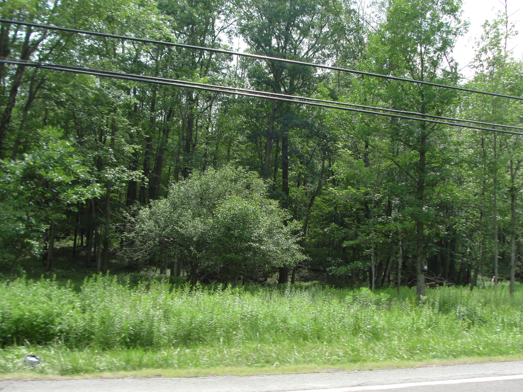

Above, at left, the woods near Bear Creek. At right, a typical village arrangement?
There is a road that I think now might have been the more likely taken by the Pathfinder -- Laurel Run Road -- that veers away from PA 115 in Bear Creek, and which joins up directly with a street leading into the old center of Wilkes-Barre. But my way stayed on 115 for the time being.
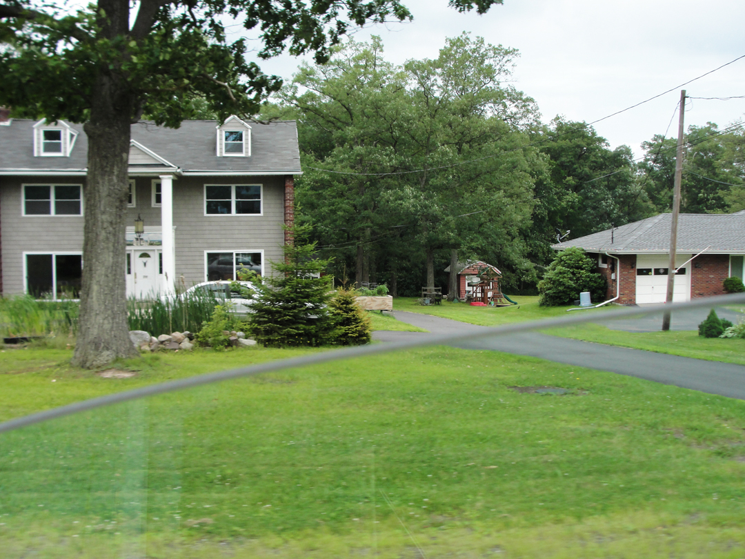
The passage of time, architecturally speaking. I find it interesting to mark the changes in the "Ideal American Home." In places, you can see the changes like rings on a tree, with the older town centers surrounded by increasing younger houses.
In other places, as here on the edge of Bear Creek, you might guess that larger plots of land were further sub-divided by later generations of owners, until the "Classic Ranch" sits side-by-side with the -- box? I don't know what decade that newer house was built in; the 1980s? I can imagine, though, the realtor touting it as "a great place for a growing family!"
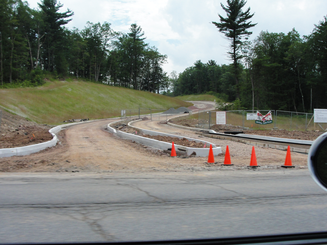

Where "civilization" reasserts itself: the Pennsylvania Turnpike Extension passes by here, as does I-81, and as the uplands near their drop to the river valley, the commercial becomes more evident, what with the interchanges and all.
Getting closer to the Susquehanna, Dreiser & Co found their environment further changing:
"The roads were better; various railroads running in great cuts came into view. We met miners with bright tin buckets their faces as black as coal...foreign women and poorly clad children carrying buckets to or from the mines. Turing a corner of the road we came suddenly upon of the most entrancing things in the way of a view that I have ever seen. There are city scapes that seem some to mourn and some to sing. This was one that sang. It reminded me of the pen and ink work of Rops or Vierge or Whistler, the paintings of Turner and Moran. Low hanging clouds, yellowish or black...a splendid filigree of smoke...Beds of goldenglow ornamented and relieved a group of tasteless low red houses...which obviously sheltered the ...miners and their wives...Immense mounds of coal and slag with glimpses of distant breakers perfected the suggestion of an individual and characterful working world...
'Isn't Wilkes-Barre wonderful' I said to Franklin. 'Aren't you glad now you've come?'
'I am coming down here to paint soon,' he said. 'This is the most wonderful thing I have seen in in a long while.' "
As in the Western reach of New Jersey, Dreiser waxes Romantic. Romantic in its historical sense, that is, and I'm sure the reference to Whistler and Turner were deliberate in such wise.
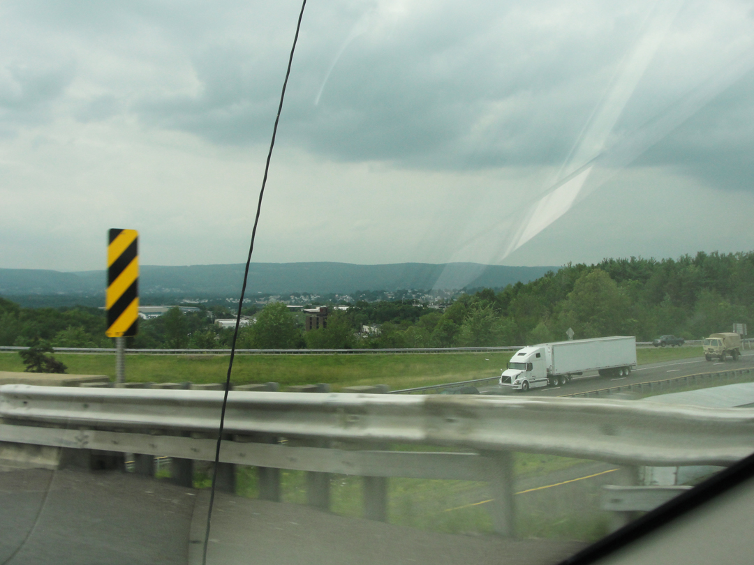
Crossing I-81, seen above, I can nearly relate. The view across the valley, the rushing of the traffic, the city neighborhoods partly hidden in their trees, all pointing to things that could take on almost any form. The road not traveled-on, leading to places yet unseen; the city that might harbor delight or terror -- who can say from here?
All those possibilities, and myriad opportunities to make of it what I will or allow it to make me. A bit of both perhaps? It's been said that in moving to a new city we soon run out of the novelty and settle back into what-ever "baggage" we brought with us; that regardless of location, we find our routines to take comfort in. And yet! That in so moving we may open ourselves up to the new, that the corners only lately turned might lead to places that inspire us to grow beyond what we were!
Then, I descend from the heights, only to find what I've found before. Talk about the routine and the baggage:
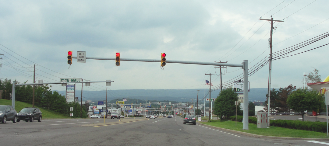
I find it hard to wax Romantic when faced with this. There is no exaltation, no terror. Perhaps Mr. Turner could find the sublime is this landscape; I can't. Anything sublime in my framing of this view is purely accidental.
And into Wilkes-Barre. I had no idea where to go, really, and so proceeded to simply "loop" about.
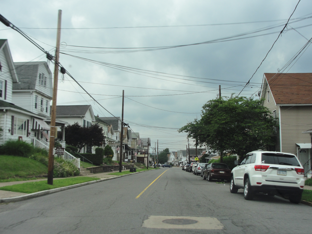
At the risk of being unfair to the other neighborhoods I drove through, this one will substitute for them all.
It is what I have lately come to think of as typically "Pennsylvanian." There is a kind of construction to the houses and their density that is like this from here to the "Steel Valley" of Pittsburgh. Even on to Steubenville, Ohio. Earlier 20th Century working and middle class houses (and mostly replacing the houses that Dreiser would have recognized from the late 19th) sheltering the union men who toiled in the mills and mines, or worked for the Pennsylvania Rail Road.
Anyway; waxing Romantic again?
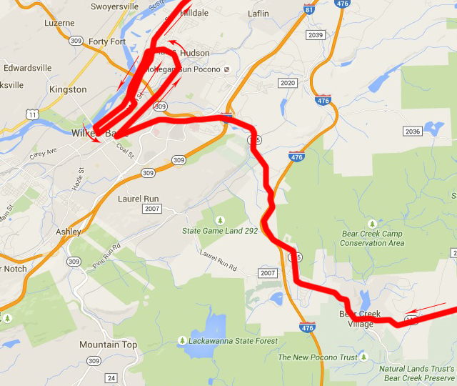
Down from the hills, with an approximation of the "loop" around Wilkes-Barre.
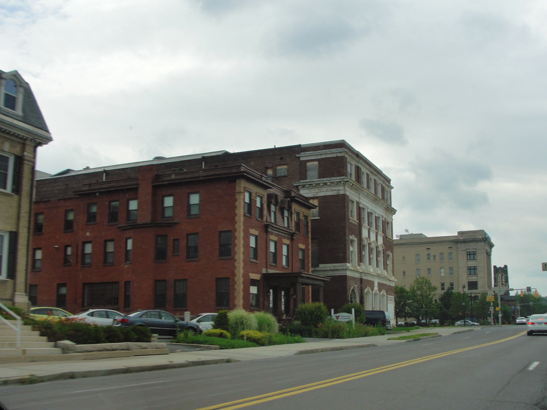
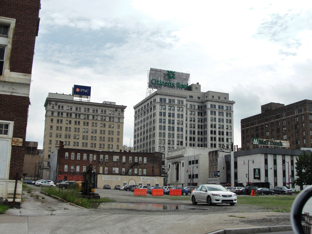

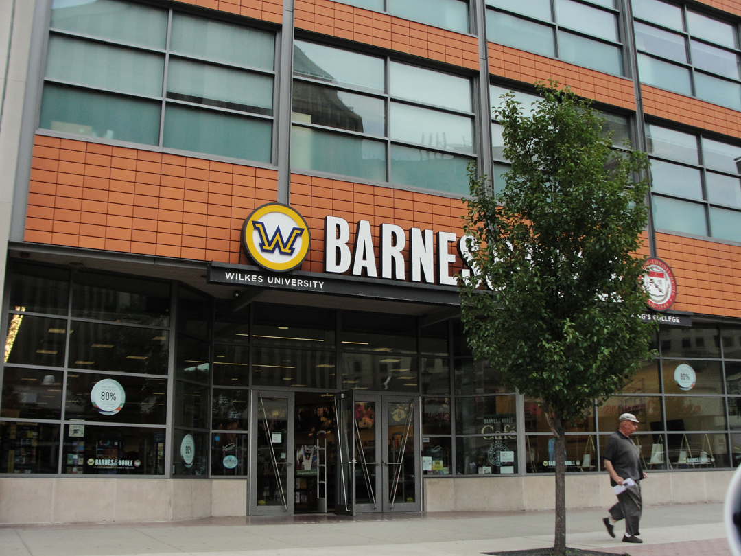
I finally found my way back to the river, and into the city's center-ish area.
"My own interest in Wilkes-Barre and this entire region indeed dated from the great anthracite coal strike in 1902, in my estimation one of the fiercest and best battles between labor and capital ever seen in America...the complaints of the public against the rising price of coal, the rumors of how the Morgans and the Vanderbilts had secured control of all these coal lands...The sword fish were among the blue fish...the sharks were after the sword fish. Posterity will long remember this time. It cannot help it. A new land was in the throes of construction, a strange race of men with finance for their weapon were fighting as desperately as ever men fought with sword or cannon. Individual liberty among the masses was being proved the thin dream it has always been."
The United Mine Workers went out for 6 months, after yet another announced cut in their already low pay per ton; a backlash against the "Coal Barons" that caught Dreiser's attention as an artist against the Capitalist Class. And as soon as his digression into the question of social equity begins, with no segue Dreiser leaves it to return to his observations of the city as he stood in it.
Over a meal, the travelers learned that beyond Wilkes-Barre, travel would be difficult at best. The view of their waiter (a motorcyclist) was that the roads were simply bad: "They were all dirt or rubble and full of ruts." This opinion was seconded by a local merchant (described as a Ford owner) who told them that "There were no large towns and no good roads west." They should, rather, continue by the Northern route: to Scranton, Binghamton, and thence to Buffalo. From there, the roads were good along the Lake Erie shoreline. This was the route Dreiser and Booth had contemplated at first before electing to attempt a straight West drive. Now they were back to that original: "It seemed the only thing to do."
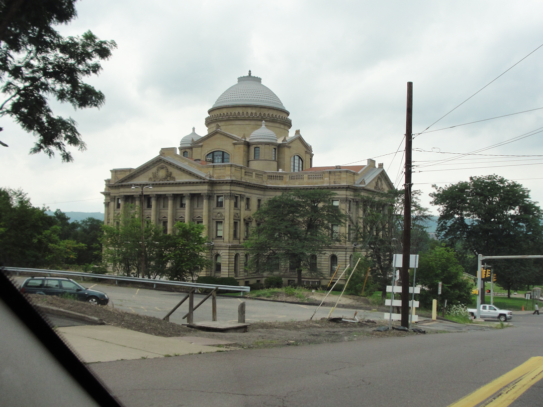
The Luzerne County Courthouse, and again it strikes me as being "Pennsylvanian:" I think it's the onion-type domes atop the otherwise Classically inspired body of the structure. Note the construction warning sign behind the power pole: there are orange cones about!
From here, I moved on toward Scranton.
The courthouse stands between the Susquehanna and River Street, which runs to the North-East more-or-less beside the river, through what had been working-man's neighborhoods. Dreiser describes the houses and tenements as cheap and done in "yellow and drab paints," a kind of uniform for the poverty-stricken residence. River Street, or its hundred year-old compliment was their road, too, passing the miner's "hives," jeered as "New York bums" by groups of boys, and watching as a run-away horse-and-wagon careened by them to crash into a tree.
Leaving this area, they paused as Speed lit the headlamps, and Booth sketched the scene:

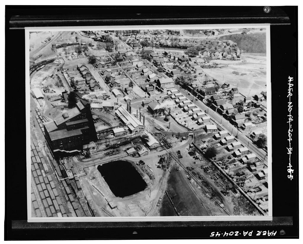
The Huber Coal Breaker, at 101 South Main, circa 1930 (LOC).
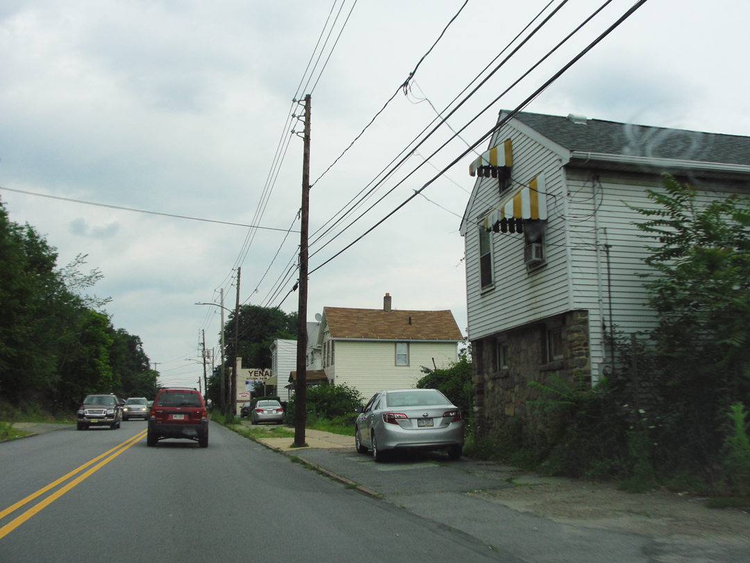
River Street in 2015 had mixed neighborhoods, where, as was usual, the "hives" and tenements have been replaced by later houses or small retail shops.
\
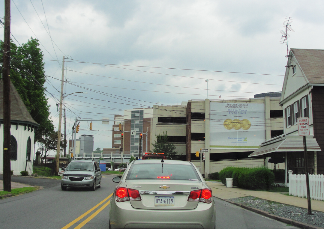
And the Wilkes-Barre General Hospital, sprawled across quite a few acres.
Like the car dealerships on the old highways, the hospital planners went looking for land on-the-cheap? I'd say. Given its current location, the city probably grew out to meet it after its initial foundation was laid.
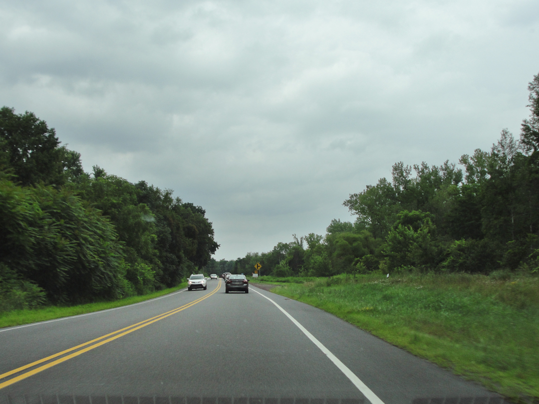
After running under the PA 309 overpass, River Street enters a stretch that is almost park-like in places. The line of the road is off the line of the river here by some distance as the Susquehanna bows North and West; in between may have been the site of the coal breakers when Booth made his sketch. If this was the place, the remains of those breakers was hidden by the screen of trees to the left of the street.
To the right, other streets branch off, and run up-hill toward the newer neighborhoods.
River Street here has become River Road.
Entering Port Griffith, it changes names again, to Main Street, and is Main again in Pittston. With the name, the landscape becomes "Pennsylvania" urban again.
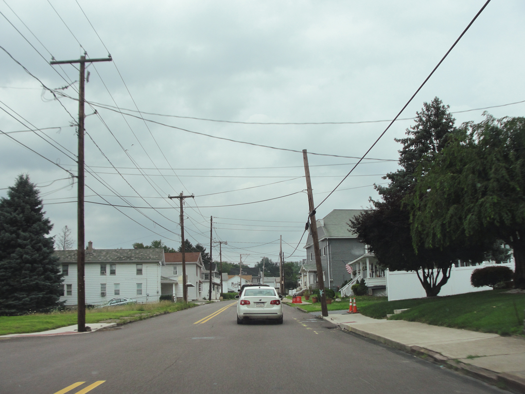
I wonder now if I think of this as "Pennsylvanian" because of the overcast sky. Someone told me, years back, that Pittsburgh had a notable number of winter days that were clouded-over like this because of its proximity to the Great Lakes.
Not subject to "lake effect" snow so much, but to "lake effect" sky.
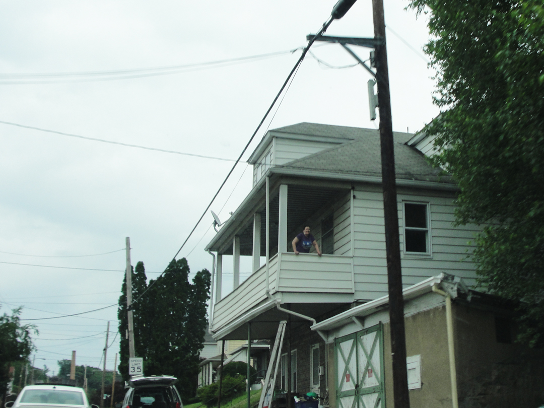
I wonder, too, if I showed these images to a Pittsburgher, if they would believe it was in the "Iron City" somewhere.
I might spend some time trying to figure where these were taken if I didn't know better!
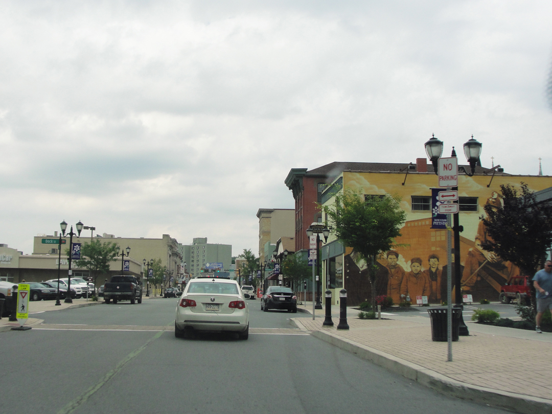
Getting into Pittston's center, I saw someone had splashed a mural across a now-exposed building face: the old miners and the Coal Barons' structures. It's visible between the street light-pole and the clumpy little tree to the right, below. Is this the posterity that Dreiser wrote of, concerning 1902?
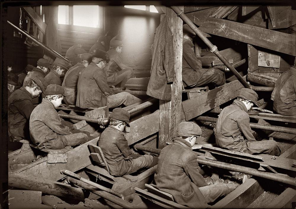
"Breaker boys," who sat atop runs of ore and picked out the lumps that were not coal. By hand. South Pittston, circa 1911 (Shorpy).
Does Posterity recall them much? Enough to get a mural, I guess.
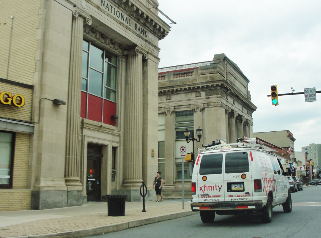
Then came the pair of old bank buildings. I smiled to think of the bank presidents glowering across the street at each other, looking out from behind massive desks,in fierce competition for more deposits!
I think, now, the Pathfinder stayed on the Main Street of the next several towns to the West of the Lackawanna River, eventually reaching West Scranton, for Dreiser states that Scranton laid to their East. Ah, well -- I turned right and took up US 11, which bent the other way to reach into Scranton from the South.
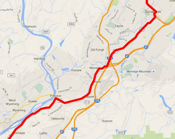
Alongside the Susquehanna, and through Scranton via US 11.
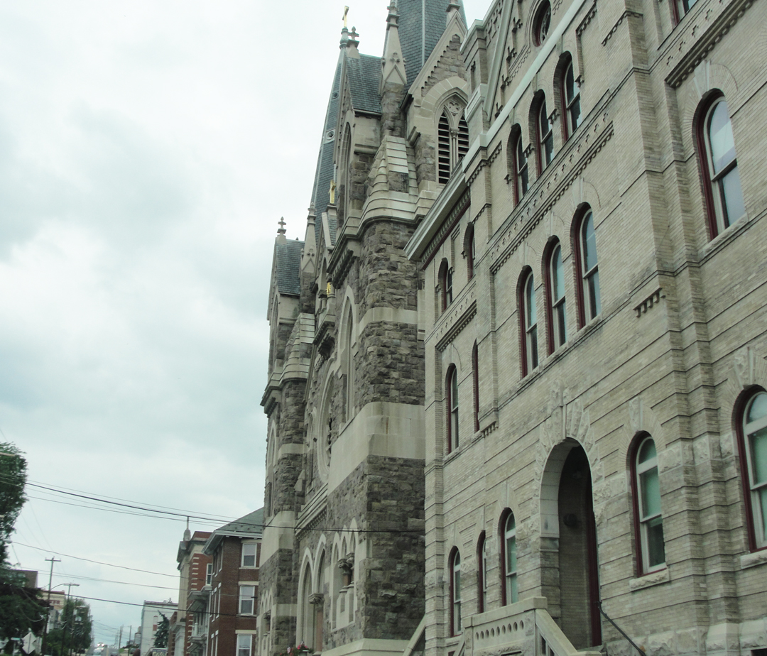
Just after my turn onto 11, I managed to get this shot of an old church and its -- attendant building? Another selection from the "they don't build 'em like that anymore" files.
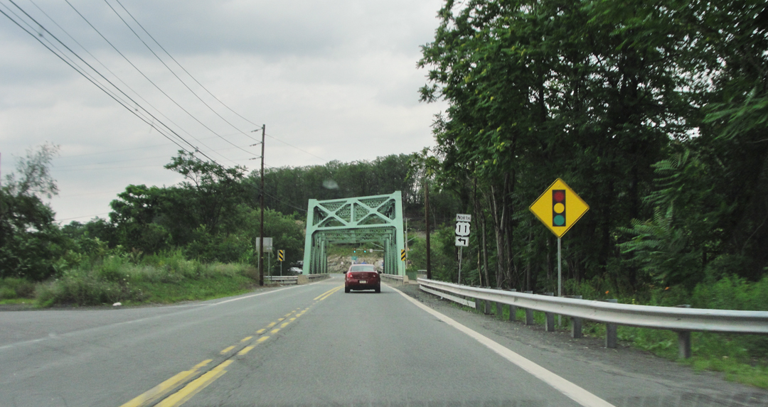
Besides driving by the now-usual mix of 20th Century houses and buildings, and the Zoned Commercial, some of the land about these little cities looked as though it had been developed, but later ignored, allowing Nature to re-claim it somewhat.
I kept thinking that Scranton would be just over the next rise, or just around the next corner. Nope; it was farther than I thought.
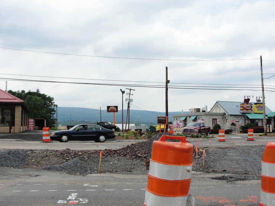
In Moosic, this emblematic image of the trip: distant hills, fast food, and orange cones.
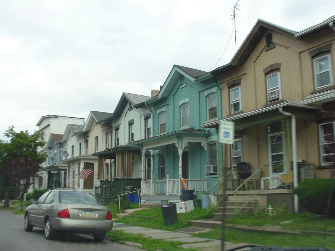
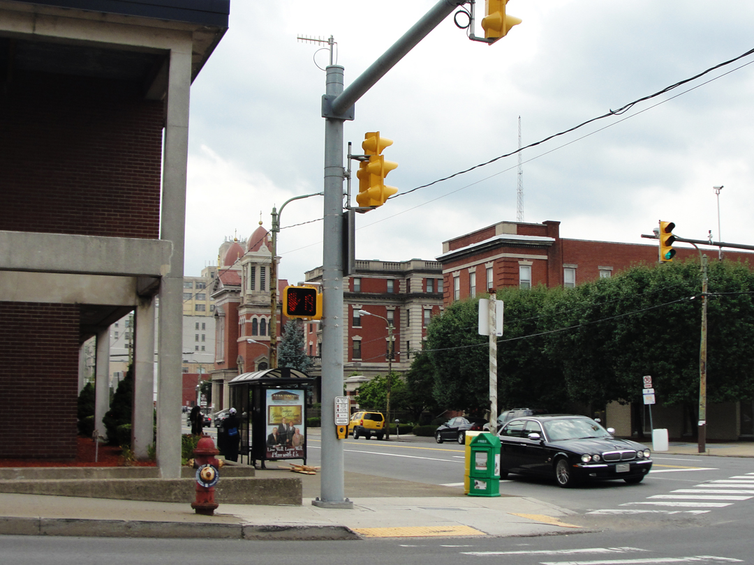
Reaching the Southern-most wards of Scranton, I saw these row houses. Like-as-not, Dreiser & Co saw much the same.
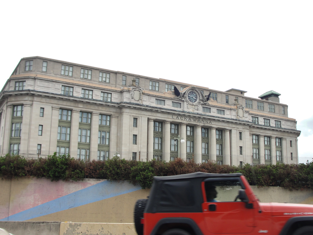
I drove by the old Lackawanna Station in '14 when I visited the near-by Steamtown National Historic Site (story here). I can appreciate that some of these "Golden Age of Rail" structures are still being used; I get a bit of nostalgia to see them, missing a train travel I never really knew. Some stations, like the Union in Washington D.C., or Vanderbilt's Grand Central Terminal in New York City, have been restored and still serve as the embarkation points for thousands daily. Others have been adapted as high-end residences or hotels (as this one has) that such as me can't afford to enter. Sigh. Someday! Oh! that will be a grand day, you bet.
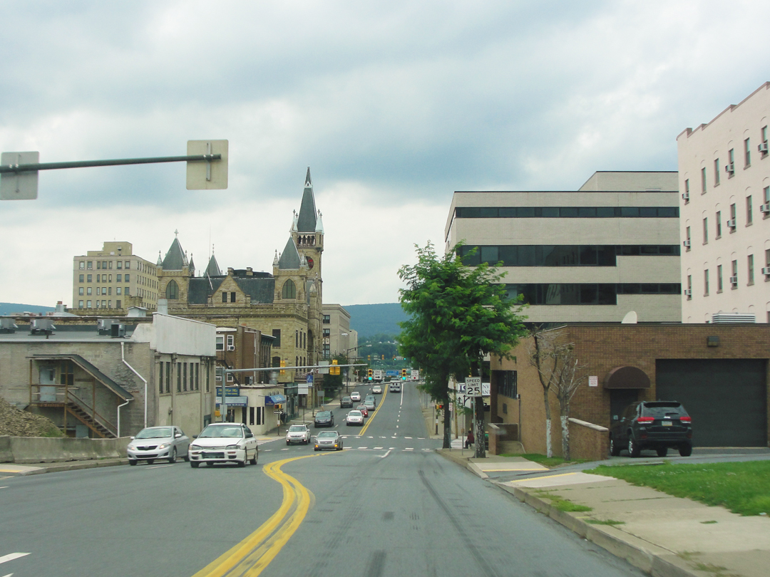
Dreiser was not enamored of Scranton; after driving in despite the added time for the detour, he compared it rather unfavorably to the recently departed Wilkes-Barre.
Entering past long streets with the usual trappings of the working-but-with-aspirations class, he wrote of this place being "humdrum," yet admitting to a desire to live among them.
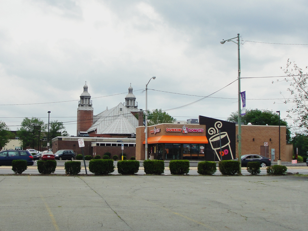
"It was so customary -- an American city...and American cities of the hundred thousand class are so much alike. They all have the long principal street...the one or two skyscrapers...dry goods store...the new post office building...Sometimes these structures are very charming in themselves...but most American cities of this class have no more imagination than an owl."
Yet today there are many who would, like in Waterloo Village, preserve those charming if unimaginative buildings, since so many are in danger of disappearing -- if they have not already been obliterated. Replaced, instead, with the architecture of the balance-book type: straight lines, glass and concrete and steel, and all so alike as to be as undifferentiated one city to another just like the brick-and-mortar retailers of the Retail Areas. Sadly, though, that cost savings runs true with the idea that many of the old, charming examples were only possible because the men who built them were likely under-paid. Alas --
Will future generations wish to keep the not-so-charming box of an office building? The square bank, plain of decoration? Some may be preserved, I hope, as examples, though I am not optimistic as to the future of architecture.
Theatre major moment: in Larry Shue's The Nerd, protagonist Willum Cubbert is an architect (in Terre Haute!) who complains at the top of the show that his client keeps asking for the details to be reduced to save money. I applauded the sentiment; still do.
Dreiser goes on to say, however, that it is in cities like Scranton that the immigrant becomes American: "They are completely undone by our perfections." There was a question, even then, amongst some intellectuals, of whether the immigrants would become assimilated, or become bomb-throwing anarchists.
"What becomes of all the young Poles, Czechs, Croatians, Serbians, etc., who are going to destroy us? I'll tell you. They gather on the street corners when their parents will permit them, arrayed in yellow or red ties, yellow shoes, dinky fedoras...and talk about 'when I was out to Dreamland...' or make some such observation as 'Say you should have seen the beaut that cut across here...' That's all the menace there is to the foreign invasion...Instead of [the] bogies of the sociologist, they would rather...smoke cigarettes...and yearn over the girls who know exactly how to handle them...They are simple, gauche, de jeune, 'the limit.' "
For better or worse!
Following some conversation concerning the conditions of the roads leading to Binghamton, the party pressed on. They paused at an amusement park North of the city then tooled off into the night.
Dalton and Factoryville were the next towns along the route, both of which still exist, and along US 11, as I had seen. I was curious to see if Factoryville had anything to recommend the name.
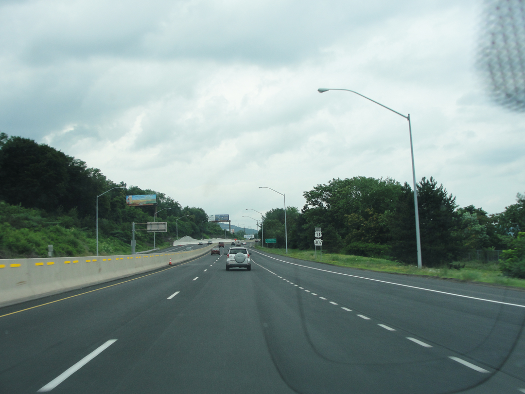
Bidding "goodbye" to Scranton came with a stretch of 4-lane leading to the North and West.
I saw no amusement parks, unfortunately.
"...up hill and down dale, and now and then we seemed to be skirting the Susquehanna. At other times we seemed to be off in side hills where there were no towns of any size."

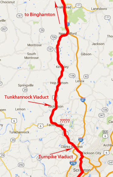
No amusement parks, but a really great highway bridge at Clarks Summit, where the Pennsy Turnpike Extension ends its North-bound run up from Philadelphia.
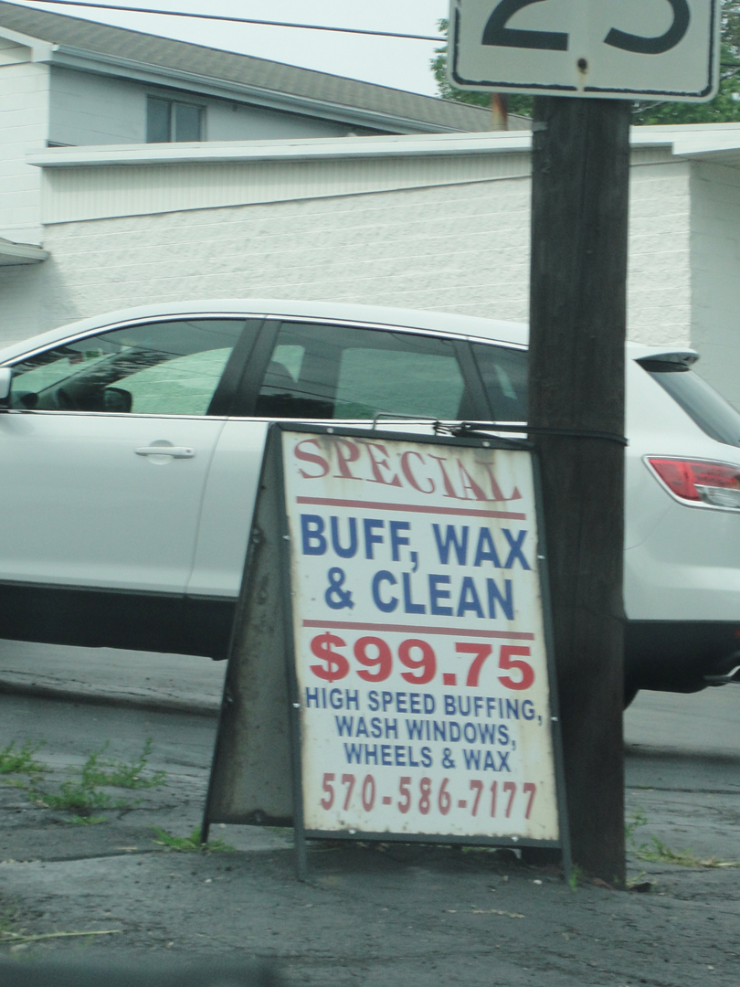
And, kinda' right under the Turnpike, I saw this sign. Call it prurience on my part, but I had to read the bit about "windows" and "wheels" before I realized that what was being offered was a car wash, not -- oh, never mind.
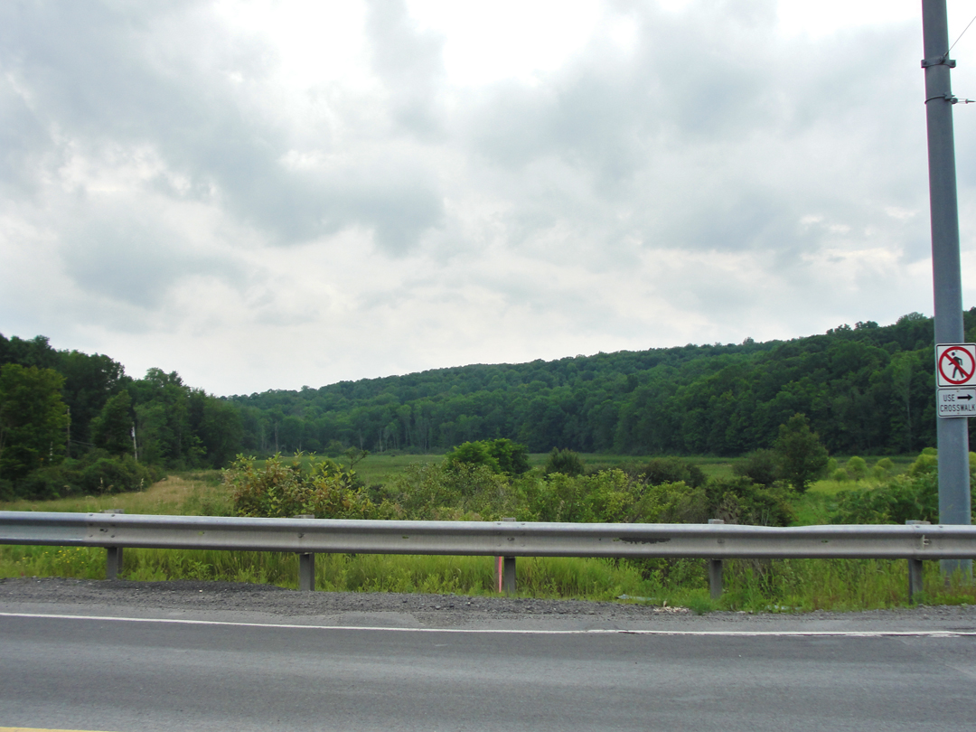

Of course there's road construction! What you expect? Some pretty countryside, though. If you ignore the guard rails, it could be nearly a classic Pastoral scene.
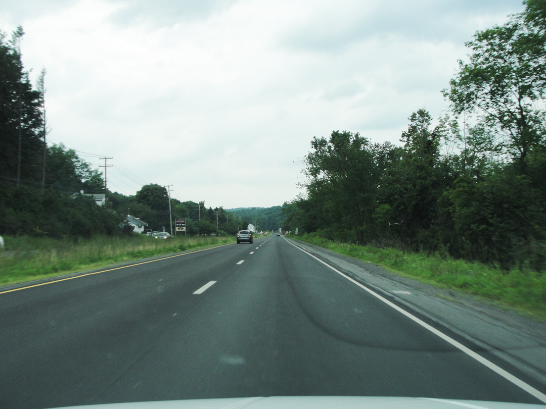
Factoryville?
Somewhere up here is Factoryville; maybe I shouldn't have been surprised that the town was still on the map. Things have a strange way of sticking around.
As with Manunka Chunk, though I was looking for a sign that I didn't see.
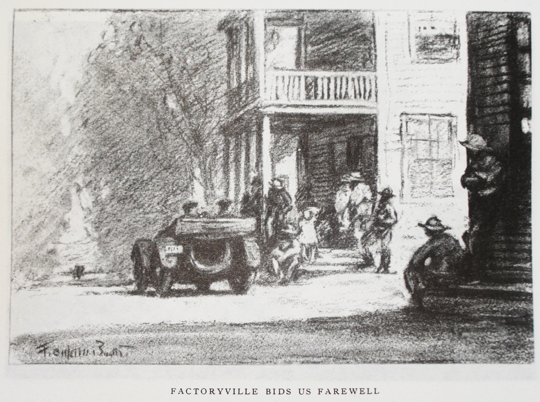
Dreiser & Co got to Factoryville around Midnight, and got a room to sleep in for the rest of the night, leaving out the following morning for points North.
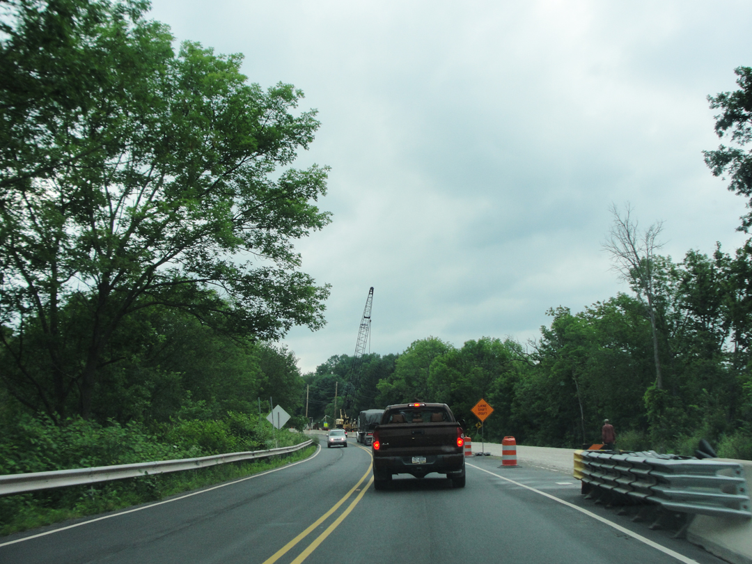
Factoryville?
Actually, this is probably right at Factoryville; US 11 is today a few score yards away from the street that the Pathfinder was on, I think. Improving the passage of traffic, I'm sure.
And maybe the ongoing construction left any sign in a ditch somewhere; but the town would be to the left, beyond the trees.
It was just after the above photo was taken that I came to a "fork in the road:" US 11 continued, turning toward the North, while US 6, which had shared the pavement for some miles, peeled off to the left and South. Now, in the book, Dreiser describes the company coming along, quite surprisingly, a very large bridge -- the Tunkhannock Creek Viaduct -- North of Factoryville, in the town of Nicholson. US 11 winds right through Nicholson, but US 6 winds the other way to Tunkhannock the town. I suppose that, unconsciously, I knew the right way to go, but had a moment of "Wait -- what?" when faced with the two roads. Fortunately, I stayed on 11; if I had gone the other way, I would have been sorely disappointed.
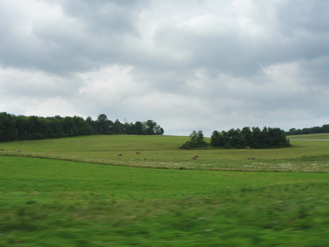
Along US 11, North of Factoryville.
"North of Factoryville a little way -- perhaps a score of miles-- we encountered one of these amazing works of man which, if they become numerous enough, eventually make a country a great memory...We were coming around a curve near Nicholsen [sic], Pennsylvania, approaching a stream which traversed this great valley, when across it from ridge's edge to ridge's edge suddenly appeared a great white stone or concrete viaduct...a thing so colossal and impressive that we instantly had Speed stop the car so that we might remain and gaze at it."
So my reaction. Passing a sign for a "scenic overlook," I thought I would stop and consult the map. When I approached the overlook, it came into view too suddenly to slow and turn across the road, but looking at it, I thought it a suitable place for a rest. When I turned back to look at the highway, I was surprised to see the viaduct looming overhead. "HolyshitTHATSIT! " I exclaimed. No, really! 'cause there it was, larger than life.
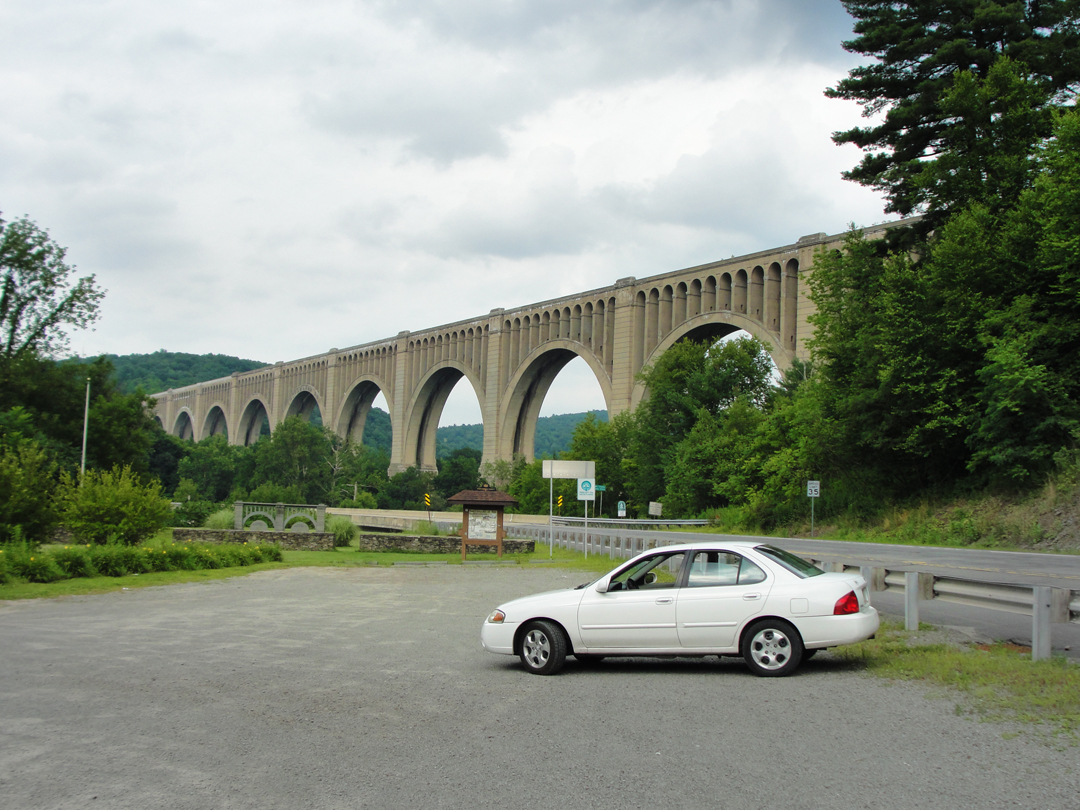
The view from the overlook. It's not much different from the first view on the road (to the right). The photos really can't do this justice, it's just too BIG.
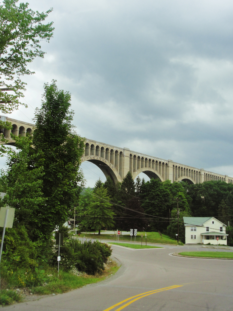
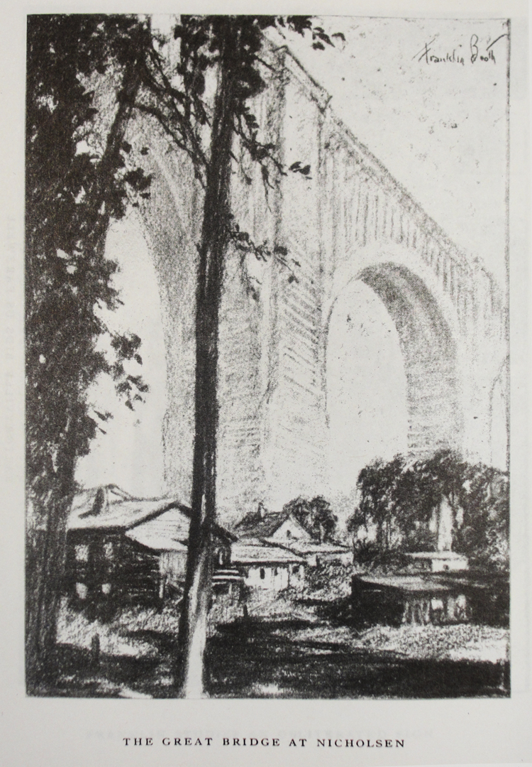
Yeah, Booth's perspective on this is better. I'm thinking he walked around the side of a hill to draw this.
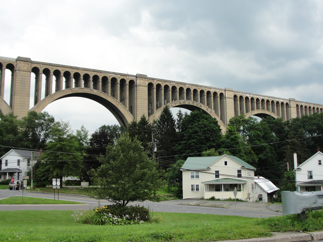
While Dreiser marveled and Booth sketched, the Tunkhannock was not yet open. It would receive its inaugural train a few weeks later. Today, an hundred years of weather has blunted the edges, but it still carries freight, and I imagine it will still be standing for another hundred years. For a thousand? Will our descendants look up with reverence, and worship the great god Lackawanna RR?
I took advantage of the overlook's parking lot, sitting in my camp chair for a bit (it's nice to sit something that is stationary once in a while) and looked over the book and the map. US 11 would be my road still, all the way to Binghamton, NY. That was easy enough. After packing my stuff away and another long gaze at the bridge, I was off.
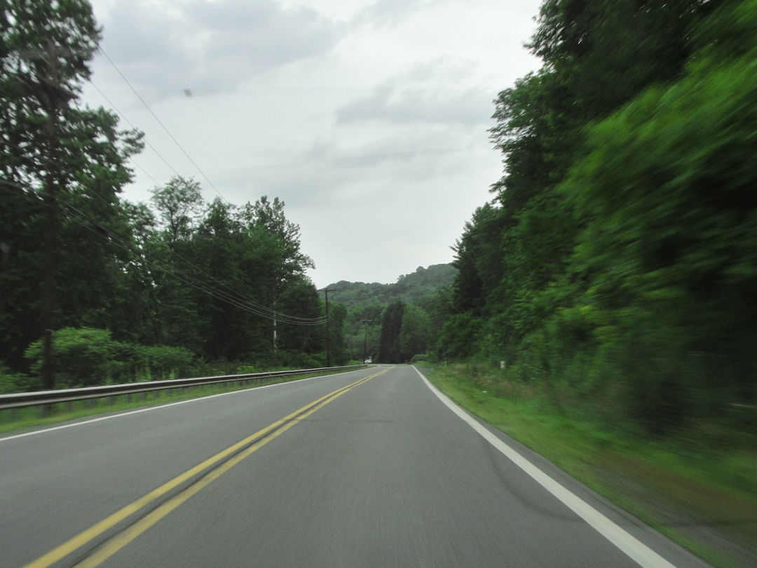
Along US 11.
For quite some miles, the highway runs through a creek valley, bounded by the high rises that necessitated the Tunkhannock.
I understand Dreiser's comment about the "sopping rain causing one's spirits to droop." While not in the rain, and not quite a-droop, the monotony of the overcast sky's light got a bit tiring. I would liked to have seen some of this under direct sunlight.
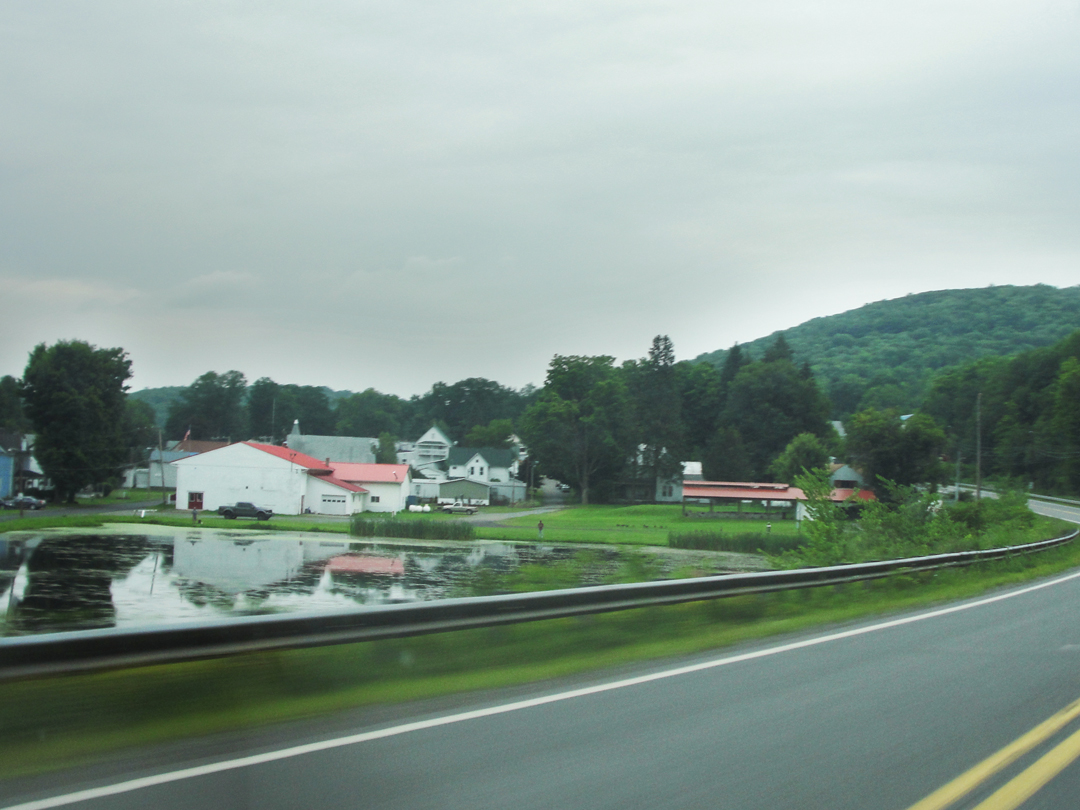
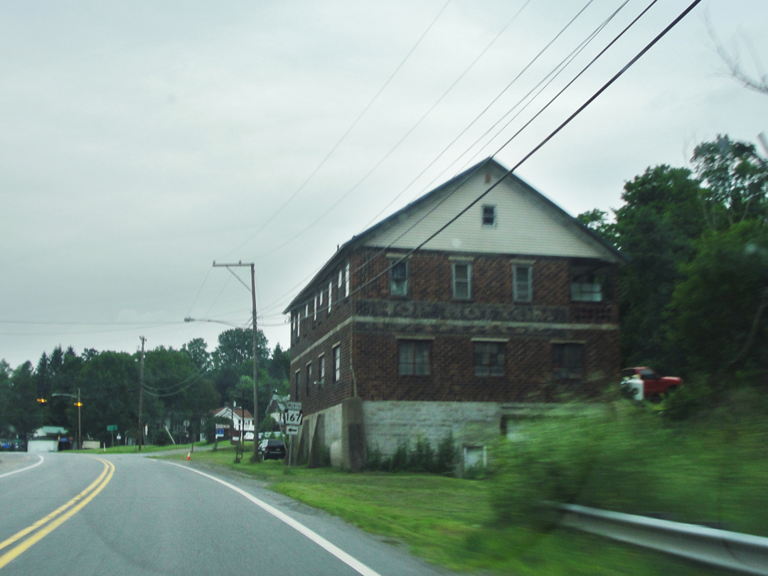
Two views of Hop Bottom, bigger by a bit than a wide spot on the road.
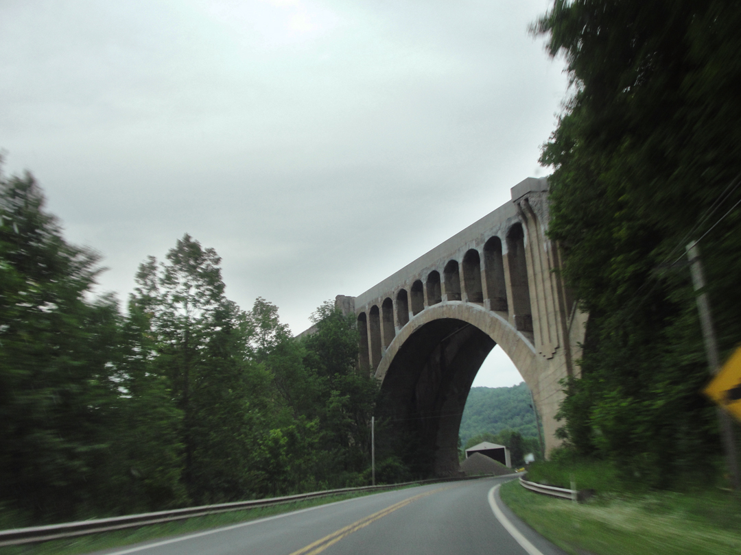
Not long after Hop Bottom, I came around a curve and saw another viaduct. "Another one?" Looks like it was designed and built by the same people who brought us the Tunkhannock, and it's on the same rail line; maybe it just isn't big enough to warrant any mention. Then, after the Tunkhannock, what would be?
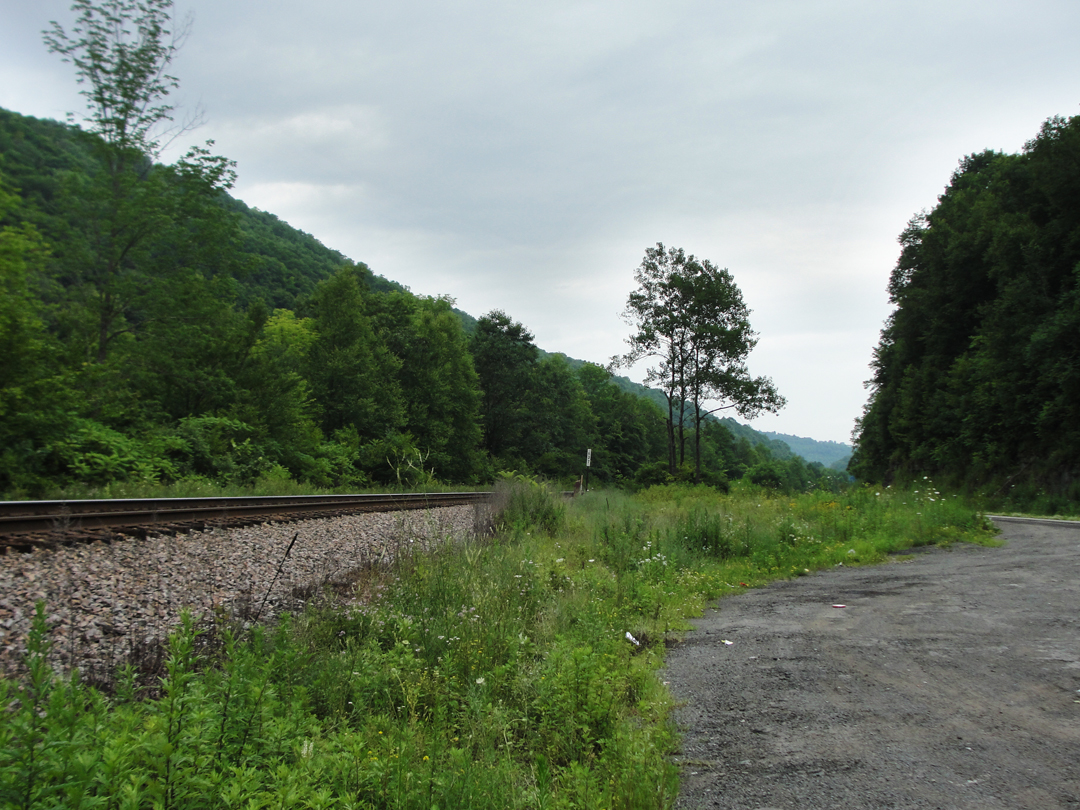
The rail line eventually drops down to join the road in the bottomland, with the creek on the other side of the trees. The creek made a pretty picture next to the road, but one which I could not quite capture.
What surprised me here, and in other places, was many long stretches of solitude with the black-top. But, the Interstate is only about 5 miles away from here, and US 11 is left nearly bereft of traffic. When I did see another atuomobile, I was between "Hey fellow driver!" and "What?! Another car?!" Honestly, it was nice to have so much road to myself. Kinda' peaceful.
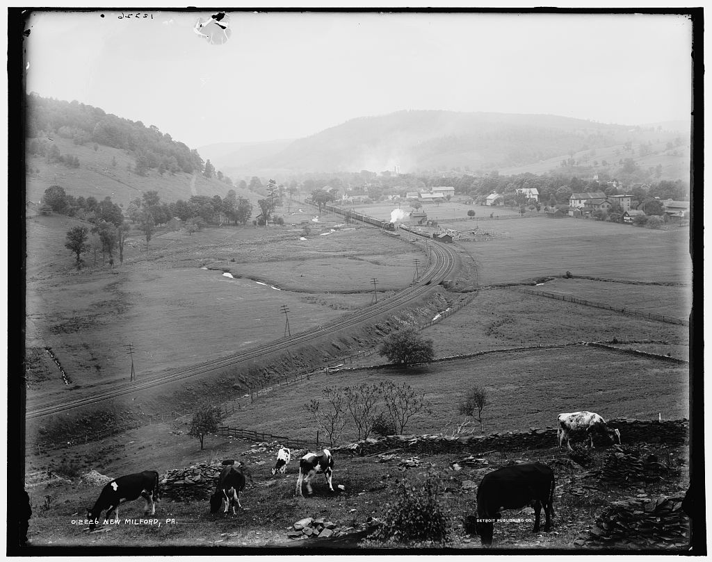
New Milford, Penna., circa 1900 (LOC).
"Beyond Nicholsen, somewhere in this same wondrous valley and in a winelike atmosphere, came New Milford..." a town to which I arrived slightly earlier than did the Pathfinder and its passengers, as the place has grown some at either end along the road there being little room to expand across the valley --
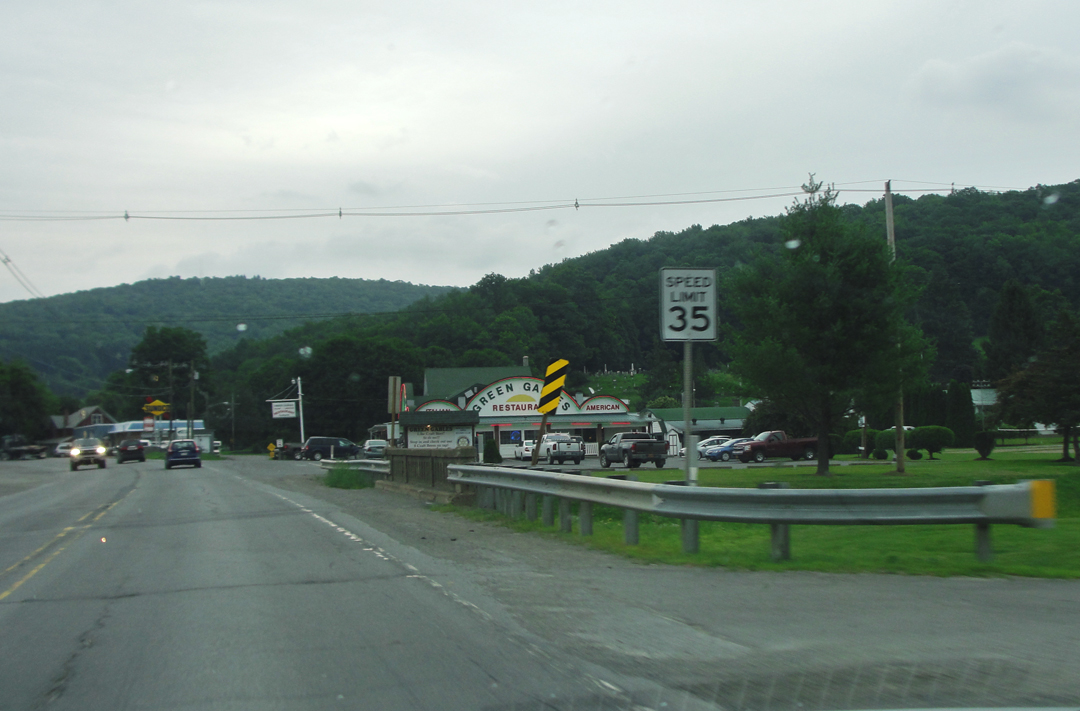
-- and where the Sunoco would likely have gotten Speed's appreciation.
So with Wilkes-Barre and Pittston, so with New Milford, though more of the older buildings remain here, once into the heart of the creek-side town.
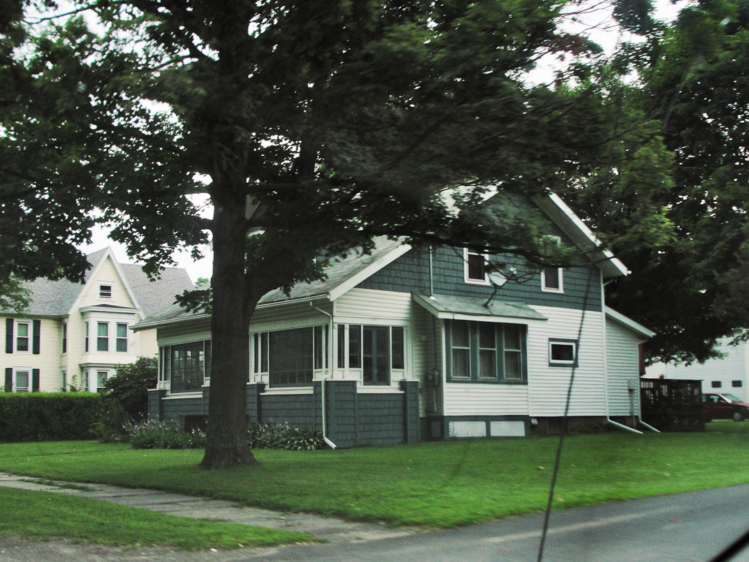
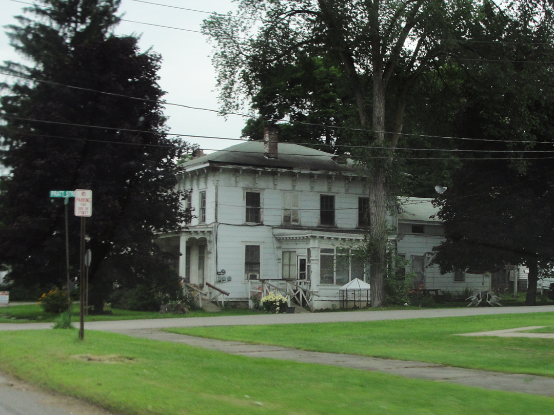
The bungalow above is a newer neighbor, but I can imgine Dreiser seeing the house at right. Well, at least the portion to the front; the ramble off the back -- not so much.
The Pratt Library was surely noticed, though not noted. It was built in 1903, and may be still in use. There's a flag flying by the door so -- ? It's actually a larger than it appears in this "end-on" shot, though not by much. It would be hilarious to find that they built a huge library underground, and that this was only the entryway!

And then there was this:
"We were rolling along aimlessly, uncertain where next we would pause. The sight of an old fashioned white hotel at a street corner with several rurals standing about...gave us our cue. 'This looks rather inviting,' said Franklin; and then, to the figure...sitting on a chair outside in the shade:
'Can't we get something to eat here?'
'You can,' replied the countryman succinctly; 'they'll be putting dinner on the table in a few minutes.' "
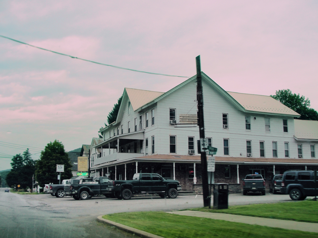
Dreiser starts inside, only to have the proprietor insist on his wearing a jacket. "Life's little rules of conduct are not so easily set aside..." though today that may not apply. The now named Parkview Inn seems to fit the bill, even to a "T." The brickwork about the lower story looks like a later "improvement," but the over-all structure could certainly be the same. I may be "painting with a broad brush" when I look at the number of pickup trucks and SUVs about the lot, but it strikes me as still catering to the local residents.
"Something about the man's manner made me ashamed of myself -- not that it would have been such a dreadful thing to have gone into the diningroom looking as I was...but that I had not taken greater thought to respect his conventions more. He was a gentleman running a country hotel...I was the brash, smart asininity from the city seeking to have my own way...I wanted to make friends with him, for I could see so plainly that he was really above the thing he was doing and yet content...to make the best of it."
Dreiser goes on, as was his want, to look at it all from both sides, calling the dining room "execrable" but also "naive, and pleasingly so." But that's Dreiser all over: aloof but dropping right down in it. He would likely understand "code switching."
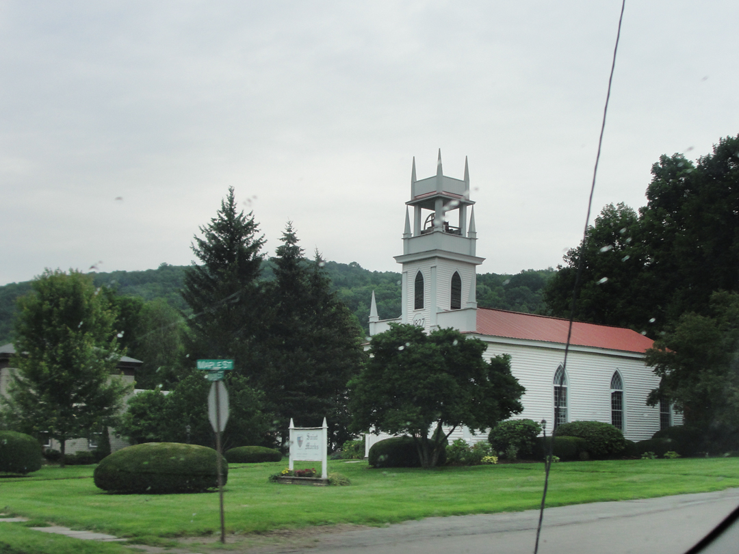
New Milford, past the church dating to 1827 by the numerals on the lintel, came to a stop with a junk yard and a few houses stringing out between US 11 and I-81 which was suddenly very close.
Reaching Hallstead and Great Bend, I didn't even bother taking photographs, though I should have shot at least one of the Interstate interchange there. It was almost unreal, to suddenly see the raised highway, with its traffic clipping along at 65 or more miles per hour. I had spent, even by this time, so many hours on the smaller lane-ways that the intrusion of this mega-road was like an affront to the senses.
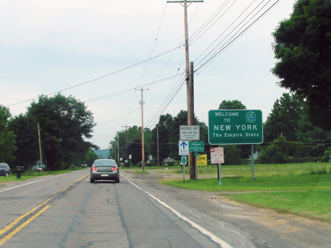
Shortly came the sign indicating that Pennsylvania was behind me, at least for a while.
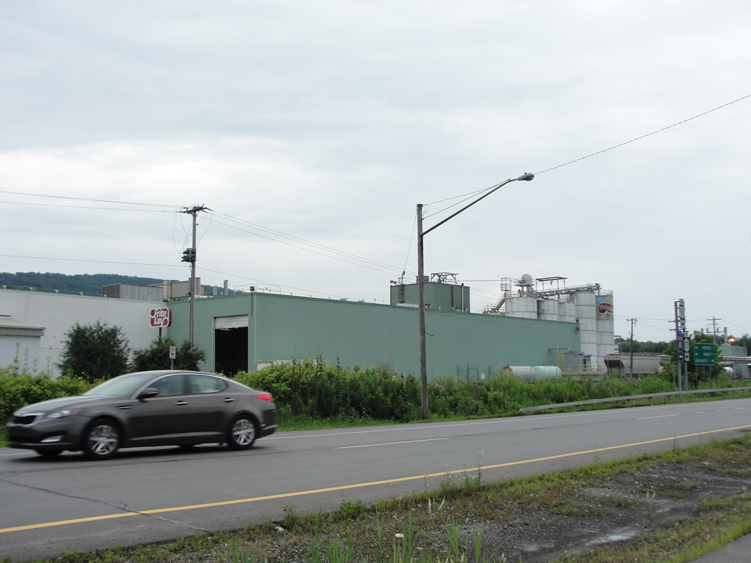
Nearer to Binghamton, I shot this view of a food processing plant. Even having seen large mills, and coal breakers, and the skyscrapers that were going up everywhere, I think Dreiser and Booth would have goggled to see a large installation dedicated to making "snacks," or what-ever.
Somehow, huge steel mills creating the bones of the skyscrapers seems sensible, but that some, unknowable product would enter one end of a plain manufacturer's like this and emerge in a bag, and that those contents were meant to be eaten -- I dunno' -- seems weird to me, and I've partaken of the stuffs myself. I mean, is it really food? Oh, what we do to maintain ourselves today.
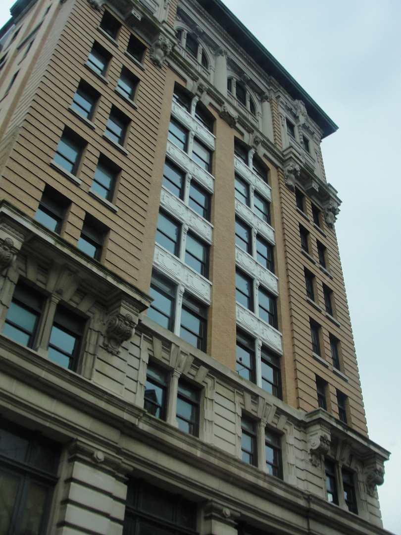
Shortly after, I entered Binghamton.
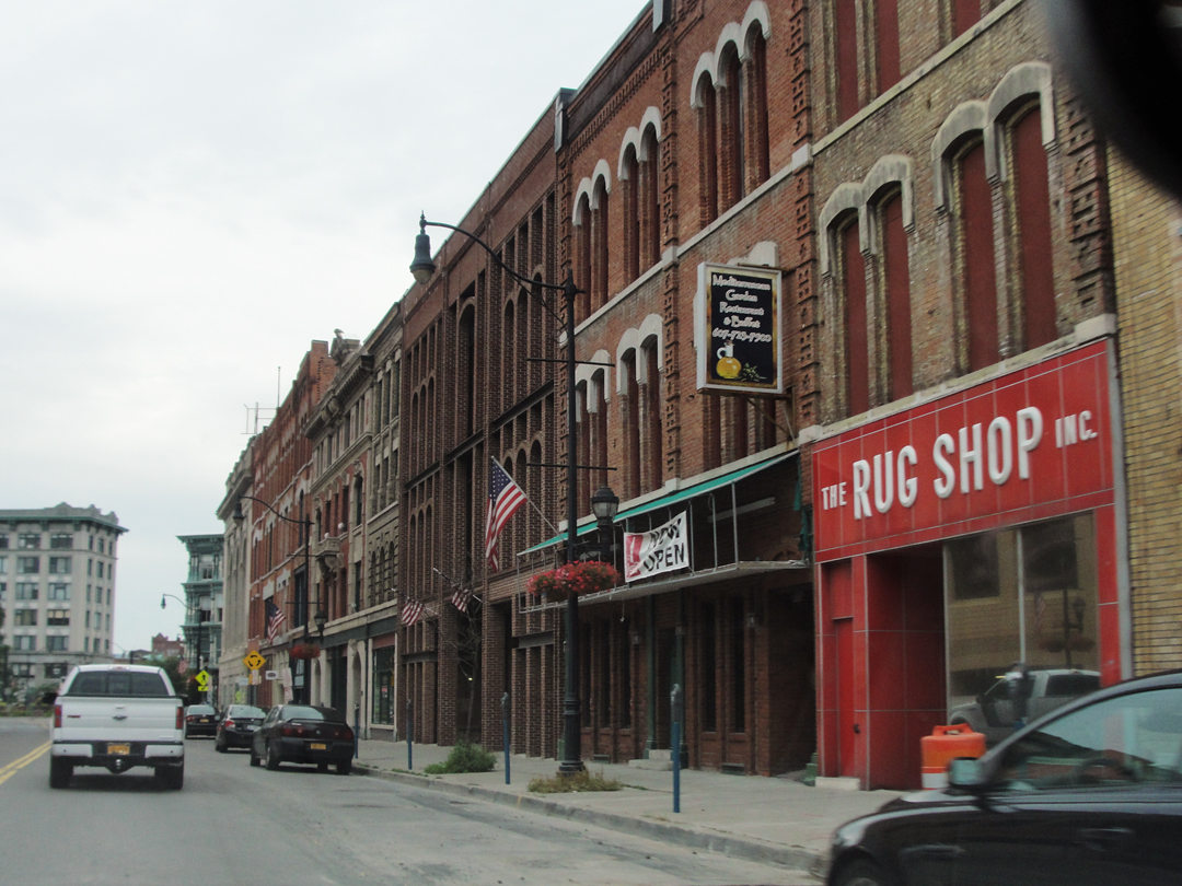
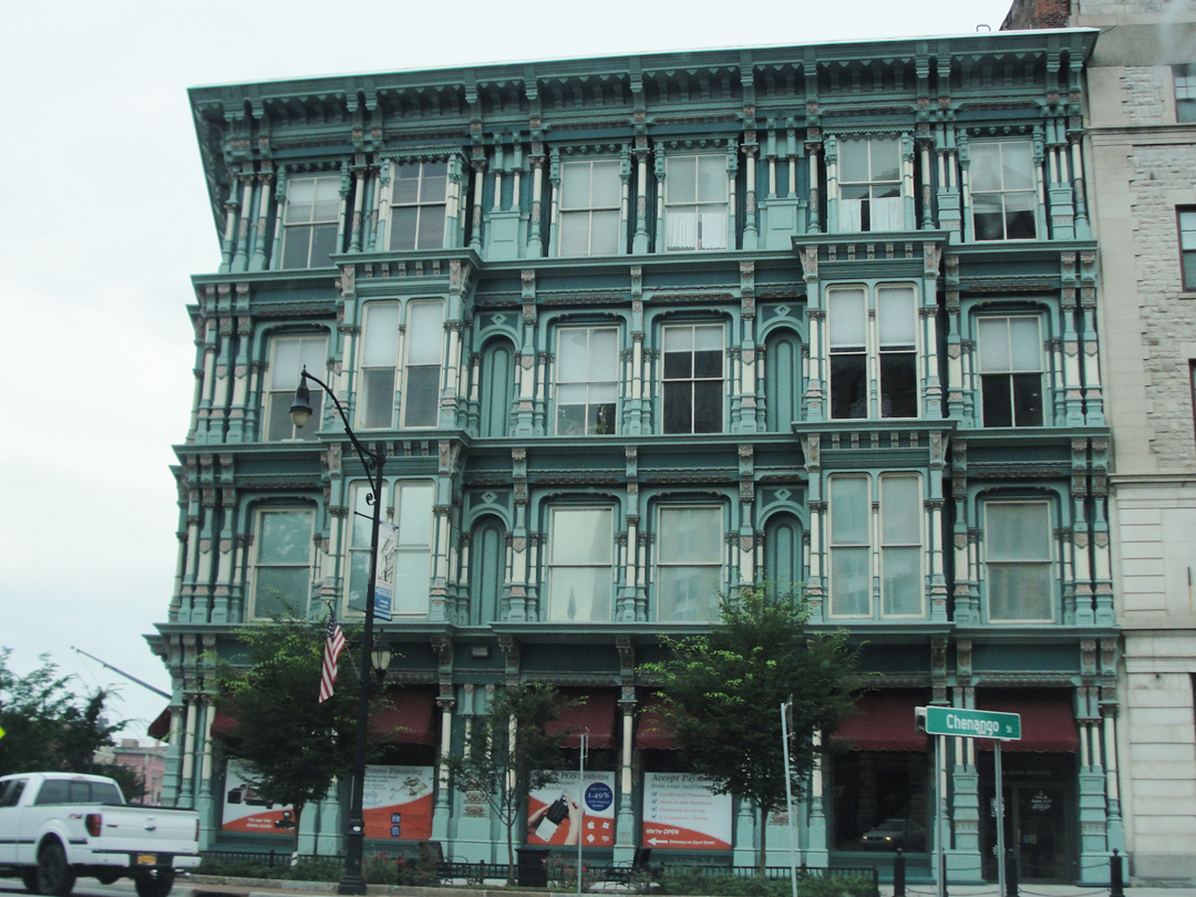

The lane at left looked to be part of a booster's program to get people to "come back downtown after 5," after the bar & grill model. Not quite Urban Renewal, but not quite gentrification, at least not yet.
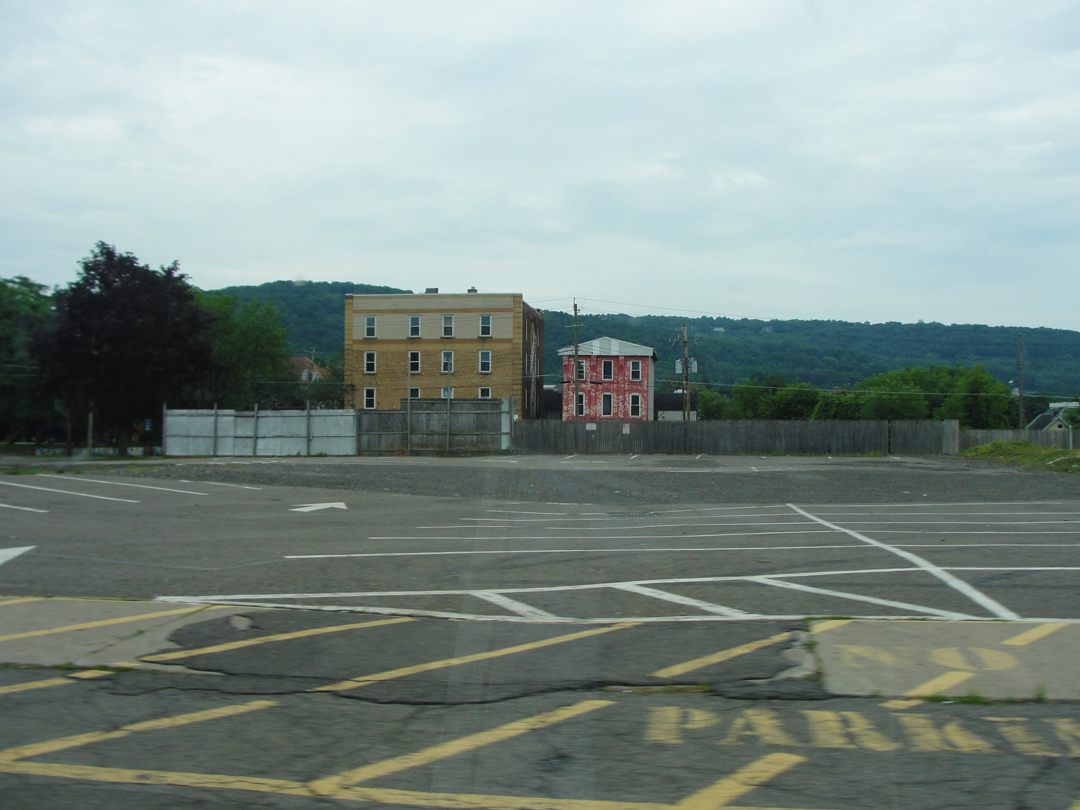
Contrasted with this view just a few blocks away. Thus is our urban environment, I suppose, still grappling with the upheavals of the post-war era. Everywhere can be found examples like this, even in smaller cities in Indiana, where a piece of the municipality, for what-ever reason, got left behind.
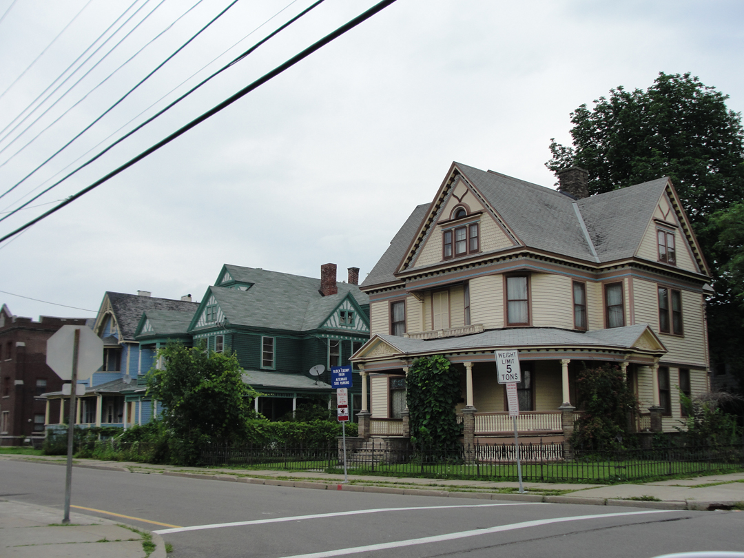
And only a couple of streets over, these houses where the upkeep has been more consistent, where money came back, where someone had a care?
We are so strange when it comes to our public policy, to our single desires when faced the our greater good. I wonder if -- should the mass of us ever be analyzed as a body -- we would be found schizophrenic?
Binghamton proved difficult for me to extricate myself from. Without my realizing it, the highway had turned along with the river's bank, and I was disoriented; but I kept on, thinking that I would recognize something soon. I had, after all, been up this way last year -- how hard could it be? Well --
I was also up against the orange cones: a detour and a bridge closure and I was doing the loop again, though not for any want of it.
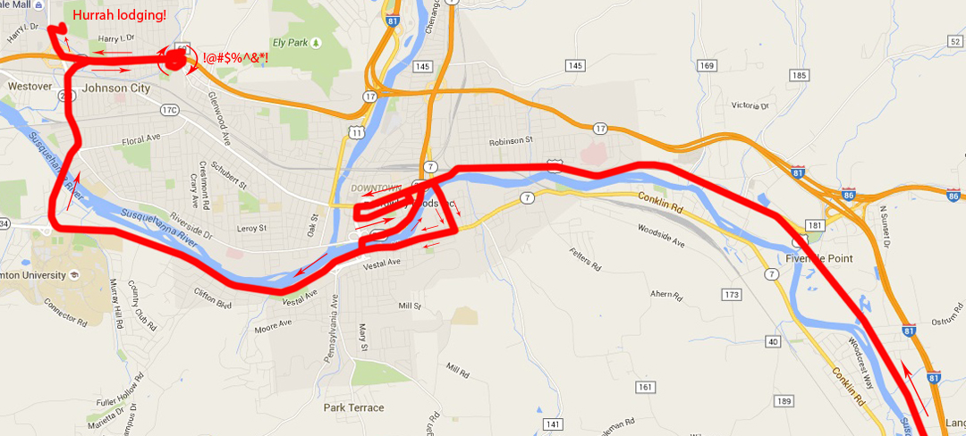
It was late in this that I realized that I had been trying to find the wrong town anyway. I was looking for Johnson City, and its oddly named Harry L Drive, because I knew of a motor hotel there. Johnson City seems to have taken up the flag of Retail for the Binghamton area, and there would be lodging, food, and fuel in convenient proximity.
Once "at the gate" I mistakenly took the wrong ramp, with my intended destination in sight, no less! Oh, well, a couple miles on NY 17 didn't kill me.
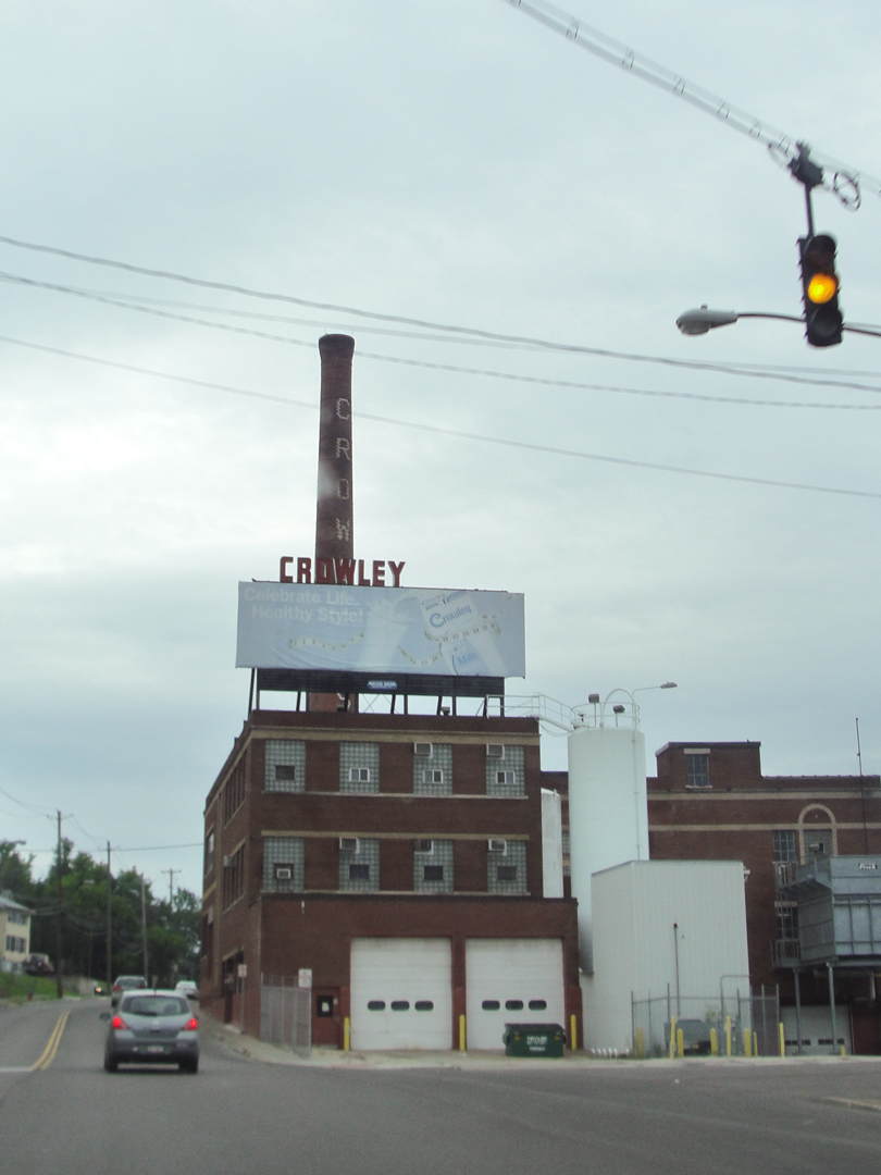
The last photo of the day: the Crowley Dairy plant, which caught my eye 'cause it was brick and had a tall smoke stack. That and it was kinda' "right there in fron'a'me." Why not?
This night: a shower, food in an establishment where your meal is served by the staff, and a really huge bed.
Tomorrow: the small highways of Upstate New York, on the way to Buffalo and Lake Erie.
